Having read lots of glowing reviews of the NC500 route across the north of Scotland, we were eager to drive it, but concerned that it may not live up to reviews. NO WORRIES! This route gets an A* rating every step (or mile) of the way!
From Thurso, heading in an anti-clockwise direction (as advised in the guidebooks), we crossed miles of spectacular moorland. From the purple hues of the heather to the yellowy-bronze of the autumnal bracken, the acres of peat bog never failed to please the eye. Known as ‘blanket bog’, this 1544 square mile expanse is reputed to be the largest in the world. The peat can be up to ten metres deep and acts as a valuable carbon ‘sink’ in the fight against climate change.
Heathers and brackenThe Autumn colours
Of interest to our military friends, we passed the Dounray Nuclear Power Station, now being decommissioned, but originally built to trial the reactors for the first of the British nuclear submarines. Local unemployment figures will rise sharply in 2025 when it closes – there must have been 1000 workers cars in the carpark!
Strathy Point was our lunch spot, and we enjoyed a good walk out to the cliffs where we sat watching seals playing close to shore. The tide was turning and we hoped to see dolphins (or a whale or two) but no luck, yet!
The rocky climb out to Strathy Point
Driving west, mountains began to appear in the distance. The rolling hills around us became higher and rockier. This amazing road sweeps around bends, over rivers, and up and down hills. In many places it is single track with passing places which kept the adrenaline levels high as Molly constantly pulled in to let oncomers through (often other MoHo’s!). But the awe-inspiring vistas around every corner and from the top of every hill far outweigh any challenges in the driving. Bettyhill is a pretty little settlement these days, but with a very sad history – it was originally settled by tenant farmers who had been kicked off their land during the Scottish Clearances (google it!). Unfortunately, none of the museums along the way were open, due to Covid, so we ‘made do’ with Google.
Breathtaking views around every corner
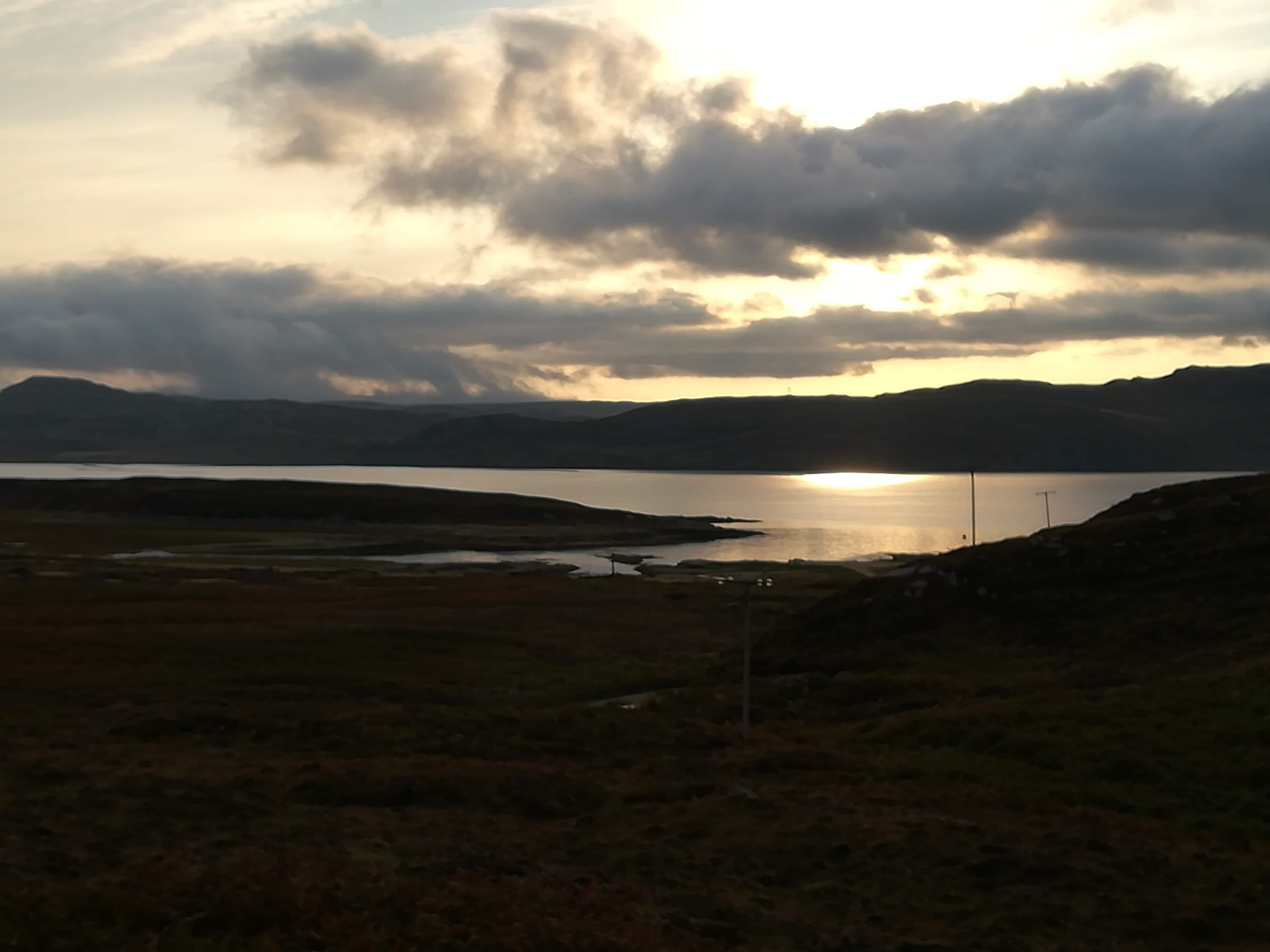
The moors slowly disappear making way for rocky outcrops, velvety green fields, and stunning lochs and inlets. The weather was still dry with no wind hence the reflections on the water were exceptional. Many of the inlets boast long white sandy beaches. The tiny settlement of Laid on Loch Eriboll was our next stop. This little CL (certified location for the non-campers amongst you) is a gem – just the five pitches, all overlooking the loch with mountains in the distance. We had two nights there and were again blessed with a glorious warm, sunny day during which we were delighted to sit reading in the sunshine, and take a stroll along the water’s edge! More ‘pinch me’ moments as I sat in sun top and shorts – am I really in the far north of Scotland in mid-September??
Breakfast in the sunshineDeserted white sandy beaches
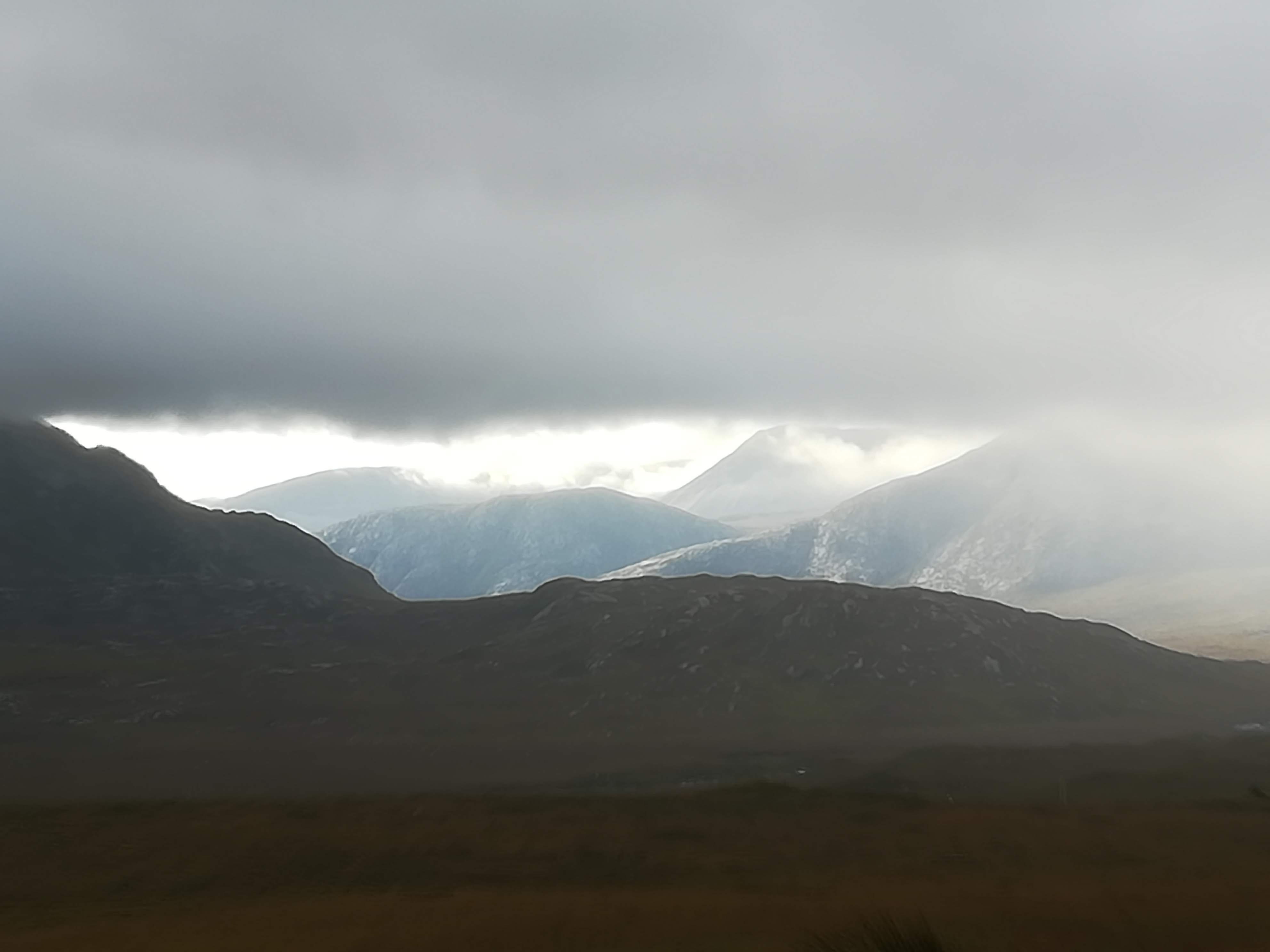
Setting off before breakfast (we were eager to see more!), we were rewarded with the sun peeking through the early morning mist in places.
The early bird gets the worm! The sun just peeping out . . . . . Mountains appear out of the morning mist
We took a VERY challenging sideroad out to Kinlockbervie – a walk among the sand dunes eventually led to a magical white sandy beach – deserted! Lots more single track road along the N500, and many more WOW moments as we came across another amazing view.
Challenging narrow roads . . . . lead to good things! Stunning vistas – note road going off in the distance.
Scourie is a tiny hamlet about half way between Durness and Ullapool. We spent a week here in 1974 for our honeymoon! The discovery of a campsite made a return visit seem very fitting – for old time’s sake, you understand! There are a few more houses in Scourie these days, AND a very good campsite, right on the edge of the harbour (if we let the handbrake off, we’d be in the ‘oggin’!) Sadly the hotel where we stayed has closed after a very short season (thanks to Covid). Instead, we enjoyed a long lunch at the Kylesku Hotel just along the road, which not only produced delicious food, but had wonderful views down the Loch.
ScourieView from Kylesku Hotel
Today’s journey from Scourie to Ullapool continued on much the same theme – stunning countryside with mist covered mountains looming in the background. Sadly the weather has become very ‘Scottish’ . . . . . . . high winds and rain showers. Ullapool is a thriving community. The campsite is enormous, but right next to the sea – all toilet and shower facilities on site are closed due to Covid (as we have seen in many places), but it is still a place to safely spend the night, plugged into electricity, and with facilities to empty toilet ‘cannister’s, dump ‘grey water’ and fill up with fresh water. As I sit here, ready to post this out to you, Molly is being buffeted by the gale force winds (you’d think we were at sea!) and heavy rain is pounding on the roof! What a change from just two days ago . . . . . .
Our pitch at Ullapool – Couldn’t get closer to the water!!
Continuing up the east coast . . . . . We spent a night on a campsite on the Black Isle (‘Black’ because it used to be covered in dense woodland and ‘Isle’ because two bodies of water may have originally made it an Island) We were located half way between Rosemarkie and Fortrose – Rosemarkie, in particular, took our fancy! Lovely houses overlooking the Moray Firth and a feeling of great community spirit – (a little too far from the grand children though!)
Two of the negative effects of the pandemic have been plain to see as we’ve travelled along the coast. Lots of oil rigs are now moored just offshore, currently redundant – a cruel reminder of the numbers of workers who must be waiting at home with fingers crossed that their jobs will survive. The other effect which perhaps we notice more as MotorHomers, is the ENORMOUS number of MoHos on the road. People have realized that it is a safe and fun way to get around the country. Sadly there are not sufficient campsite places to match the number of motorhomes. The result is that they are parked all the way along every seafront and in any space possible! All this is understandable, but leaving piles of rubbish by the roadside is beyond comprehension. (enough of my ranting)
Back to the positives! Travelling in your ‘home’ as it were, allows you to stop and make a coffee when you fancy it – don’t forget that I’m married to a retired Royal Marine, who just LOVES his map reading! Winding our way along a very narrow road, we found our way to Lock Fleet Nature Reserve where we spent a happy time drinking our coffee in the sunshine, whilst watching seals frolicking in the sea. (no photos! too far away!)
Coffee overlooking the Moray Firth – seals were frolicking in the bay
The road up the east coast is fairly narrow, though very easy to drive. That is, until you get stuck behind not one, but two VERY large wide loads complete with police escort! Two industrial units were being moved, and any oncoming traffic was stopped and moved to the side – big lorries certainly gave us a few ‘breath in’ moments! However, it did ensure that we went at a snail’s pace, allowing lots of time to enjoy the countryside and views as we went. Some 40 minutes later, (by which time there must have been a three-mile queue behind us!), the police were able to let us all through on a conveniently wide piece of road.
Reaching John O’Groats was a bit of a let-down, and I’m afraid we didn’t bother to find the famous signpost to take the usual selfie! Instead we continued out to Duncansby Head and had a lovely walk in the afternoon sunshine, watching thousands of seabirds nesting on the sheer cliffs. The sandstone ‘stacks’ in this area are impressive, but difficult to get the right affect with the camera.
Sandstone stacks at Duncansby Head near John O’Groats
A visit to Dunnet Head was a must. The most northern point of the UK mainland, its sandstone cliffs can be seen from many other parts of the coast. Molly has done well, so far, at negotiating the tiny roads out to these headlands! AND Peter does well at spotting a parking space, and then directing me as I reverse into the tiniest of spaces – team Reynolds at work!
Dunnet Head, the most northern point on mainland Britain
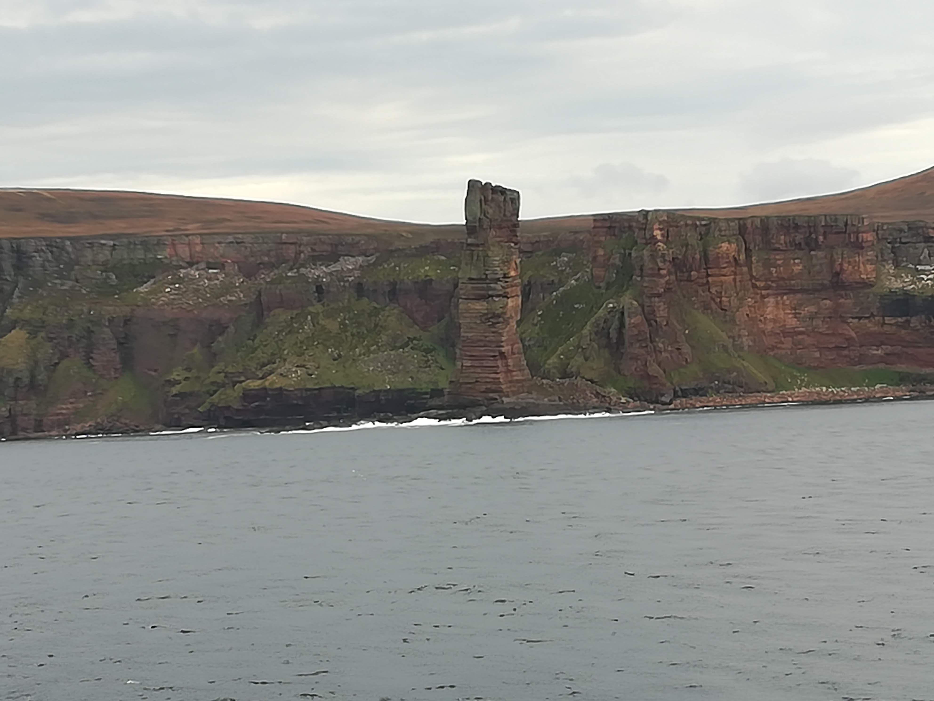
An early start was required in order to catch the ferry to Stromness in Orkney from Scrabster on the mainland. Needing to be in the queue by 07:15 meant that we had time to put the kettle on and have our breakfast whilst waiting to board. Having heard horrific stories of the Pentland Firth being known for its rough seas, we were so thankful that there was VERY little wind – a lovely smooth crossing of just 90 minutes. There were good photo opportunities whilst passing the Old Man Of Hoy as we neared Stromness. And, for the first time ever, in all our years of travel, we were first off the ferry – Molly just happened to fit directly in front of the drive-off ramp – perfect!
The Old Man of Hoy
Orkney is often described as ‘magic’ or as a ‘taste of heaven’. I cannot put my finger on what makes it so, but IT IS BOTH OF THE ABOVE AND MORE! It is blissfully peaceful, made all the better with Covid rules, which means that there are presently NO busloads of tourists visiting the islands. It is not flat, but undulating, there are no trees, but many shrubs (all leaning in the direction of the prevailing winds), many miles of arable farmland with little crofts dotted about. Healthy looking cows and sheep enjoy the green pastures. The bulls are all ENORMOUS & MEAN looking – is there something in the grass here? The sheep often cling to the clifftops, and yet seem to know just how close to the edge they can go!
Kirkwall was our first stop – it’s the capital of Orkney with a population of only 9500. St Magnus’ cathedral dominates the centre of town with its beautiful sandstone walls. It was founded in 1137, and presently belongs to the people of Orkney. A light rain shower drove us into The Daily Scoop (what a great name for an ice cream shop!) where we enjoyed a panini and watched the locals – socially distanced of course!
St Magnus@ Cathedral, Kirkwall
But a visit to Orkney is really a history lesson in the making! Scapa Flow looks like any other body of water yet is well known for the scuttling of 52 German ships during WW1, so that they ‘couldn’t get into enemy hands’. Seven of those ships remain on the seabed. Remains of shipwrecked blockships are still visible above the water. Despite the blockships used during WW2, a German UBoat managed to enter Scapa Flow and sink HMS Royal Oak, killing 833 crew. Churchill immediately ordered the construction of four permanent barriers. Over four years, thousands of tons of rock were dropped into 59 feet of water as a base. 66,000 concrete blocks both small and large make up the core and the sides of these spectacular causeways. An impressive engineering feat. These days the causeways connect five of the islands of Orkney, making movement and transport very easy.
One of the Churchill Barriers, Orkney
There were many Italian POW’s housed on Orkney. Not only did they help with the construction of the Churchill barriers, they also created a chapel as their place of worship. Two Nissan huts were put together, end to end, to form the Italian Chapel. An artist among them provided the inspiration for the beautiful and thought- provoking painting. As you enter the chapel, you think the walls are brick and that there are clever stone carvings everywhere – No, it is all paint! Brilliantly done, and now being preserved by the residents of Orkney.
The Italian Chapel
We have been truly blessed with the weather whilst on Orkney. The blue skies and clarity of the air helped make our visit very special. Skara Brae is a 5000 yr. old (yes, that’s 5000!) stone age settlement. To put this in perspective, Stonehenge was 2100 BC whereas Skara Brae was 3100 BC. This ‘village’ was uncovered by a big storm in 1850 – it had been buried under sand dunes for millennia. Archaeologists have been able to piece together how the Neolithic peoples used to live.
Part of the village at Skara Brae
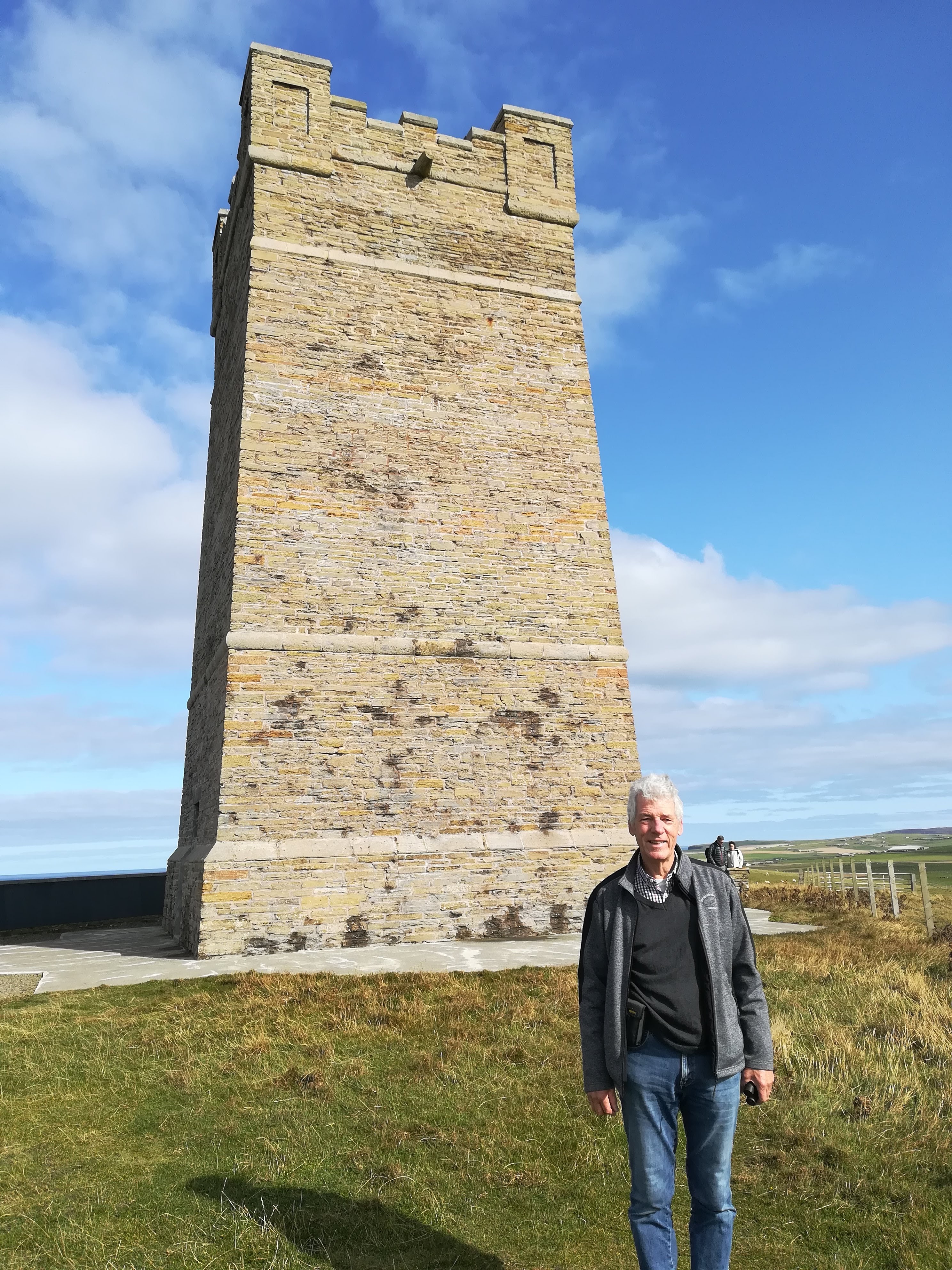
A visit to the Kitchener Memorial – General Kitchener perished, when HMS Hampshire sank off the coast in 1916, when it hit a German mine. The people of Orkney built the 48 ft tower in his memory in 1926. Recent restoration work included building a commemorative wall with names of the 737 men who died. Reaching the Memorial entails an empowering cliffside walk, but we were rewarded with far reaching coastal views in both directions – glorious!
Kitchener MemorialViews from Kitchener Memorial towards Birsay
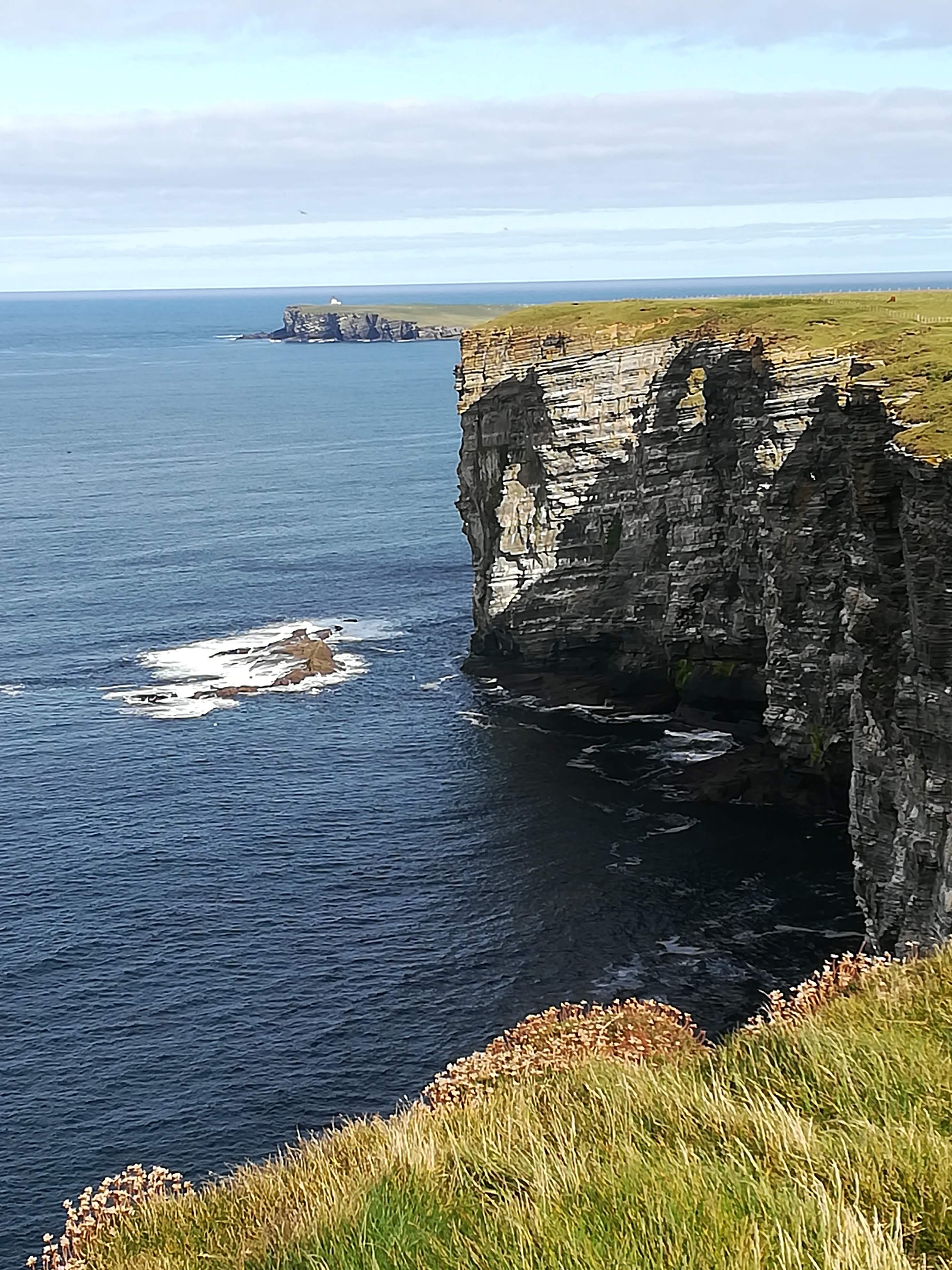
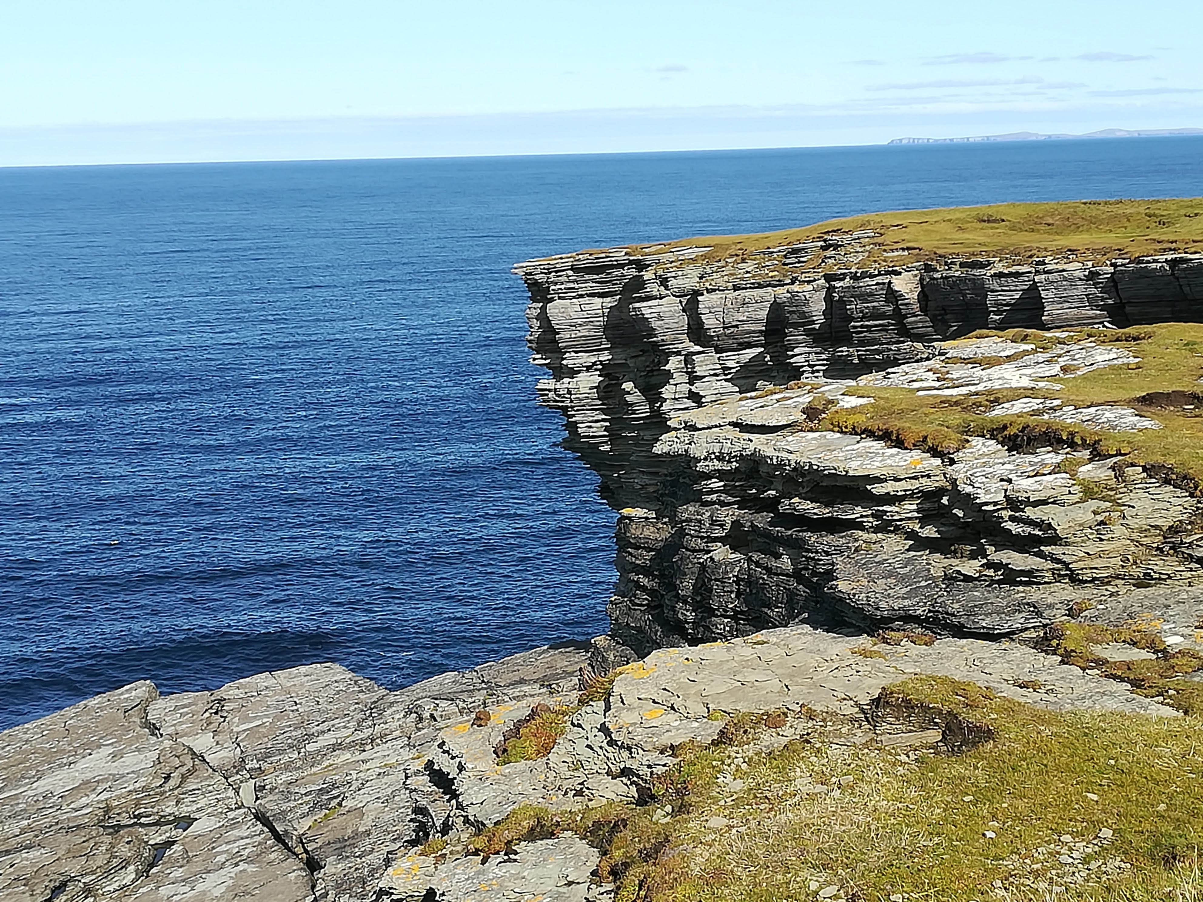
The Brough of Birsay is the north-western tip of Orkney, a fraction above 59 degrees N Latitude (compared to Ross which sits at 51.9 N Lat) The lighthouse here is on an island which is only accessible at low tide, via a manmade causeway. As with everywhere we visited, it’s well maintained and well signposted. Sitting out on the very point, looking 52 metres down to the swirling seas was a real ‘pinch me’ moment. Also on the island of Birsay are the excavated remains of a Viking settlement, where Norse families lived and worshipped 1000 yrs ago.
The Brough of Birsay – most northwestern point of Orkney
The magic of the Orcadian countryside continued to envelope us as we travelled all the way around the north and down the east side of the mainland. Crafts are one of the mainstays of the Orkney people – indeed there is a ‘craft trail’ signposted throughout the island, enabling craft lovers to visit all manner of different workshops and galleries. On recommendation, we stopped in Tankerness to visit the Sheila Fleet Jewellery Gallery and tea rooms. I was NOT disappointed – beautiful jewellery designed along the varying themes of nature. What a clever idea to include a tearoom where the ‘other-halves’ can sit and relax whilst we ladies swoon through the gallery! Needless to say, even the jewellery was glistening in the afternoon sunshine!
The rolling countryside of Orkney
We couldn’t leave Orkney without seeing some of the historic Standing Stones. The Ring of Brodgar is thought to have been built 2500 yrs BC – 21 of the original 60 stones still stand, a couple of which are 5 metres high. It’s believed to have been a place of ritual and worship during the Neolithic age – these days it’s very atmospheric – silent and mysterious.
Ring of Brodgar
The Standing Stones of Stenness are said to be older (3300 BC) and higher at close to 6 metres. How could they have withstood the elements for so long? It is very humbling to stand among them.. . . .
Standing Stones of Stenness
Returning to mainland Scotland on the ferry gave us time to contemplate (the return crossing was EVEN smoother!) . Yes, Orkney gave us a ‘taste of heaven’ – beautiful countryside, easy driving with very little traffic and very few people (thanks to Covid!) friendly locals, spectacular cliffside walks, and oodles of jaw-dropping history. We WILL return. . . . there are many other islands to explore!
Hi Everyone – time to update you on our travels so far. As we headed north through Yorkshire we took the opportunity to visit RHS Harlow Carr near Harrogate. Covid rules dictated that we had to pre-book our tickets, so we also prebooked a small campsite ten minutes drive from the gardens, so that we could fully enjoy our garden visit. What a treat! Some formal gardens, an alpine house, lots of woods, acres of perennial beds and an enormous kitchen garden. Betty’s tearooms (from York) run both the onsite restaurant and the takeaway café within the gardens. We were amused to note that all the girls still work in their frilly white blouses, black skirts, black tights and flat black shoes – so old fashioned, but so much a part of Betty’s! What a lovely ‘escape’ made all the better by perfect ‘garden viewing’ weather.
Leaves beginning to turn at Harlow CarrThe extensive gardens at Harlow Carr
Our campsite was ideallic – very well kept, and overlooking a field of sheep, who persisted in trying to prove that the ‘grass is greener on the other side’!
Grass is greener on the other side!
For those of you on the look out for nice places to stop on the way up the A1, I can recommend Hardwick Park, nr Stockton-on-Tees, as an excellent place to stretch your legs (lots of walks through the park and around the lake) and a nice café for much needed coffee.
The moors of Northumberland did not disappoint, as we made our way north to the Scottish Borders.
NorthumberlandProof that we’ve crossed the border!
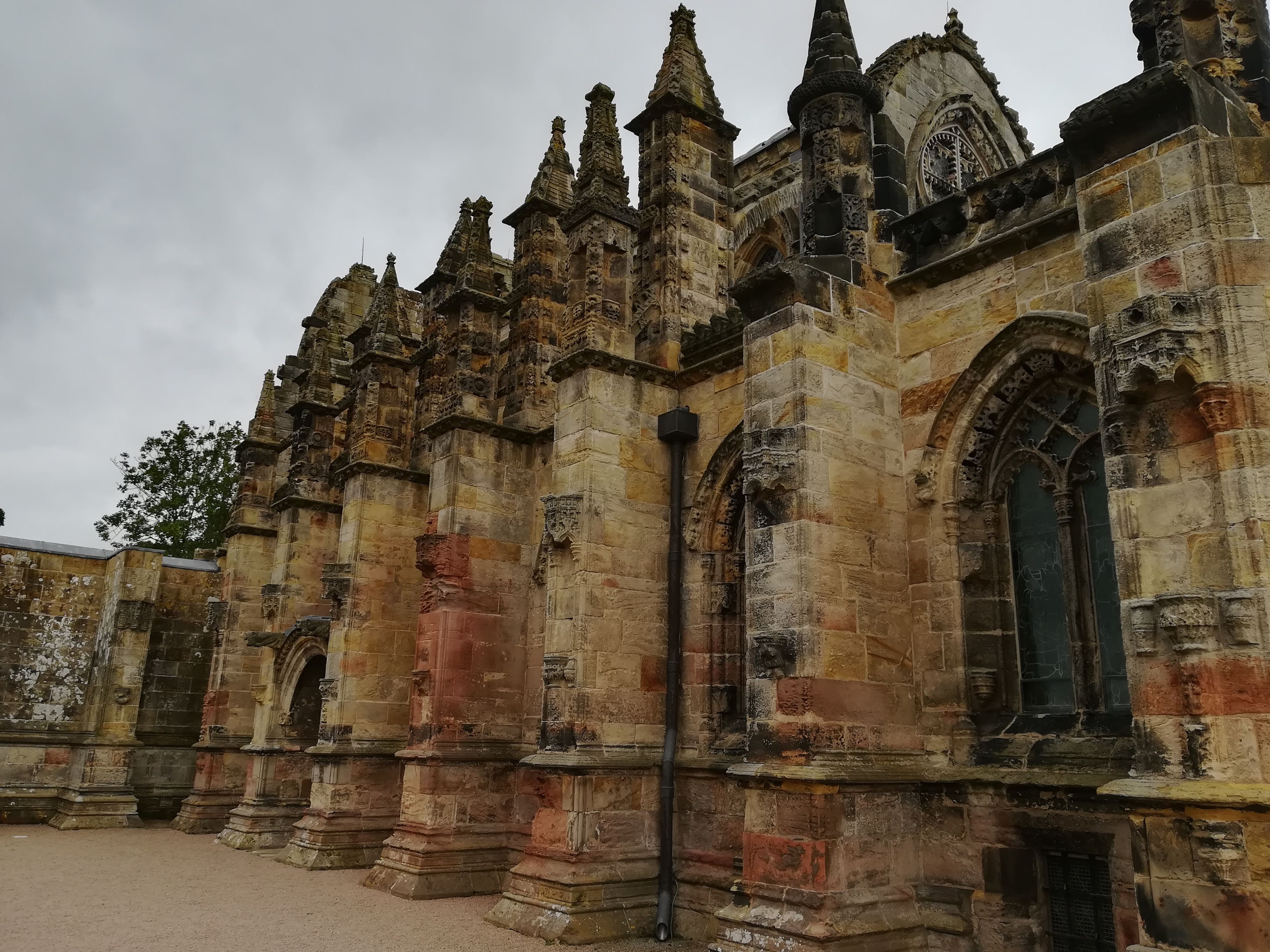
Being fans of the Da Vinci Code, a visit to Roslyn Chapel just south of Edinburgh was a must. Any chances of the Holy Grail being hidden here have long been refuted. However, the fact that some of the movie was filmed there means that (under normal circumstances) some 1500 visitors a day descend on this tiny chapel. There are some good things to have come out of the pandemic! We were part of a group of only 11 people who met at 9am and had a wonderful tour guide to ourselves. The numerous ancient stone carvings in the chapel are exquisite – the history and many stories of the various conservation/renovation projects are very impressive. As with everywhere we’ve visited so far, it was all very well organized and Covid safe. Thank you Dan Brown for putting Roslyn Chapel on the map!
Ancient stone carvings around the main stained glass window at Rosslyn ChapelThe beautiful sandstone structure of the chapel (wish I could have ‘caught it’ in the morning sunshine)
We have made a point of meeting both family and friends on our way north. As I’m sure you’ll all agree, family and friendships have become ever more important during these strange times. One such ‘meeting’ was at a restaurant very near the Forth Bridges!
The Forth Bridges – the old road bridge (used for taxis and buses now) and the railway bridgeThe new Forth Bridge – Queensferry Crossing – impressive! 2.7 km long!
Molly coped well with being buffeted by strong winds as we crossed the 1.4 mile Tay Bridge at Dundee. A visit to friends in Arbroath was a thrill as it was the first time we’ve returned to the town since we lived there 30 years ago. The sun glistened on the sea, as the yachts bobbed about in the new marina. We made sure we drove past the Royal Marines barracks at RM Condor where we were based for two years, on our way north to Stonehaven.
We’d forgotten how stunning the Fife countryside is. . . . . . . Rolling hills seem to drop into wide, meandering, peat-coloured rivers – small farmsteads dot the countryside as Molly weaves her way along the open roads. The acres of grain, recently harvested, look particularly golden when the sun peeps out from behind a big grey cloud. Thousands of bales of straw sit waiting (some rectangular, some round) to be collected before winter sets in. Molly often takes a breather, as we pull in to one of the frequent laybys to allow the inevitable queue of traffic behind us to go through – we quietly giggle as we know they’ll all get held up behind one of the many tractors out collecting straw bales!
Some of the thousands of straw bales waiting to be collected.
The North 500 now beckons! We have settled in for the night, on a site overlooking the Moray Firth just north of Inverness. With a bit of luck we may miss the worst of the bad weather currently hitting Scotland – for now at least! More anon . . . . .
Many of you will have followed our travels in 2018, as we journeyed across all ten of Canada’s provinces – in Lulu. We have hankered after having our own MoHo ever since. Our dreams have been answered, and we’ve recently purchased Molly (we are her ‘folks’!)
Molly will become our 2nd home – she is fully fitted with kitchen, toilet and shower, plus all mod cons. We have no need to use a public toilet or any ‘onsite’ facilities, hence we can keep totally safe during the Covid Pandemic.
For those who like statistics, she is 21ft long (6.3 metres), and is within the 3500kg allowed, to be driven without an HGV licence. She has central heating, and aircon in the cab to make driving more comfy, and a good sized awning to roll out when we get to sunny climes.
We spent a happy three nights at a Malvern campsite – practicing! Getting our heads around how everything works, and finding the right space for all those bits and pieces that you think you should have ‘just in case’. Four very rainy days and nights in mid Wales near Rhayader, not only proved that Molly is watertight, but also helped us to work out where to hang dripping wet clothes and how to deal with damp walking shoes!
The sun DID shine, sometimes! We were very near the source of the River Wye.
And NOW THE FUN BEGINS . . . . . . . Thanks to COVID 19, trips across the channel have been put on hold. However there is SO MUCH of UK that we have not visited . . . . .
Scotland and the North 500 route becons! We’re looking forward to a three week touring holiday from next week. I shall add to the blog every few days, to let you know where we’ve stayed, what we’ve seen, recommendations and what to avoid! Needless to say, if you’re not interested, please ignore all this – we will not be offended . . . . . .
Entering Ontario, we drove a few hundred kilometers of road that we’d already been on – funny how the road and scenery always looks so different when driven in the other direction! Kapakabeka Falls near Thunder Bay had been a lunch stop in July – this time we headed for the campsite there and enjoyed our first campfire for many weeks – campfires had been banned due to the high risk of wildfires, and quite rightly so. Ontario, on the other hand, has a much more humid climate than the western provinces, hence small campfires in their designated rings were considered to be safe.
Hwy 17 – part of the Trans Canada Highway – follows the shore of Lake Superior, the largest of the Great Lakes, and had been recommended as being a beautiful route to take. Sadly, the lake and surrounds were covered in thick fog and we spent a nerve wracking two hours driving very carefully, (no cats-eyes in this country – the snow plows would dig them up every winter!) through steep sided rock cuttings and negotiating some very sharp bends. What should have been phenomenal views across the lake were banks of white cotton wool! Sheer exhaustion and tired eyes (I know, we’re getting old!) meant we stopped at a pull-in for an early lunch followed by a siesta. Imagine our delight to find that visibility had improved a lot during our sojourn! Minutes later we had to do an emergency stop when a family of Moose decided to cross the road in front of us – mother and two young ones! Prayers of gratitude all round! A)It was lovely to see some wildlife B) Thank goodness they did not cross in front of us in the thick fog!
Two young moose following ‘mum’ (already up the bank and in the bushes)
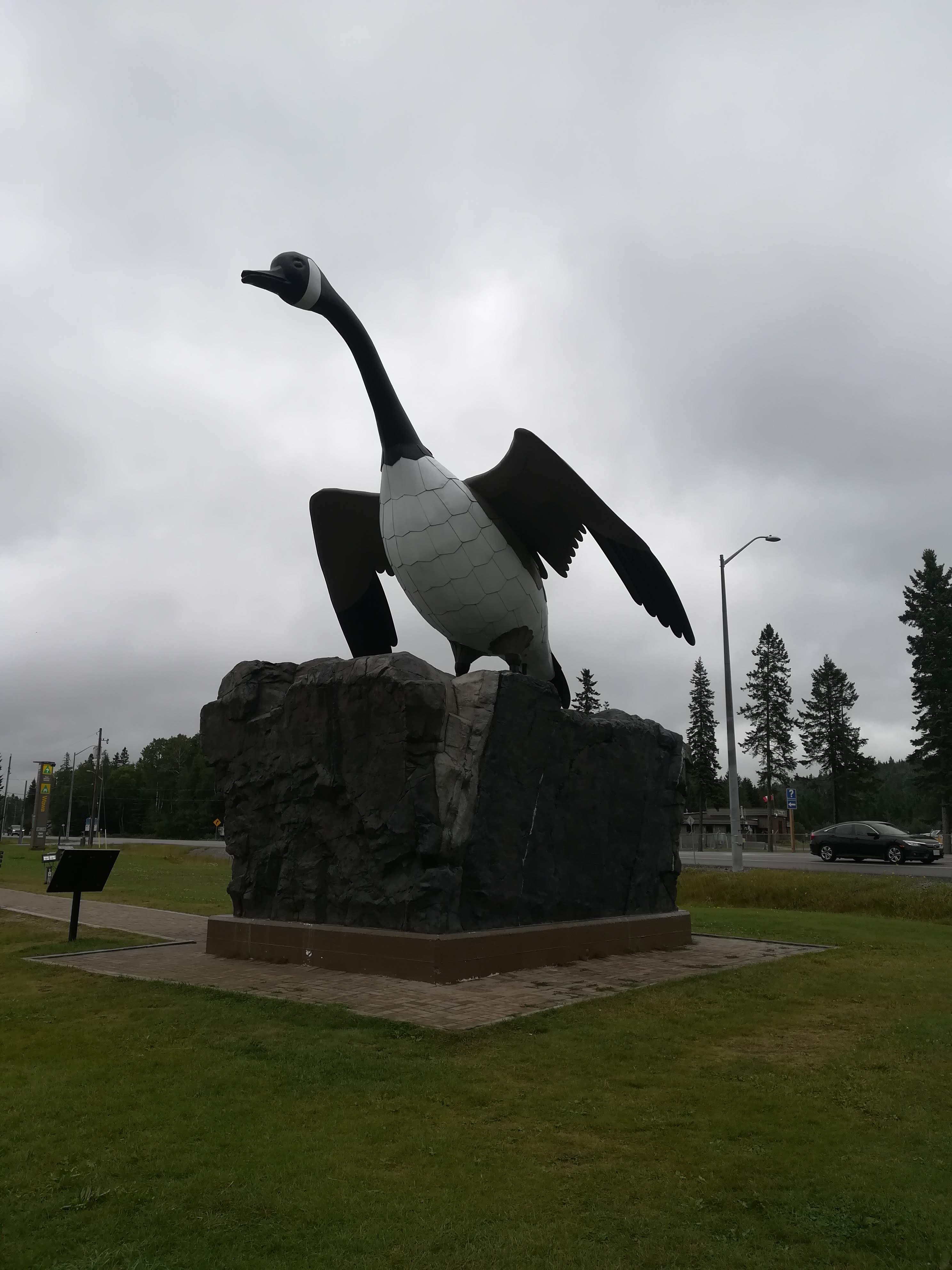
Stretching 7,821 kilometres across Canada, the Trans Canada Highway goes through some pretty rugged country. The area through the Canadian Shield is no exception. This link was finally completed in September of 1960 after twenty years of political wrangling. Wawa, a mining town (gold and iron) was finally connected to the rest of the country. A local entrepreneur wanted to encourage tourists to stop in the town, and created a giant Canada Goose statue (Wawa translates to ‘wild goose’) which towers above the intersection of Hwys 17 and 101. Interpretation boards in various parts of the town relate stories of local residents and what they’ve contributed to the town – a wonderful way to tell visitors the history.
Canada Goose statue at Wawa
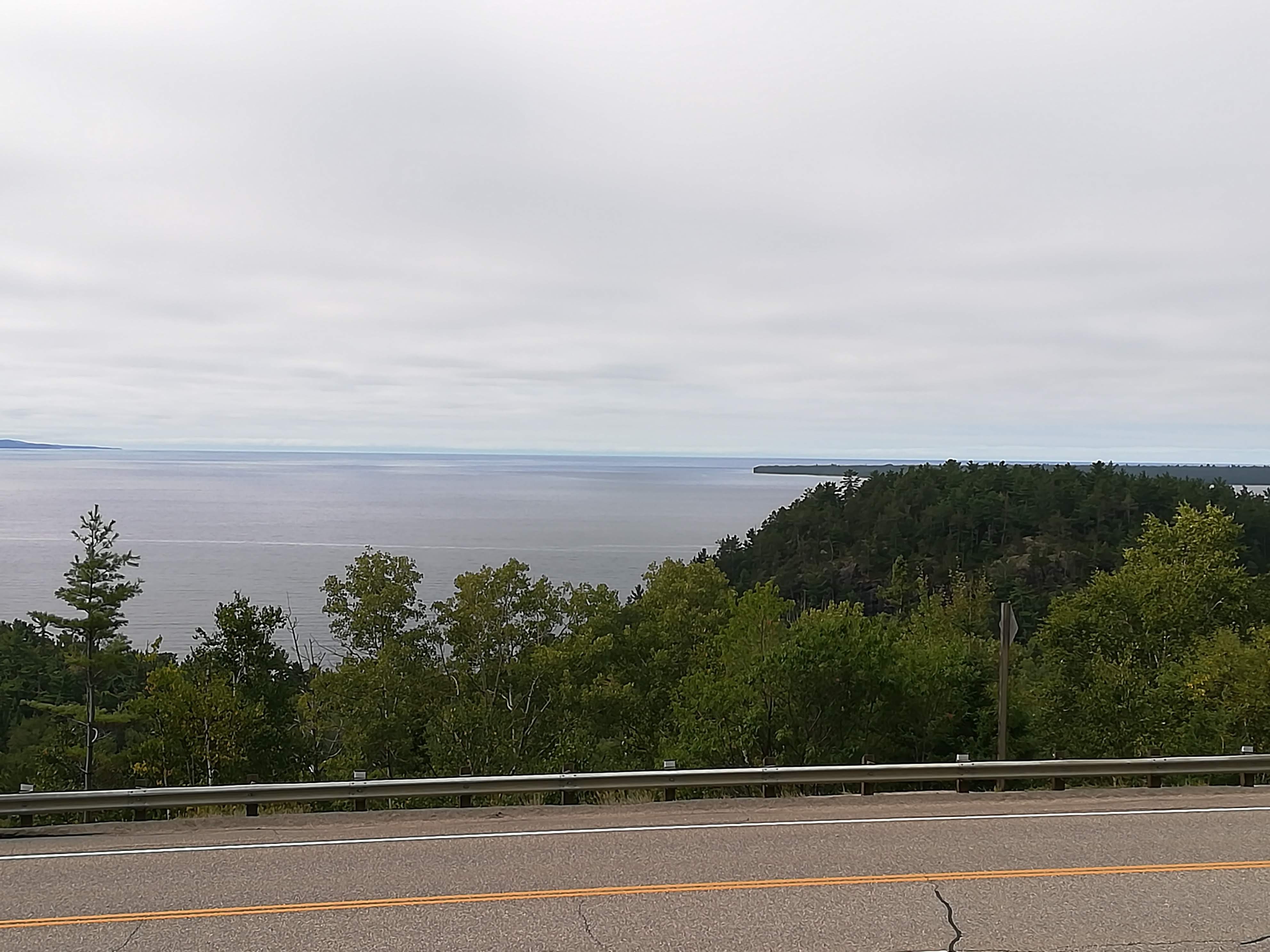
After two nights in Wawa campground the fog finally lifted and we had a glimpse of Lake Superior on our way south to Sault Ste Marie.
Lake Superior – on a clear day!
From the ‘Soux’ (as the locals call it) the road turns east and goes a little inland from the shores of Lake Huron through further forests and smaller lakes. We spent a very comfortable night at Brownlee Lake Resort near Thessalon. Probably the most peaceful of all the campgrounds we’ve stayed in, our site overlooked an idyllic lake, the only sound been that of a loon or the fut-fut of the odd fishing boat. No sooner was the campfire alight and wine in hand, than thunder started to roll in the distance! Half an hour later, we had to retreat inside – heavy rain, very loud claps of thunder and scary lightning flashes kept us awake for hours – but on the positive side, Lulu was given a good wash!
Brownlee Lake Camping – note firepit. Also note whole cloves in dish with nite lites ready to light when we eat – keeps the wasps away! (Try it – it works!!)
A visit to Lively near Sudbury, provided the perfect opportunity for me to look up an old school friend. Forty years seemed like ‘just yesterday’ as we reminisced about our childhood days together and caught up on family news. One last night in Lulu, in Bolton just north of Toronto, and then it was time to do a ‘deep clean’ and hand her back. After 20,000 km, we were assuming she would be given a rest and a good going over. All that was going to be done IMMEDIATELY as she was due to go off on more travels within a day or two! No rest for LULU then, but a long weekend’s rest for us! Time to savour all those memories whilst enjoying the hot summer weather and the friendly Canadians for just a bit longer! Will we come back again? You betcha!! Yukon and the Northwest Territories are drawing us like a magnet. . . . . . . . .All that being said, we’re so looking forward to our own bed, and to catching up with family and friends.
Thanks for taking this journey with us – see you on the next holiday!
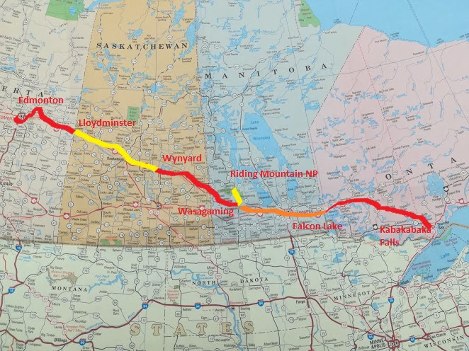
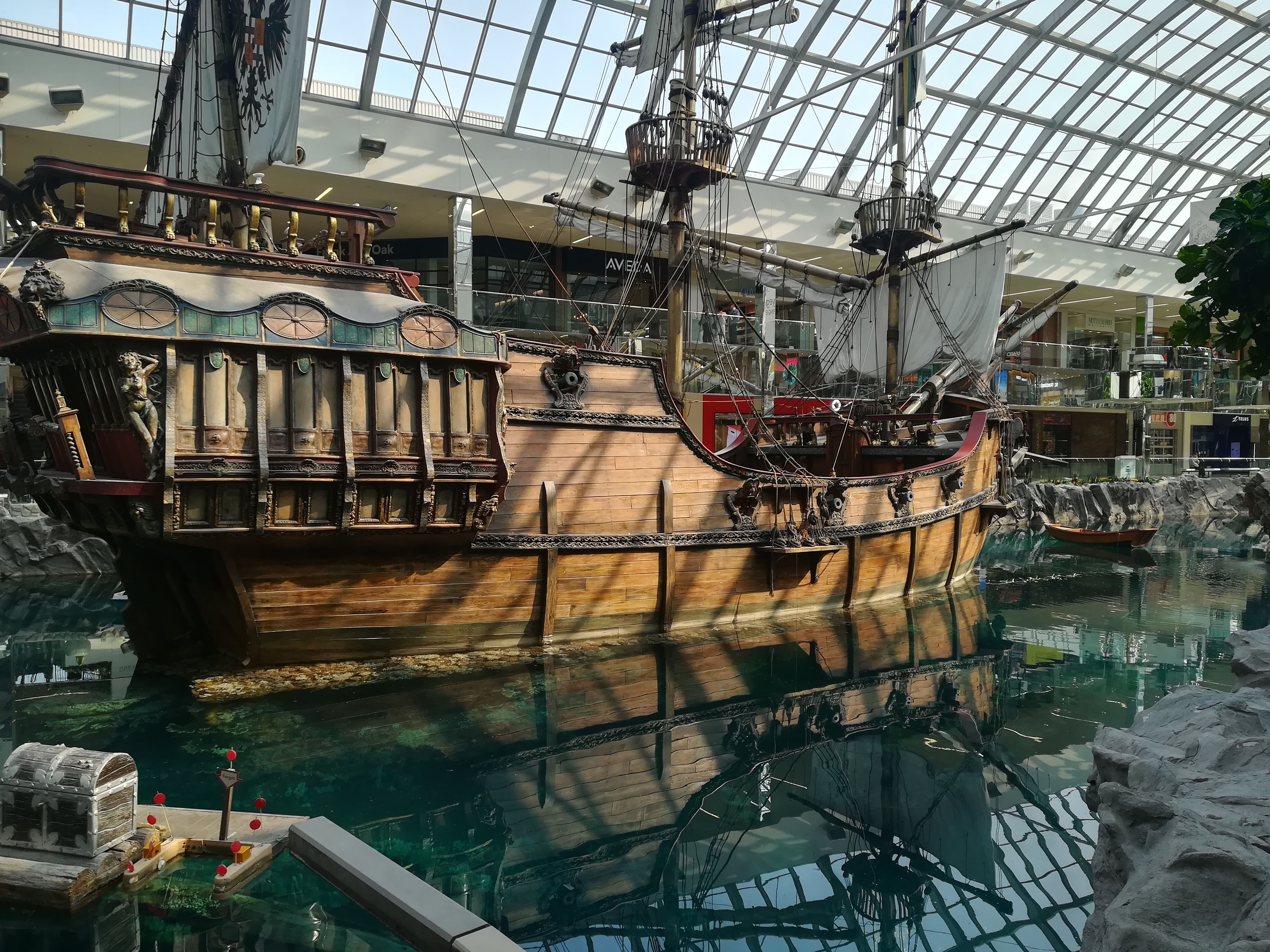
Edmonton, in Alberta, sits on the North Saskatchewan river which originates from the Snow Dome Continental Divide , where we were last week. ( keep up now!) We spent a very happy weekend, staying with my brother who I see very little of, thanks to living 5000 miles apart. For those of you who enjoy shopping whilst on holiday, the West Edmonton Mall is a MUST! It is the BIGGEST MALL in Canada and what an eye opener! Not only is there every shop you can think of . . . . there is also an enormous swimming area, with beach, wave machines, slides etc . . . . . . there is a huge lake area with a full sized pirate ship moored, ready for weddings and events to be held in ‘THE place in Edmonton’ . . . . AND on top of all that, there is a full sized ice rink! If you’re that way inclined, the whole family could happily spend a day there (good marketing ploy!)
West Edmonton Mall
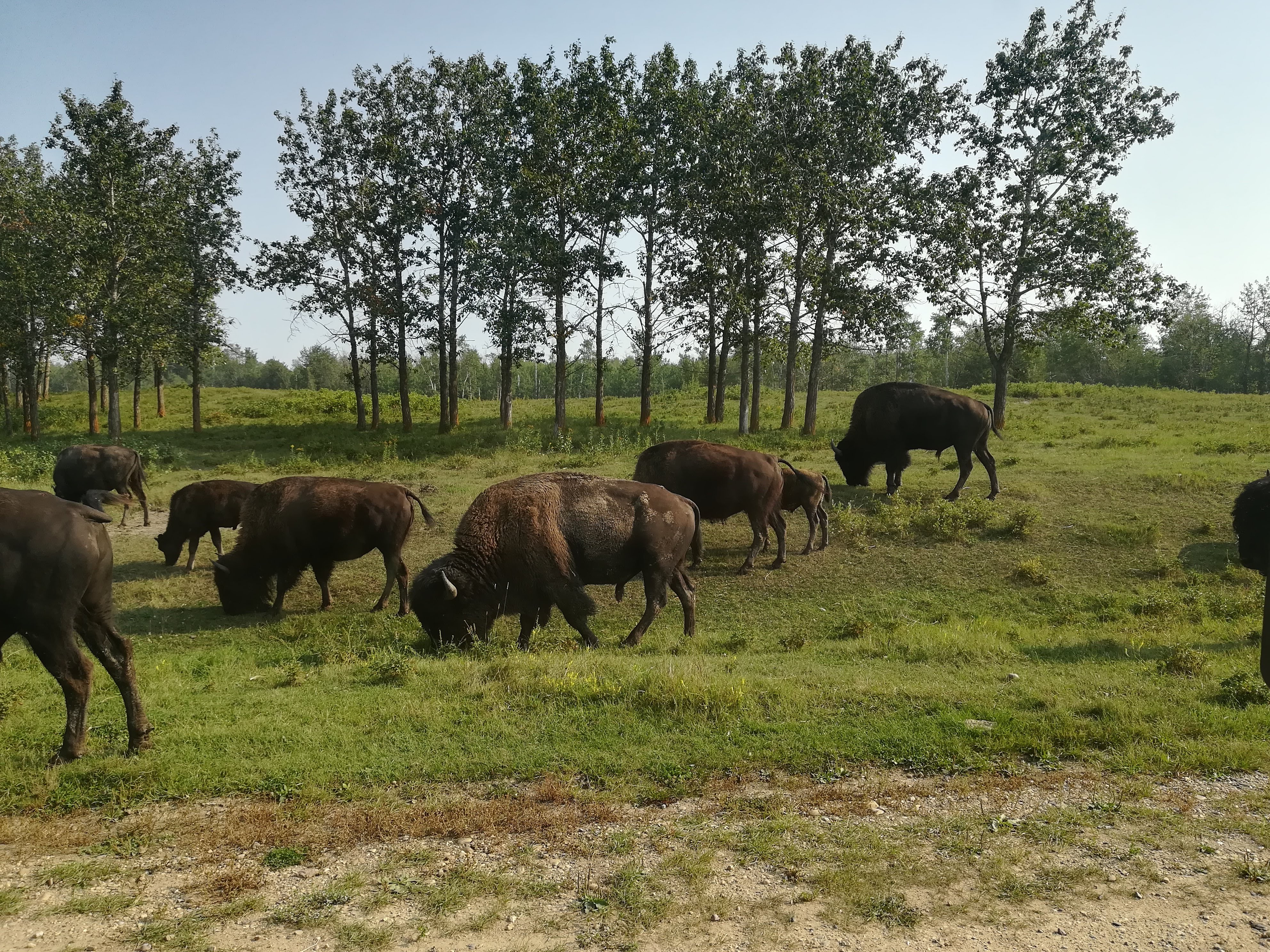
Beginning the final part of our figure of eight around Canada, we drove east and detoured through Elk Island National Park. This enormous area (194 sq km) is home to a large number of bison. There is an active and successful breeding programme, resulting in bison being introduced to other national parks where they will be protected and thrive in their natural environment. By sheer luck, we came upon a herd on the road, so were able to quietly sit and watch as they munched their way past. Big, strong animals – you wouldn’t want to mess with them!
Bison at Elk Island National Park
Our daily search for somewhere to stop for lunch often brings a nice surprise. One day this week we found ourselves in a Ukrainian settlement area. Like so many other Europeans, they were offered cheap land upon immigration in the early 1900’s. Vegreville is one of the Prairie towns, central to their area and we discovered an idyllic little park (lake, fountain, picnic tables, nice flower beds). A massive and very colourful Psyanka (Easter Egg in Ukrainian) dominates the park. Purported to be the largest Psyanka in the world, it weighs a mere 5,512 lb and is made up of 524 star patterns and 2,208 triangular pieces. (rather puts any patchwork quilt to shame!) No, it’s NOT chocolate!! It’s made of aluminium which has been permanently anodized in gold, silver and bronze. Mounted on a 27000 lb base, it swings and moves with the wind. A very unusual weather vane!
Vegreville Pysanka
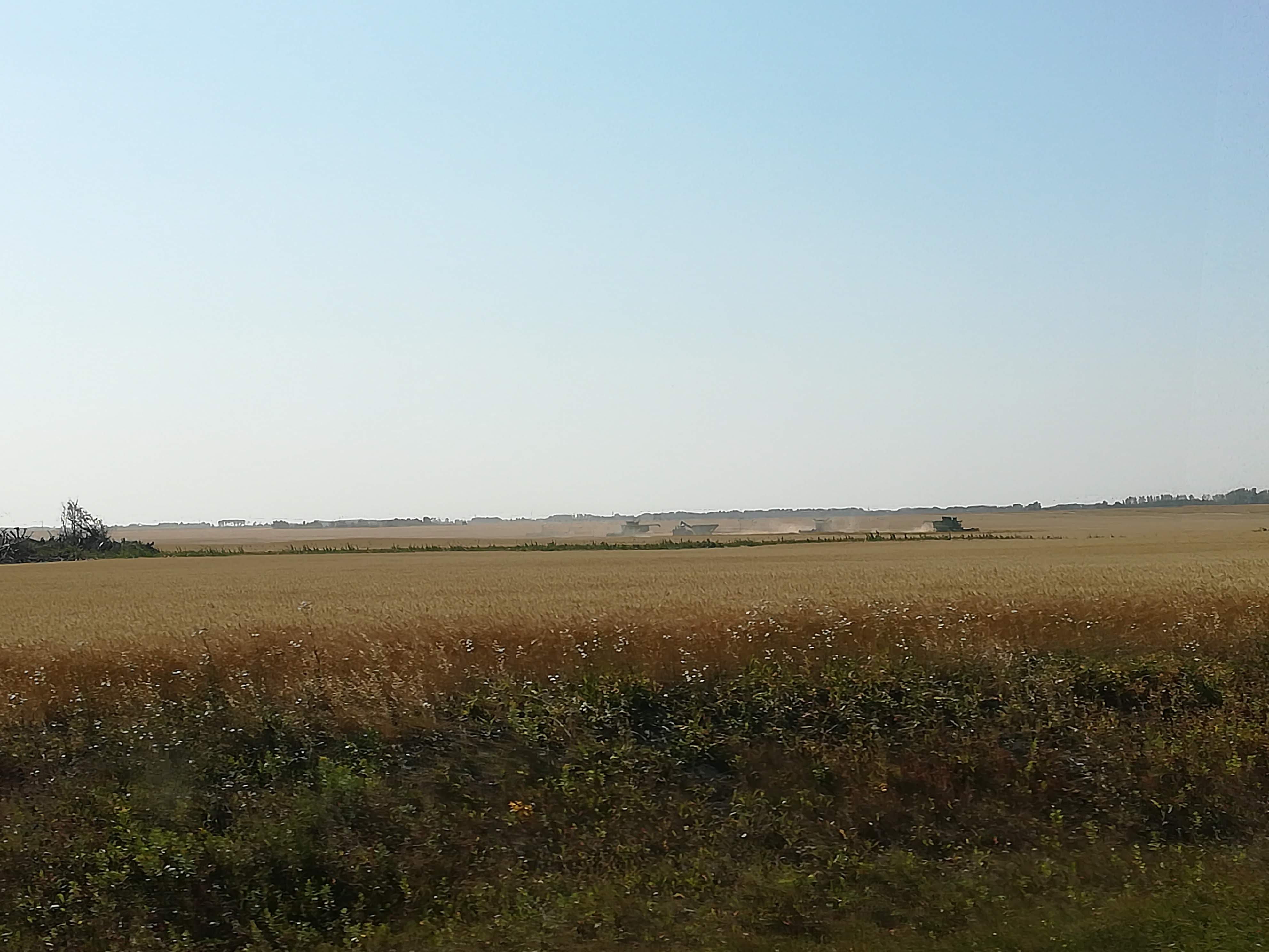
Lloydminister sits on the border of Alberta and Saskatchewan which runs right through the centre of town. It’s municipal campground made a perfect overnight stop. Continuing east we enjoyed crossing the Prairies once again. Great expanses of gold in all directions. Combine-harvesters and swathing machines appearing like tiny dots on the horizon, recognizable only by the cloud of dust which surrounds them. I was remembering my father who used to arrive home from a day’s harvesting, covered in dust from head to foot – looking like a baker who’d fallen into the flour pot! The machines may have changed over the years, but the typical summer dryness, just in time for harvest is still the norm.
Harvesting in the Prairies
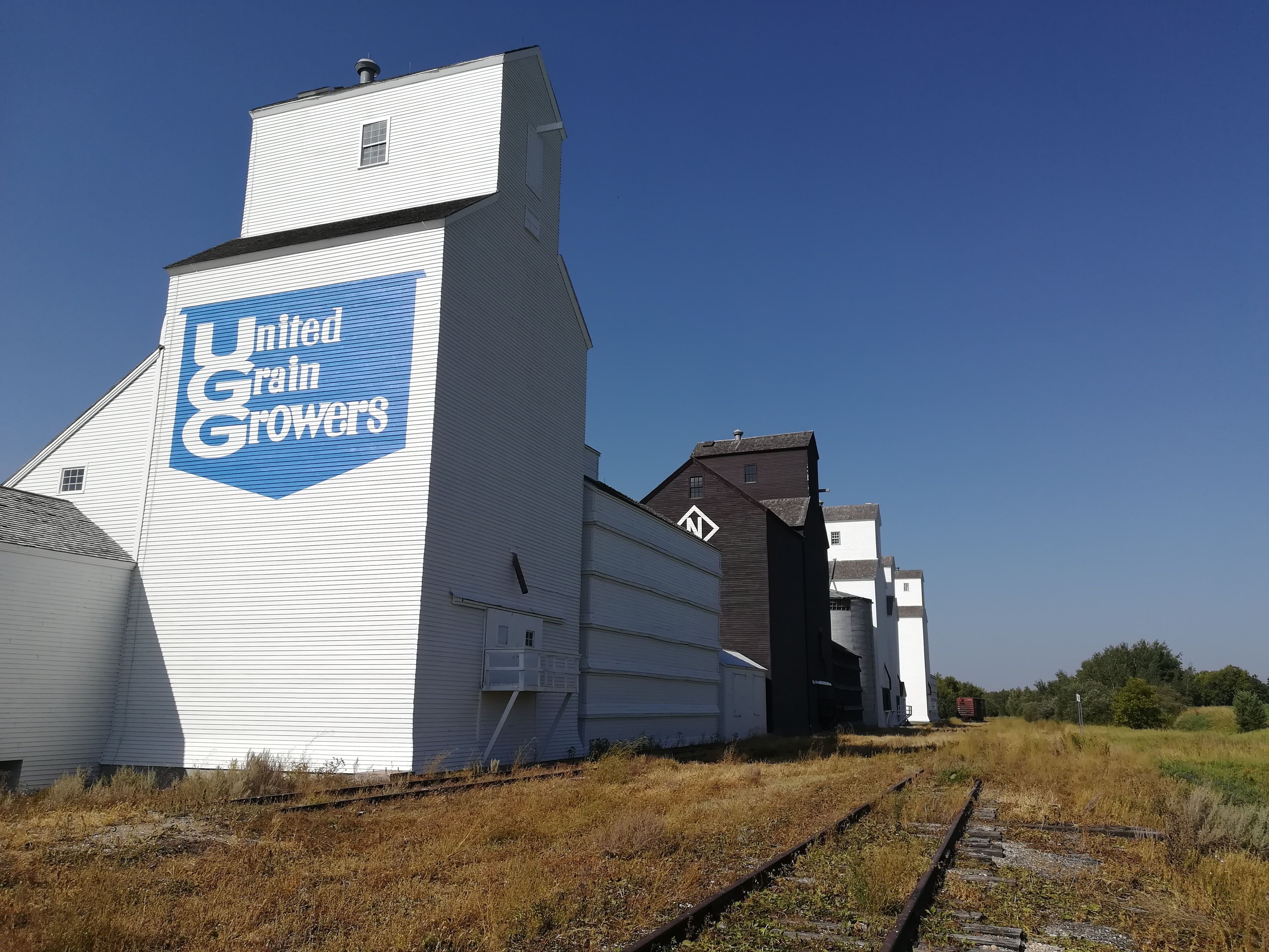
As I mentioned in July, the grain elevators are very much a part of the Prairie skyline. Western Canada was once known as the World’s Bread Basket, and during the 1940’s there were well over 5500 elevators across the Prairies. Railway lines were constructed (both branch and main lines) to connect the elevators and take the grain to ports, from where it was shipped around the world. The tiny town of Inglis in Manitoba has set up a National Historic Site, where four wooden elevators, built in the 1920’s, are preserved and open to the public.
Inglis Grain Elevators
Times have changed – grain elevators are now built of steel or reinforced concrete, and most branch lines have been closed. Trucks now transport grain from the isolated farms to the much larger new elevators. Oats, wheat, flax, canola, barley and lentils are all twenty first century commodities from the Prairies.
Modern Grain Elevators
We were intrigued to see the grass on the roadsides being baled into hay. Google tells us that Alberta suffered a drought last year which devastated hay supplies. Saskatchewan and Manitoba farmers are busy making hay with any grass they can (once you’ve made the grass into hay, it’s yours!) and then selling it on to Alberta farmers. Controversy is rife as the roadside grass is full of weeds, salt and pesticides! Now you know what keeps us amused whilst on the road!!
Haymaking on the roadside
Two days of rest and relaxation were enjoyed at Wasagaming in Rising Mountain National Park, in Manitoba. A lovely campground, with plenty of trees, lots of privacy – but within walking distance of Clear Lake with its sandy beaches and boating facilities. A number of local walks and nature trails – with warnings of a bear being in the vicinity, so we had to sing (or talk loudly) on our walk through the nature reserve! Local shops and restaurants were also within walking distance, all of this giving Lulu (and her drivers) a much- needed break from the long trek back across the country.
Sunset at Wasagaming
Passing into Northern Ontario, the Prairies quite suddenly stop, and thick mixed forest starts. We had forgotten just how big Ontario is – it took us three days to drive across the top from east to west. We’ve allowed six days to make our way back to the rental company. See you next week, when I shall be mopping up the tears . . . . . .
No doubt the British Columbia wildfires have reached the British press. Be reassured that we have seen plenty of smoke, but no flames! A very efficient website, keeps everyone up to date on where the fires are, and what roads are closed. We have been so lucky – unlike the thousands of people who are being evacuated from their homes to spend nail-biting days in a recreation hall, hoping and praying that their house has been saved. The poor firemen struggle to bring a huge fire under control, only to find that lightning has started another dry area burning – I sincerely hope they are being paid OVERTIME!
Most of this week’s photos will be of a smokey nature – apart from one exciting ‘stroke of luck’ – read on! I posted a smokey sunset at the end of last week’s entry in Castlegar. The wildfire website informed us that Hwy 3, which had been our planned route, was closed due to a fire. A one hundred km detour was necessary, which resulted in a very windy, slow road following the Kootenay River to Balfour where we caught a free ferry across Kootenay Lake. Government- funded because it is on a main road – takes 80 cars at a go – two ferries run back and forth all day. We used the 40 minute crossing to have breakfast onboard Lulu!
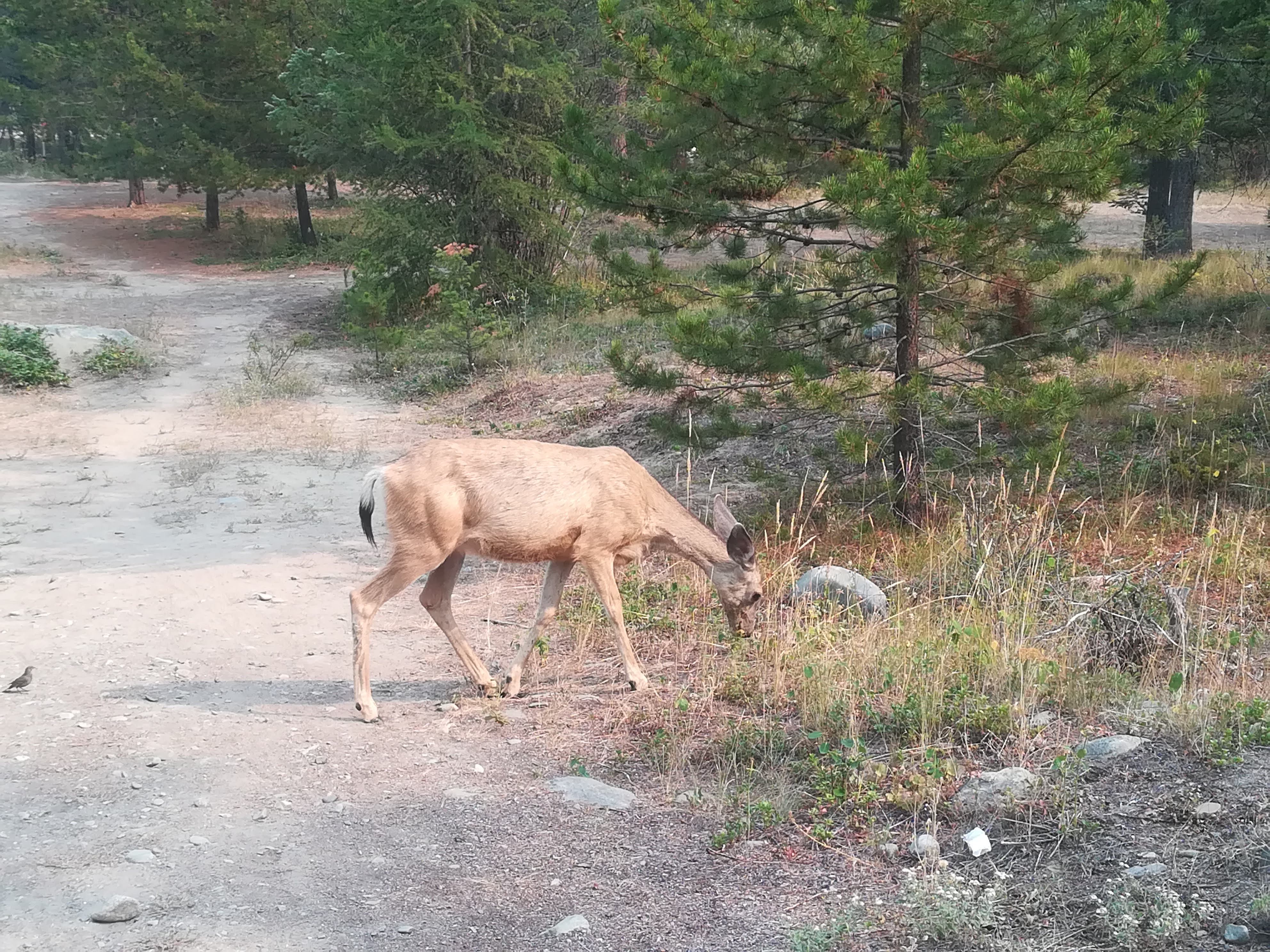
Continuing east and then north, our campsite for the following two nights was near Kimberley – a lovely mountain site, with lots of trees around for privacy – but big warnings to be on the look-out for wildlife (we managed a deer!).
Deer on the path at Kimberley campground
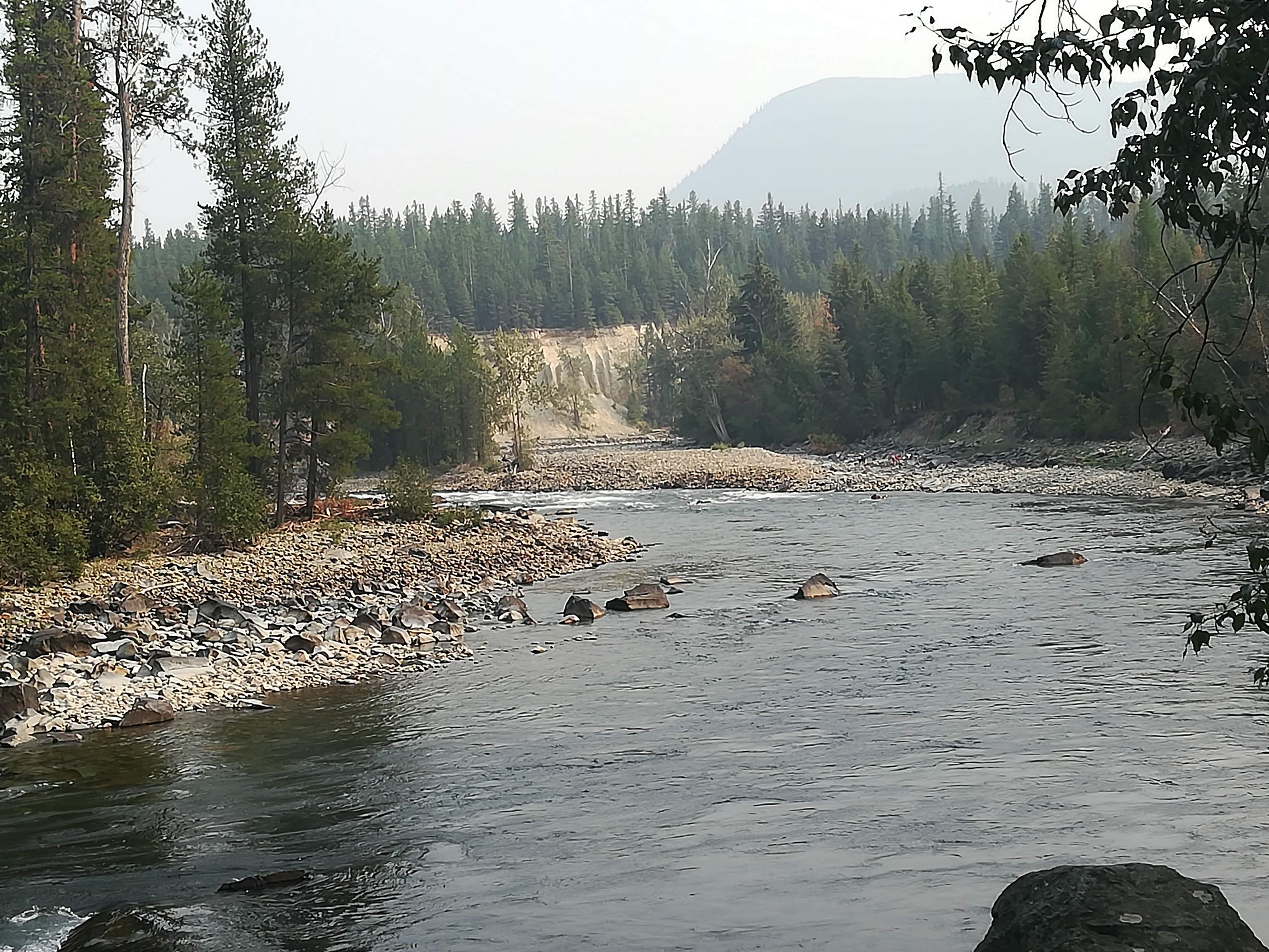
The campground was bordered by St Mary’s (very fitting, we thought!) river and had some good walking trails about.
St Mary’s River at Kimberley
Kimberley itself was originally a mining town. The mine closed some time ago, but was very successful in its day producing huge quantities of lead, zinc and silver. We enjoyed a very good underground tour in the mine – being taken down by a tiny train, such as the miners would have traveled on. An ex-miner was on hand to show us just how tough their life was – but insisted that they all thrived on it and were well remunerated. It saddens us to hear this afternoon, that residents of Kimberley have been put on evacuation alert – the fires are getting very close to them.
Kimberley Mine entrance from Miners Train
Driving due north we headed for Golden – a town that we had already skimmed past on our way out of the Rockies in July. Downtown Golden proved to be a thriving and busy place – it took three tries to find a table in a restaurant! We also managed to get a third Oil Change for Lulu – yes, we’ve driven 16,000 km! The campsite there was right next to the river AND an enormous Railway terminus! Suffice to say, that we were up and on the road very early the next morning!
Smokey Scene at Golden
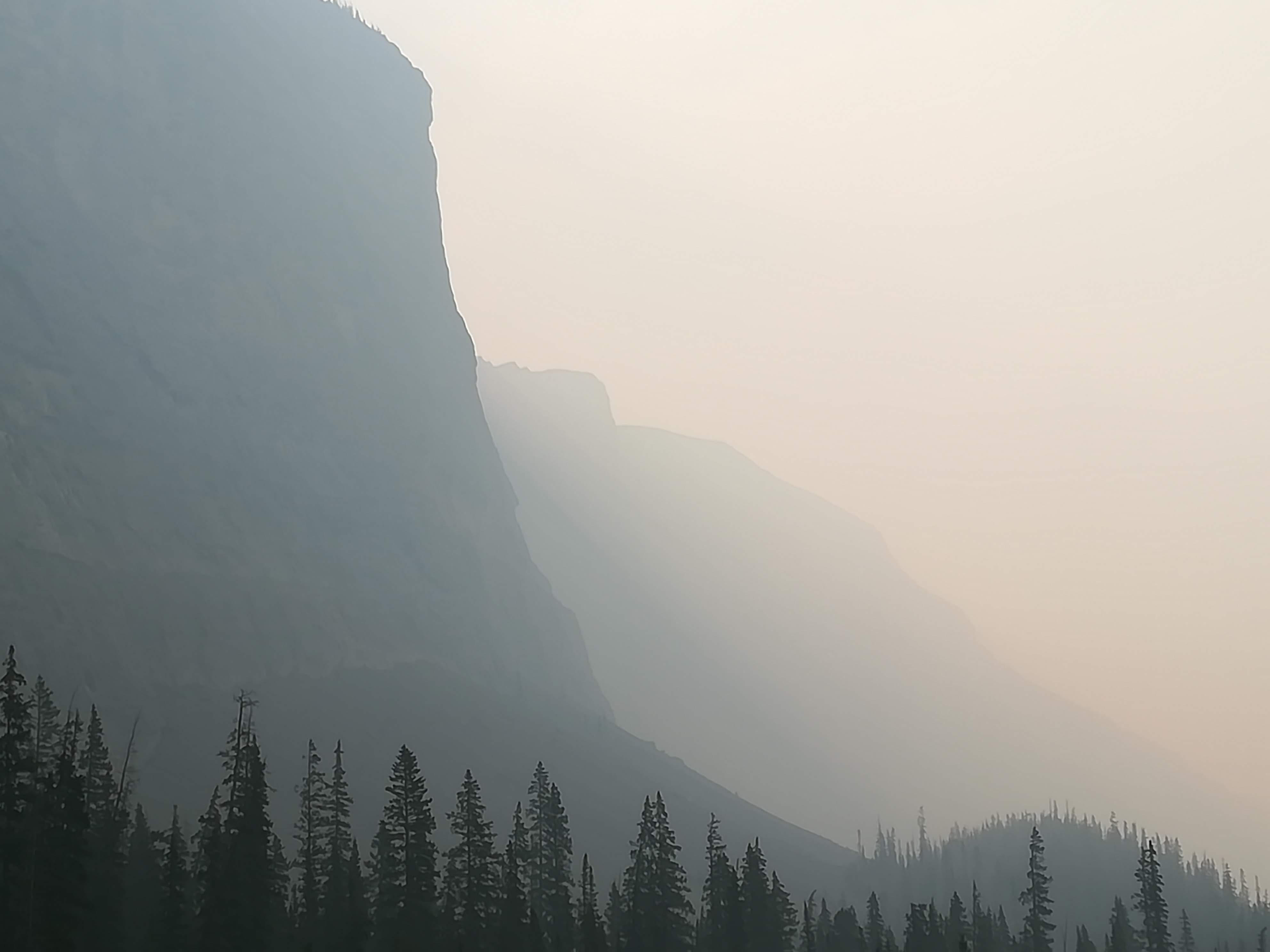
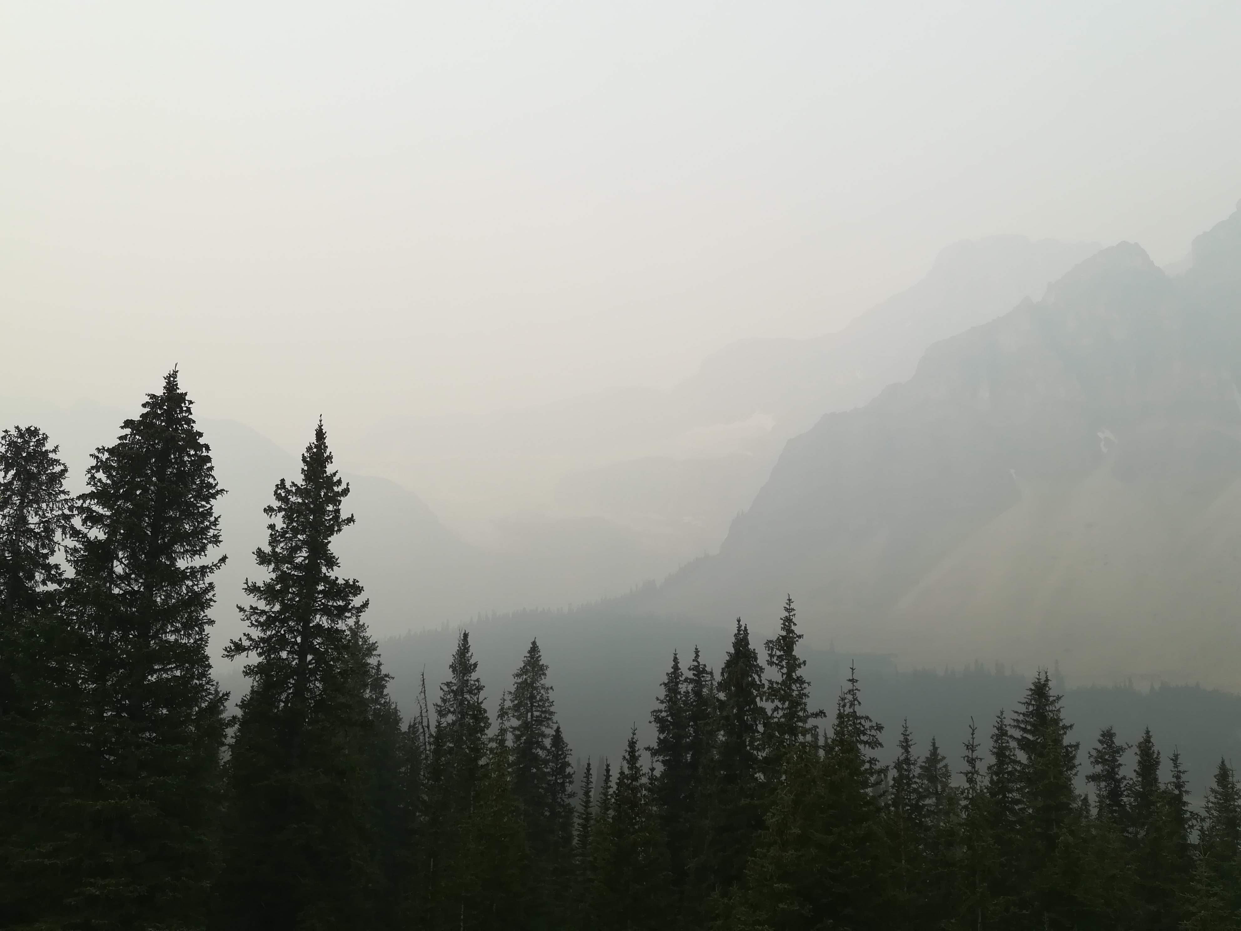
By now, the smoke from wildfires was getting very noticeable. Mountain views up and over the Kicking Horse Pass were being blanked out by a sort of grey smog. Our fingers were firmly crossed that the smoke would not have reached into the Rockies as far as the Icefield Parkway. Having looked forward to driving this famous route for the previous three months, you can imagine our disappointment, as we drove along seeing precious little.
Smoke over Kicking Horse Pass
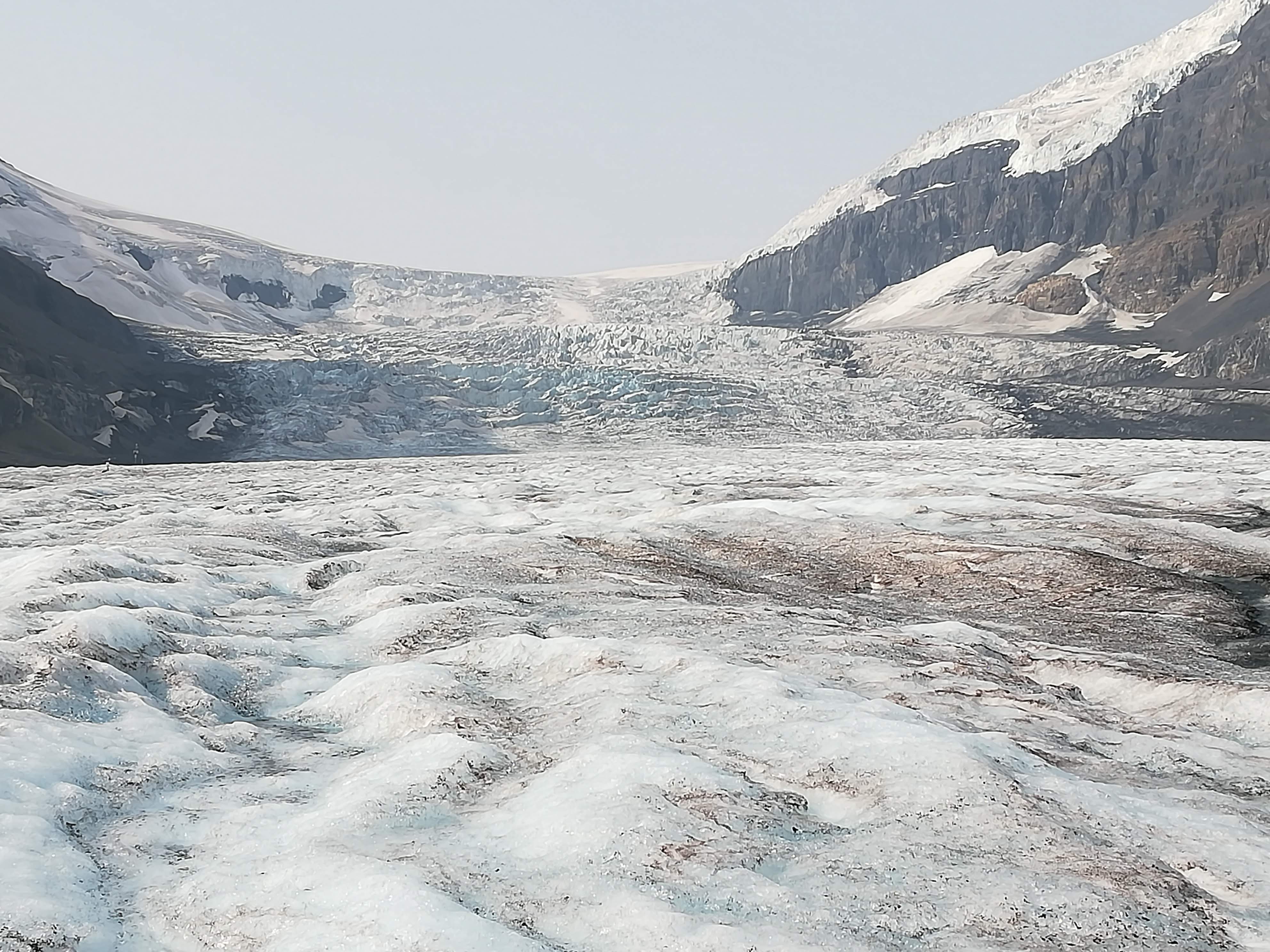
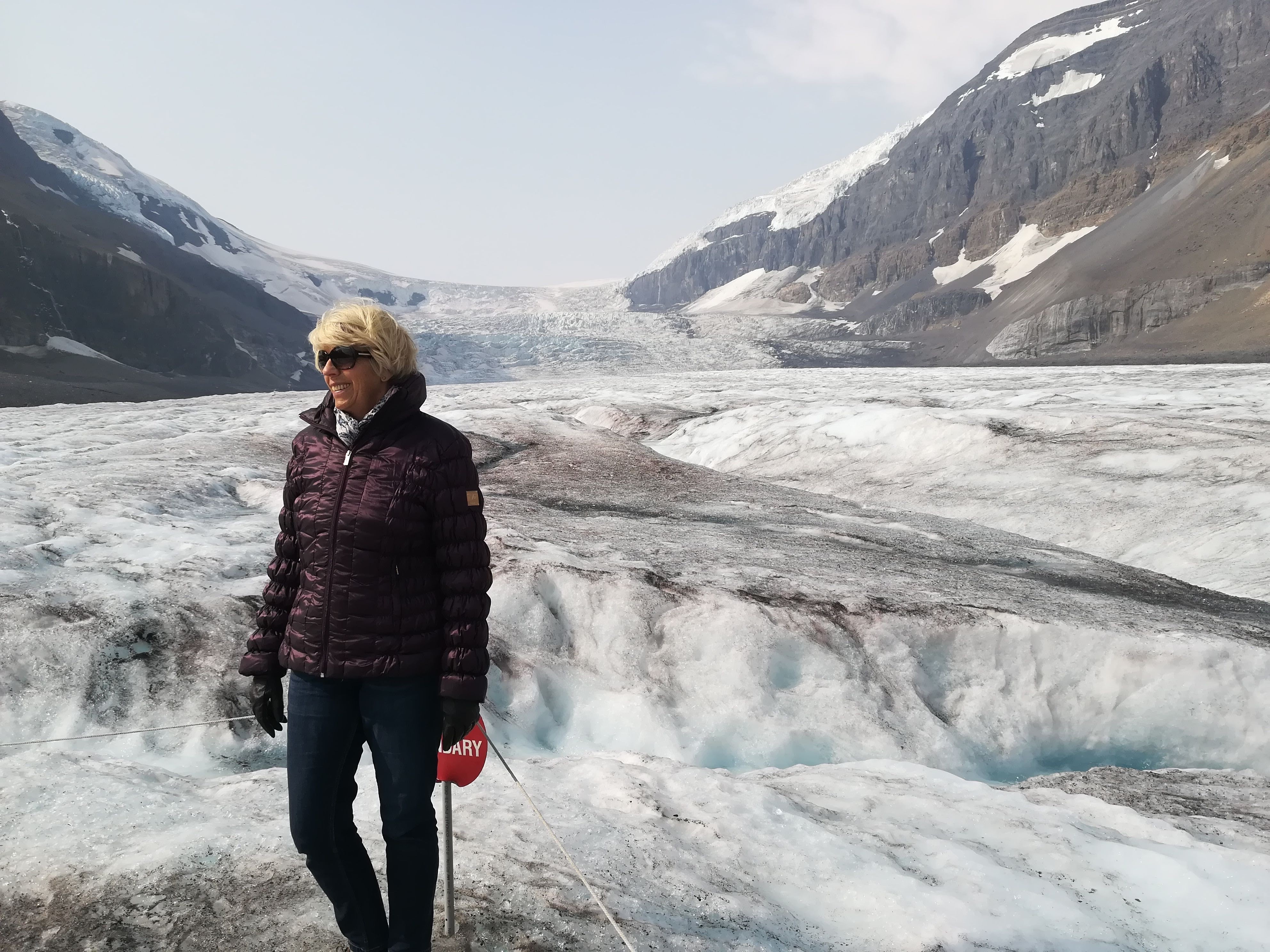
Our plan was to drive from Lake Louise to Jasper (ie the whole Icefields Parkway) on the first day, and then to return to the Icefield Centre on the second day to do a pre-booked Glacier Tour. After a miserable day one (too much smoke, too many people and everyone looking dour), we retired to our campsite in Jasper with fingers firmly crossed. Hallejuah! Our prayers were answered. A very early start resulted in no traffic, and much more clarity as the sun rose over the mountains! We arrived at the Icefield centre with time to walk to the Toe of the Glacier, before actually taking the tour – which involves a hair-raising ride on an IceBus and then a 40 minute walk on 850 ft depth of ice, on the Athabasca Glacier (7000 ft altitude)! What a thrill! It was AWESOME – and there was very little smoke for those two hours.
Athabasca Glacier
850 ft of ice underneath me!
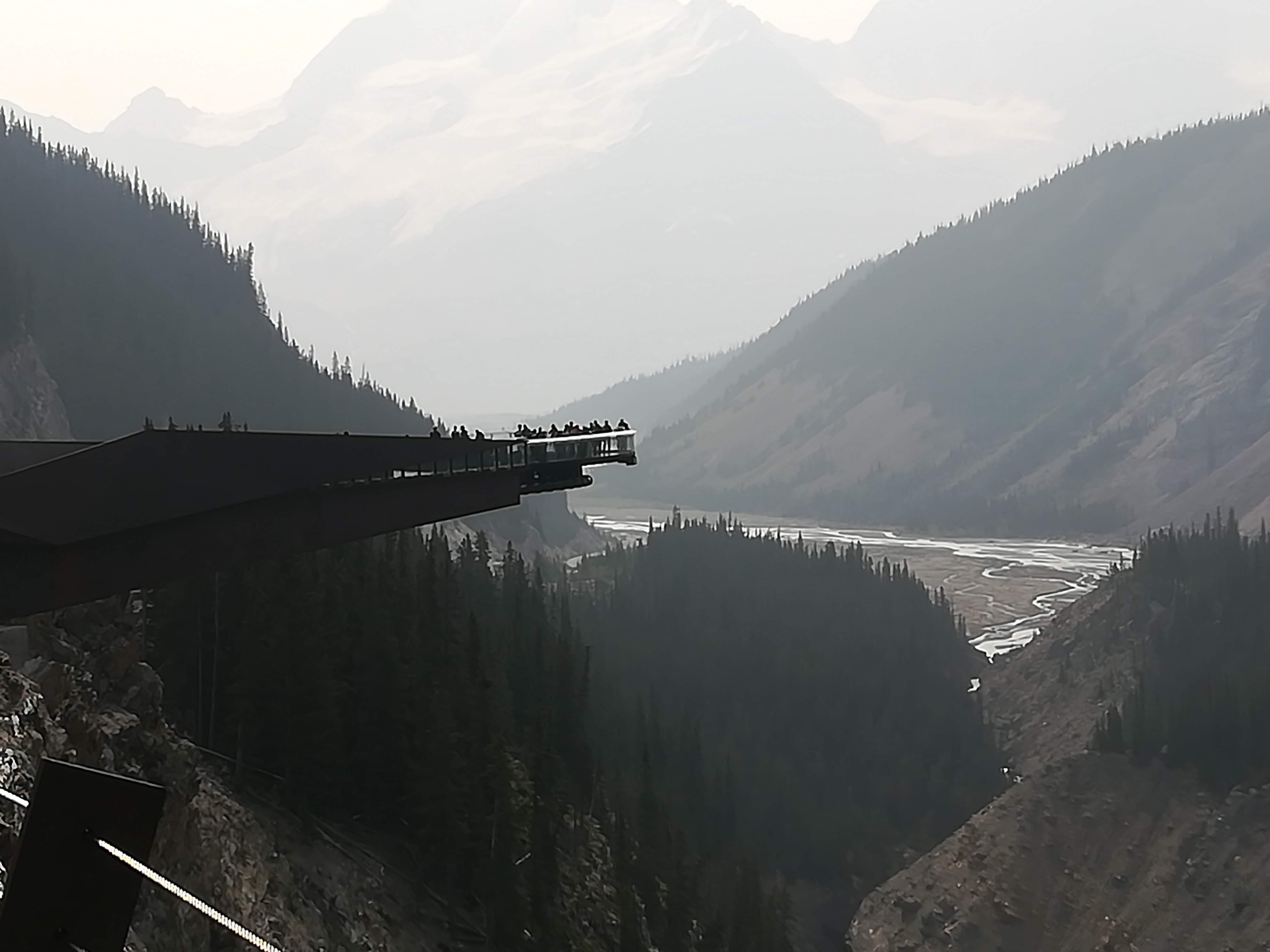
The tour includes a visit to the Glacier Skyway – a very scary and precarious ‘balcony’ built 950 ft above the Sunwapta Canyon! A glass-bottomed walkway allows you to look WAY DOWN THERE, if you can bear it! People were literally lying on their tummies to take photos – not me, though!
Skyway over Sunwapta Canyon
As we returned to Jasper, the smoke came down over the mountains again – and has not left us since. However, we have absolutely no complaints compared to the poor people whose homes are in danger. And what of the wildlife in the many square miles of bush that are alight? It’s a very sad situation . . . .
We’ve exited the Rockies now and come further east to Hinton. The smoke seems to have infiltrated well into Alberta. We are heading for Edmonton to spend the weekend with my brother. Apparently, even the Edmonton skies are doused with smoke.
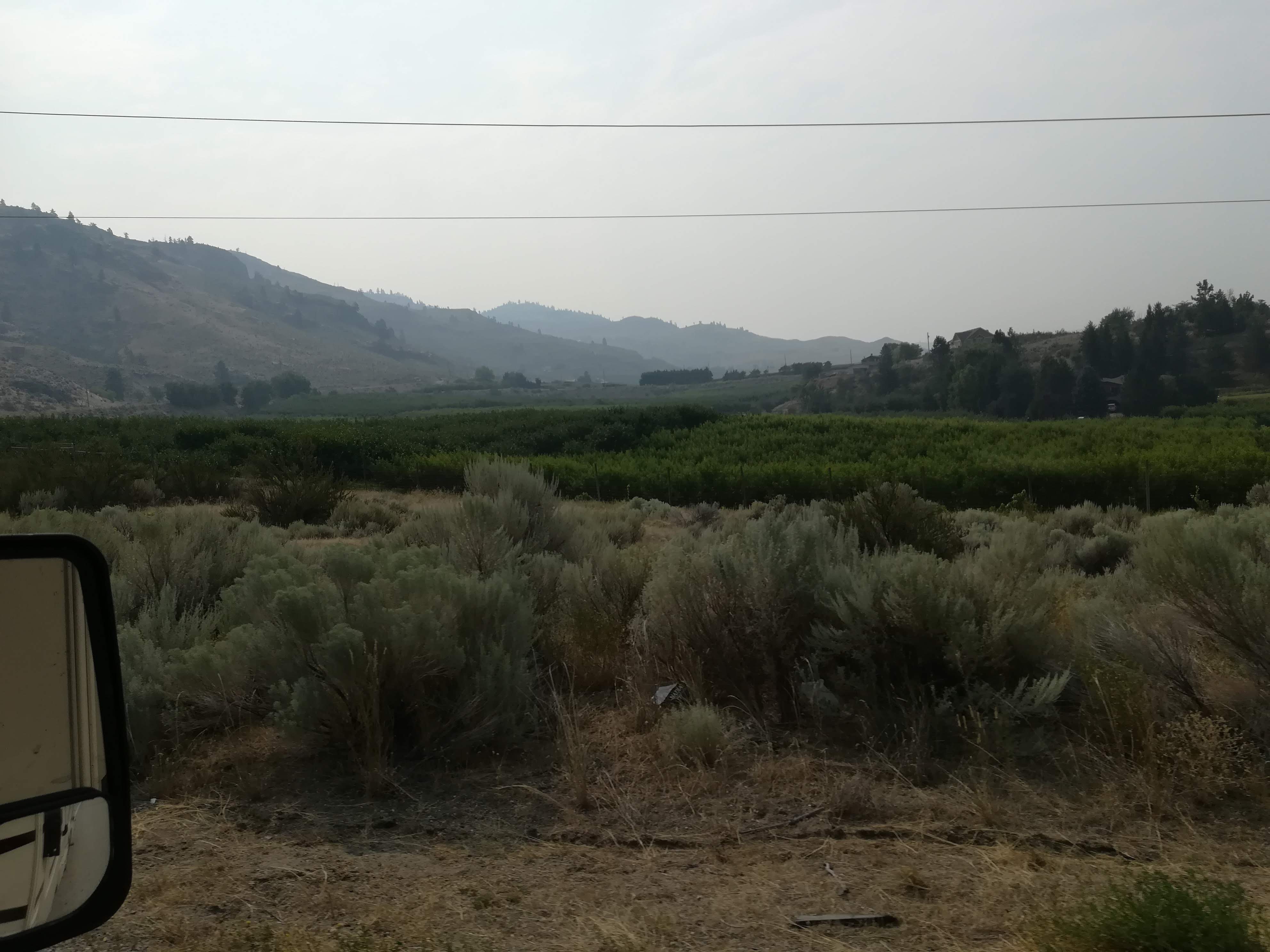
Driving east from Hell’s Gate, we have followed Hwy 3 along the southern area of B.C., very close to the USA border at times. The Okanagan valley is well known for its numerous vineyards. It is also VERY DRY and DESERT-LIKE. After passing through several more mountain passes, the countryside suddenly opens up into very wide valleys, with towering rocky cliffs. Thick green forests are replaced with shabby, dry scrub-land. Every available flat area seems to be planted with fruit trees (peaches, apricots and cherries) or grapevines. Irrigation from the numerous rivers is paramount to the success of this enormous area, as is the more moderate climate. Lots of pretty lakes act as magnets to holiday makers, keen on beach holidays, fishing, or boating.
Fruit trees among the scrub!
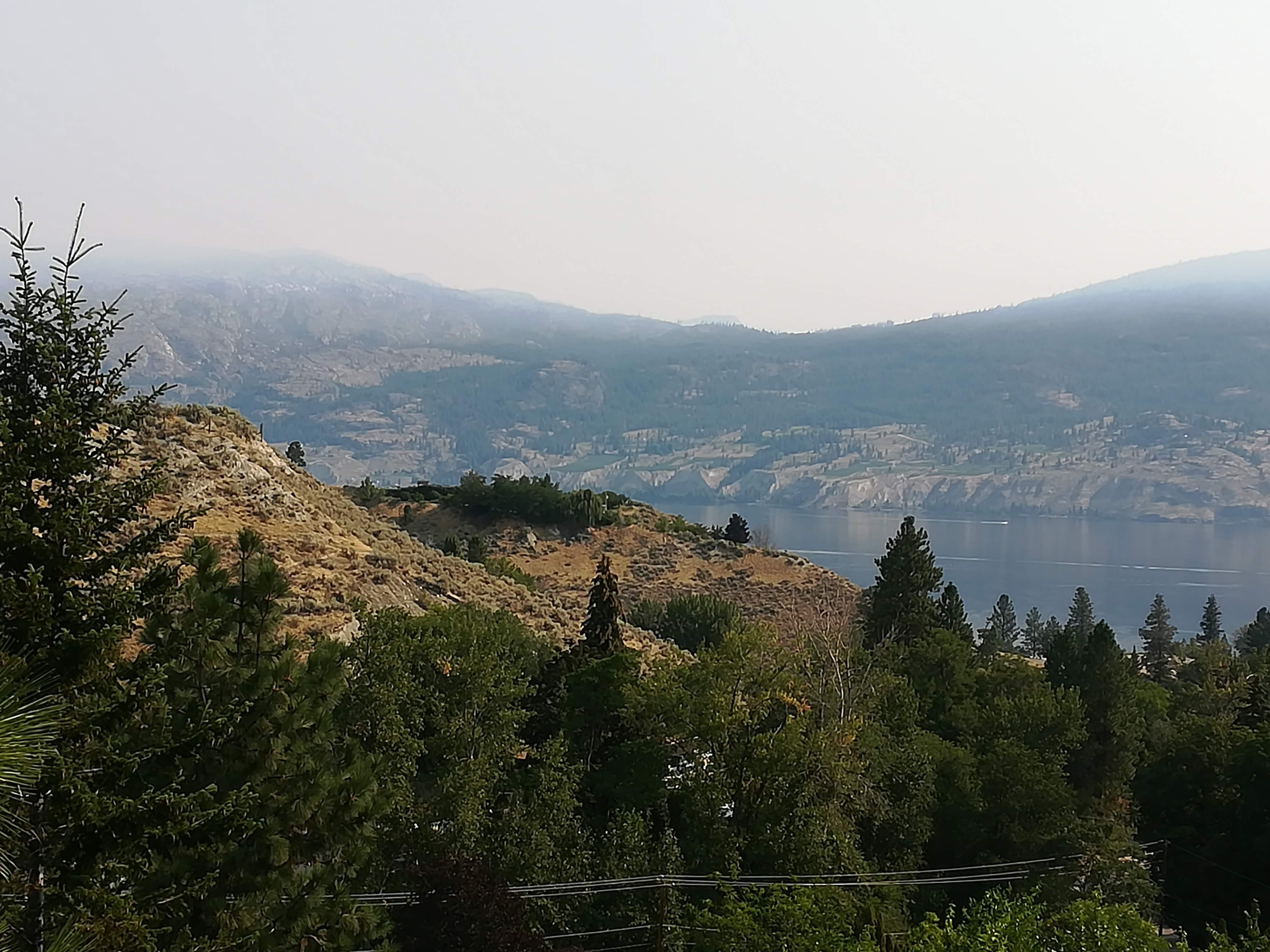
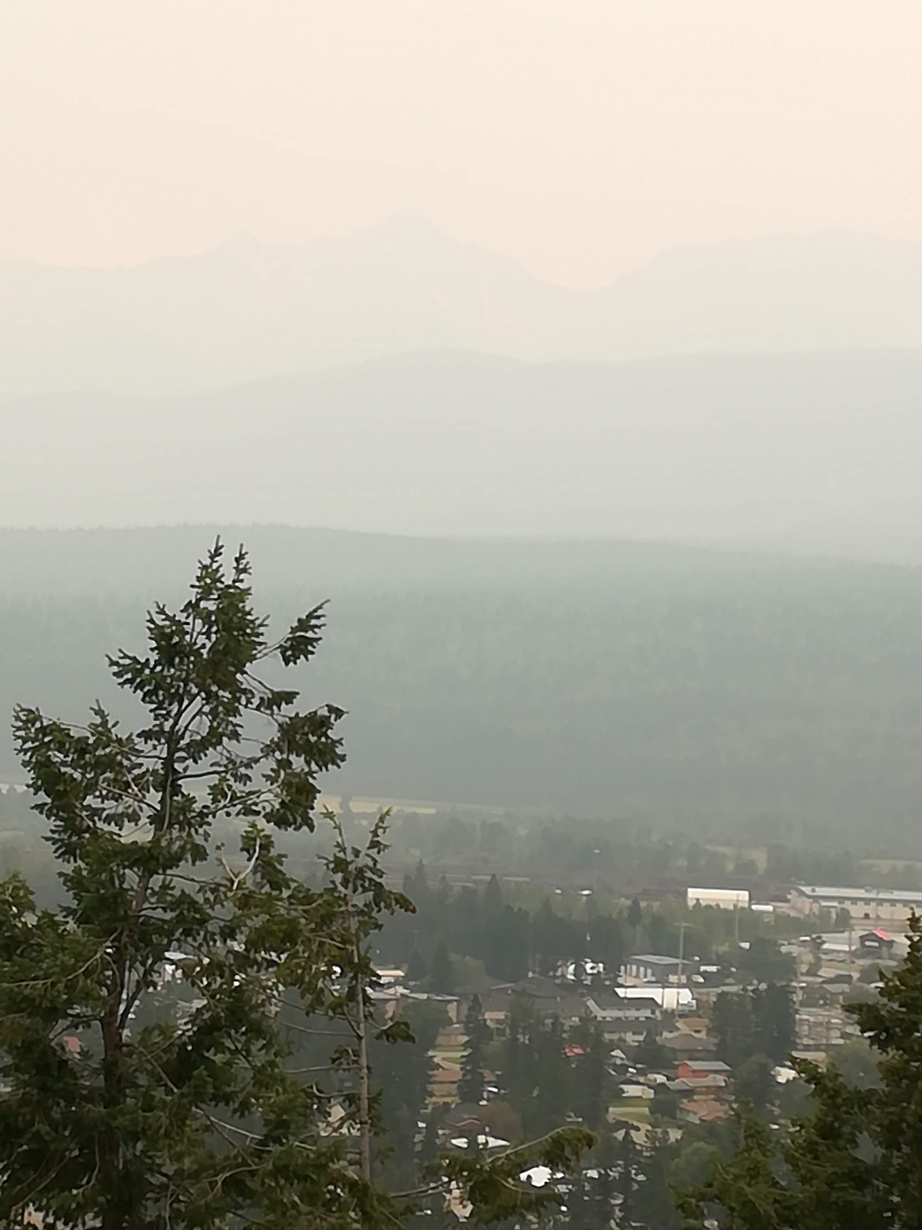
As I’ve mentioned in earlier blogs, we have had to book campsites well ahead, as we are now in peak season. Umpteen phone calls resulted in a four night stay in Summerland, with us thinking “Oh goodie, four days relaxing on the beach”. The municipal campground is “within walking distance of the beach”. Disappointingly, the campground is overcrowded (another RV carpark!) and the local beach was badly damaged in this year’s floods – making swimming not at all pleasant. Lots of other beaches are a short drive away, but Lulu is just too big to squeeze into small spaces under trees. Unusually high temperatures (39C by 11am), and wildfires in the vicinity meant there was a continual ‘smog’ hanging over the area.
Smoke and Heat Haze over Lake Okanagan
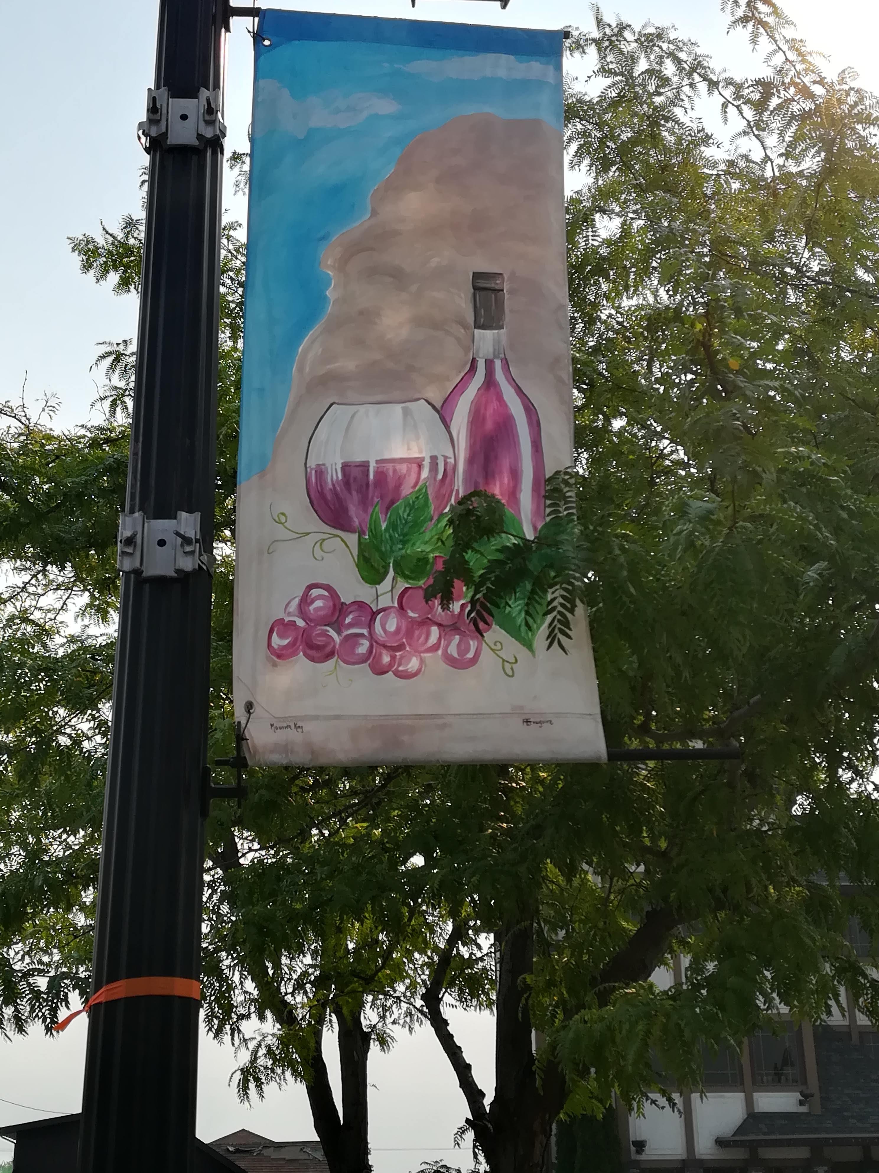
All was not lost however. We did early morning walks, discovering a very welcoming local town with lovely coffee shops, good places for breakfast and wonderful banners painted by local people.
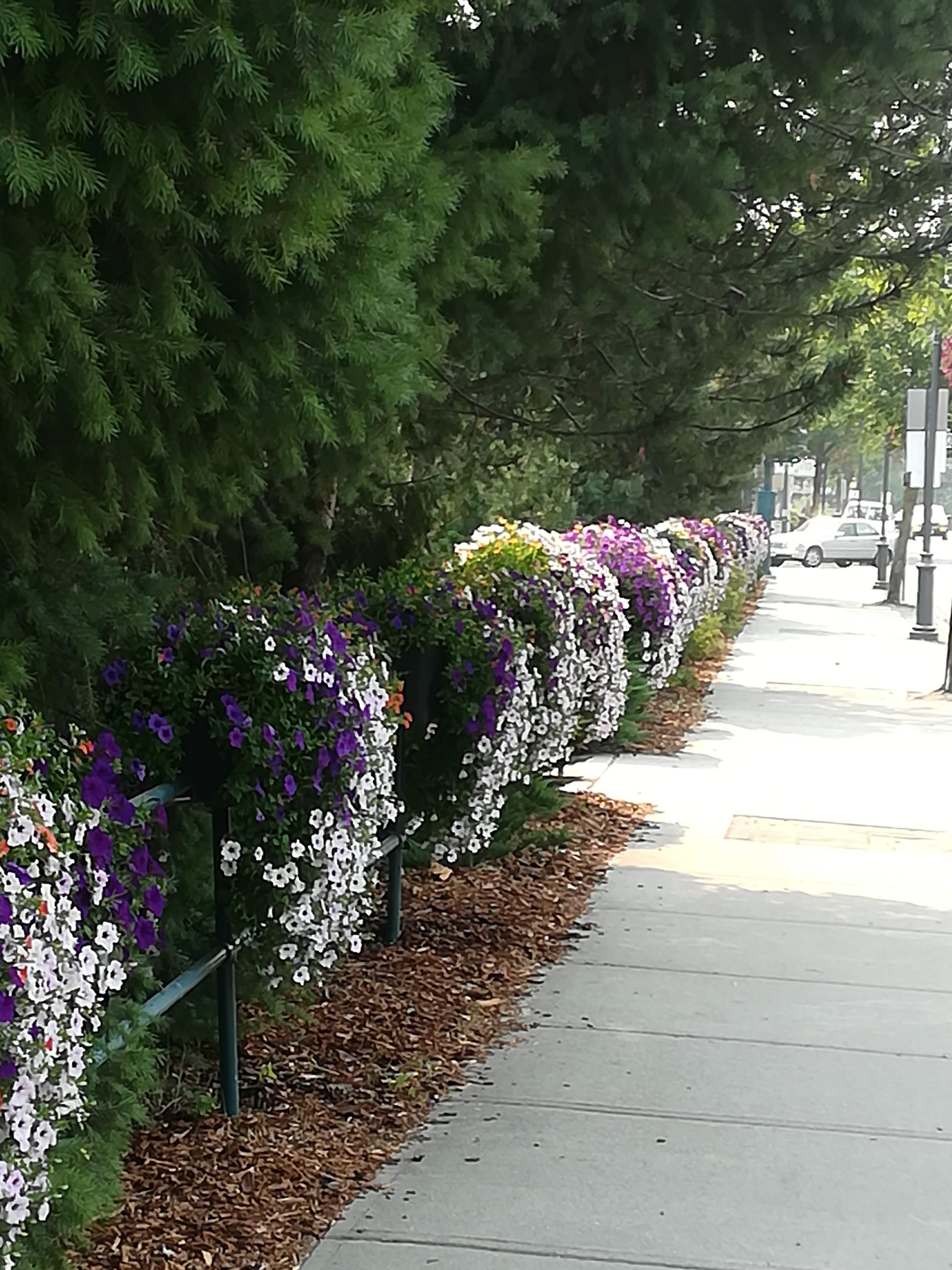
Banners in Castlegar
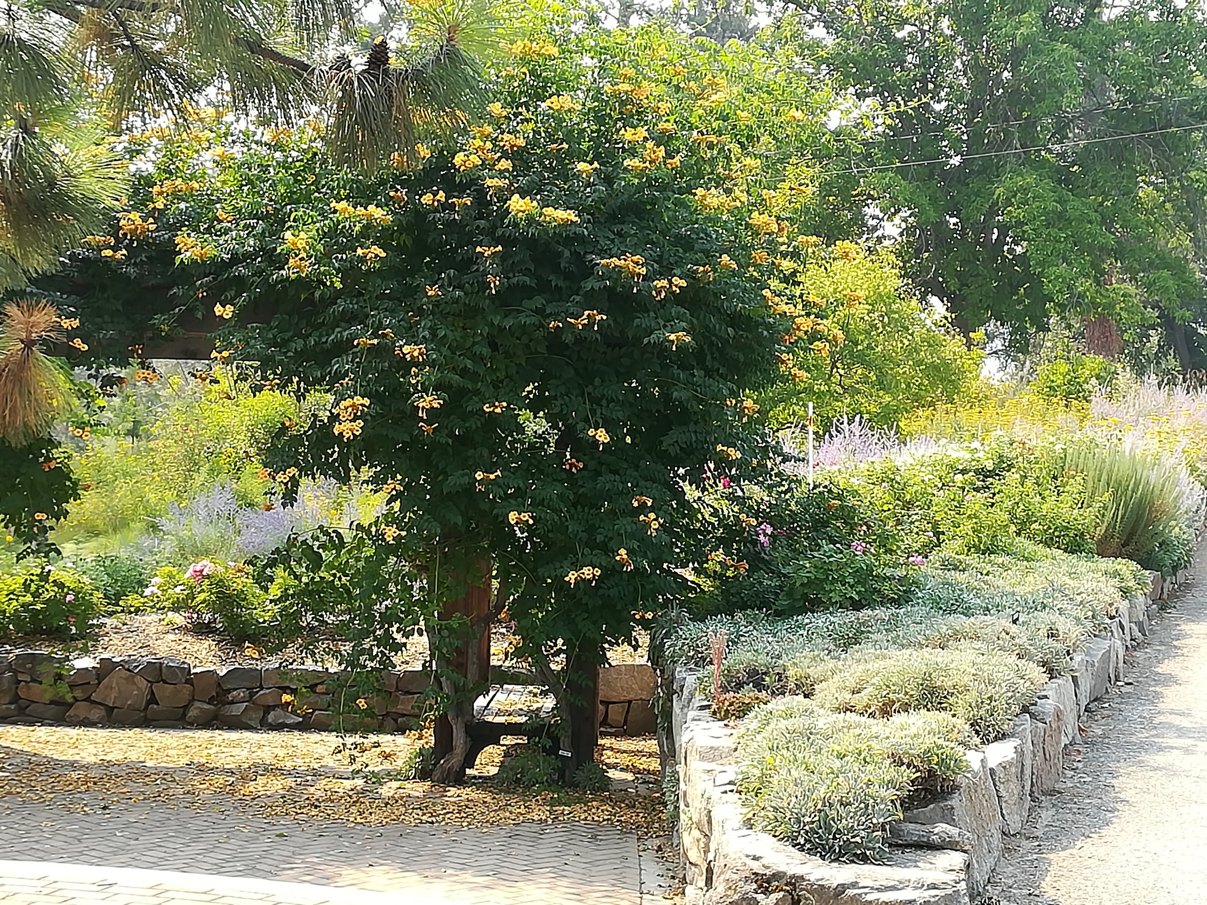
The local Ornamental Garden was a real bonus – lots of parking for Lulu, and several benches in the shade with a breeze from the lake, allowing us to enjoy the colourful gardens (we went two days running, just to escape the heat!) . Local taxis ferried us out to an excellent restaurant one night, and then to a very good folk concert at one of the local vineyards on another night. What a wonderful combination – good live music, sipping local wines, outdoors on a balmy evening!
Ornamental garden
Not many miles further south, the lush forests and mountains return. Now further east in Castlegar, we have savoured two nights on an idyllic campground – Adults Only! Beautifully quiet, individual sites have lots of space, freshly mown grass and shade to sit and watch the river go by. Castlegar is situated at the junction of the Kootenay and Columbia rivers within the Selkirk mountain area. Nice town (good coffee!) and the usual wonderful flower displays. I’ve been wanting to mention how Canadians really push the boat out, with their summer displays. Perhaps this is a necessity after the long winter months.
Floral Displays in Castlegar
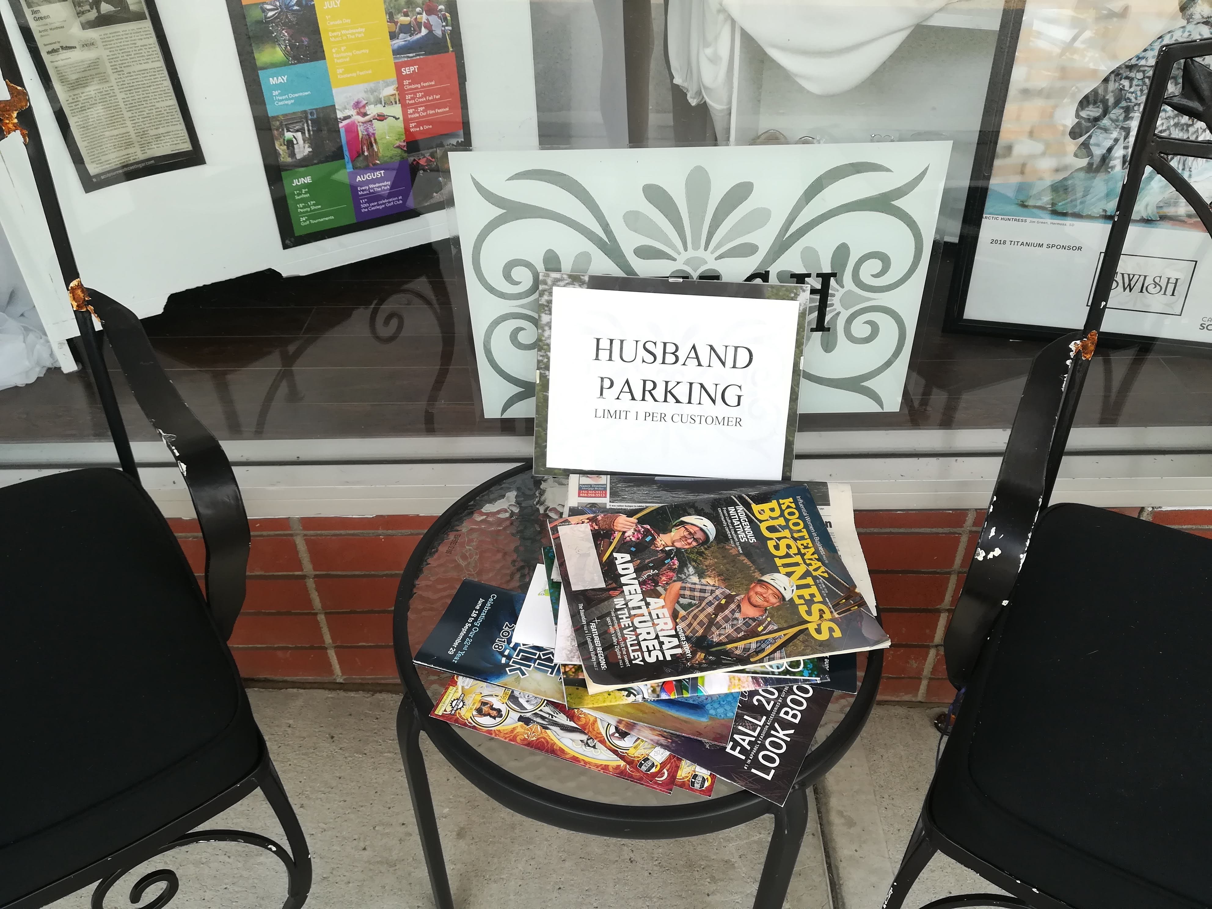
Finally, to remind you of Canadian humour and ingenuity! This was outside a Ladies Clothing shop – but could also be useful outside a Patchwork Fabric shop!
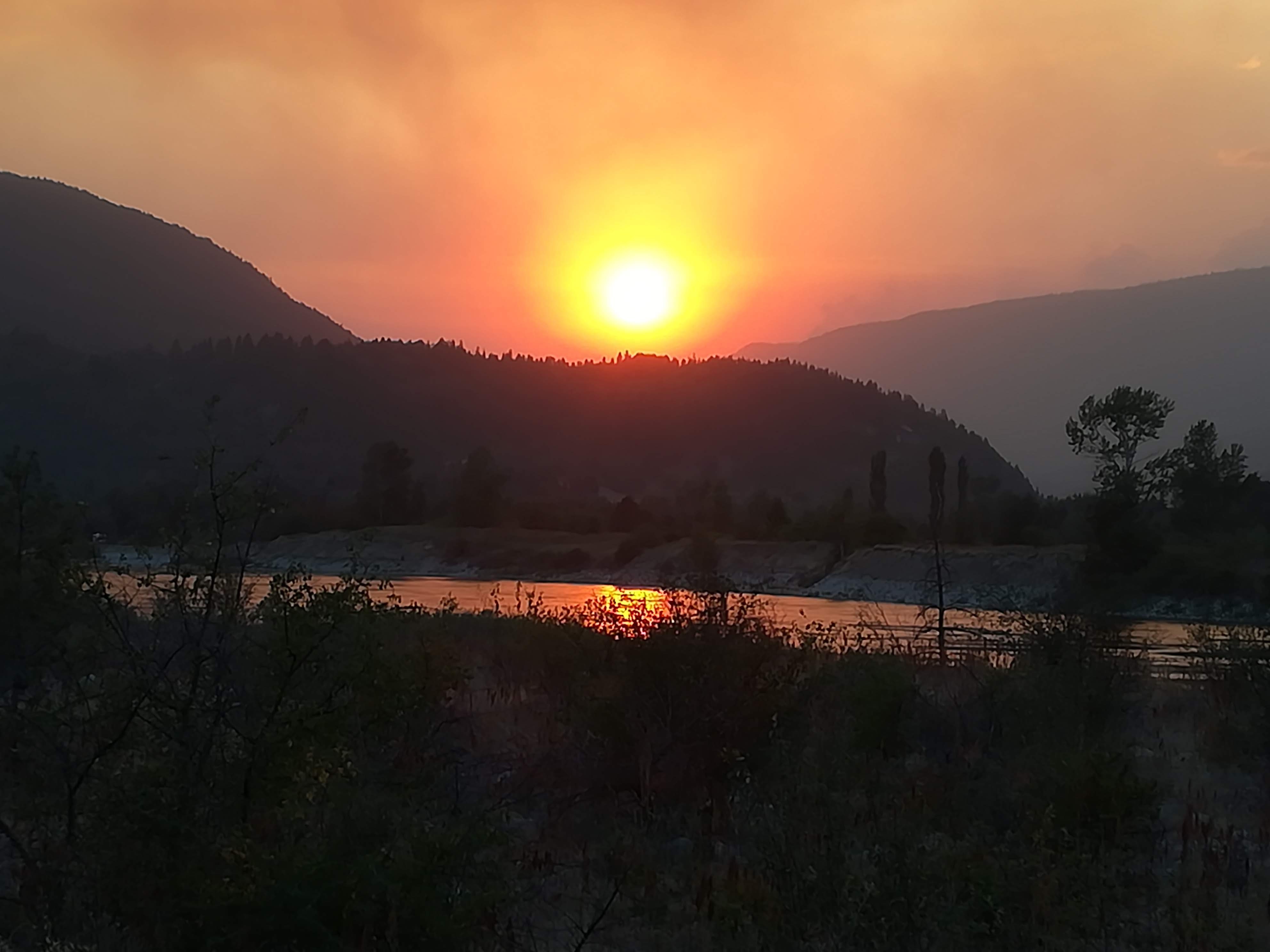
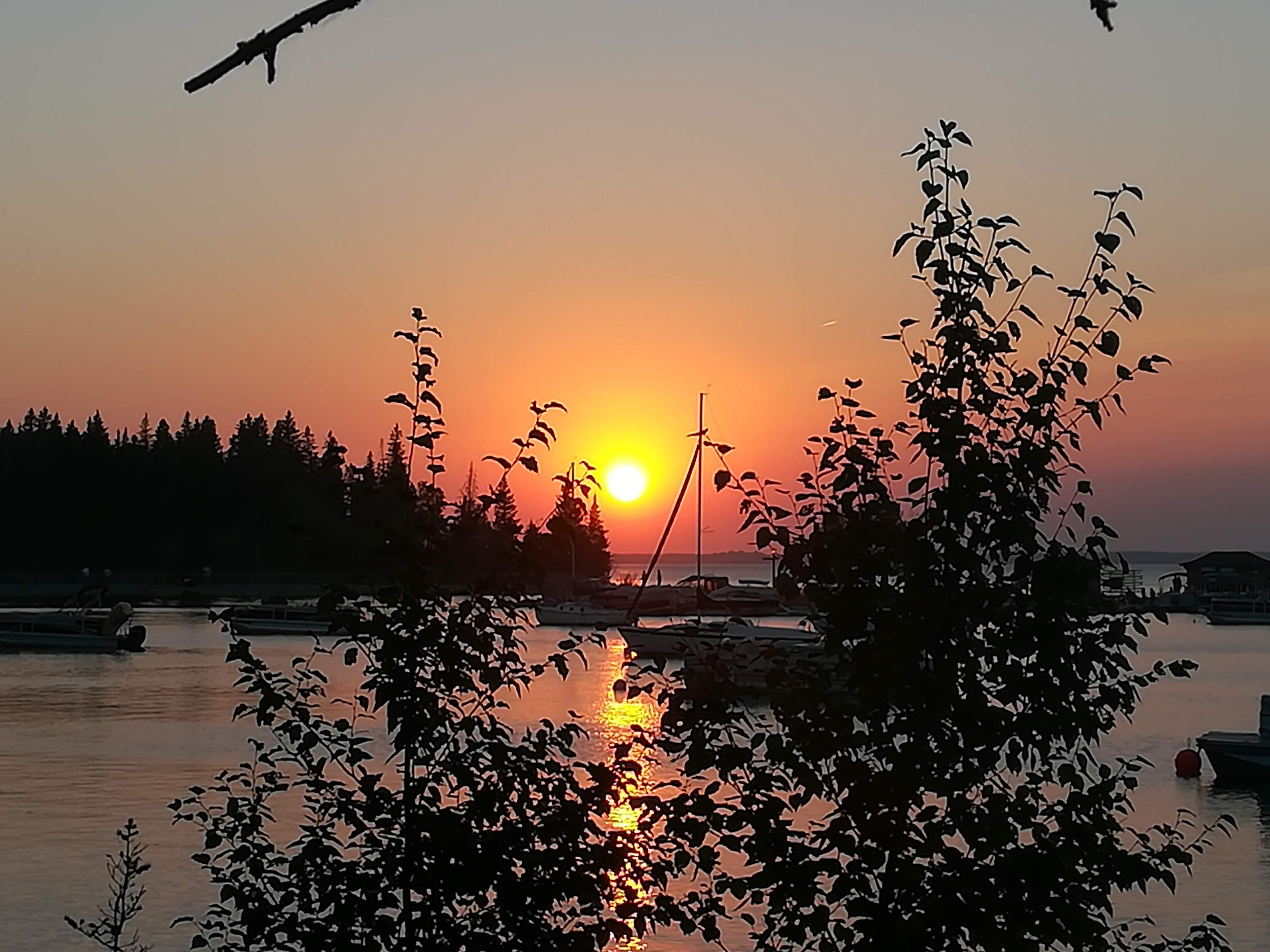
A fitting end to this week’s missive, is tonight’s sunset over the Kootenay River. Note the smoke filled sky . . .
Blue Horse Folk Art Gallery is an absolute ‘must visit’, if you should find yourself on Salt Spring Island. The owners are family friends and we were lucky enough to park Lulu on their drive for the night, and enjoy a lovely meal which included figs and cherries straight from the garden. This little ‘piece of heaven’ also does Bed and Breakfast, so please add it to your bucket list should you be travelling on the island. (google it!)
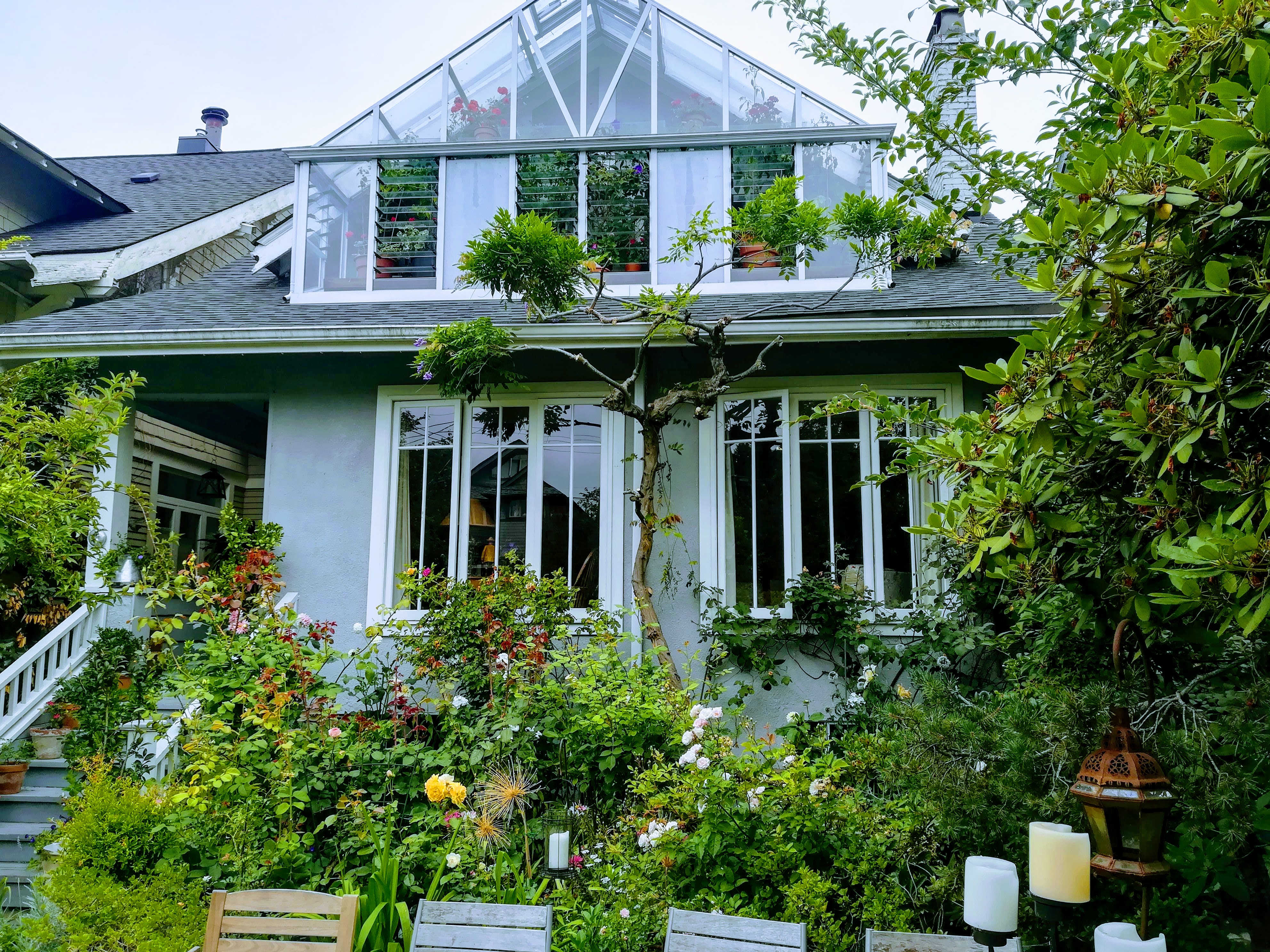
A two hour ferry journey from Long Harbour takes you to Vancouver, where we were overjoyed that more family friends had cordoned off sufficient space outside their home for us to park Lulu! (think chairs and string!) Situated within minutes of the ocean, we enjoyed two nights in a proper bedroom with the use of a proper shower, in this Heritage House with its beautiful front garden. The garden is FULL of a spectacular array of plants, with lots of colour – and becomes the dining room for the summer months.
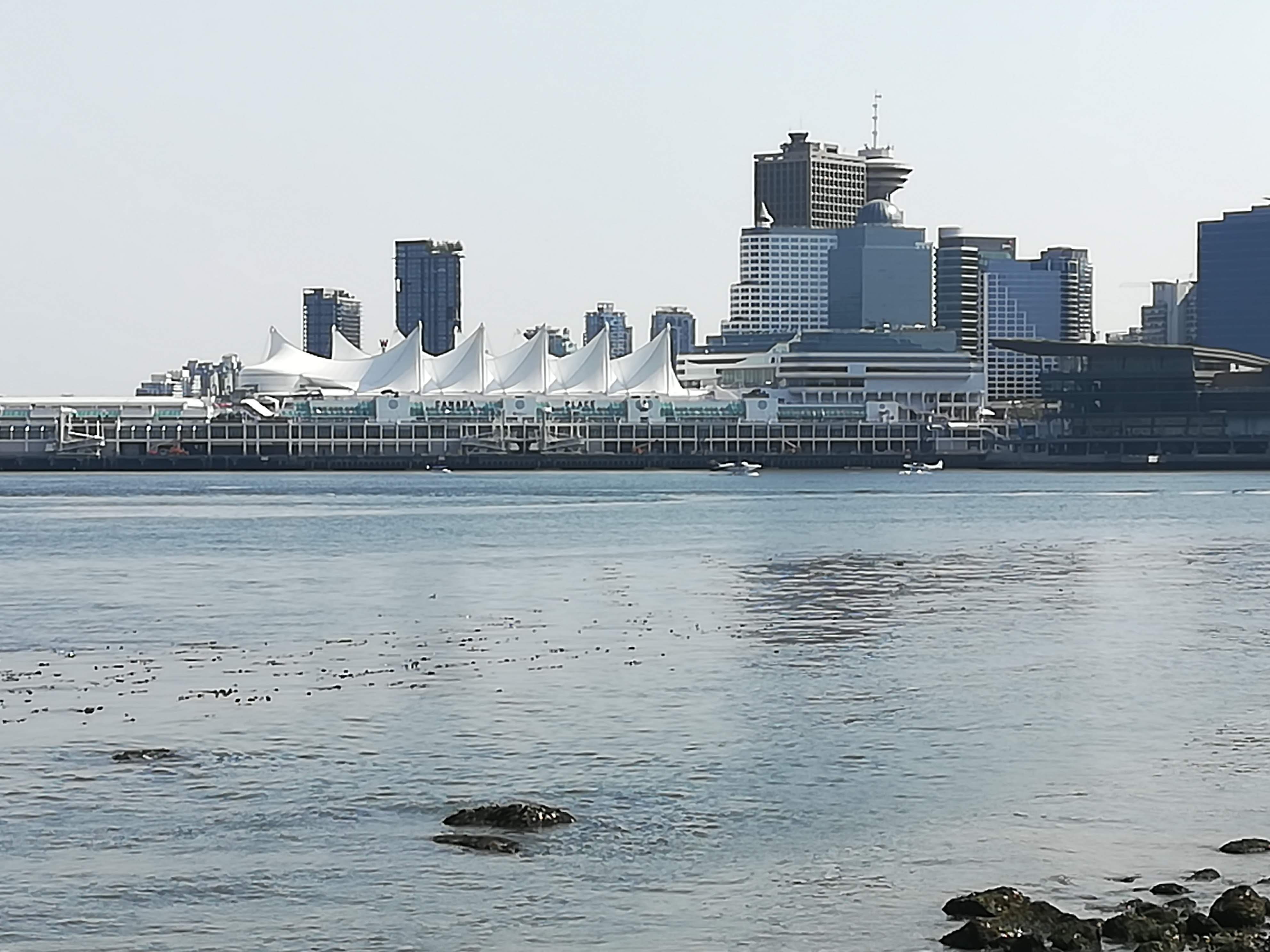
From here we discovered that Vancouver is a great ‘outdoor’ city. Bicycle lanes snake throughout the city, beaches skirt the harbour, and wonderful trails cross the many parks. Stanley Park is probably the most well known (think rose gardens and cricket pitches) and it includes a nine km perimeter walk where we watched the enormous ships waiting in the harbour to off-load their cargo, numerous sea planes running passengers to local lakes, ferries rushing back and forth as well as many pleasure boats enjoying the sunshine.
Canada Place – sea planes arriving and leaving
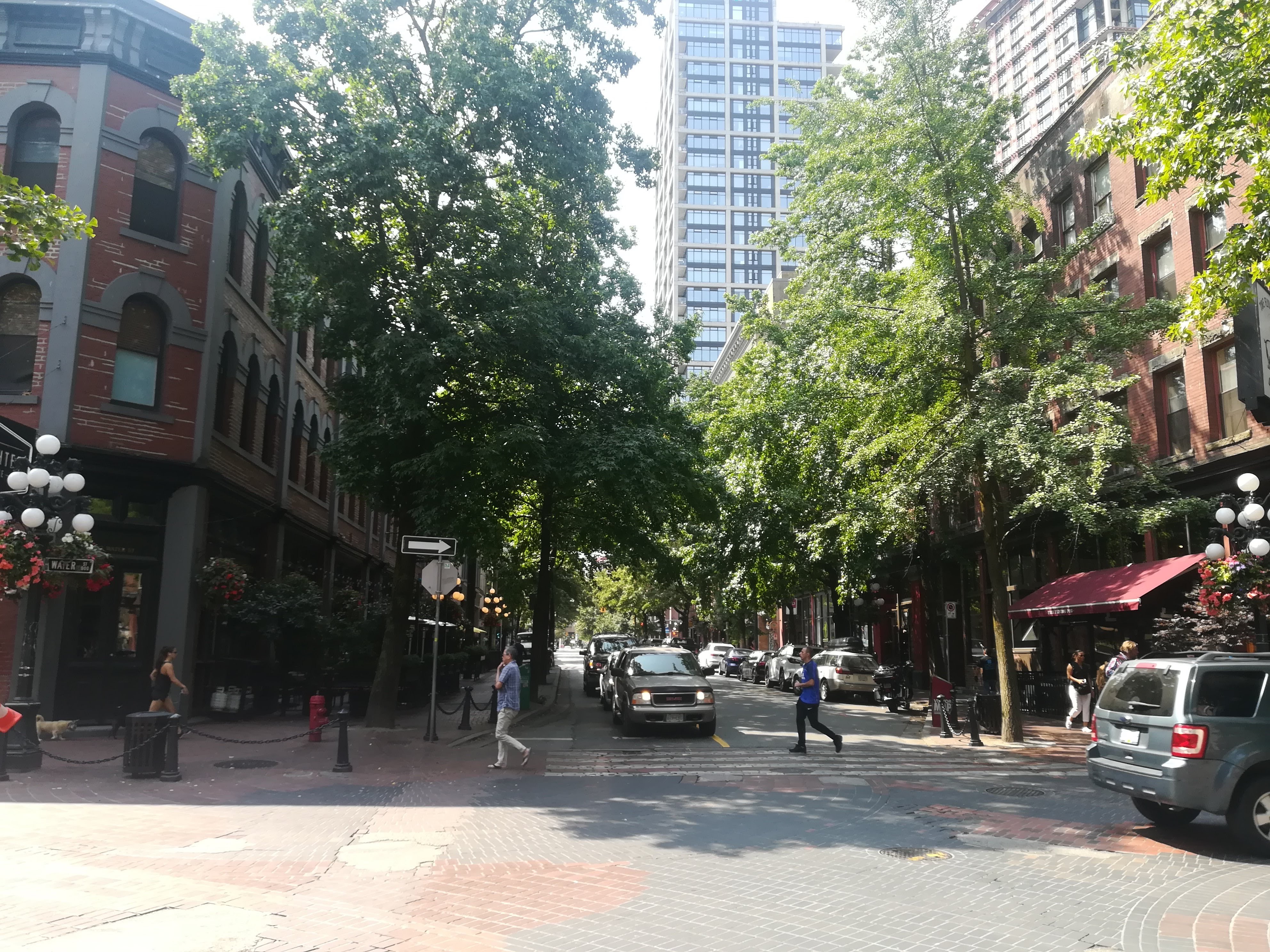
We spent a happy day enjoying both a City Tour and a Park Tour – both hop-on/hop-off type buses – which gave us a good feel of the city. We will definitely return – it needs at least a week to do it justice. Vancouver has a vibrant atmosphere, and lots of smiling faces. It’s location and investment potential make it one of the most expensive cities in the world, but well worth a visit!
Downtown Gastown area – shaded avenues/hanging baskets
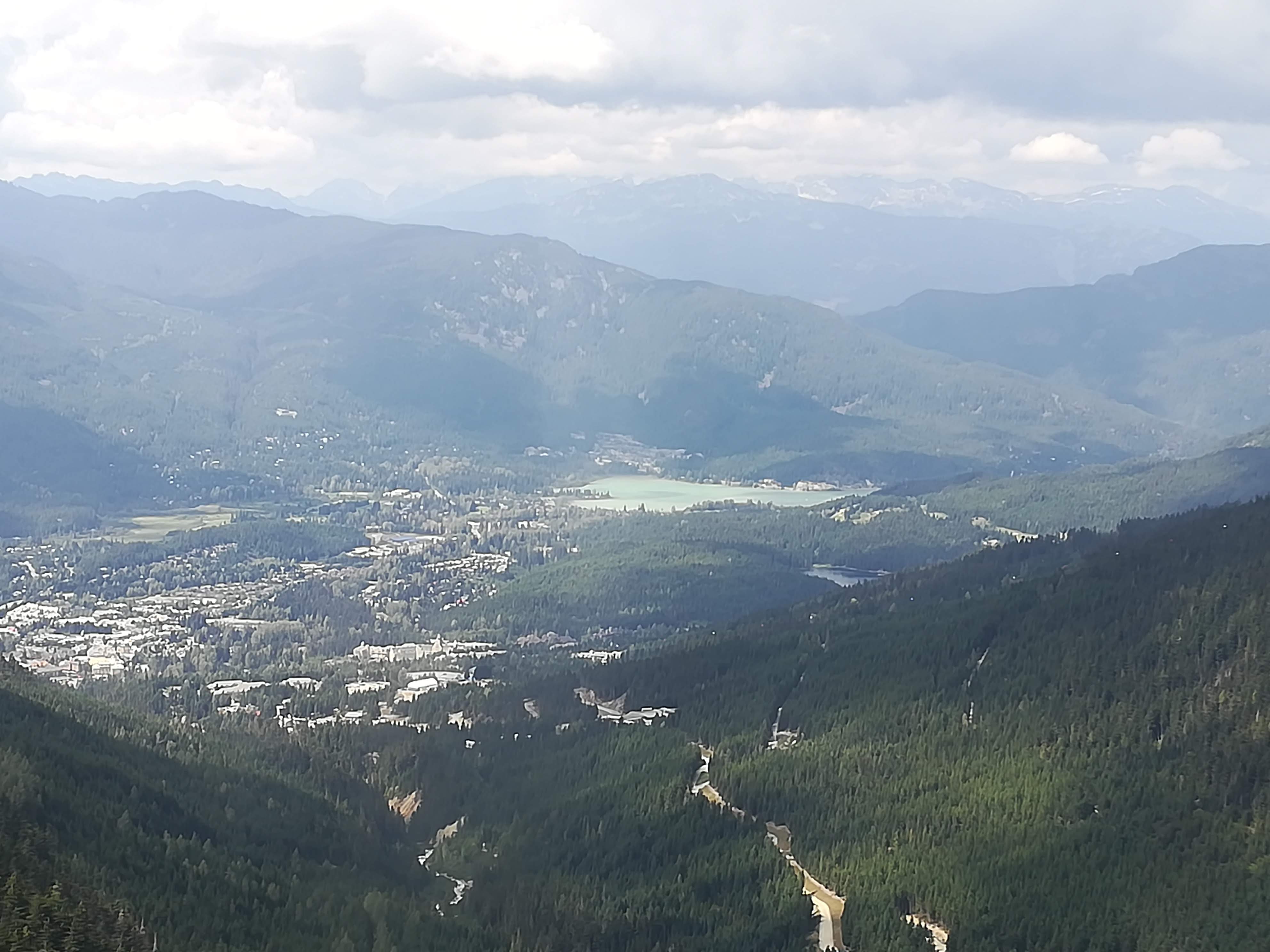
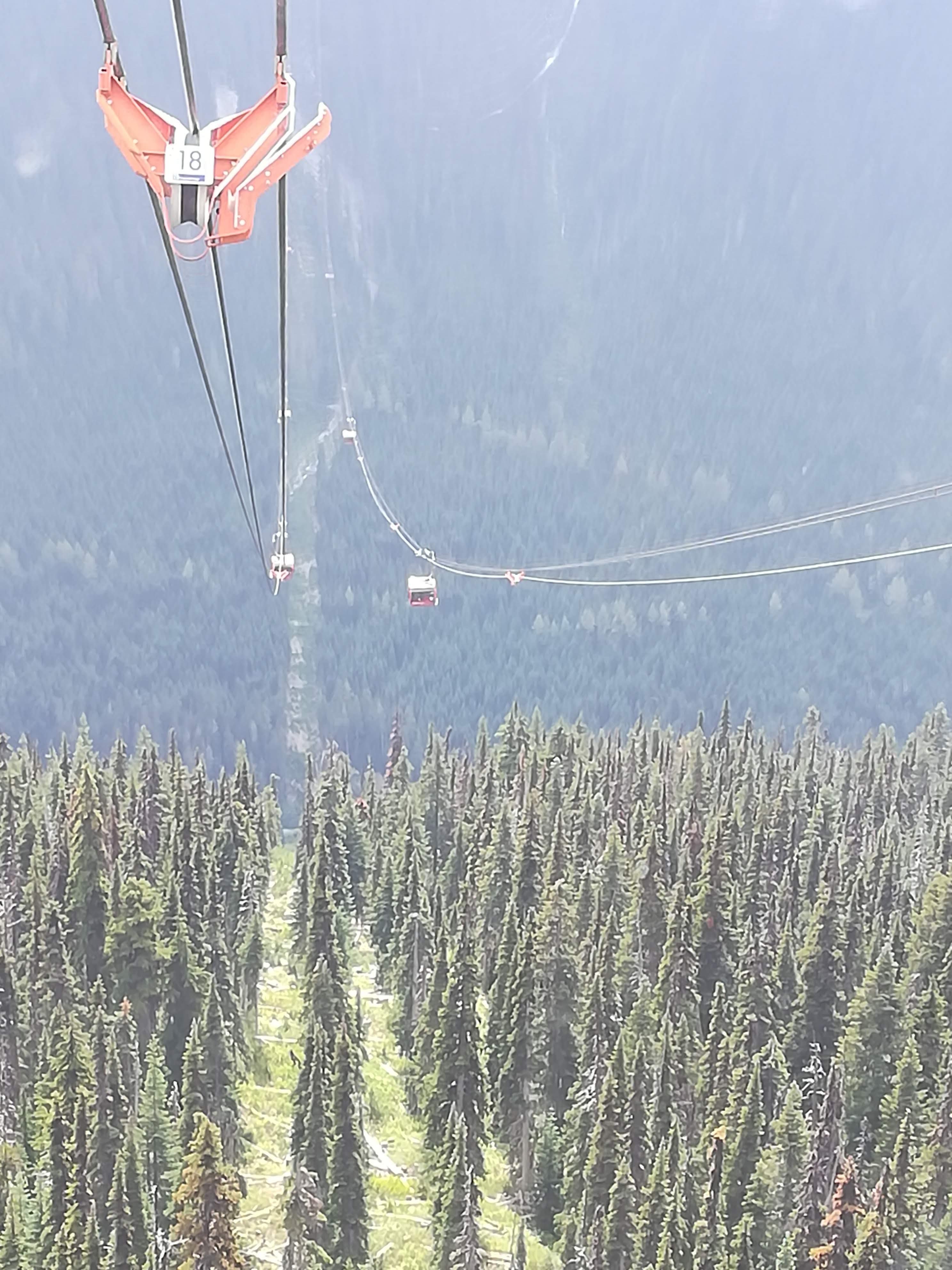
The road north, around and through the Coastal Mountains is spectacular. We spent two nights in Whistler, famous as the skiing centre for the 2010 Olympics. Jaw dropping scenery in all directions. Again, it’s not ‘what you know, but who you know’ – another family friend acted as tour guide. A gondola ride up Whistler Mountain was breath taking (a half hour ride!) – a Peak to Peak Gondola (20 mins) had us suspended from the ‘longest unsupported span in the world – 3.024 km – whilst we crossed from the top of Whistler to Blackcombe Mountain. Wonderful views in all directions, though sadly the haze and high cloud does not compliment my photos!
Whistler from the Peak to Peak Gondola
Longest unsupported span in the world!
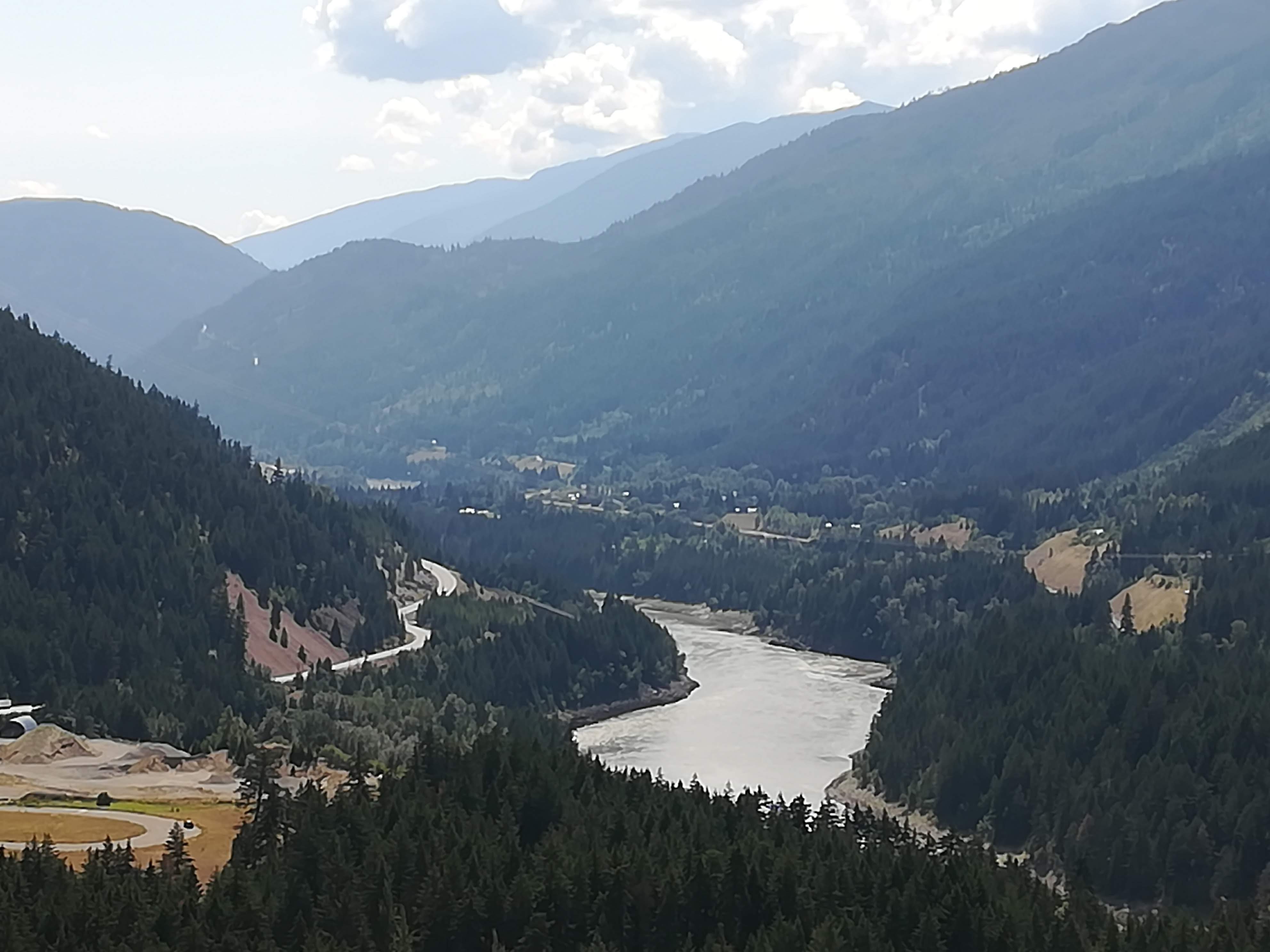
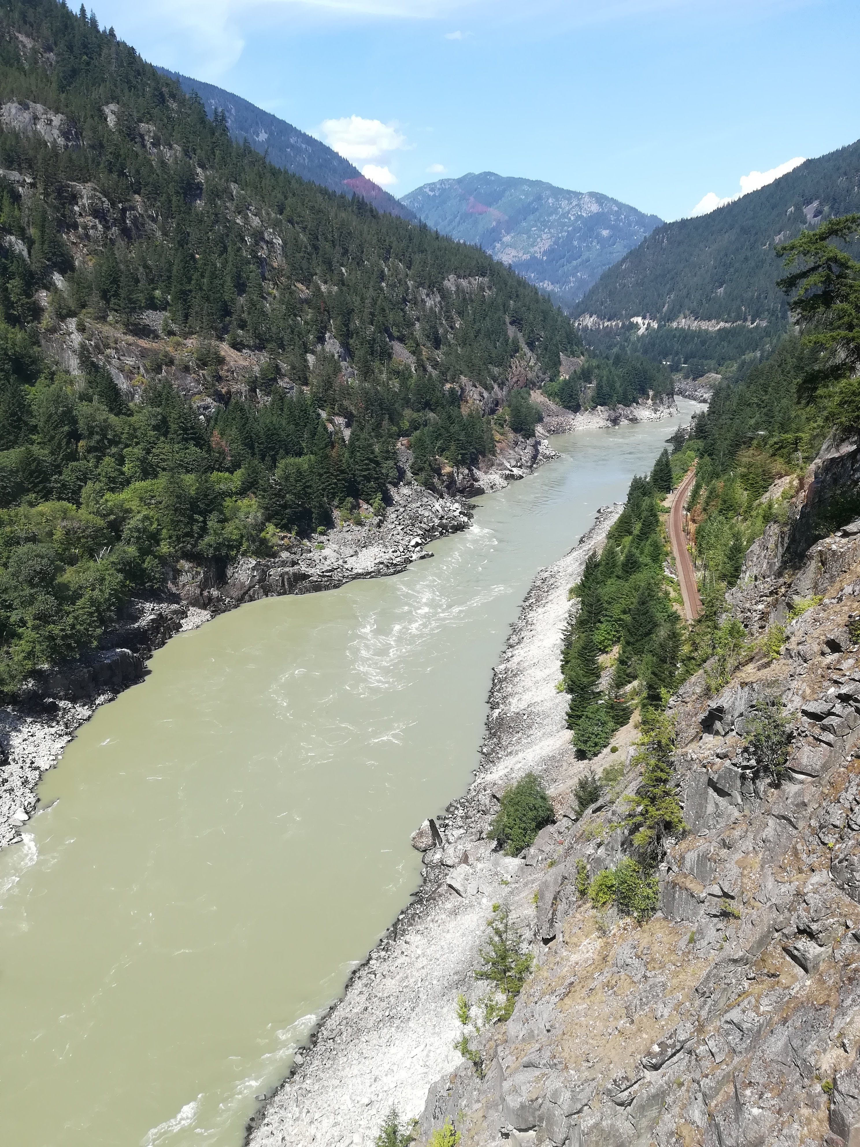
Heading further north from Whistler, we put Lulu through her paces as we went up and over an amazing mountain pass (hair-pin bends++!) and followed the Duffey Lake Road all the way to Lillooet on the Fraser River. Turning south, the Fraser Canyon with its precariously built roads and railways has held us in awe for several days.
Fraser Canyon
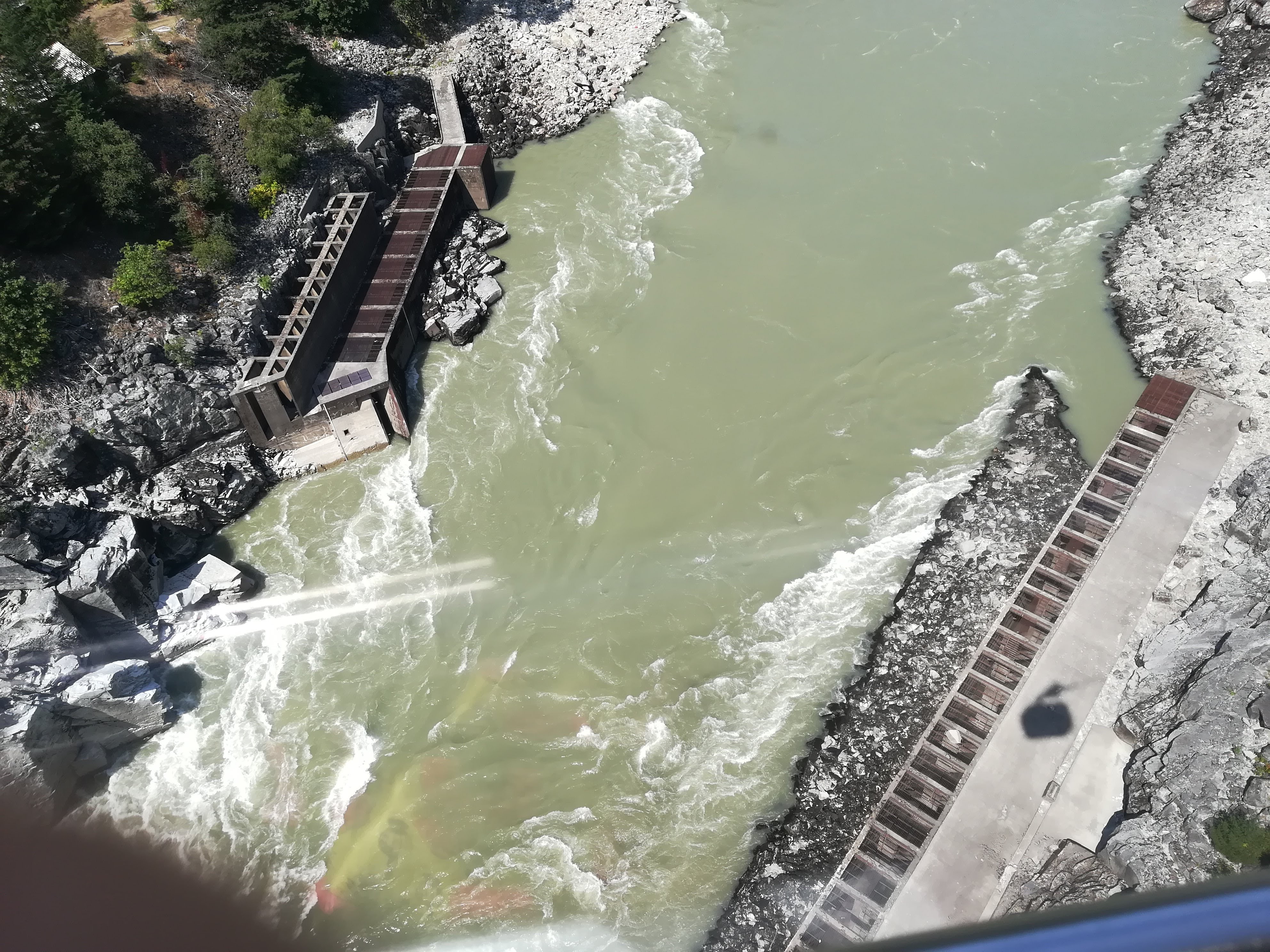
Hell’s Gate is one of the narrowest parts of the Fraser River where the towering rocky cliffs come towards each other forcing 200 million gallons of water per minute, through a 33 metre passage. Simon Fraser himself (after whom the river is named) struggled at this point of the river, which he decreed “a place where no human should venture, for surely these are the gates of Hell”. The construction of one of the two railway lines that run along opposite cliffs, resulted in a huge rock fall which almost blocked the river in 1914. The annual salmon spawn was all but obliterated. Many years of unrest between the local Aboriginal tribes and the Government resulted in the blockage being removed and fishways being built. Over the years, they have been altered to allow for the varying water levels and salmon levels have returned towards normal. All of this along with a heart stopping Air Tram, made this visit a memorable one.
Hell’s Gate – 200 million gallons of water per minute! (note railway)
View from the Air Tram, (drops 330 m down into the Canyon in 4 mins!) showing Fishways.
Some of you have kindly asked if we have been affected by Wild Fires. British Columbia has an excellent website (BC Fire Info) and we have been able to keep an eye out. From our campsite at Canyon Alpine, we have been aware of helicopters coming and going to refuel and pick up more fire crews and support materials. An area we passed through today was slightly hazy (and smelled of smoke) from the Snowy Mountain fire (currently covering 12,000 hectares) So far, we’ve been lucky – we’ll keep you posted.
We are now in an almost desert like area in the south of the province. It’s a wine growing region – depending on how well the tasting sessions go, (Hick!) I may see you next week!
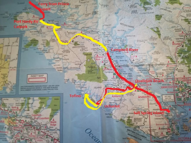
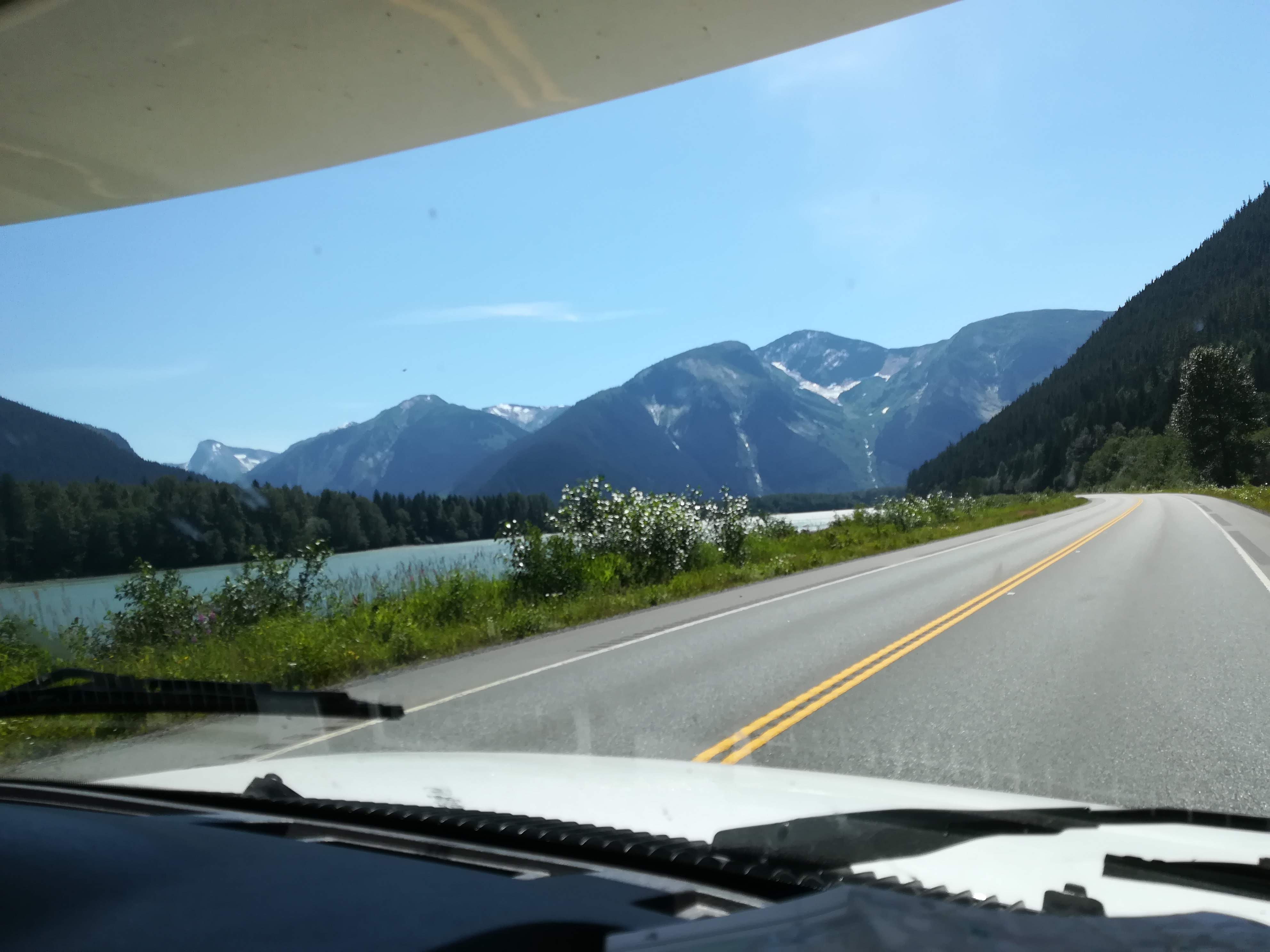
For those of you who have never visited Northern British Columbia, I can’t recommend it highly enough. The journey from Hazelton to Prince Rupert passes through some of the most magnificent and dramatic scenery we’ve seen. Beautiful snow-capped mountains, pristine lakes, wide rivers which vary from quiet, mirror-like pools with very clear water, to rushing torrents of milky glacial run-off. There are some very fertile and productive farms in the valleys – a lot of fruit is grown in the Terrace area, which has its own micro-climate. The majority of the area however, is thick mixed woodland, where the lumber industry employs much of the sparse population. The Canadian Railway criss-crosses the road and winds itself around the mountains. Huge freight trains regularly chug along the lines, stretching up to 14,000 ft long – that’s 4km! You can read a book whilst you’re waiting at the level crossings! Once again, we were blessed with brilliant sunshine and blue skies, which helped to show this area at its best.
Scenery on the road between Terrace and Prince Rupert
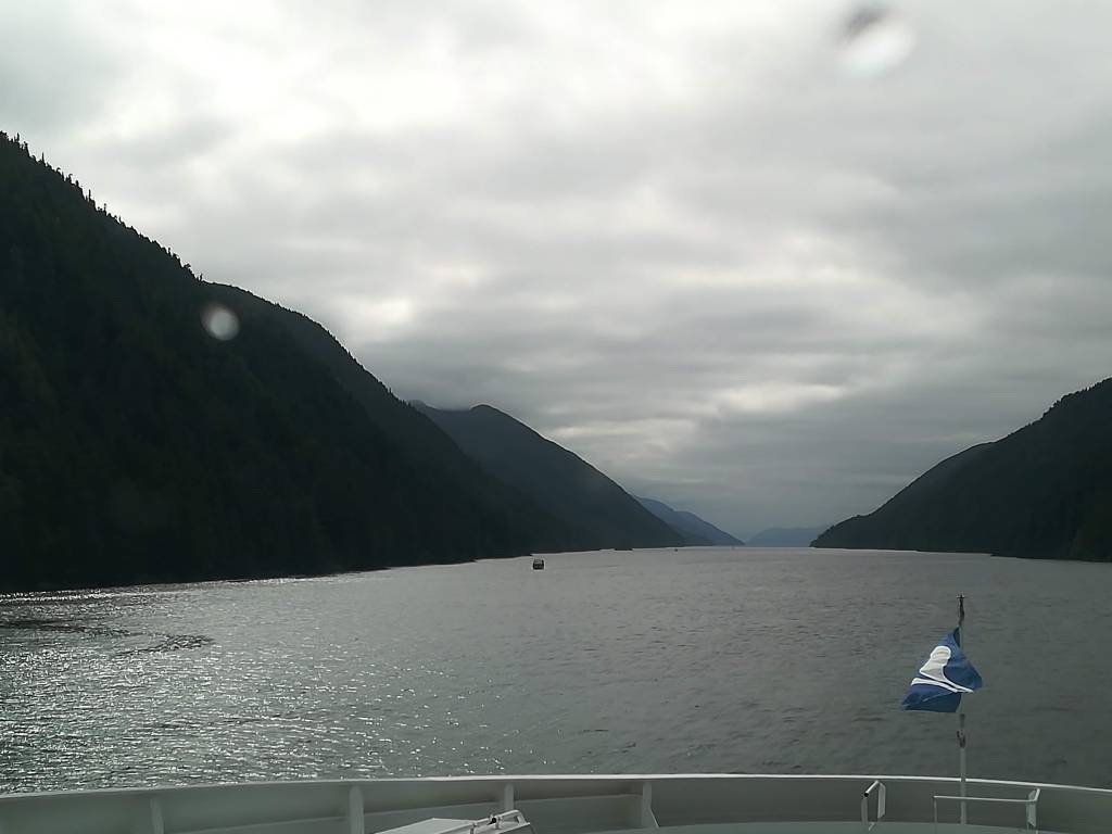
British Columbia Ferries run an impressive ferry route up and down the west coast of B.C. between Prince Rupert and Port Hardy (on the north-eastern coast of Vancouver Island), which takes you through the ‘Inner Passage’. This eighteen hour journey had been highly recommended, and not without reason. Trip Advisor served its purpose, and we followed the suggestion of pre-booking reclining chairs in the Aurora Lounge which has floor to ceiling windows on one of the upper levels at the bow of the ship. This paid off – we sailed at 7:30 am and docked at 11:30 pm. Apart from the last hour of darkness, the entire journey was picture postcard perfect. The route takes you through the very narrow (1400 ft) Grenville Channel, with its steeply sided mountains and enormous depths of water (up to 1620 ft), and then widens at various river junctions.
Entering Grenville Channel
‘Lighthouse’ at Boat Bluff (1907)
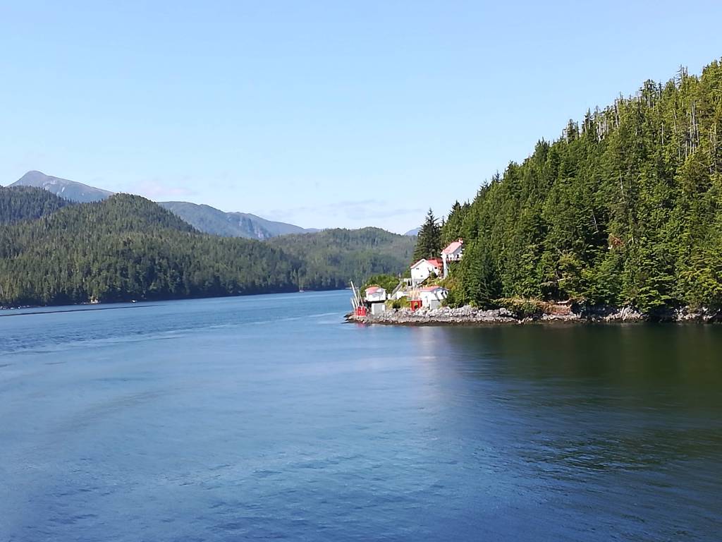
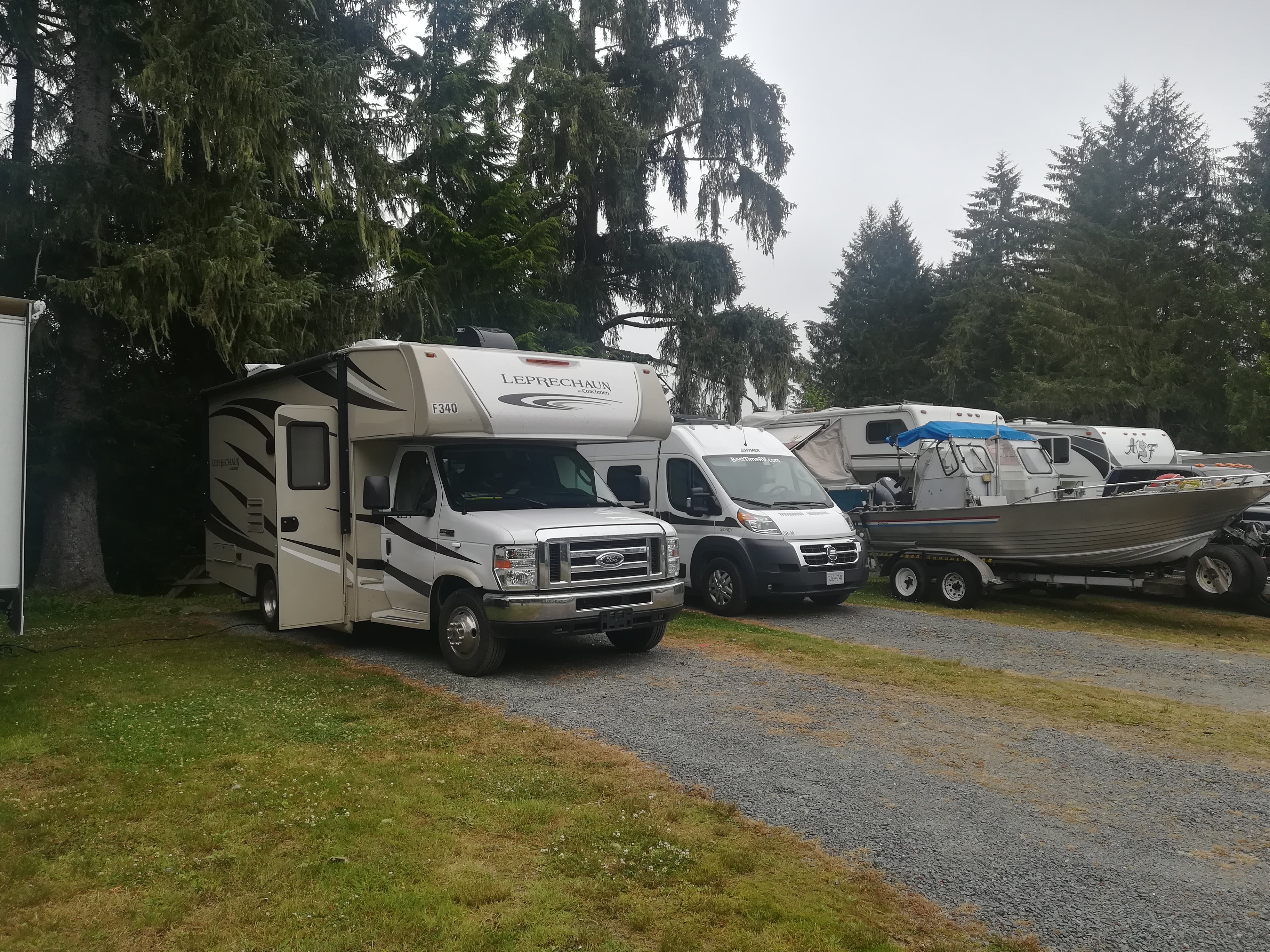
Very old lighthouses (still manned!) are dotted along the route – and the tiny town of Bella Bella ( a First Nation’settlement) is a regular stop to take on and discharge passengers. Not only is the scenery breathtaking, so is the wildlife. Orcas and humpback whales performed for us in several places and pods of porpoises frolicked in the water. Bald eagles swooped for jumping salmon. Again, I can’t grace you with photos – in the excitement of seeing all these amazing creatures, I never have my camera at the ready! Several campgrounds have been set up at either end of the ferry run – unfortunately, the fact that the majority of the campers are either arriving at midnight, or departing at 5:30 am, means that individual private sites are non-existent. These campgrounds should be called RV Carparks!! Sadly, we were not allowed to park and sleep in the ferry queue. . . .
Port Hardy RV Carpark!
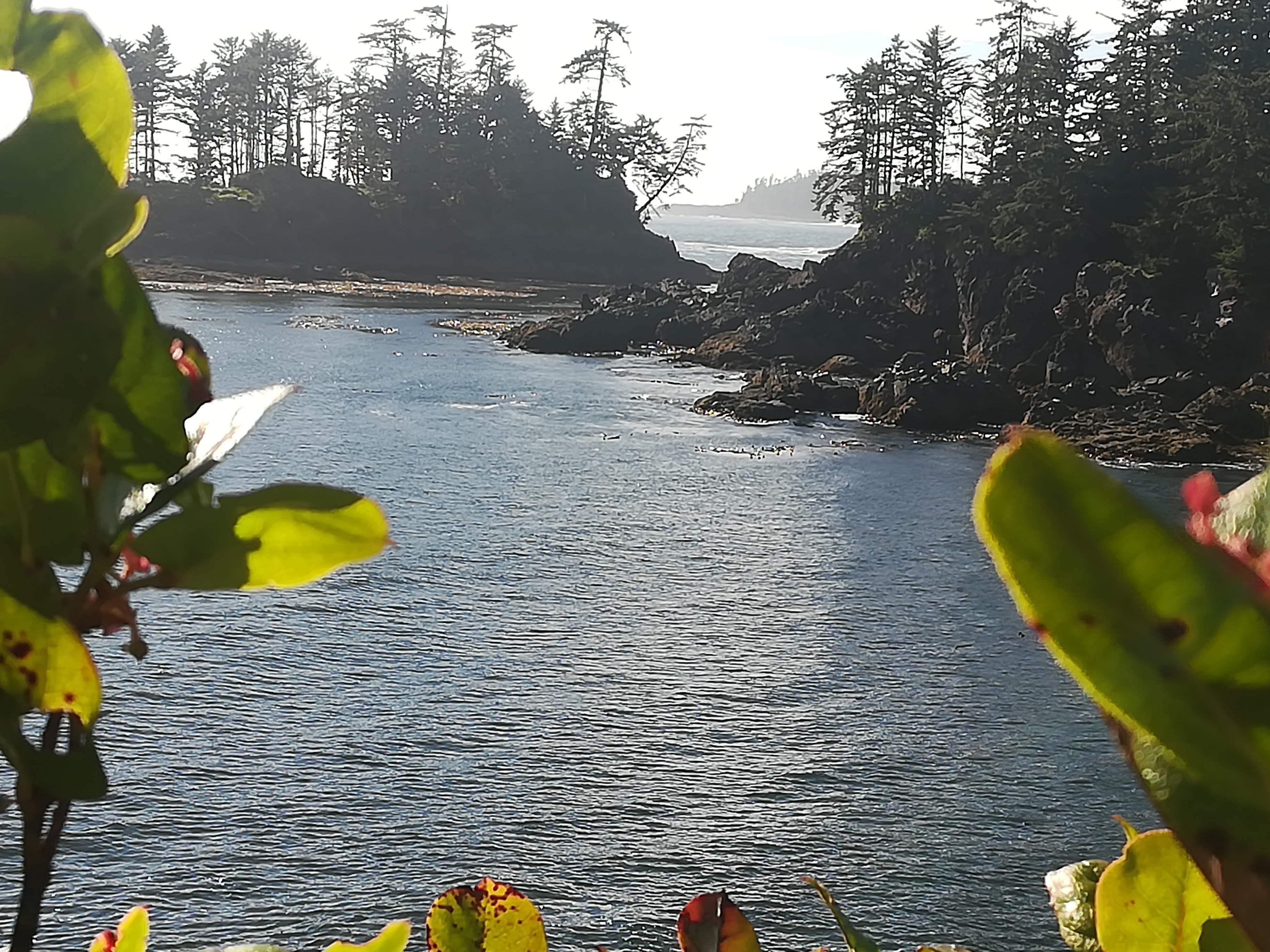
Vancouver Island is a very popular holiday destination, as well as having its own population of 780,000. It is 500km long and 100 km wide, and boasts a temperate climate. Boating, beaches, hiking in the mountains or the rainforests – the Island has it all. Our campsite at Campbell River backed onto a tidal inlet where we sat and watched four bald eagles on their nests. The town was an easy walk away for shopping and a meal out – and much needed haircuts! The Pacific Rim Trail along the west coast of the island provided a lovely hike through the trees – knarled with age and sea winds – with awe-inspiring views of the ocean.
View from the Pacific Rim Trail
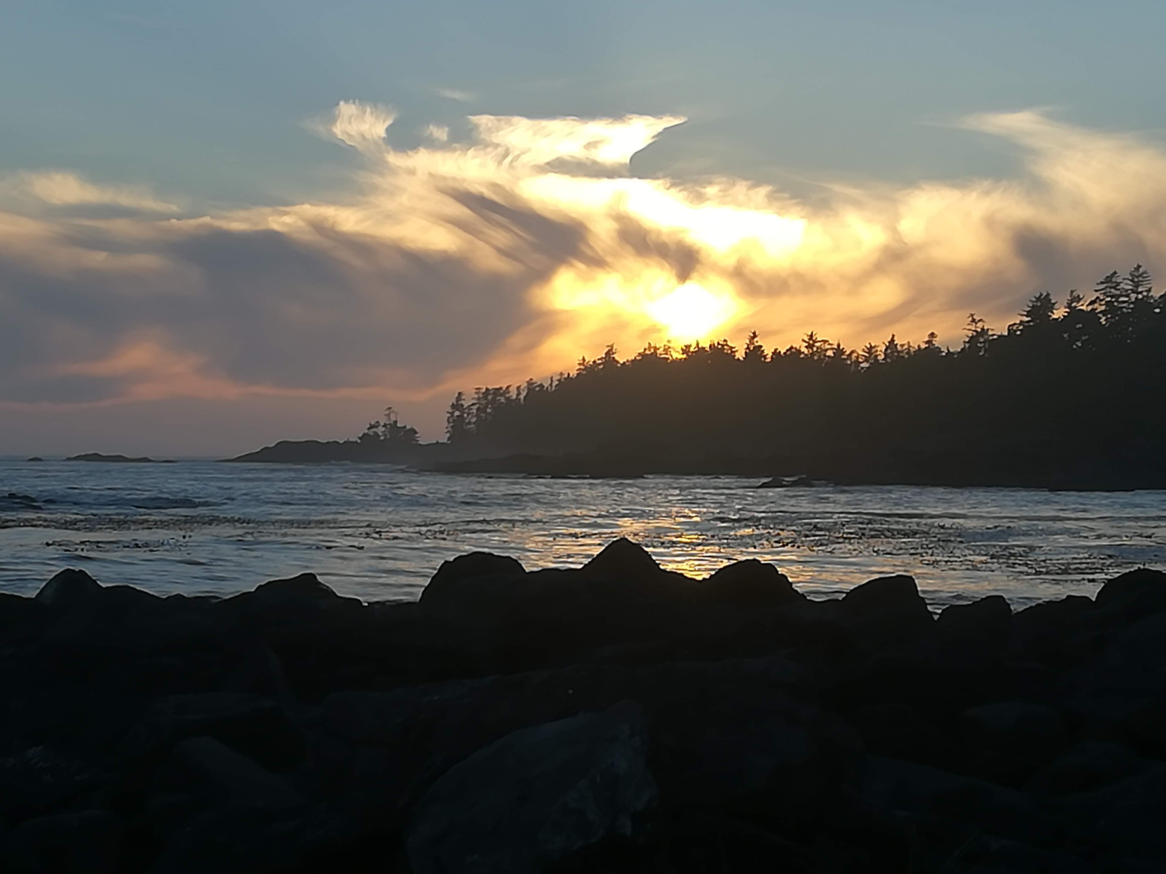
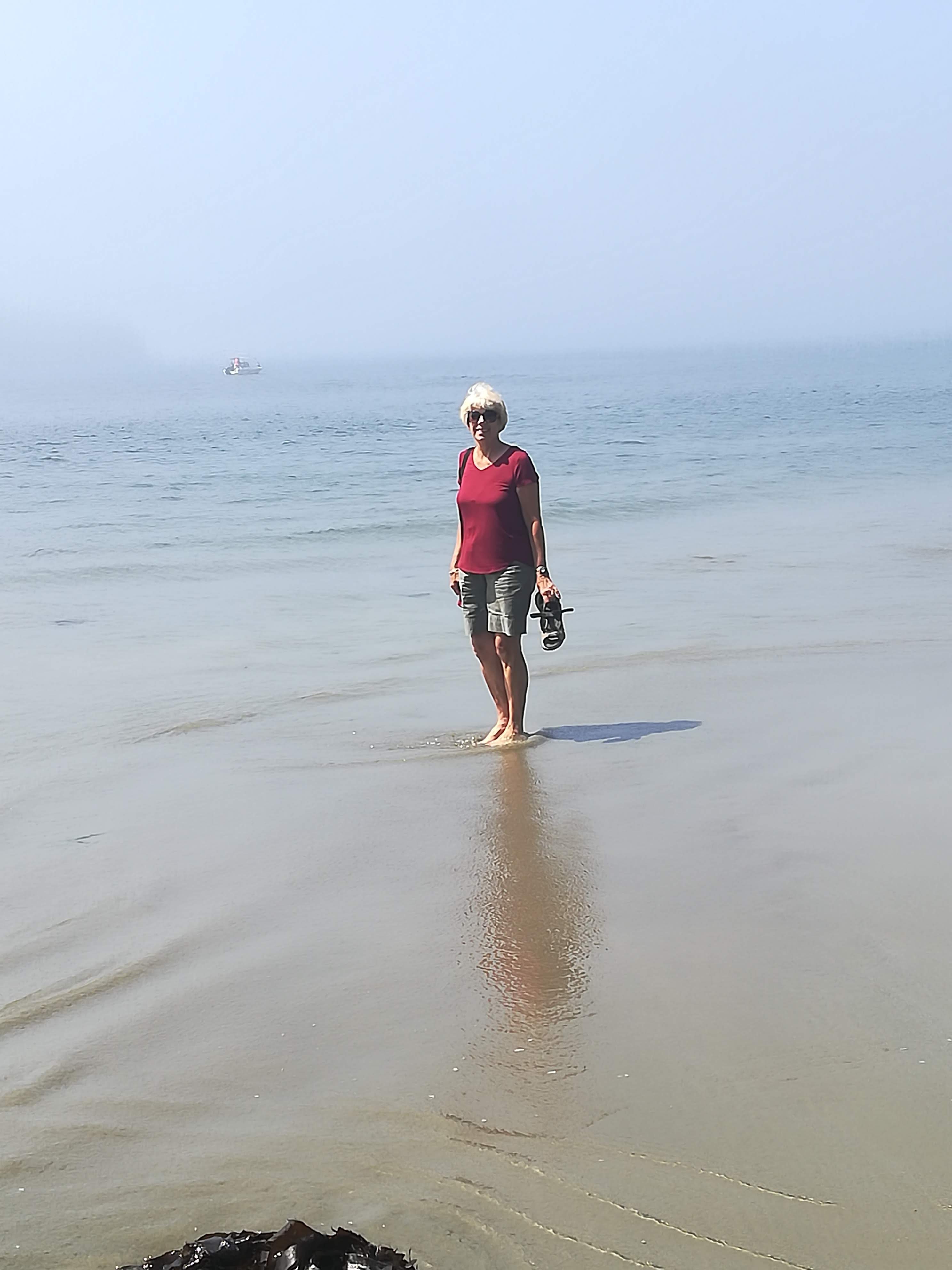
My goal was to see the sunset over the Pacific, as well as dip my toes in – I managed both!
Sunset over the Pacific at Ucluelet
My toes in the VERY COLD waters of the Pacific Ocean at Tofino
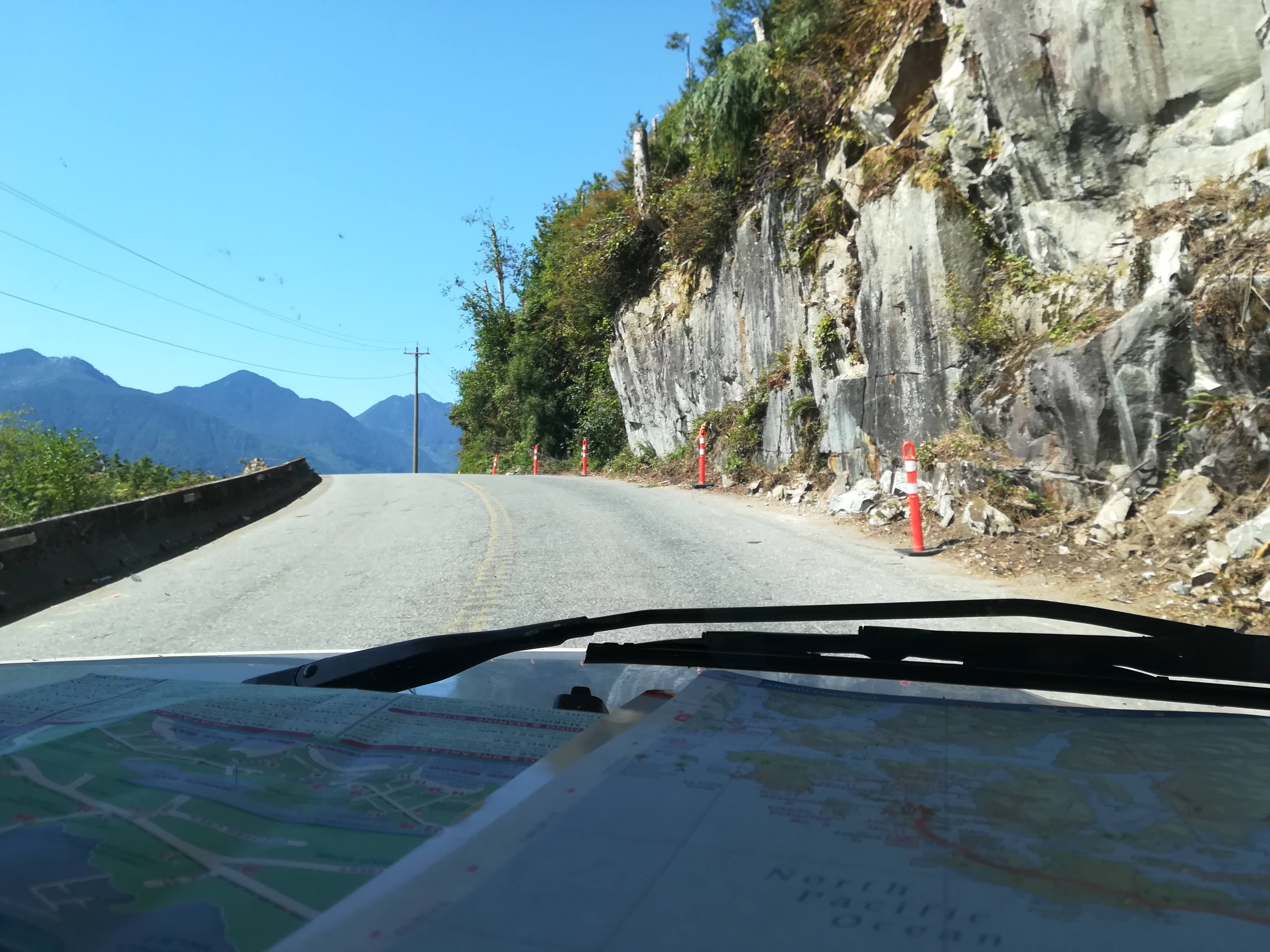
The road from the east to west coast – Hwy 4, the Alberni Highway, takes a lot of patience and tested Lulu (and her drivers!) to the limit. Steep mountains passes and narrow, very tight bends meant queues of cars building up very quickly. Nervous intakes of breath became the norm whenever an enormous truck appeared in the opposite direction! Passing places help to relieve the pressure, but this road will be remembered as one of life’s challenges . . . . .
Cliffs and blind summits – a challenge!
After a night to recover in Cedar Grove Campground at Qualicum Beach, a small roll-on, roll-off ferry has brought us to Salt Spring Island, the largest of the Gulf Islands in the Strait of Georgia between Vancouver Island and the mainland. With a population of 10,000, its location and climate have attracted everyone from artists to farmers, from writers to retirees. The Mowhinna Creek campground near Ganges, has wonderful big, private sites with lots of shade to keep Lulu cool. Every guidebook lists the Saturday Farmers Market on the island as being a number one priority. This of course means that every other tourist seemingly in the whole of British Columbia is attending the market as well!! We walked into town (2km) having decided that parking Lulu might be difficult – a good decision. . . . This market is enormous – easily 200 stalls, and vendors must “make it, bake it or grow it” themselves, with all products being ‘vendor produced or sold’. A very popular spot with visitors and locals, and a tremendous atmosphere. The hot summer sun twinkling on the harbour waters next to the stalls, just seemed to nourish everyone’s already contented holiday disposition. They definitely got the marketing right on this gem!
Ganges Harbour
Moving on to Vancouver soon. . . . . See you then.


 Driving east from Hell’s Gate, we have followed Hwy 3 along the southern area of B.C., very close to the USA border at times. The Okanagan valley is well known for its numerous vineyards. It is also VERY DRY and DESERT-LIKE. After passing through several more mountain passes, the countryside suddenly opens up into very wide valleys, with towering rocky cliffs. Thick green forests are replaced with shabby, dry scrub-land. Every available flat area seems to be planted with fruit trees (peaches, apricots and cherries) or grapevines. Irrigation from the numerous rivers is paramount to the success of this enormous area, as is the more moderate climate. Lots of pretty lakes act as magnets to holiday makers, keen on beach holidays, fishing, or boating.