It should read ON YER BIKE!
Author: malyoga
The overnight ferry from Harwich to Hook of Holland, with Stena Lines, is very comfortable. We cooked & ate our supper sitting in the queue (advantages of motor homing!) – we were almost the last on and, you guessed it, almost the last off! With new Brexit rules for not carrying meat or dairy into Europe, our first stop was a supermarket to stock up. Lovely fresh food and marvellous vegetables and fruit – no surprises there, as it’s all grown here!
Our route took us around the perimeter of Rotterdam with its enormous shipping port. Molly took to driving on the right with no problems (‘tis useful having a Canadian driver!) and the ring roads took us to the east.
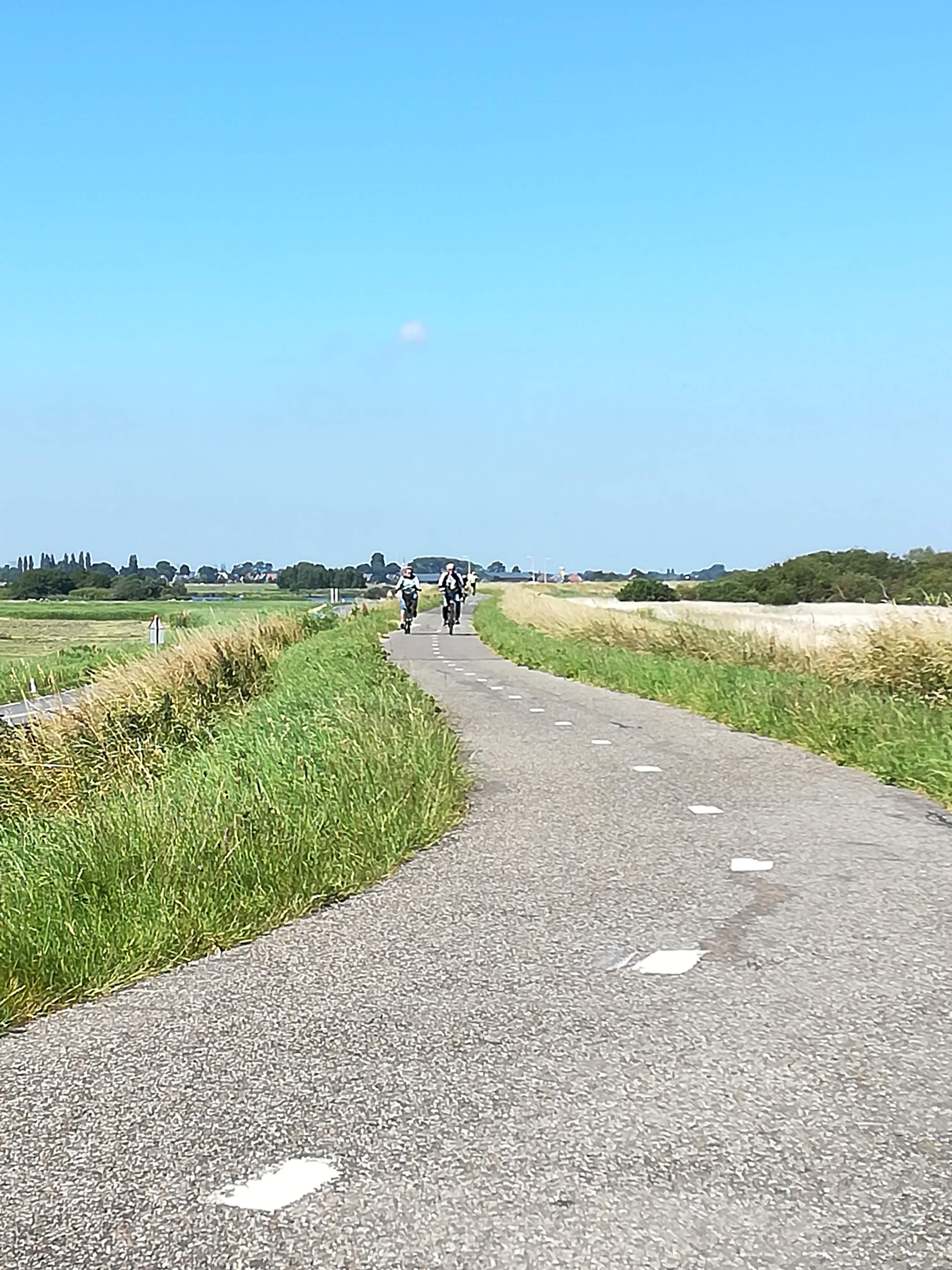
Joining the quieter back roads, we were quickly immersed in the pretty countryside – beautiful green fields, tree-lined avenues, cattle and/or sheep (mostly Jacobs) grazing peacefully in the fields. But what really stands out, of course, is the flat terrain. Alongside each and every field is a canal, in some cases just an irrigation channel, in the case of towns and cities they can be the width of a river!

A quick history lesson for those of you who’ve forgotten (like me!) The Netherlands (the word means “low-lying country) lie mostly below sea level. The Dutch built dykes to hold the water and used the canals for travel and irrigation. The freshwater in the canals comes from the River Rhine, which originates in Germany and has its delta on the Dutch coast. Abundant rainfall levels help to keep the canals full. Sluices are opened towards the sea when flooding is threatened. Easily irrigated agricultural land stretches as far as the eye can see.
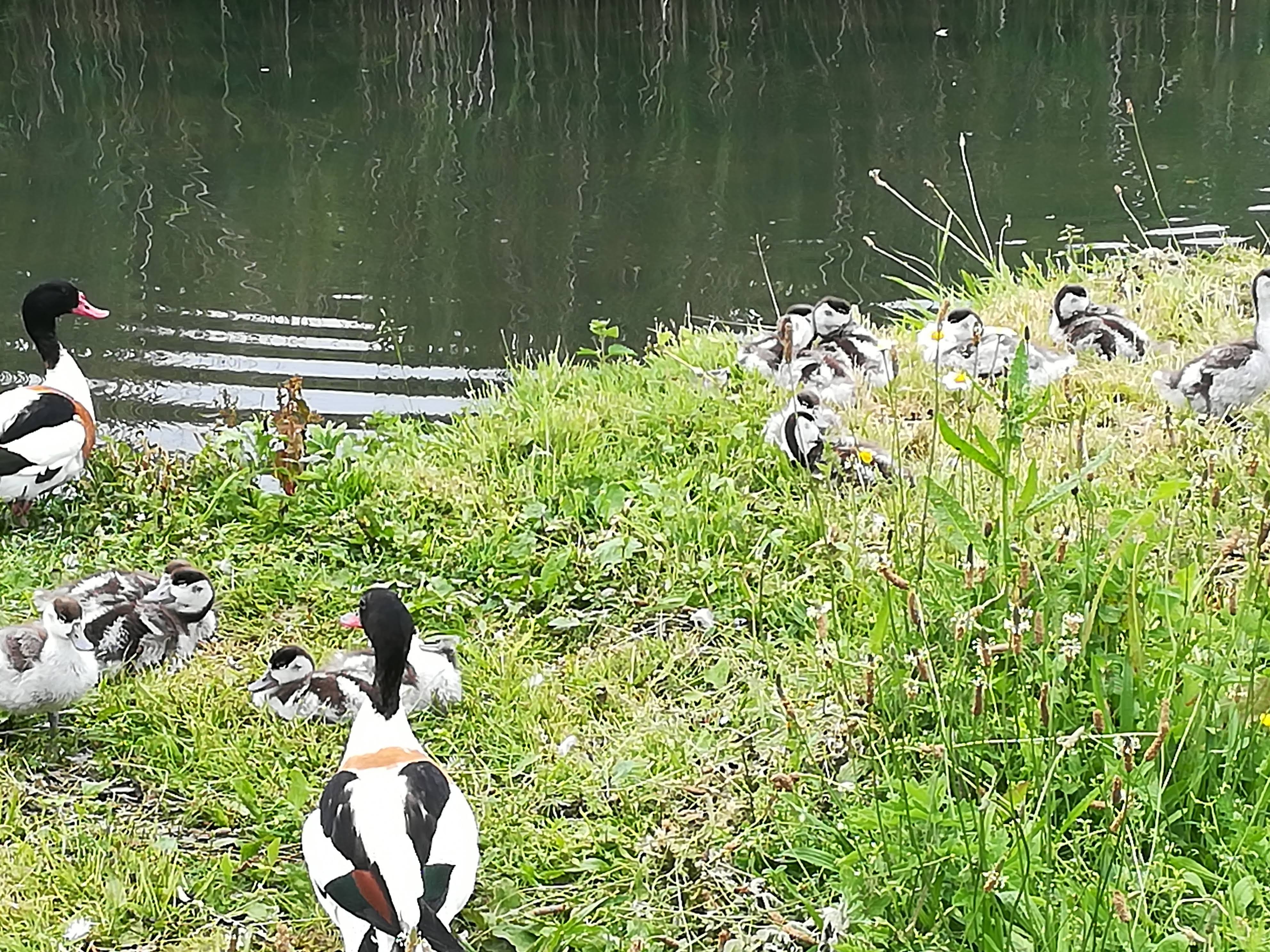
In an attempt to find the Windmill Museum at Kinderdijk, we found ourselves being led 2 km away to park Molly. We settled for a pleasant walk in the sunshine, where we viewed the windmills from afar, but came across lots of wildlife.


Our first stop (2 nights) was at a peaceful campsite in Otterlo in the province of Gelderland. The Kroller Muller museum was the magnet that drew us to this gorgeous little town. Situated in the middle of 5,500 hectares of the Hoge Veluwe National Park, this gem is the brainchild of Helena Kroller Muller who, along with her husband, collected 11,500 pieces of art in the early 1900’s. She realized her dream of sharing her collection with the public by opening the museum in 1938. It holds the second biggest collection of works by Van Gogh, alongside many other well-known artists. Even to our untrained eyes, it was very impressive.
One of highlights was actually getting there. A 25-minute walk from the campsite took us to the park entrance, where 100’s (yes, I mean 100’s!) of white bikes are provided free of charge. There are several bike stations around the park, where you leave one bike and pick up another as you leave. Very simple bikes – no gears, no brakes – but remember this is FLAT land, and there are cycle paths EVERYWHERE EXCEPT THE MOTORWAYS.
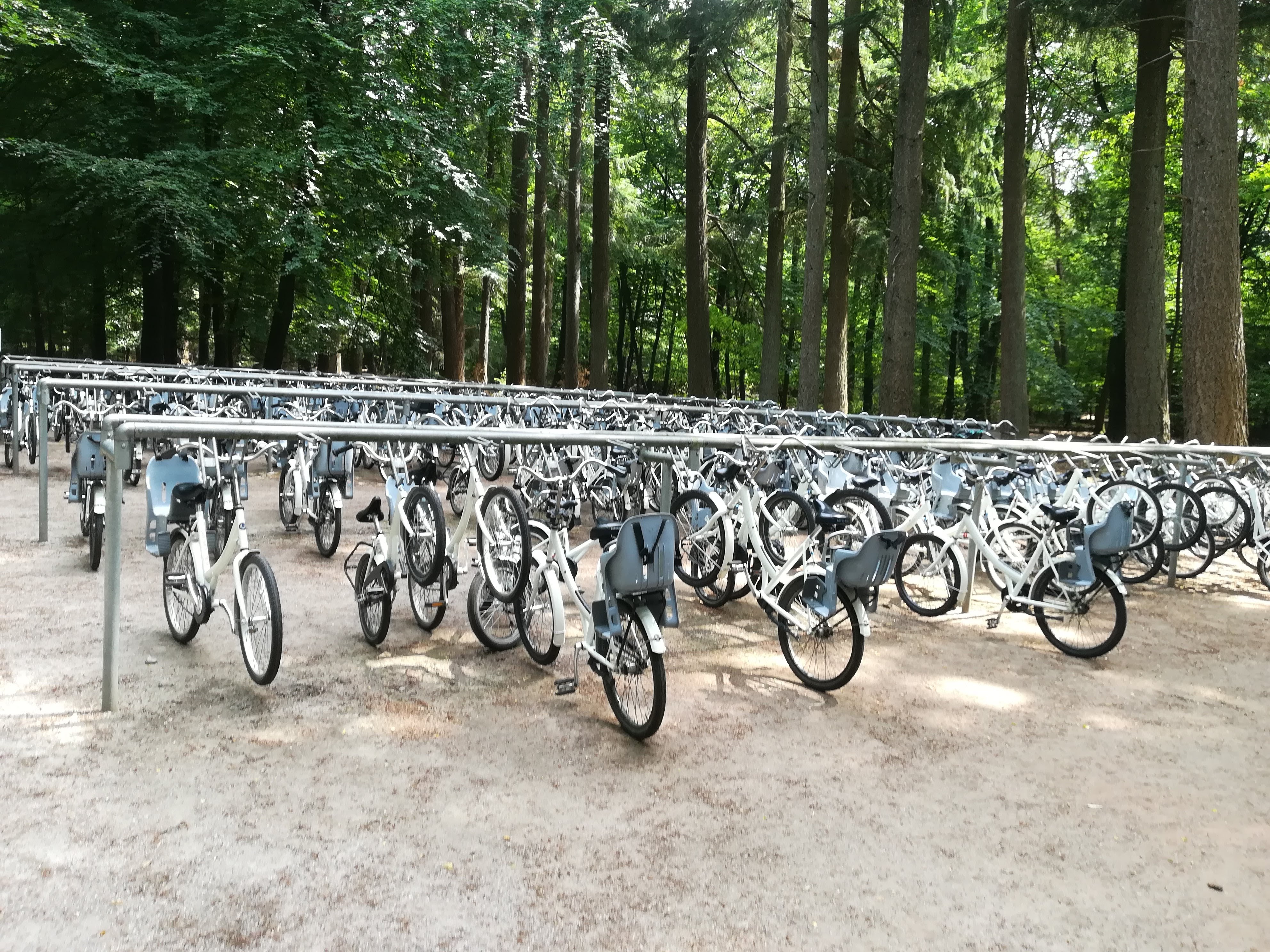
Well laid out, smooth, two-way cycle paths. EVERYONE uses a bike – for the dentist, for the shops, to visit friends, for a night out. All manner of clothes grace a bicycle! Only the keen racing cyclers wear lycra and partake of a helmet. It is very normal to ride alongside your friend, chatting away, hair billowing out behind you. Dogs ride along in a specially adapted dog carrier which goes on the front of the bike. (you could put a child in there too!)
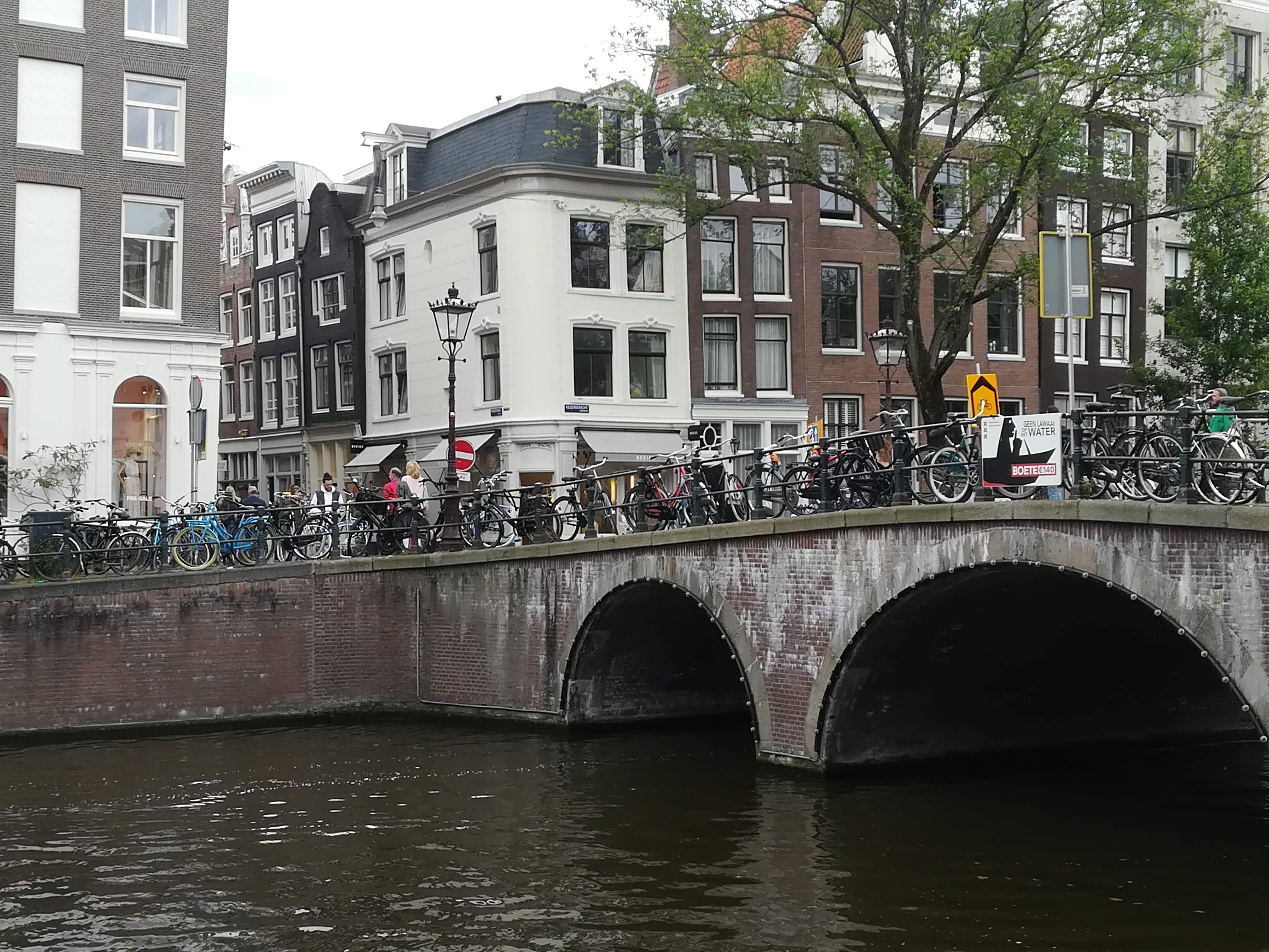
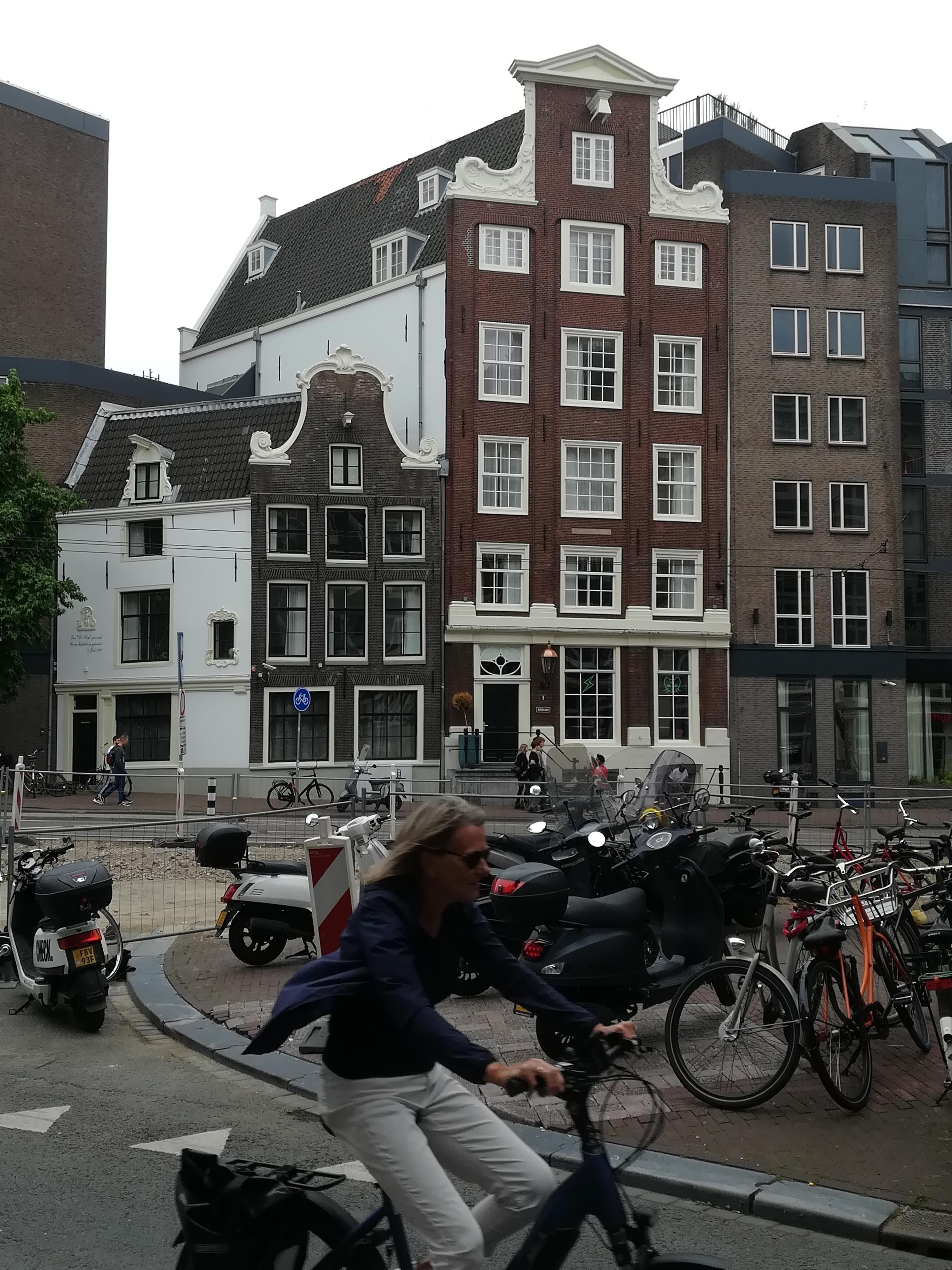
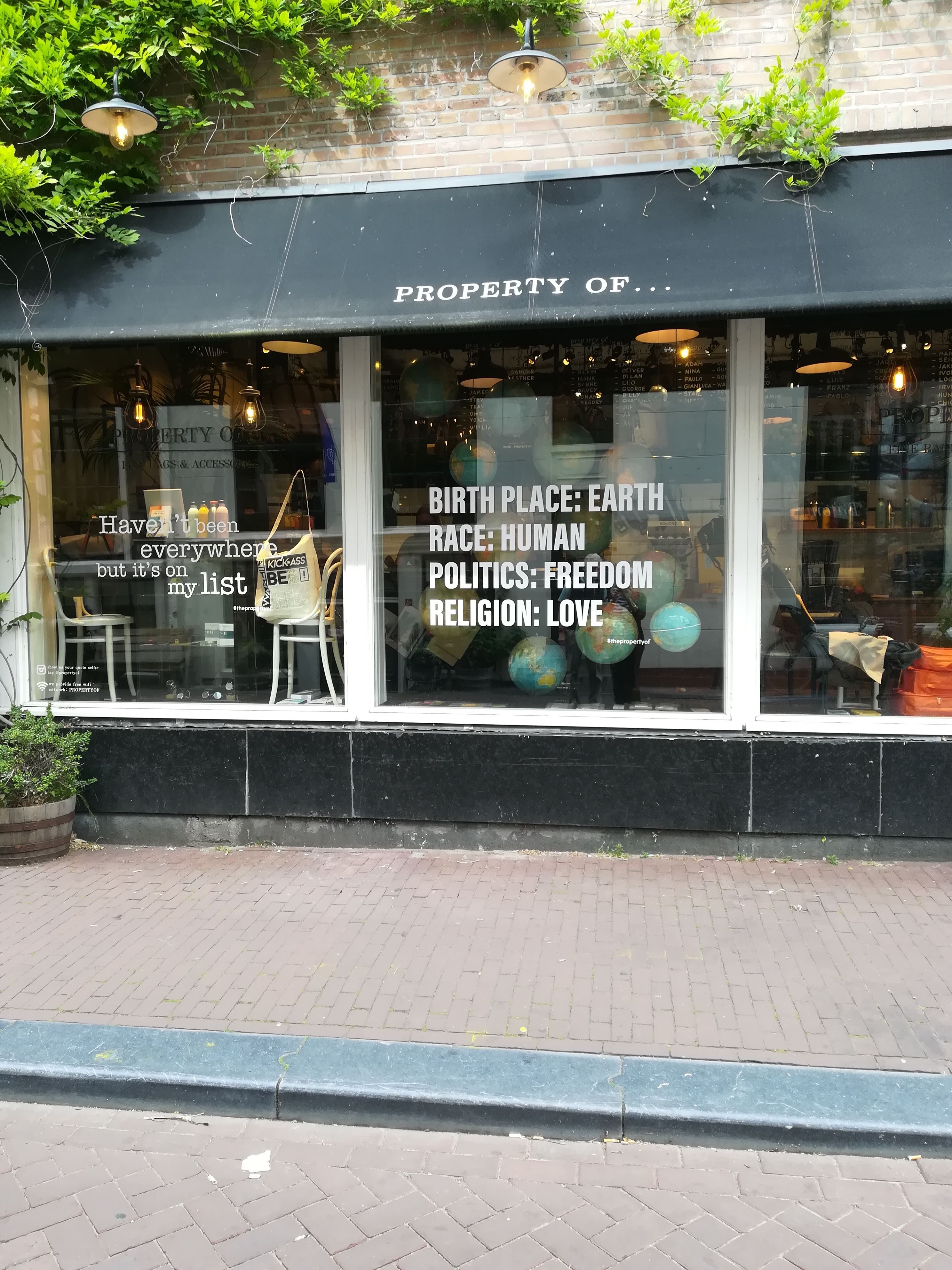
Thanks to a Camping & Motorhome Club recommendation, we moved to Gaasperplas Camping on the outskirts of Amsterdam. A convenient 10-minute walk from a Metro station, then 25 mins on the Metro took us to Central Station in the middle of Amsterdam city. Despite its checkered history – prosperous 17th century, economic decline in the 18th century, re-emergence of wealth in the 19th century, growing inequalities & emancipation, along with war and repression in the 20th century – Amsterdam is now a truly vibrant city. Pretty canal bridges are adorned with flowers, fascinating architecture (see more below) wherever you look. Bicycles and trams are the main mode of transport, and we needed ‘eyes in the backs of our heads’ to avoid bicycles coming from behind, in front and to either side. BICYCLES HAVE RIGHT OF WAY here, and it takes some getting used to.
The average age in Amsterdam is just 38 yrs, and it shows. Youngsters flood here for employment, and in pursuit of freedom. The Dutch live their lives with the firm belief that everyone can just be themselves and do as they wish. No doubt the cultural leniency towards sex and drugs adds to the appeal!
On a sunny Sunday afternoon, the streets were full of live music – a different beat on every corner – people enjoying conversation with friends – and the sound of MANY different languages being spoken as the city enjoys a booming tourist trade.

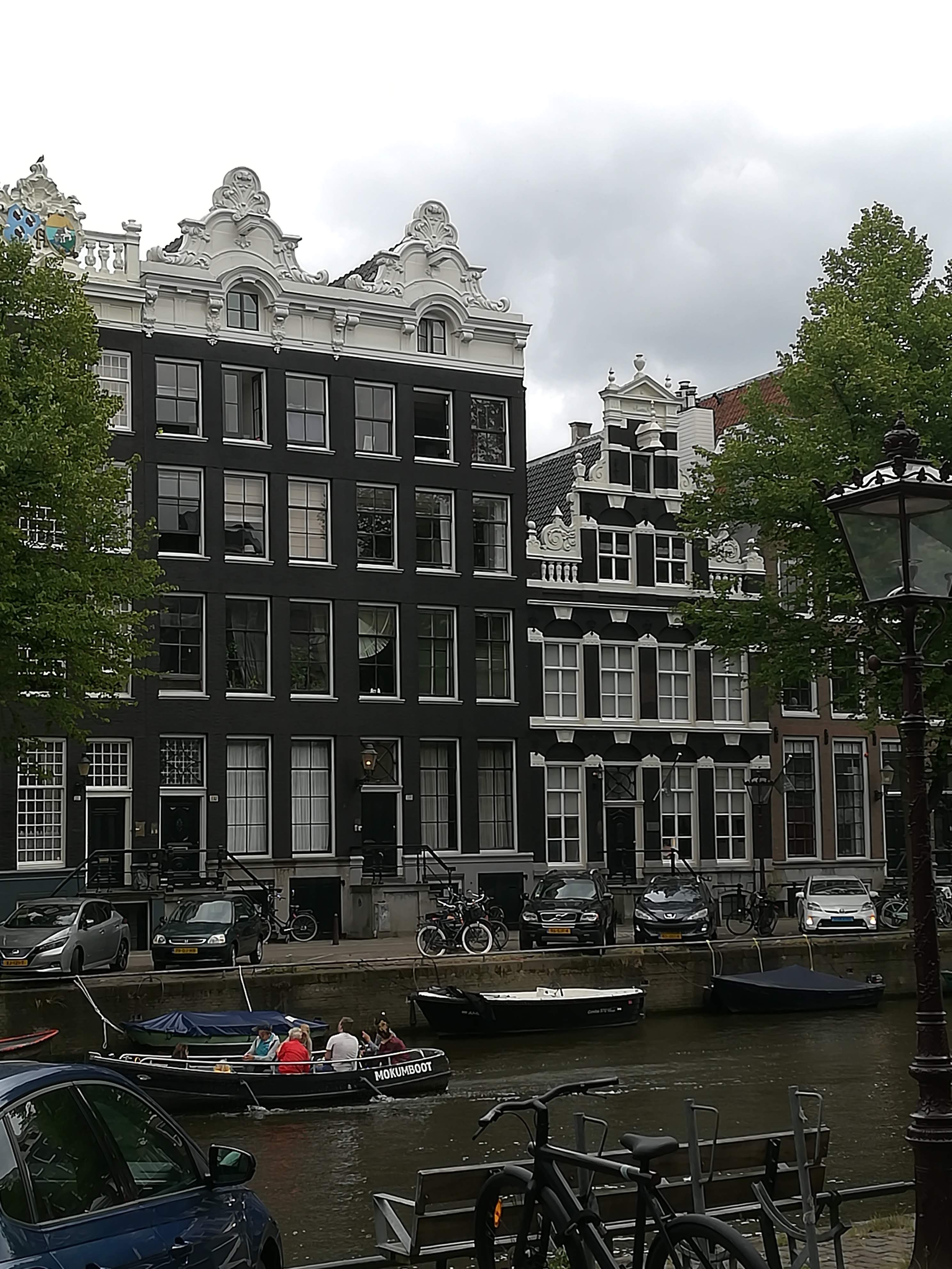
The beautiful old canal houses were built on poles sunk many metres into the sandy marsh – as long as the wooden poles stay wet, they won’t rot. Hmmm? Lots of properties have funny angles as they tilt to one side or the other. Many were built with their facades leaning forwards to enable pullies to move furniture to the top floors without the platforms knocking the front walls. Canal houses were always very narrow, as owners had to pay very high taxes on the waterside walls – hence the houses were always tall and deep, spreading a long way backwards and always with a garden – growing food has always been encouraged. Highly ornate gables signalled the opulence of the owners.

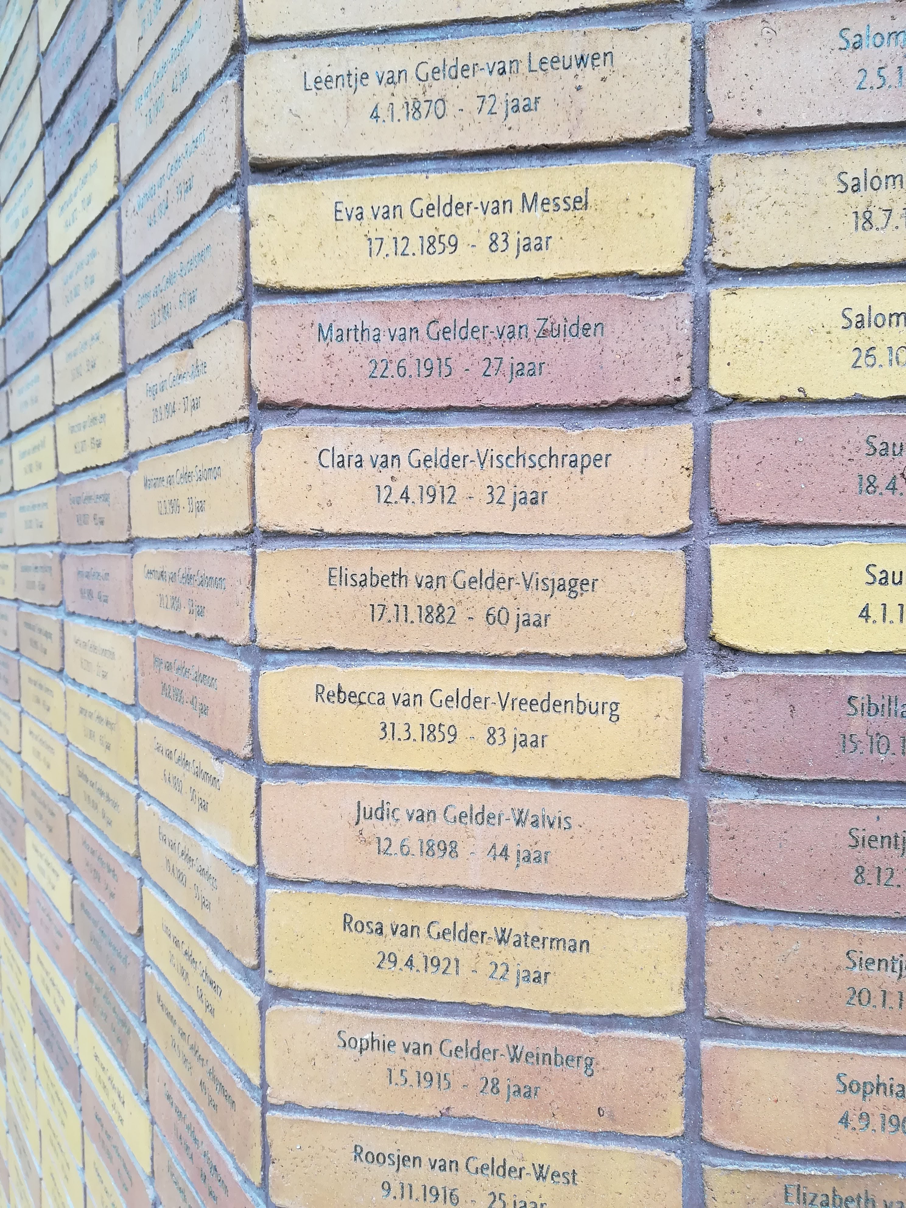
Though the city was never bombed during the war, it did suffer terrible repression. Some 80% of the Jewish community were killed by the Germans – approximately 120,000 people. The impressive Holocaust Memorial ensures that those people are never forgotten. Every individual is named on a brick which is cleverly displayed under huge curving mirrors. We will always think of Amsterdam as being vibrant and forward thinking, and yet its history must never be disregarded.

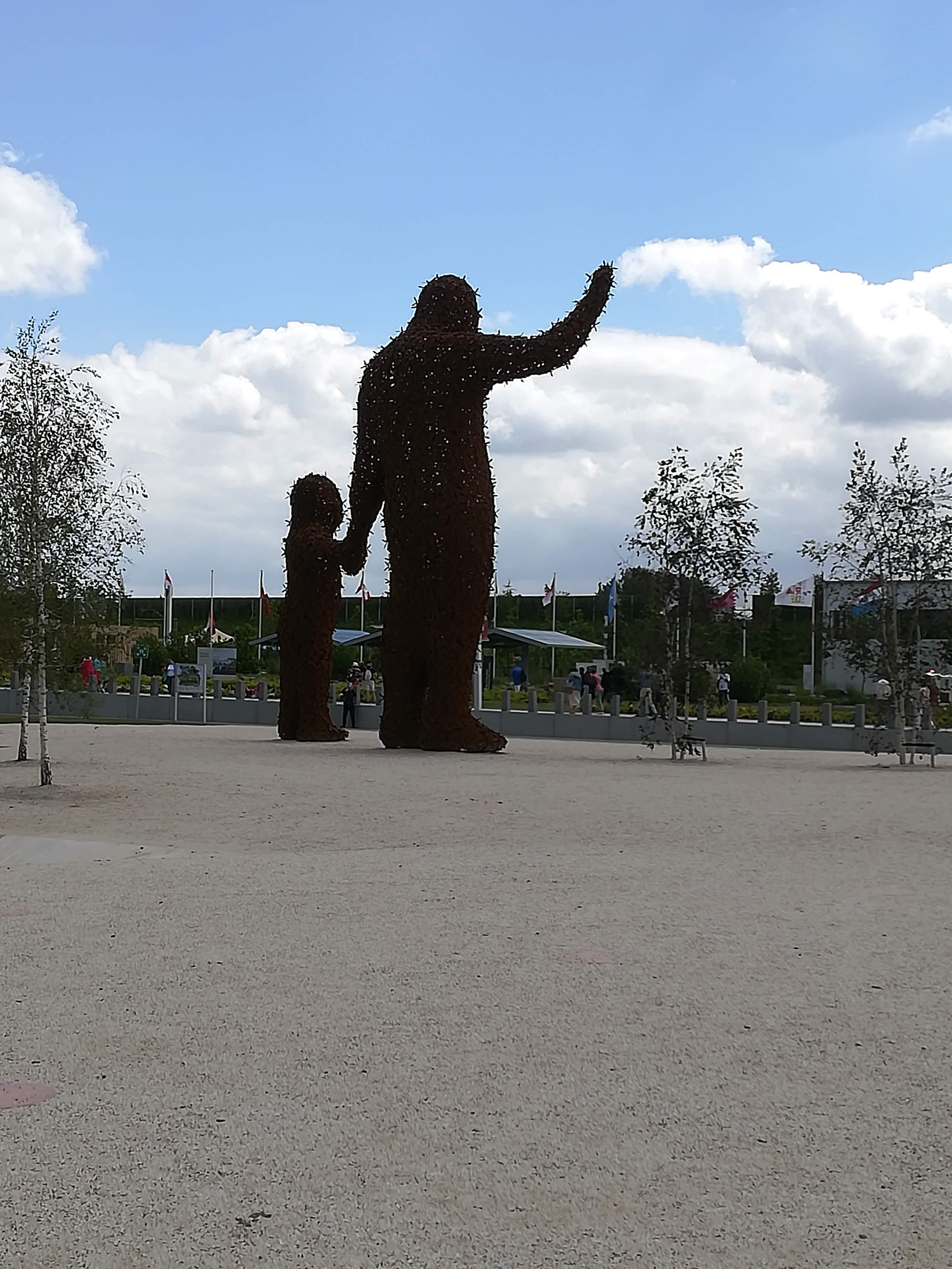
Our proximity to Amsterdam, meant that we were able to take a day visiting Floriade. This enormous International Horticultural Show which takes place every ten years in a different place in The Netherlands, allows the Dutch to show off their agricultural prowess and more importantly, their forward thinking. The 850-metre cable car ride gave us a birds-eye view of the 60 hectare site in Almere (about 20 mins by train to the east of Amsterdam). Within the theme of ‘Growing Green Cities’, we were shown various innovations and solutions, which inspired us to enrich our own garden, and try to live a greener way of life. The site itself will become a ‘green city’, with eco houses built on large plots to allow owners to ‘grow their own’. In the meantime, we enjoyed some beautiful gardens with lots of vibrant colour.


We are now heading north and east through The Netherlands to the border with Germany. See you next time . . . .
Molly’s 1st Foray into Europe
With Covid restrictions being relaxed, we feel it’s time to explore a bit further afield. We will shortly be ‘crossing the water’ to Europe, and exploring three countries that we’ve never visited before. Holland, Northern Germany and Denmark. Given that it’s high season (i.e. school holidays) in these countries, we have been advised to prebook our campsites to avoid disappointment. After much head scratching and studying of the Lonely Planet Guides we have planned a route. No doubt there will be the odd ‘blip’ and a few challenges on the way – but that’s all part of the fun!

Follow us as we go – I shall add some news each week. Molly is raring to go (I wonder if she knows how much diesel prices have risen?) and we’re looking forward to seeing something new. See you on the other side . . . .
The Isle of Skye
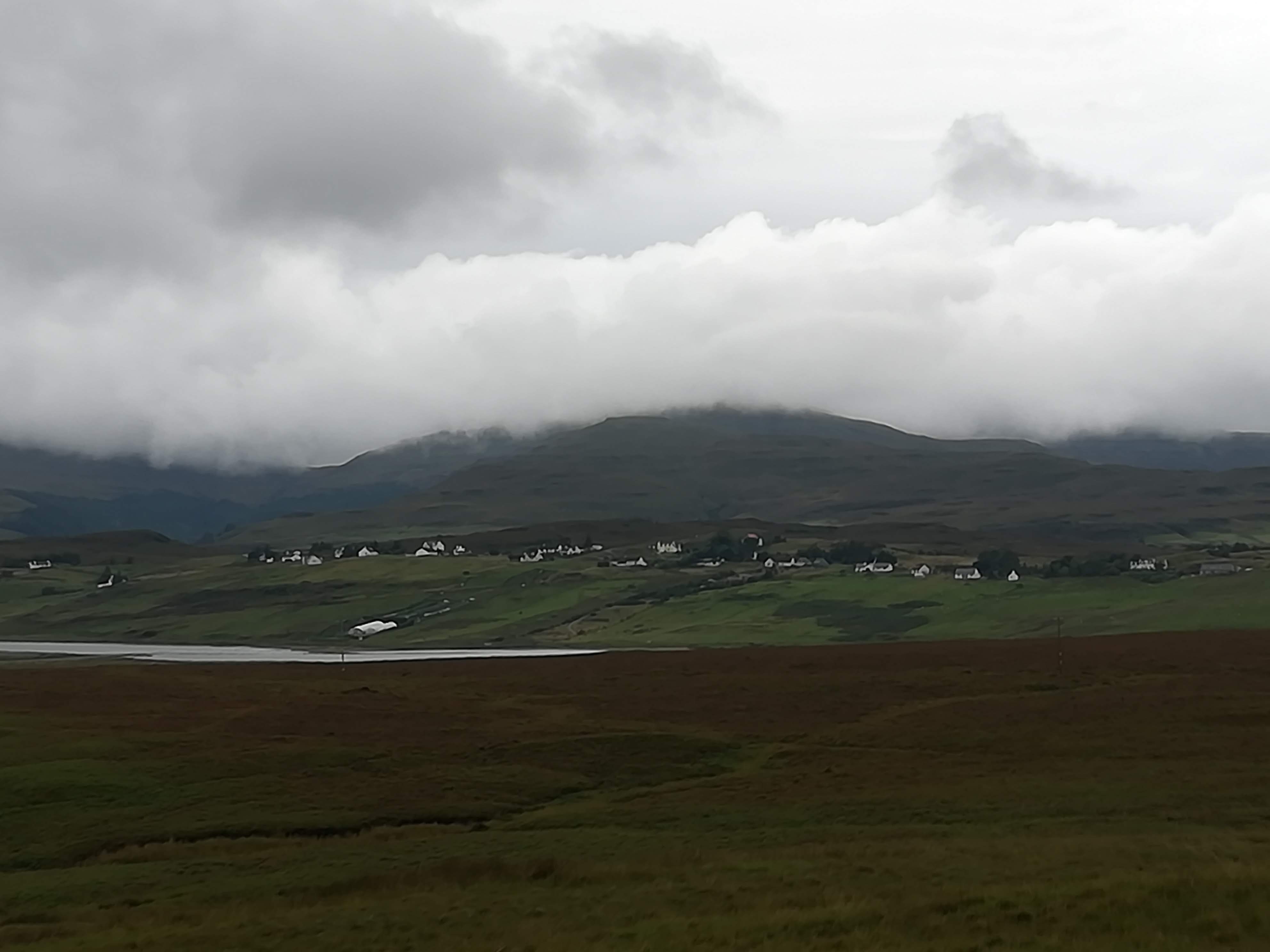
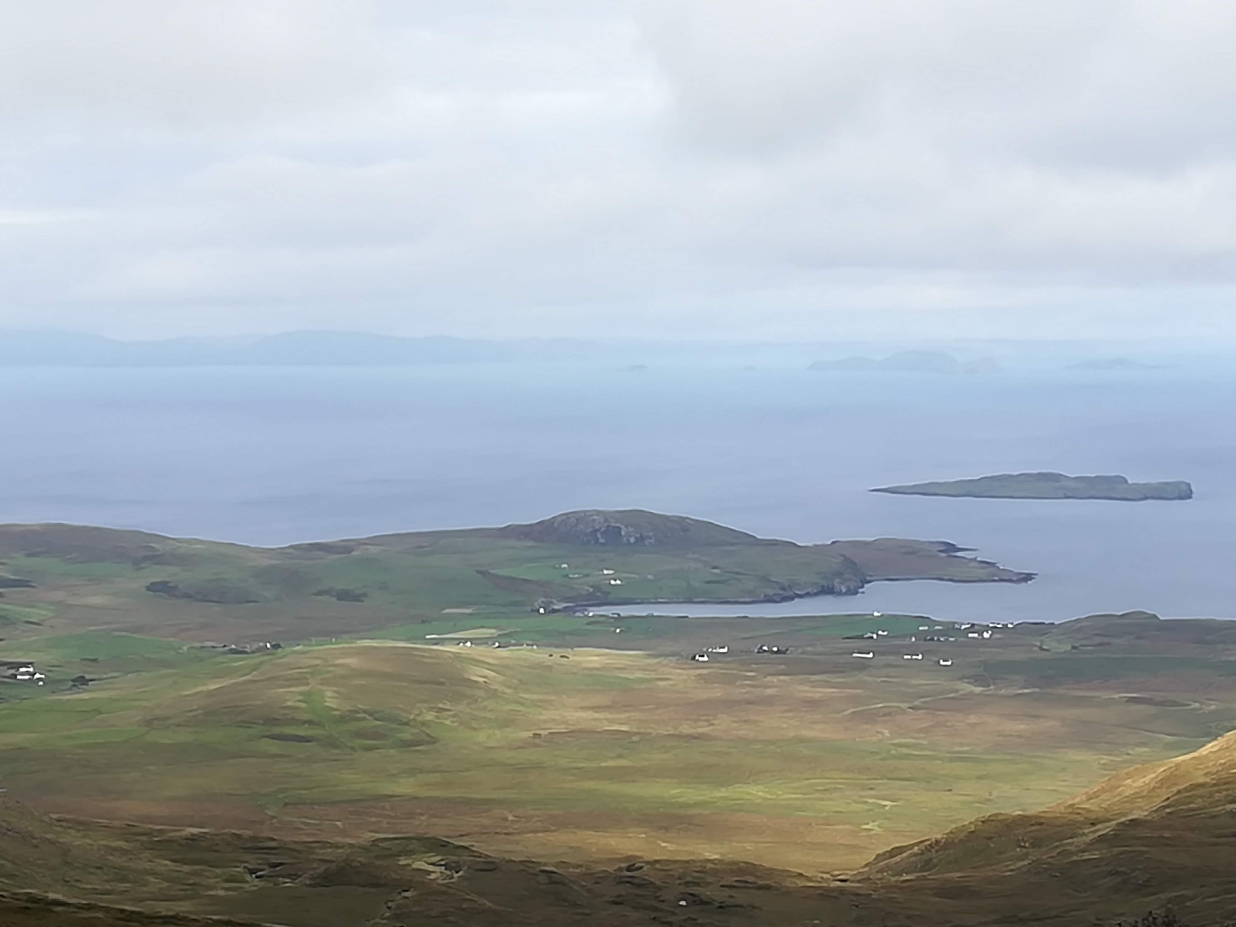
Leaving the Outer Hebrides, we caught the ferry from Tarbert to Uig on the Isle of Skye. Once again, we were blessed with calm waters – phew!
Skye is the largest of the Inner Hebrides and is 50 miles long and only 5 miles wide at its widest points, thanks to many deep inlets. The people of Skye must have been thrilled to be connected to the mainland via the new bridge (built 1992) – it will have improved the economy in every way. However, the ease of reaching Skye means that the tourist industry is booming. EVERY site of interest is now so crowded that we quickly learned to visit these places very early in the morning. (Reminded us of visiting Lake Louise in Canada!) Car parks are too small and road surfaces are terrible thanks to the increase in traffic from tour buses to motorhomes (yes, I know – that’s us!), from motorcycles to bicycles – they are ALL on the roads! Perhaps we noticed this more keenly, having just had two relatively quiet weeks in the Outer Hebrides!
The name Skye translates from the original Norse – meaning ‘island of mist’. Oh dear! You guessed it . . .. we’ve had lots of low cloud and rain!

Highlights:
The ruins of Duntulm Castle on the north-west coast of the island sit on a headland overlooking the Minch. The present ruins date from the 14th century, and it is said that there was once an Iron Age Broch on this site.

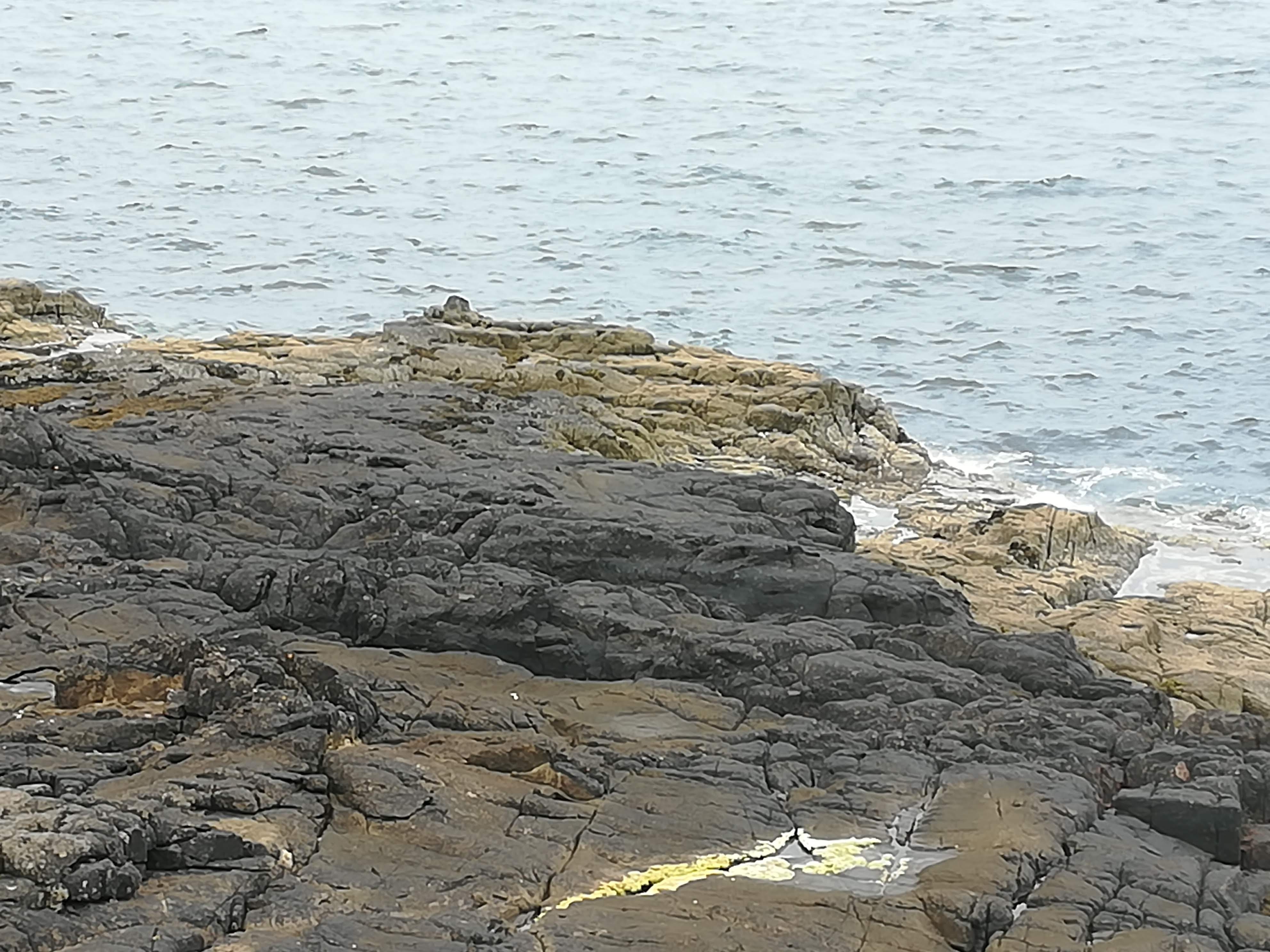
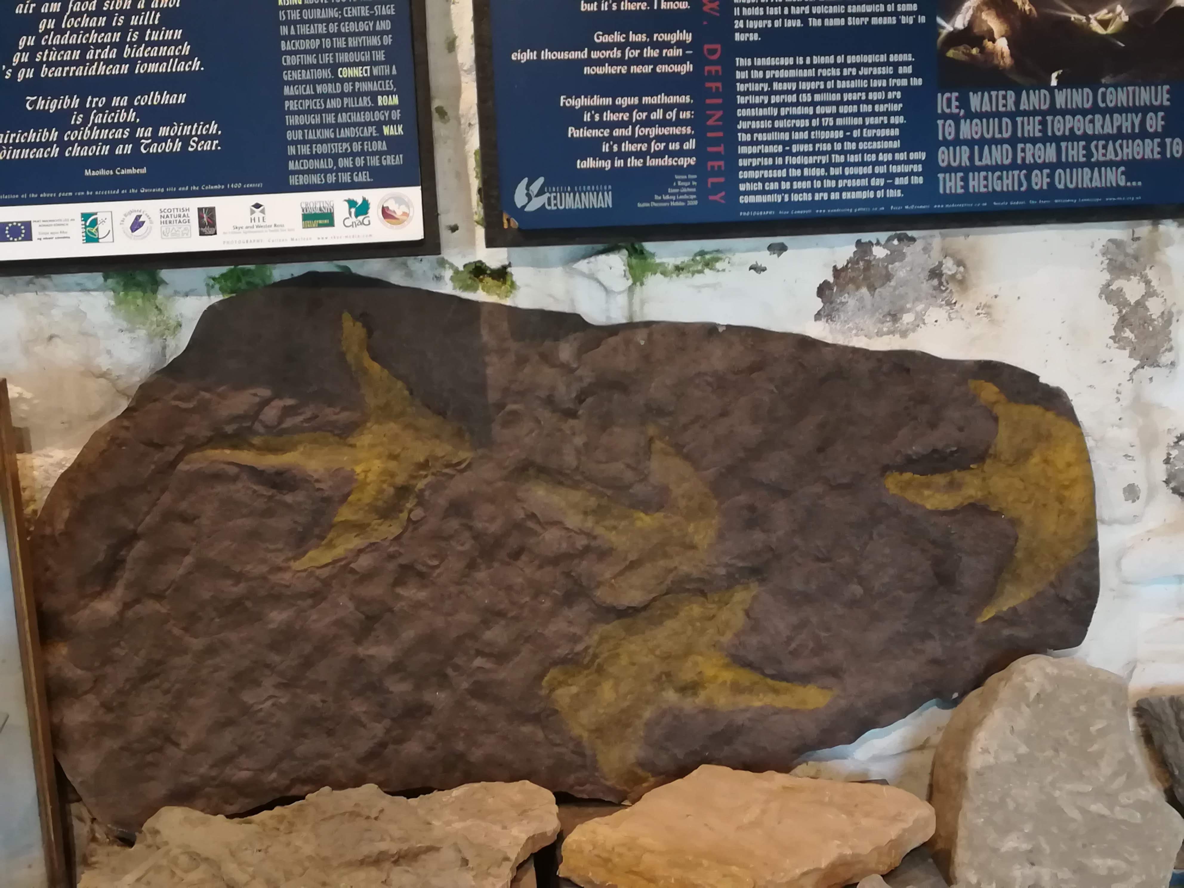
More exciting for us was searching for dinosaur footprints on the shore below the castle. Yes! You read that correctly! These 170-million-year-old fossils have been discovered recently. Apparently, they only appear at low tide when a recent storm has cleaned the rocks of seaweed and shingle. The local museum had some good examples. It is just incredible that something SO OLD can be preserved by the salt water – three cheers for the clever geologists/scientists who discover these things.
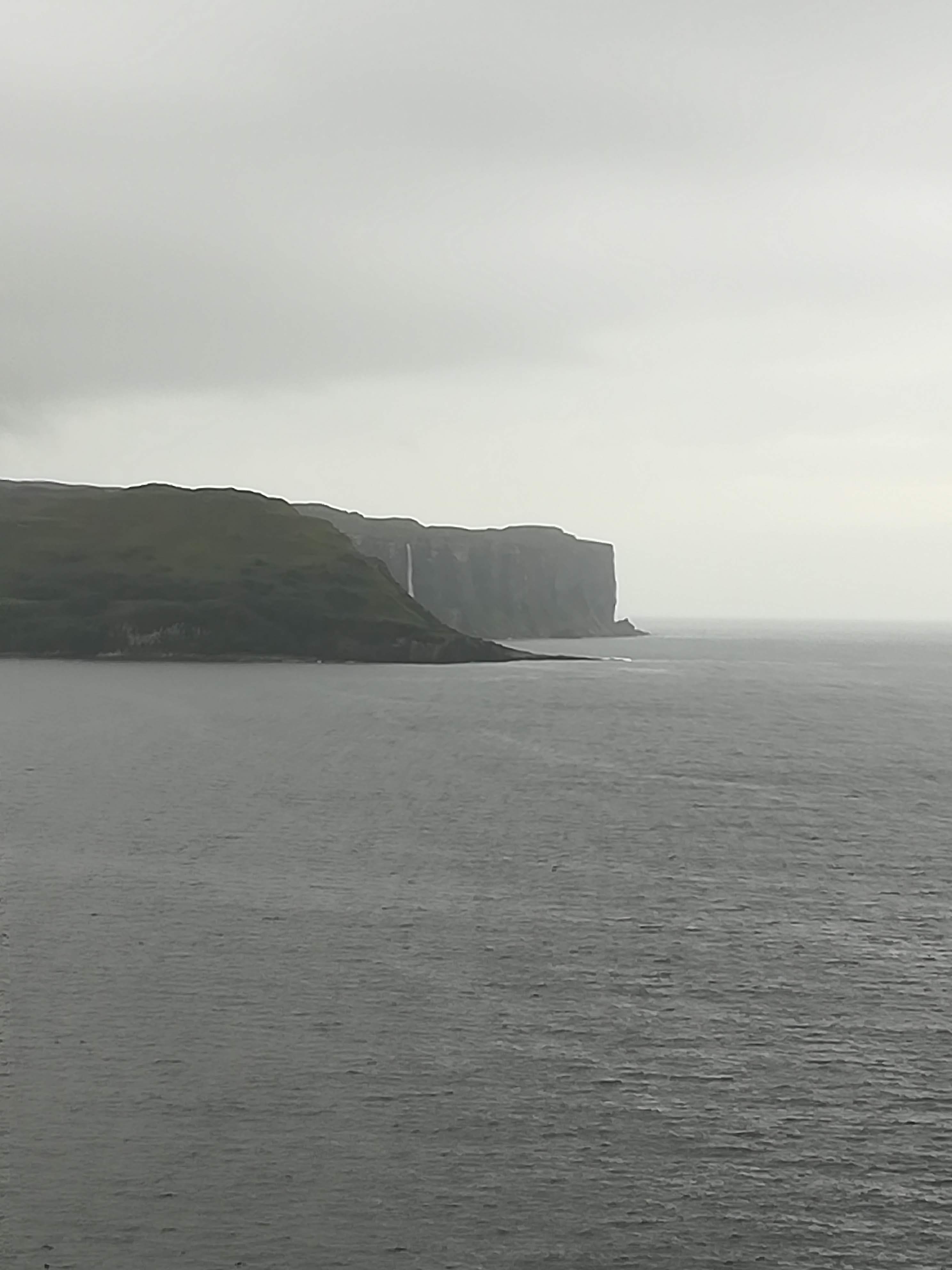
Kilt Rock and Mealt Waterfall – Skye’s coastline has some very steep, columnar cliffs. At Kilt Rock it is said that the rocks resemble the tartan pleats of a kilt (I’ll leave you to decide . . . )

The Mealt Waterfall tumbles 55 metres into the sea from an inland loch named Mealt.

Given the miserable weather and low cloud, a visit to a castle and gardens was a must. Dunvegan Castle dates from the 13th century and is home to the MacLeod clan. It is the oldest continually inhabited castle in Scotland.

The surrounding gardens date from the 19th century, and have been constantly updated since the 1970’s. The interminable rain stopped for us as we arrived at Dunvegan . . .. . hence, we were able to admire the acres of garden accompanied by – you guessed it – MIDGES!


A day of sunshine and clouds was a definite invitation to get out and walk in the mountains of the Trotternish Ridge. I shall leave you to research the geology in greater depth, but suffice to say that basalt lava flows combined with horizontal dolerite sills have created some of the most dramatic landscape in Britain (it says so in the book!)


We felt truly blessed to have the stamina (and some sunshine!) to climb the Quiraing (543 m). The views were spectacular in all directions. The clarity and colours were magic. The 8km walk took three hours, not only because of the arduous climb, but because of the numerous stops for photos!

Not only were we enchanted with the captivating scenery, we were overjoyed to FINALLY see some eagles! No photos . . . they were too far away, but we sat on a rocky outcrop watching them soar overhead – just breath-taking.
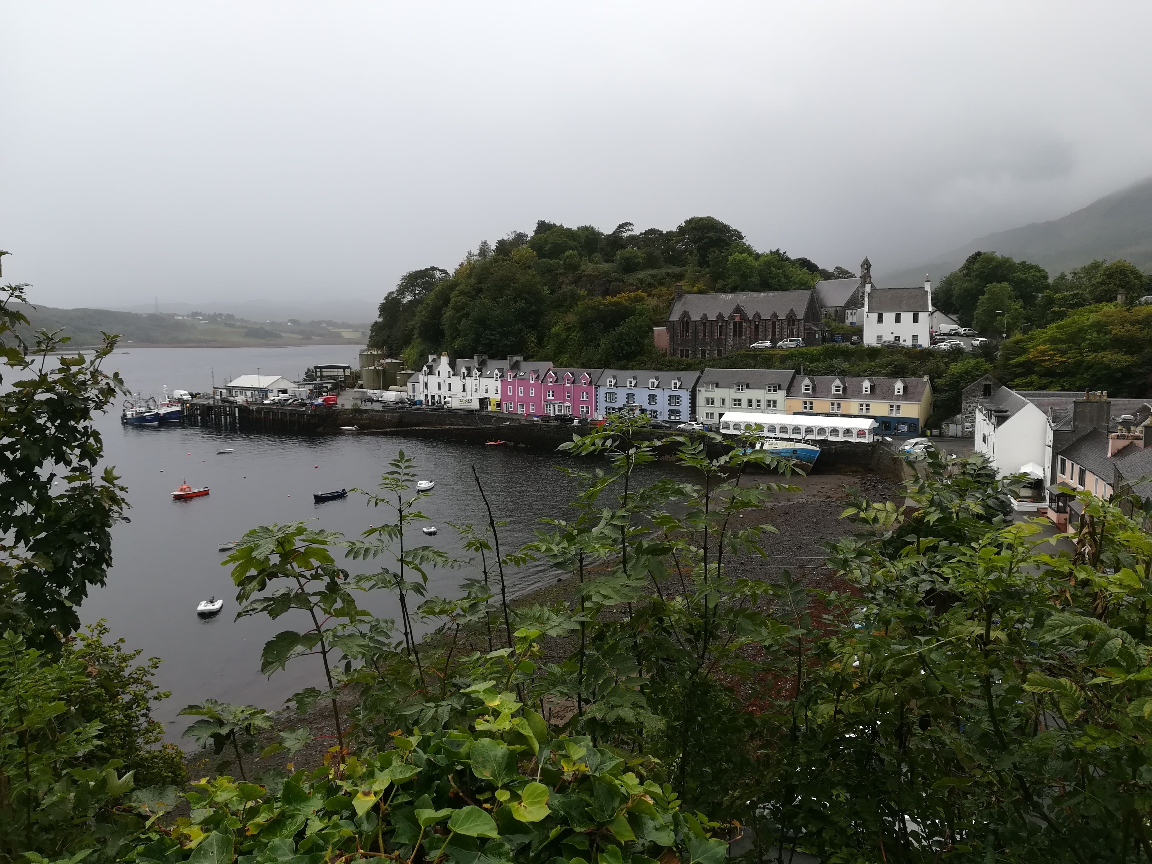
Portree is a pretty seaside town (we missed Charles and Camilla’s visit by a day!) and we enjoyed wasting a few hours in the rain (yes, more rain!) looking in the various shops (Harris Tweed anyone?) as well as replenishing Molly’s food supplies.
Portalong is at the end of one of the many peninsulas. Single track roads lead to these tiny places where there is always a little car park and a jetty for the fishing boats. We sat watching a seal enjoying the turn of the tide – whilst listening to the rain pitter-pattering on Molly’s roof.
One last day on Skye, and the rain held off. An early start gave us an uninterrupted view of the Fairy Falls which tumble down throughout Glen Brittle


Armadale Castle – home to the Macdonald Clan is sadly now a ruin. However, it is surrounded by beautiful gardens and an arboretum full of very impressive trees.


We begin our journey home tomorrow . . . . . I shall add more to the blog when we go on another interesting holiday!
Thanks for following . . . . .
The Rain Clears – time to explore!
Two days without rain – even a few rays of sunshine – have changed the landscape here beyond belief. Little did we realize how beautiful the mountainous region is – the colours and textures are so vivid – if only I could paint!
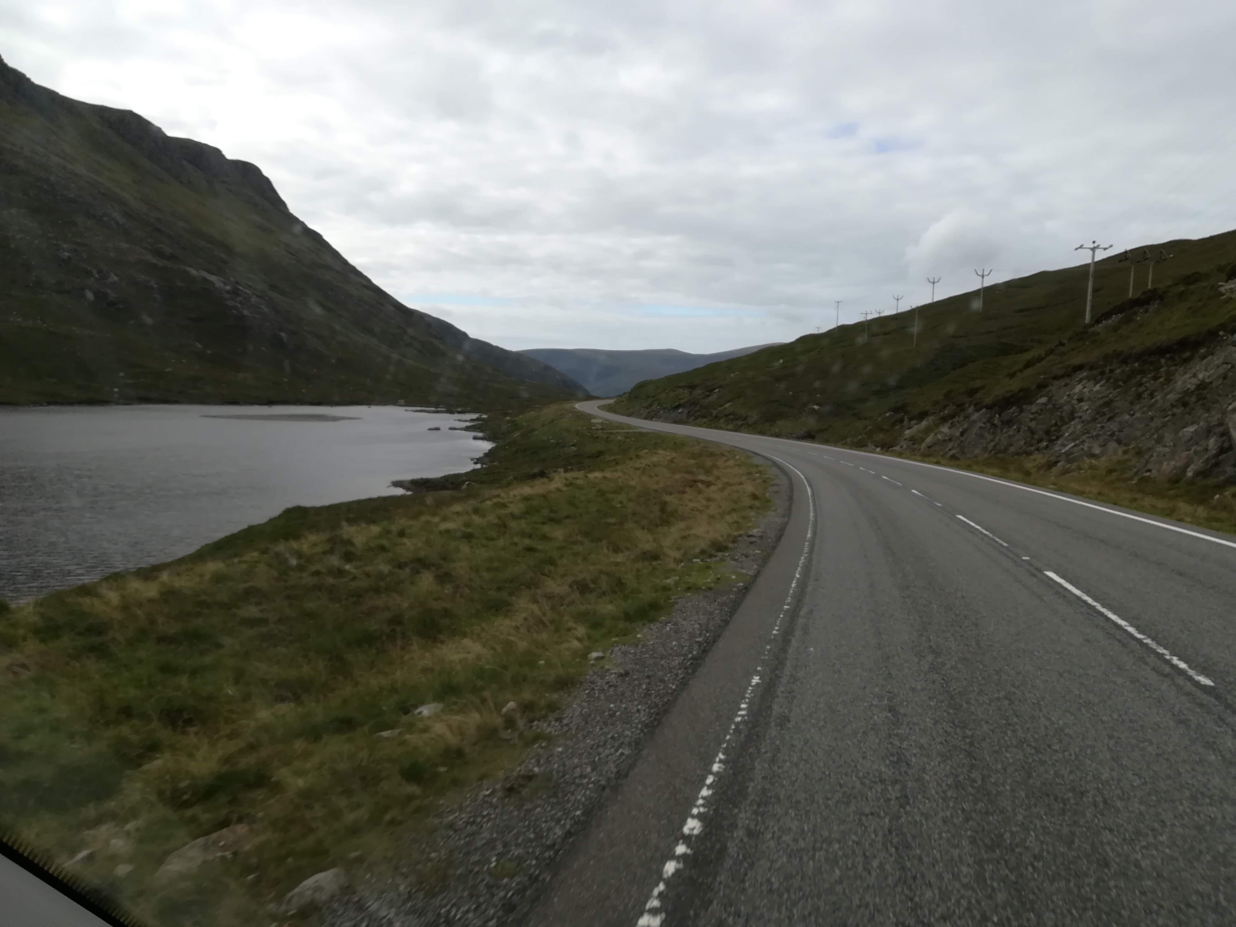

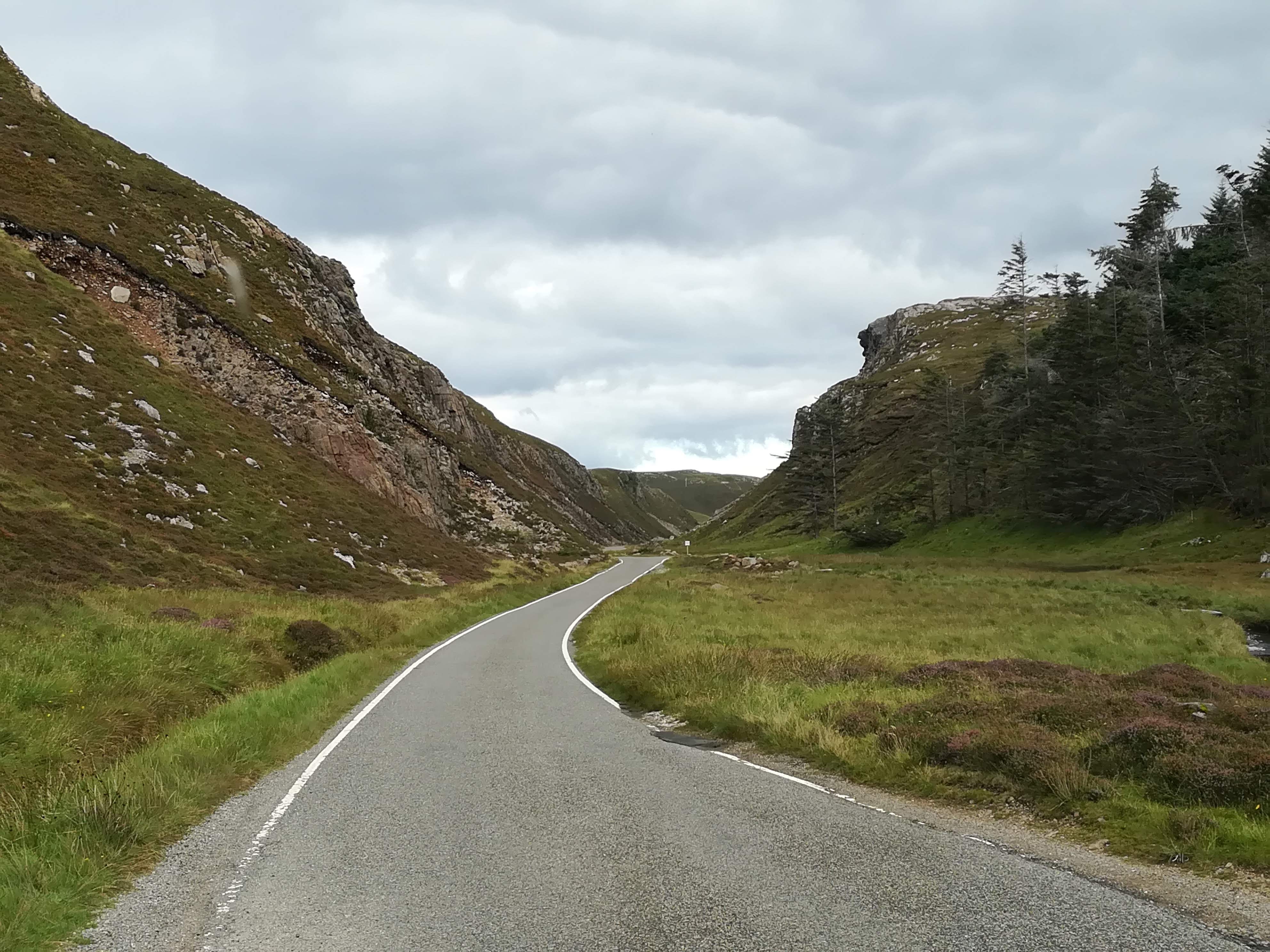
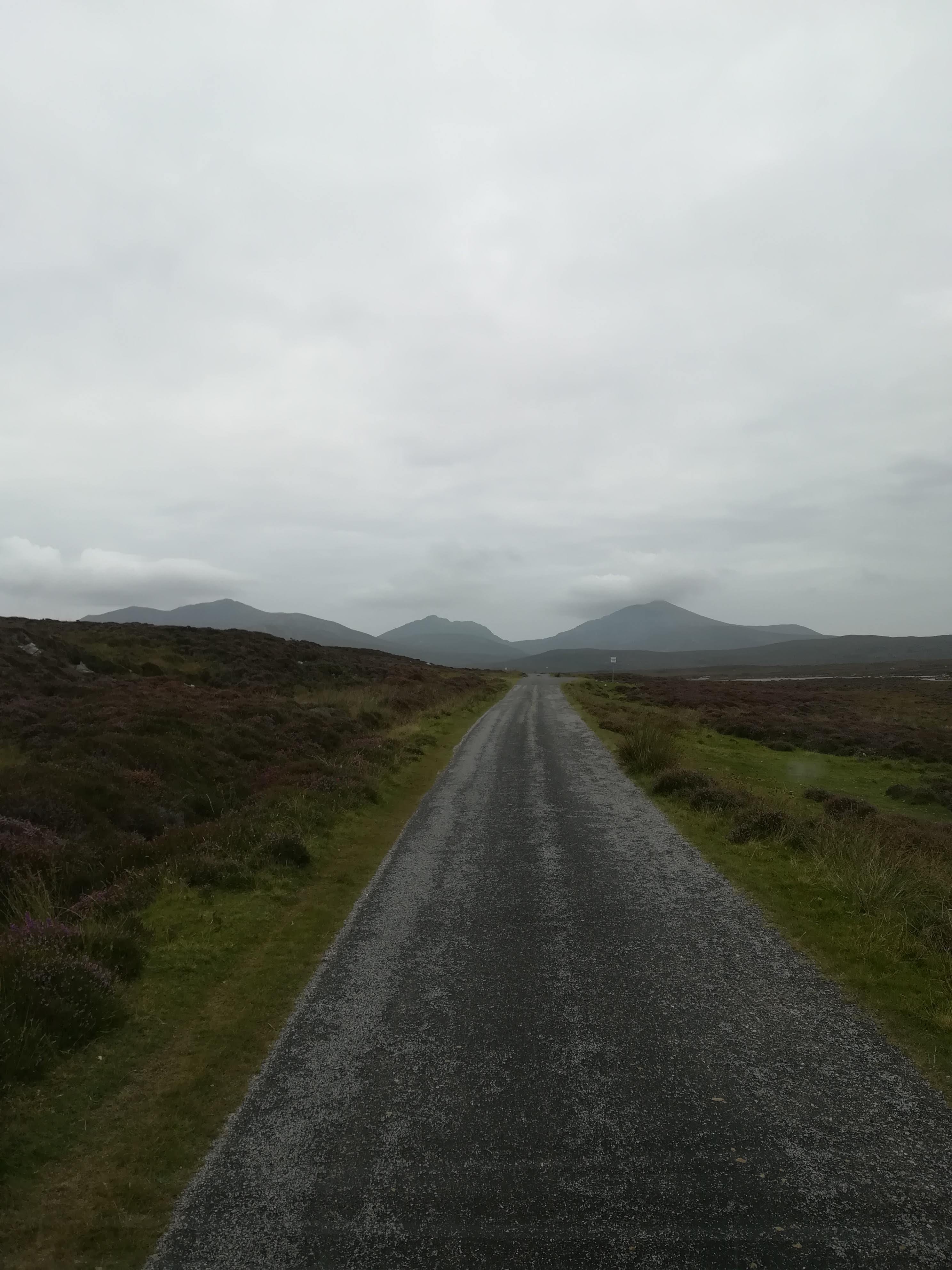
Getting off the main roads is our passion – not that the main roads are particularly busy here. Back roads are much more exciting! They are VERY windy and narrow, with potentially dangerous drops off the pavement into bog or over a cliff! Never ones to be put off , we set ourselves a two-day challenge. The first was to drive Molly westwards to Uig Sands.

Coffee break was taken overlooking Loch Suaineabhal, (66.7m) reputed to be the deepest lake in Britain’s offshore islands.


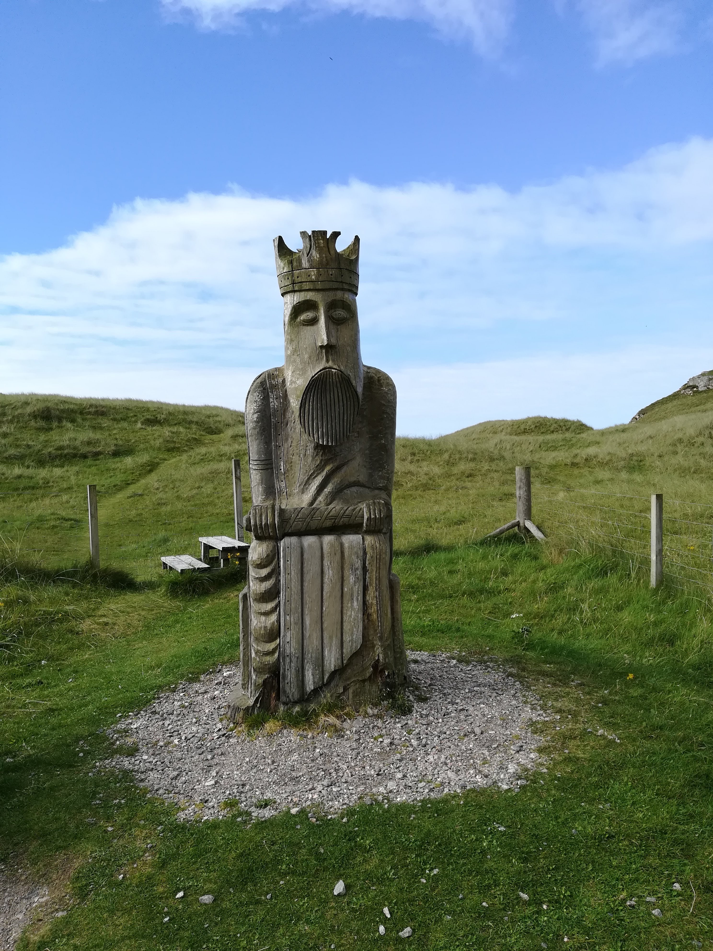
Uig Sands are popular, not least because the Lewis Chessmen are said to have been found here in 1831 amongst the sand dunes. A large wooden statue of the ‘King’ ensures we don’t forget this!
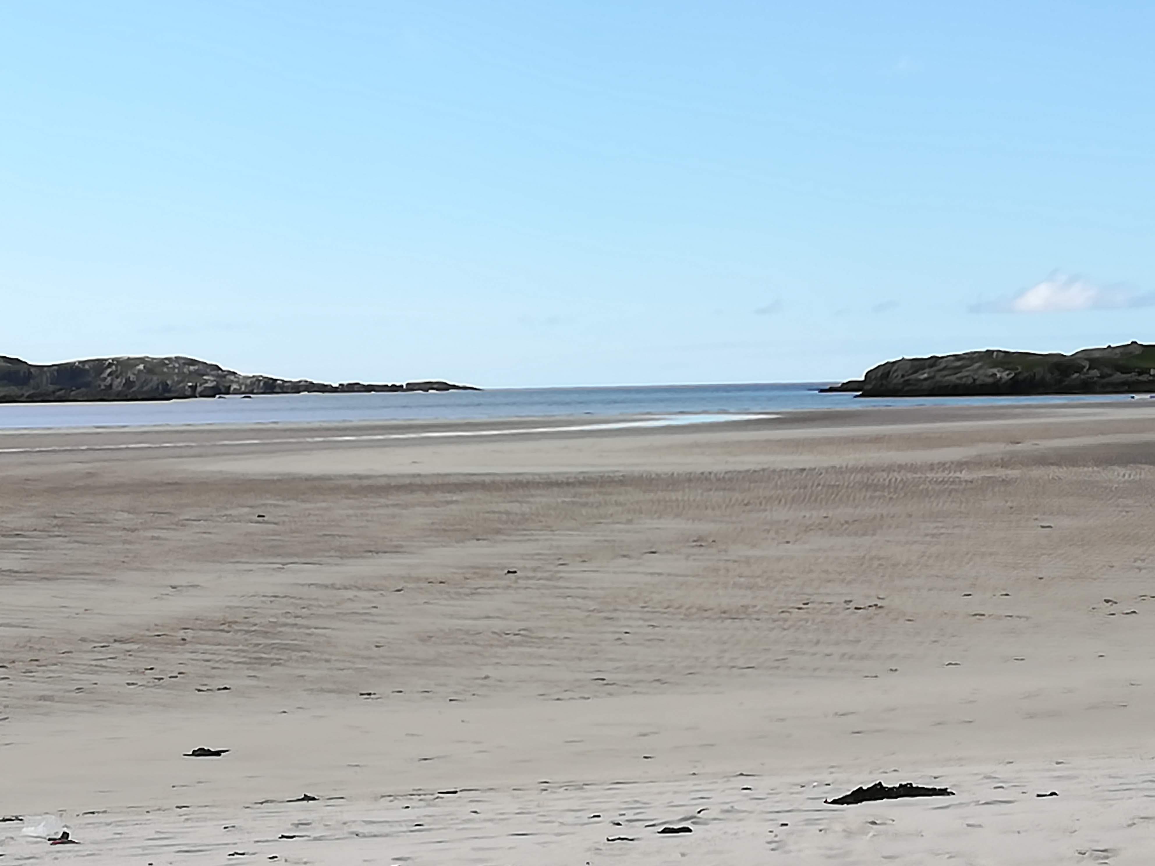
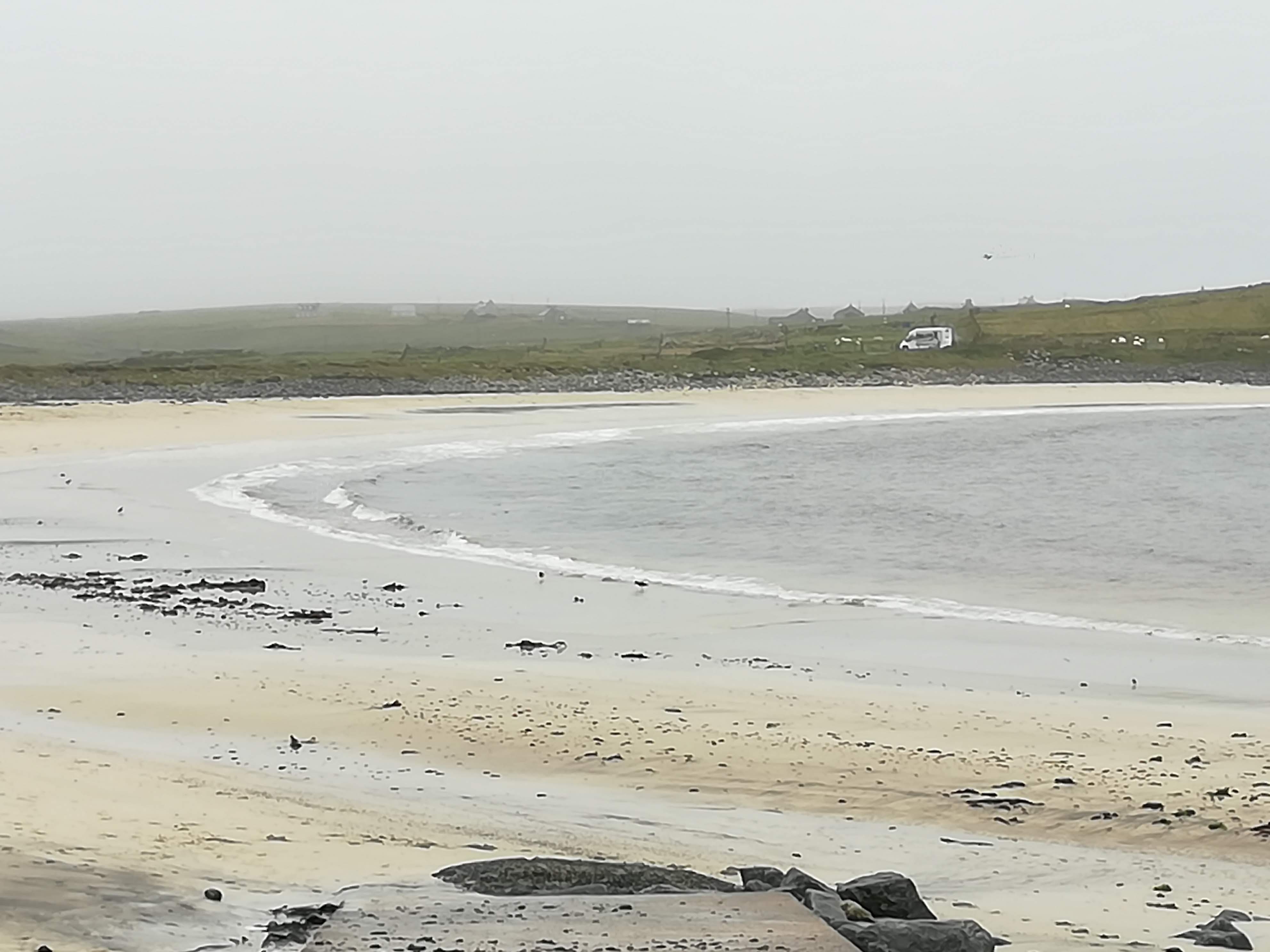
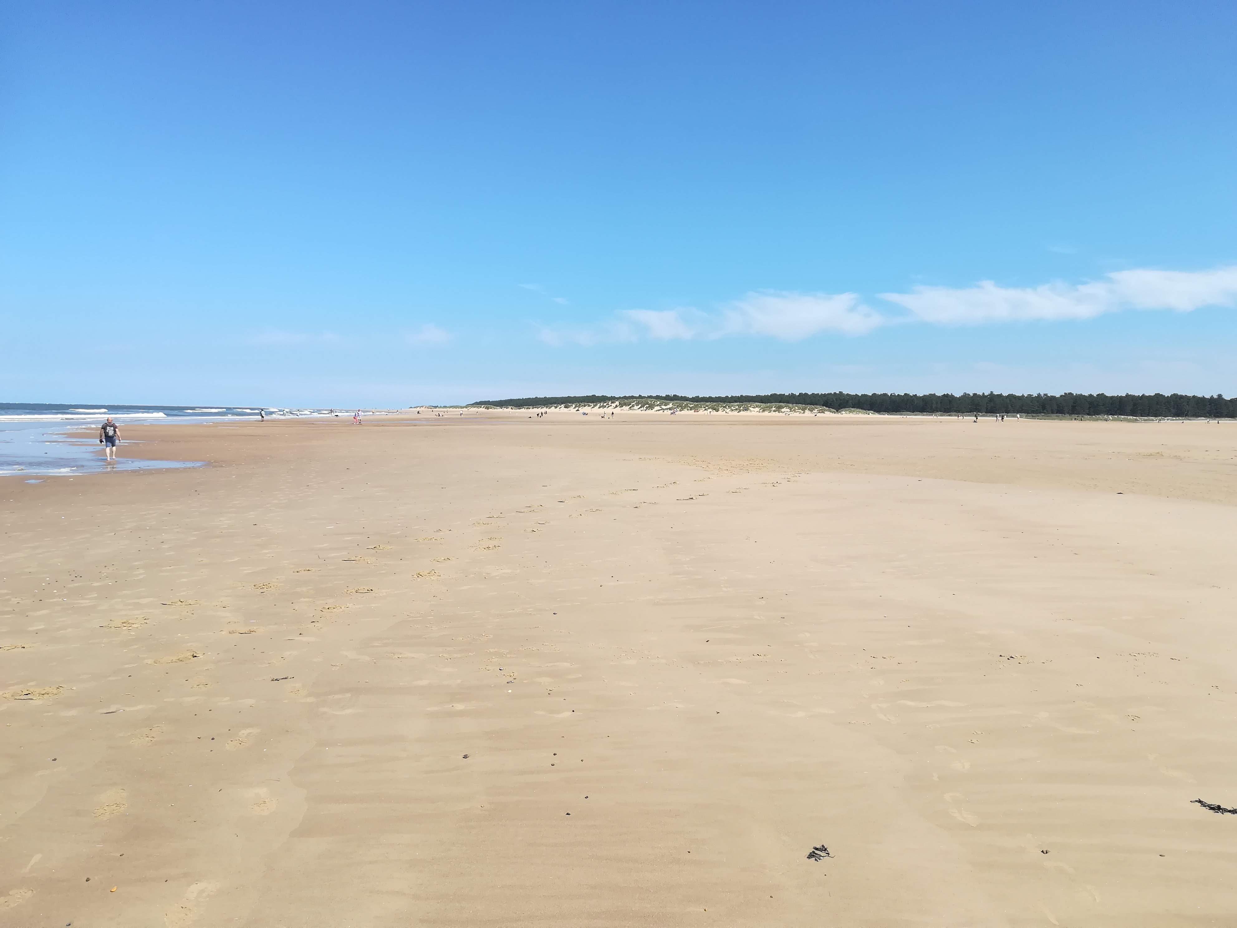
The beach at Uig has an extraordinary tidal range – the distance between low and high tide can be as much as a mile – walking across the sands towards the sea seemed to take forever – but oh, what a joy! Miles and miles of clean white sand!
A quiet spot off the road gave us beautiful views down Loch Rog Beag, where we spent a relaxed night, watching the sea birds as the light dimmed.

Our day two challenge was Huisines – a remote settlement on the west coast of Harris. With only four houses, it is at the end of a 14 mile very narrow single-track road, which twists and rises, in keeping with the contours of the rocky outcrops. Blind summits and tight curves kept us on the edge of our seats – and yes, we shared the driving! But the views were worth it . . . .


A brazing walk along the beach was needed to settle the adrenaline rush before we started the journey back.

Anhuinnsuidhe Castle
The narrow track to Huisines takes you right past the front door of this castle, built in 1868 by the Earl of Dunmore – we are thankful that the present owners are happy for the road to pass so close to the castle, and through their gardens. Perhaps it is so remote, that the passing of cars (and motorhomes!) reminds them that there is a world out there!
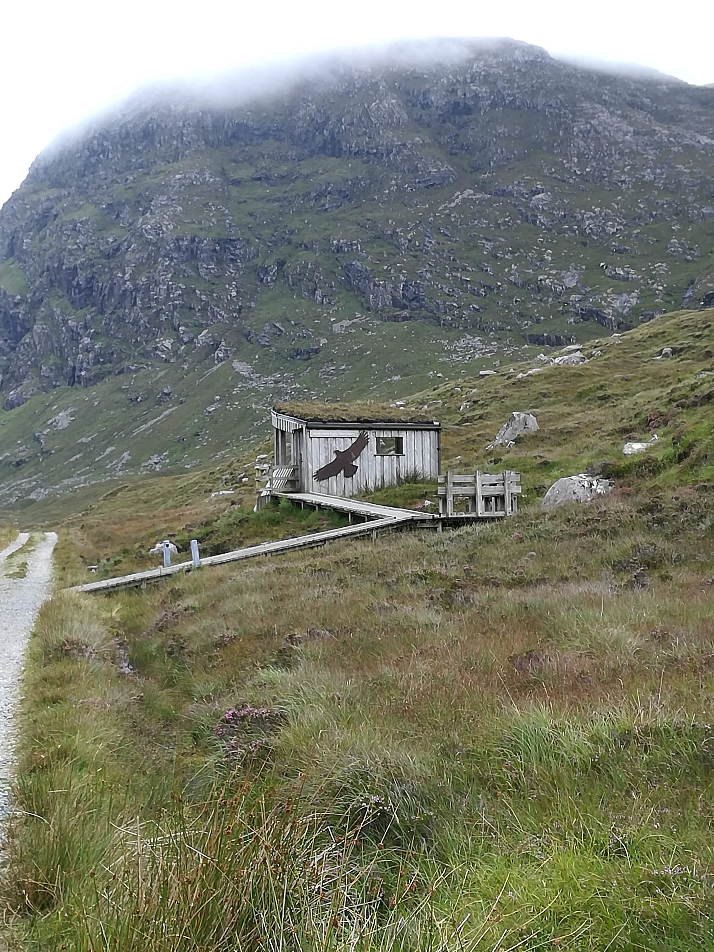
North Harris Eagle Observatory
Given our pathetic record for seeing any wildlife, the Eagle Observatory was like a magnet to us! A 45-minute walk up the valley of the River Mhiabhaig – mostly peat bog on the valley floor, with the mountains rising up on either side. The Reynolds ‘jinx’ took over again . . .. the clouds rolled in over the higher peaks as we approached the ‘observatory’. As you’ll see from the photo, it is a little wooden hide-out – where we sat for some time with our binos – WE DIDN’T SEE ANYTHING! If the eagles were soaring, we couldn’t see them! As we commented on the walk back down the valley, we didn’t even see a rabbit! The valley was silent . . ..

We’ve moved on to Skye today, so I will record a further entry later in the week.
Benbecula – Flat and Foggy!
Our campsite on Benbecula was called Otter’s Edge – ‘that sounds hopeful’ we thought. Silly us! Having taken advice from the owners (and he gave the same advice to everyone) we got up very early and walked 40 minutes out onto the beach, to a carefully placed bench where we could expect to see sea otters – two hours either side of hide tide was the advice. NOTHING! Are we jinxed? The campsite owners like to remind us of how far we are from the rest of the world..

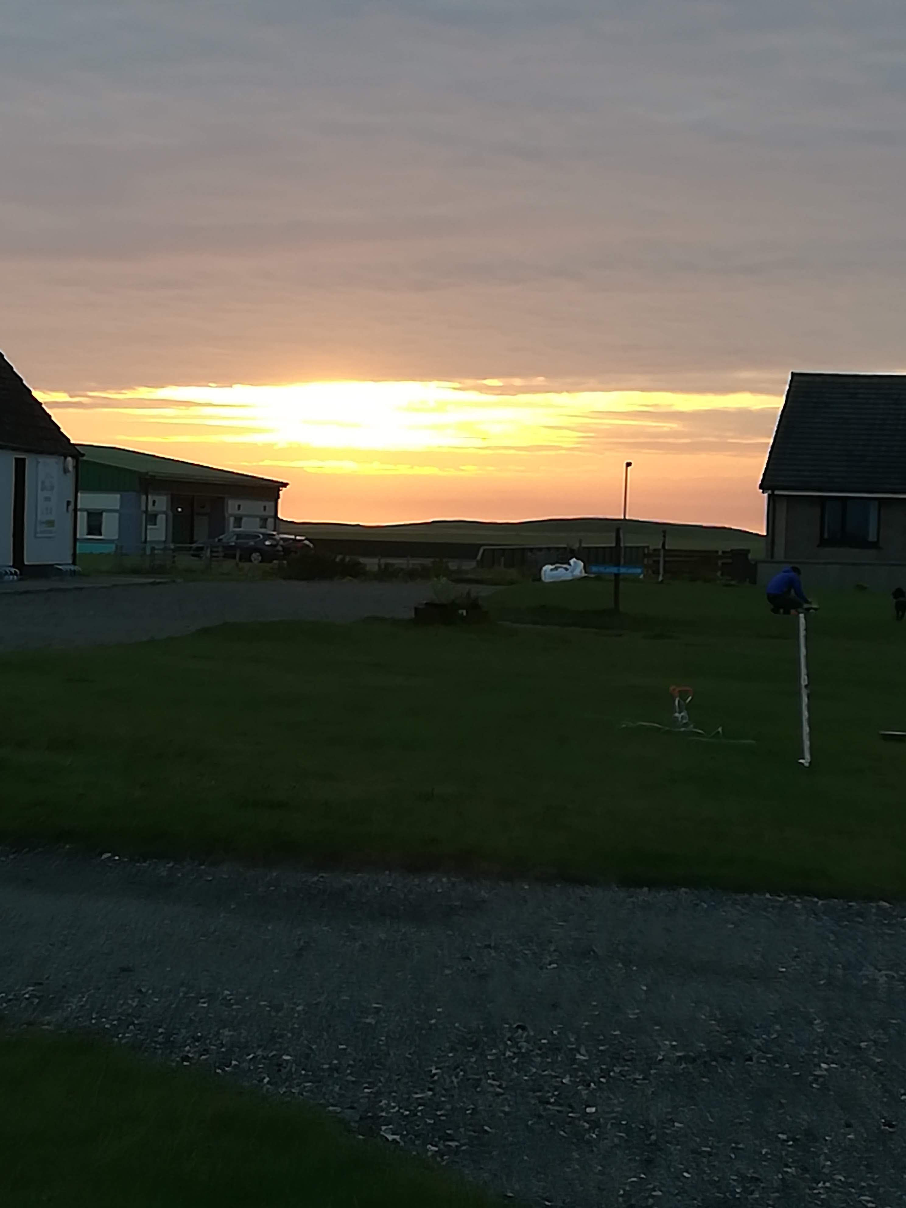
Our planned walk for later in the day never happened due to thick fog/sea mist rolling in and blanketing everything in all directions. The fog became rain at times and then just reverted to damp, all encompassing yuck! BUT . . . . you don’t come to the Outer Hebrides expecting sun and warmth. The Islanders assure us that they’ve HAD lots of sun and warmth and now they need rain! A brief respite from the rain, produced a wonderful sunset which lifted our spirits.
As with most of the islands, Benbecula boasts many miles of white sandy beaches. A brisk walk along any beach in a strong wind is a sure-fire way of improving one’s zest for life.
A Boat Tour was recommended from the little island of Grimsay – just to the east of Benbecula. Ten of us took to the seas on Lady Anne, with much promise of wildlife ‘as seen on every trip’. A happy two hours passed by, as we pottered about the inshore lochs and inlets. . . . seeing many red deer and numerous sea birds. Yet the famous sea eagle, who normally ‘poses for the camera’ was nowhere to be seen. Told you we were jinxed!

Moving North:
As recommended, we ‘wild camped’ amongst the sand dunes on the little island of Berensay, ready to catch the 07:15 ferry to Harris. Joining the queue at 06:45, little did we know what a long day we were going to face. . . . . Thick fog meant our ferry was cancelled. Spring tides meant fewer ferries were running. A few lucky cars and MOHO’s were squeezed onto the 10 am, but the rest of us had to wait (with fingers firmly crossed) until 4pm. Not only were we praying to get on the ferry, but that the much-threatened fog would not close in again! No one moved from the queue – we didn’t want to lose our place and perhaps miss out on a crossing. There is NO OTHER WAY to cross to the Island of Harris. Not only was the weather vile, but the midges were horrendous – no wind and thick fog meant the midges had a party! Creeping outside to stretch our legs, required large amounts of bug spray AND the (very fashionable) netted head cover! What a motley sight we must have made! Chat with other people in the queue just didn’t happen, thanks to the midges, and not daring to sit inside one another’s MOHO’s because of COVID restrictions. Cups of tea, too many biscuits and many a crossword kept us going . . . . .
The Sound of Harris is a notorious crossing because of the many rocks that make navigation a nightmare. Not being a good traveller, I was relieved that the waters were calm, and the fog had lifted sufficiently for the captain to see the buoys marking this hazardous journey.
Harris & Lewis:
Very heavy rain and fog greeted us at Leverburgh. Two hours of difficult and tense driving followed as we made our way north through the mountain roads which effectively divide Harris and Lewis. As the rain became heavier AND fog became thicker, our full attention was needed on the road – all the peaks were covered in thick cloud. Peering ahead through the mist to check for oncoming cars on single track roads was the order of the day.
Making our way up to our booked campsite near the north-west coast of Lewis, we passed through many little villages. All with unpronounceable Gaelic names, the villages are well spread out with majority of the houses down the main road. Plots extend back onto the ‘machair’. This is the low lying arable or grazing land formed, over many years, by deposits of sand and shell fragments near the coast. The Machair is the focus of what little agriculture there is in the Hebrides. Houses are bigger and in general, built to a higher standard than the tiny crofts in the Uists.
It was the change from trees and mountains in Harris, to open moorland in Lewis that really stood out for us. North of Stornaway the peat bog (known as blanket bog) covers an area of nearly 59,000 hectares. There are no crofts and no livestock as far as the eye can see. Not only one of the world’s largest carbon stores, but the bog is also a haven for water birds and plays a big role in water management. Driving across it however, makes one feel like you’re approaching the end of the world!

Sites of Interest on Lewis:
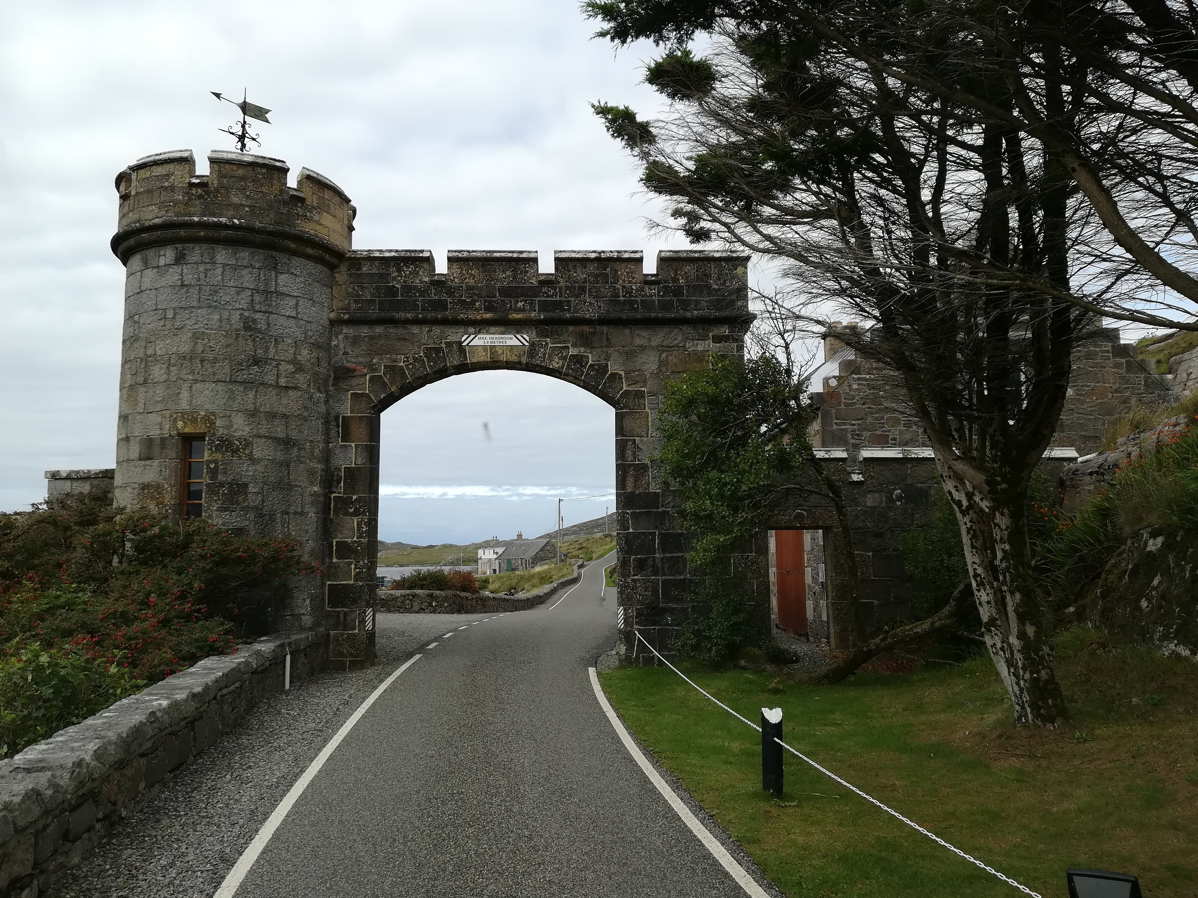
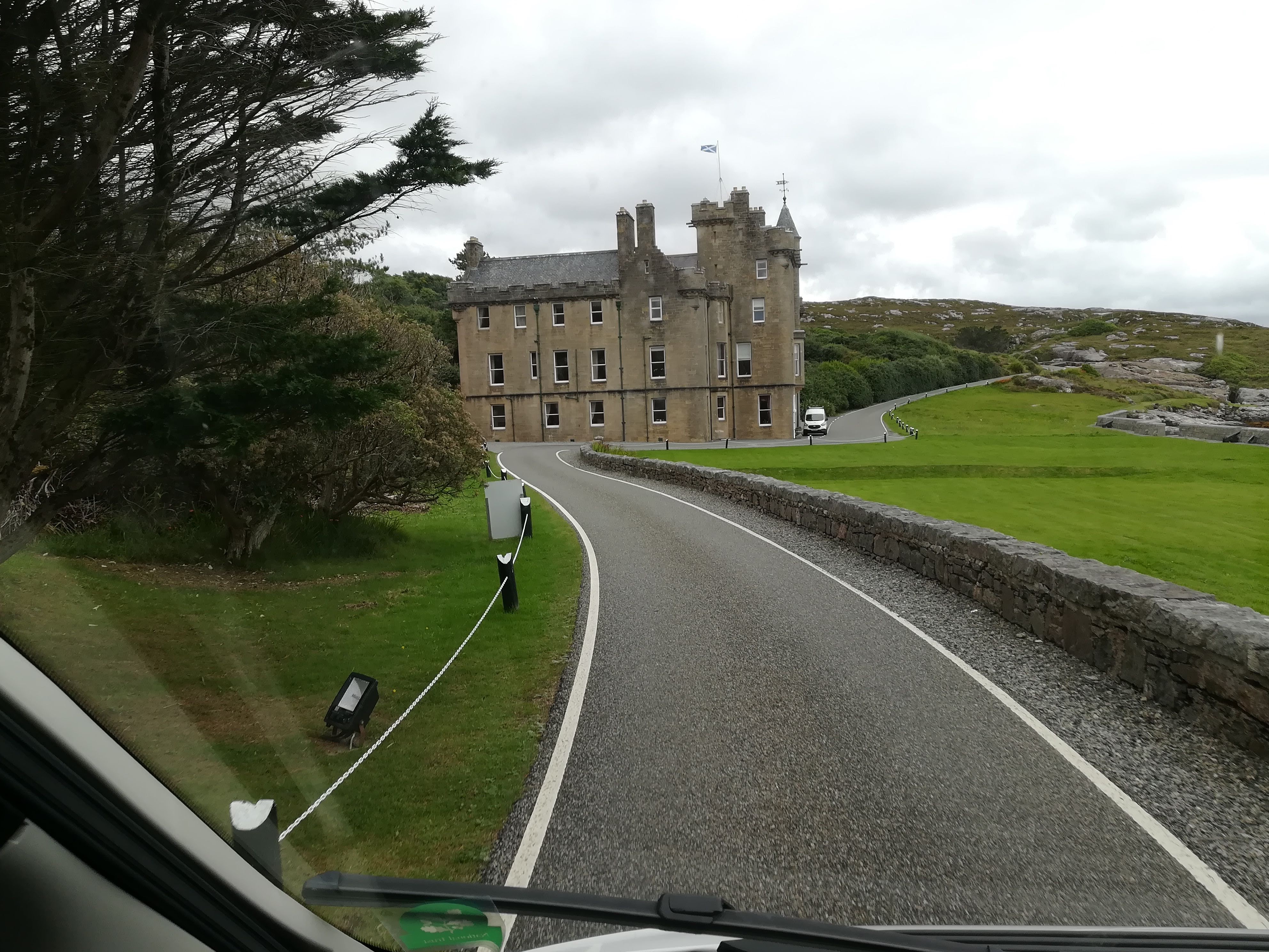
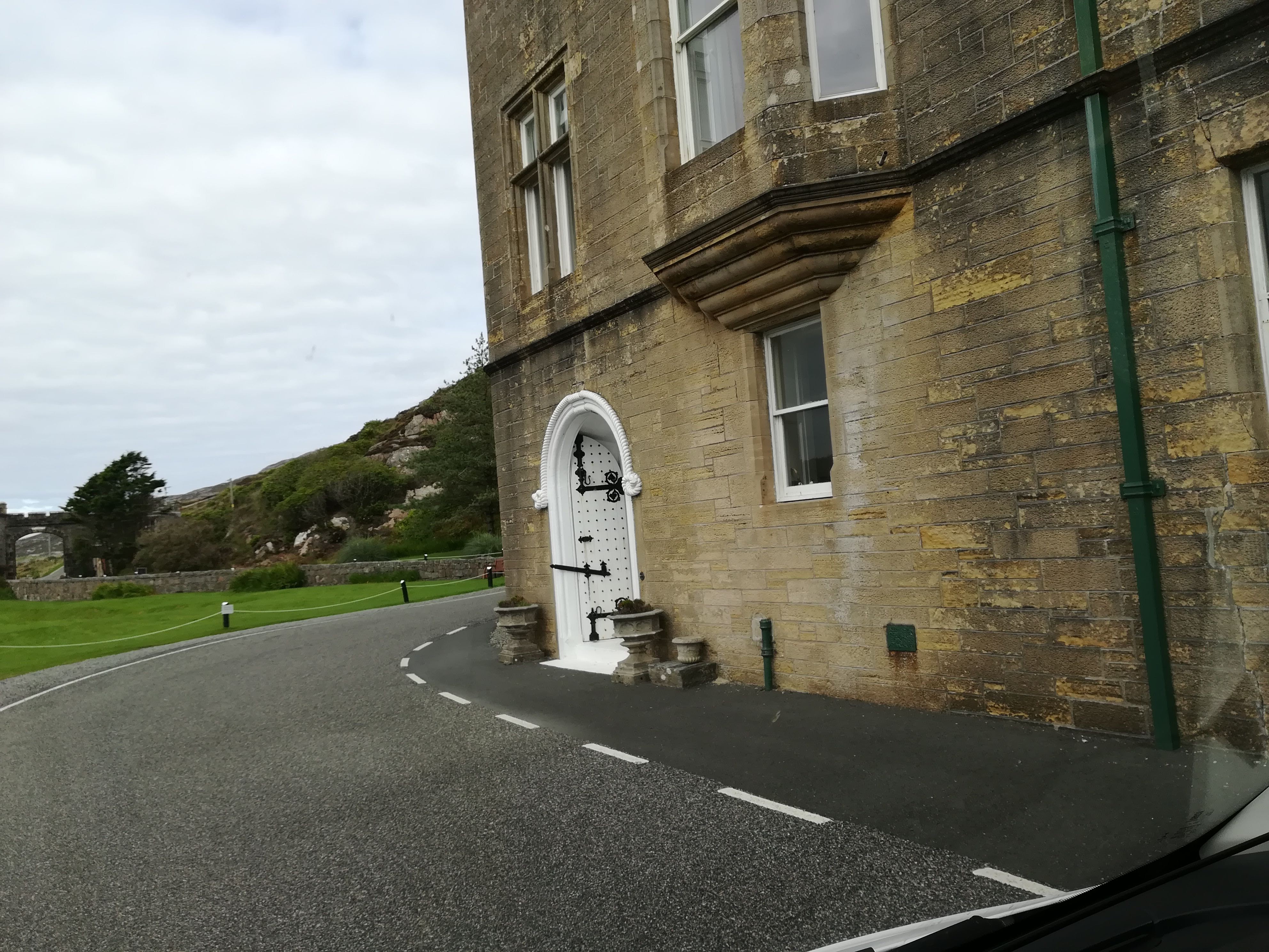
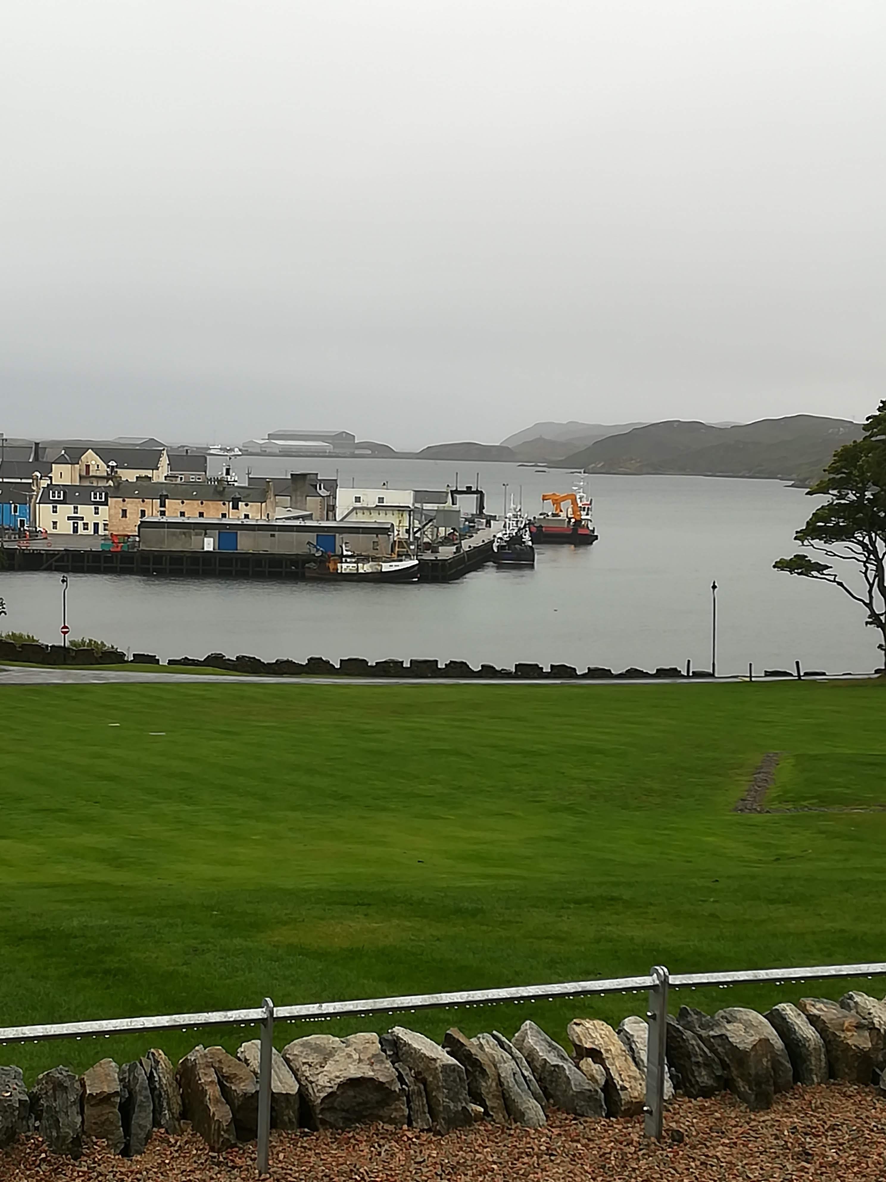
Stornaway serves as a jolt back to reality. It has tree lined streets, big houses, lots of business and industry, as well as a busy port. Heavy rain necessitated a day indoors, so we headed for the Museum nan Eilean. What a find! Opened in 2016, with interesting displays and galleries, the museum manages to humanize the many stories of fishing, farming, and singing which bring the islanders together. They have learned to live with what they’ve got and take the inclement weather into consideration at every turn. If nothing else, the six Lewis chessmen, found in the sands of Uig in Lewis, (on permanent loan from the British museum) and thought to be 12th century are worth seeing. Carved from walrus ivory, they are a stark reminder of just how long the intricacies of the game of chess have been testing the human brain.
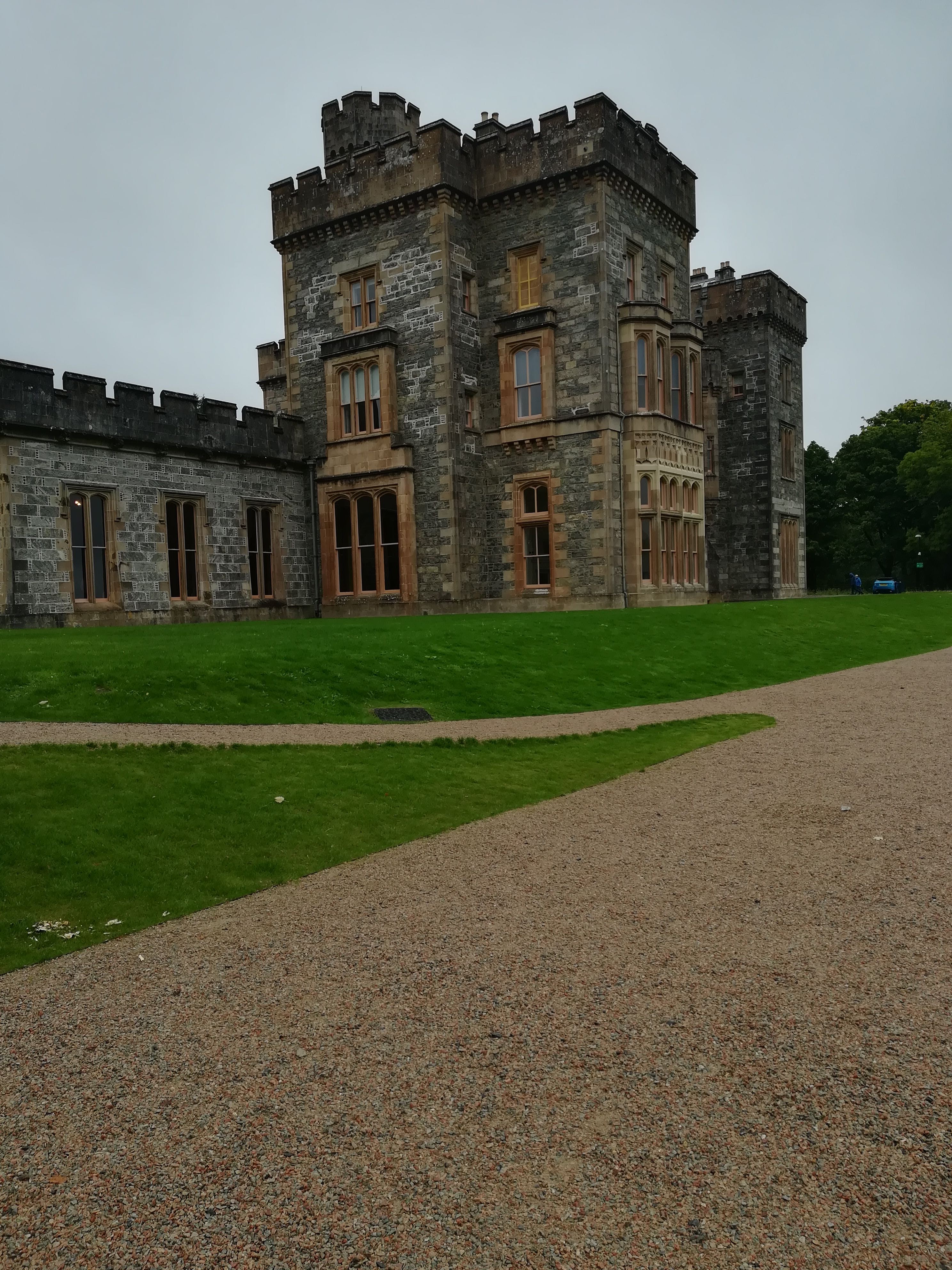
The museum is a clever addition to Lews Castle, parts of which are medieval, and recently restored. Nowadays it is run as an events centre and has accommodation on offer. Beautiful grounds surround the castle, including a golf course (you can all guess who was looking at that with interest!) with panoramic views across the harbour.
Trushal Stone – the tallest monolith in Scotland at 5.8 metres, this stone was once part of a 5000 yr old stone circle. Sadly, the other stones have been used over the centuries to build the surrounding walls. The stone now stands in splendid isolation between crofts.

Livestock – what little livestock there is live on the various crofts scattered about on the machair. Hebridean black sheep often grow two sets of horns making them easy to identify. Highland cattle survive well in the inclement weather conditions.


Community Centres are commonplace in the Hebrides. Bragar, on the west coast of Lewis, has just such a centre – recently opened in an old school building. It now has an excellent café (visited twice for its coffee and CAKES!), an exhibition room, accommodation, AND a launderette (which saved our ‘bacon’ when trying to deal with wet washing in the rain!)
Restored Ancient Houses
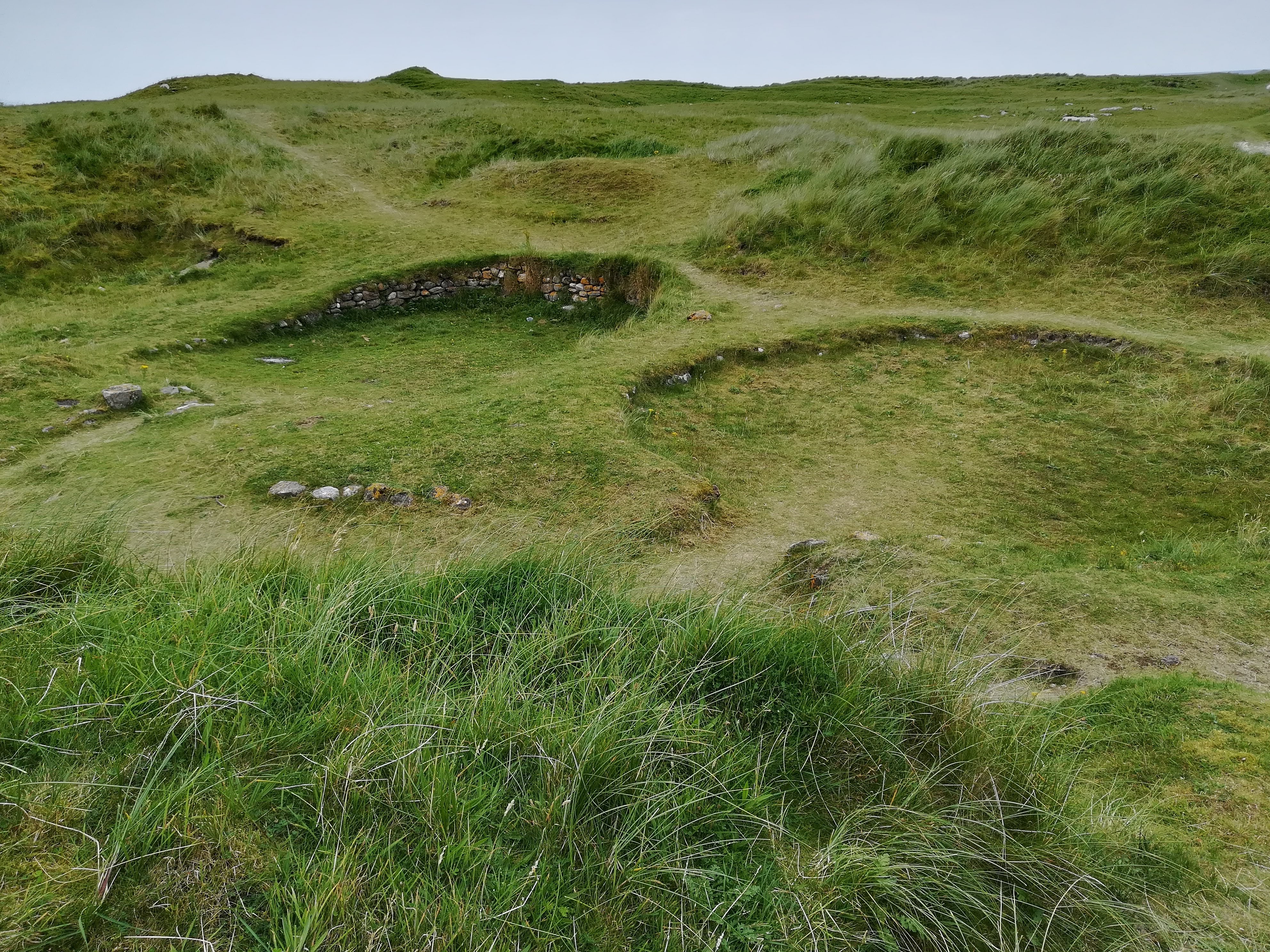
A Shieling is a hut (or several) situated out in the mountain pasture, into which the family would move for the summer months to keep watch over their livestock on the higher ground.

Blackhouse is the term used to describe the original dry-stone longhouse which existed here in the islands more than 1000 years ago. Double stone walls filled with peat helped to keep the families warm. The peat fire in the living area was always kept burning. The livestock lived in an adjoining wing on the side. Cattle provided dairy products and meat, hens were kept for eggs and meat, sheep provided mutton. The proximity of any livestock provided extra warmth.

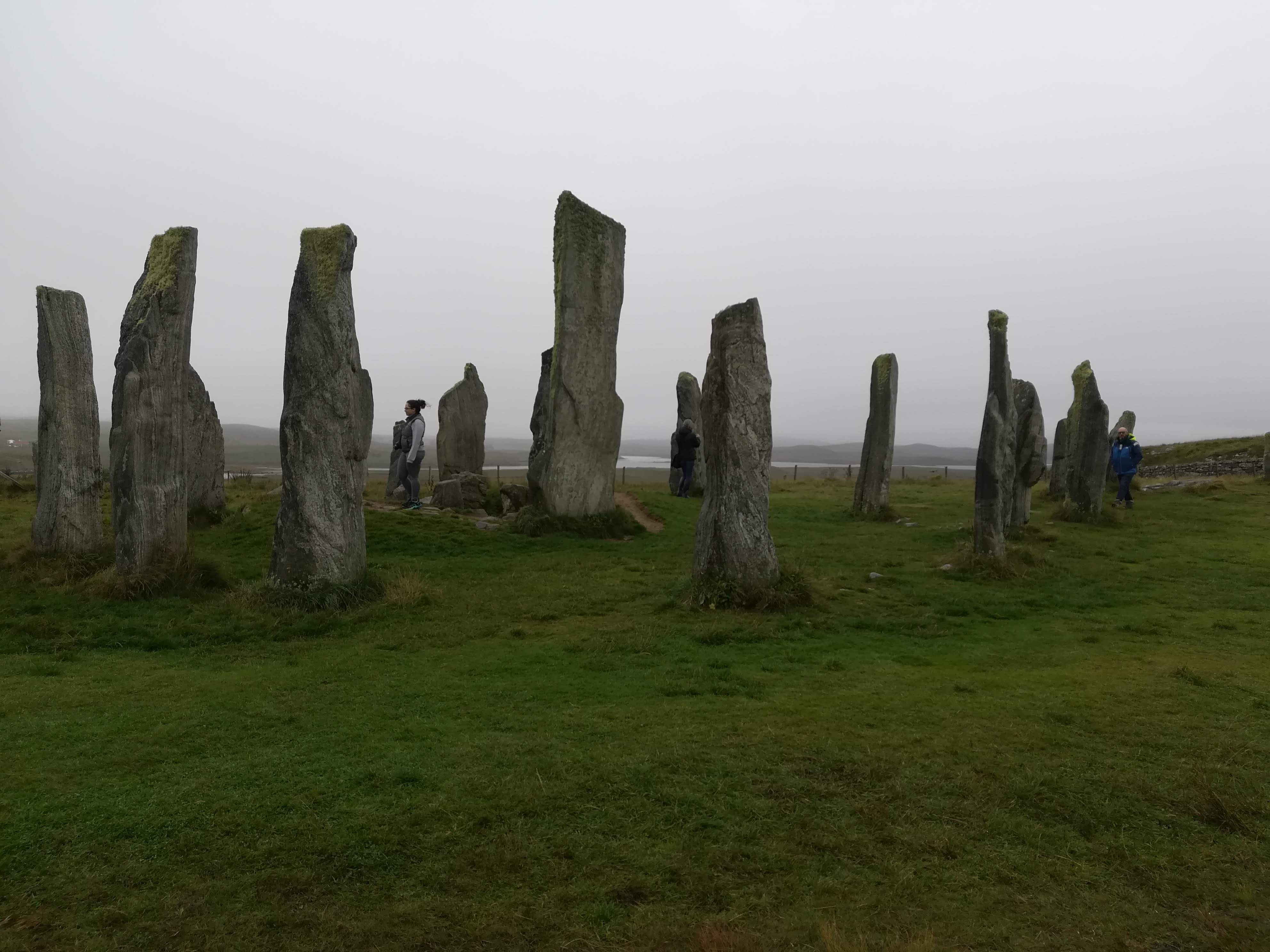
Callanish Standing Stones – said to be older than Stonehenge, this circle has a central monolith at 3.5 metres tall, which is surrounded by 13 stones, whilst avenues of other stones lead away to the points of the compass. Built in the local Lewis Gneiss stone, it is an unbelievable triumph of strength and determination by whoever created it. The purpose is a mystery . . . . .

Butt of Lewis
Standing on the most north-westerly point of the British Isles and of Europe was a real ‘pinch me’ moment. Known to be the windiest place in the UK, we were (almost) relieved that rain and fog were the order of the day. The 60-to-80-foot cliffs tower above the broiling seas whilst seabirds swoop and slice through the winds and the waves. The 36-metre red brick lighthouse, built in 1862, is now fully automated and controlled from headquarters in Edinburgh. It would have been a lonely existence for the lighthouse keeper in days gone by.


We are promised better weather tomorrow – the photos may improve!
Outer Hebrides – Sept 2021
Outer Hebrides – September 2021
Well, we wouldn’t be Marilyn and Peter if we didn’t want an adventure! “Let’s head for the Outer Hebrides” we said. “That’ll give Molly a good run!”
A last-minute change by CalMac, to our ferry booking (both time and departure point!) meant two longer days travel than planned. Setting off from Penrice at 06:30 gave us a good start and we happily pulled into a friend’s driveway near Stirling at 5pm having taken good breaks for breakfast, coffee, lunch and tea! Thank you Alice and Clive, for providing Molly with electricity and water . . . . .
In brilliant sunshine and warmth (were we REALLY in Scotland??) the journey across the Highlands . . . Stirling to Perth. .to Spean Bridge. . to Kyle of Lochalsh was spectacular. Scottish news is full of the lack of rainfall and their freshwater lochs are indeed very low.
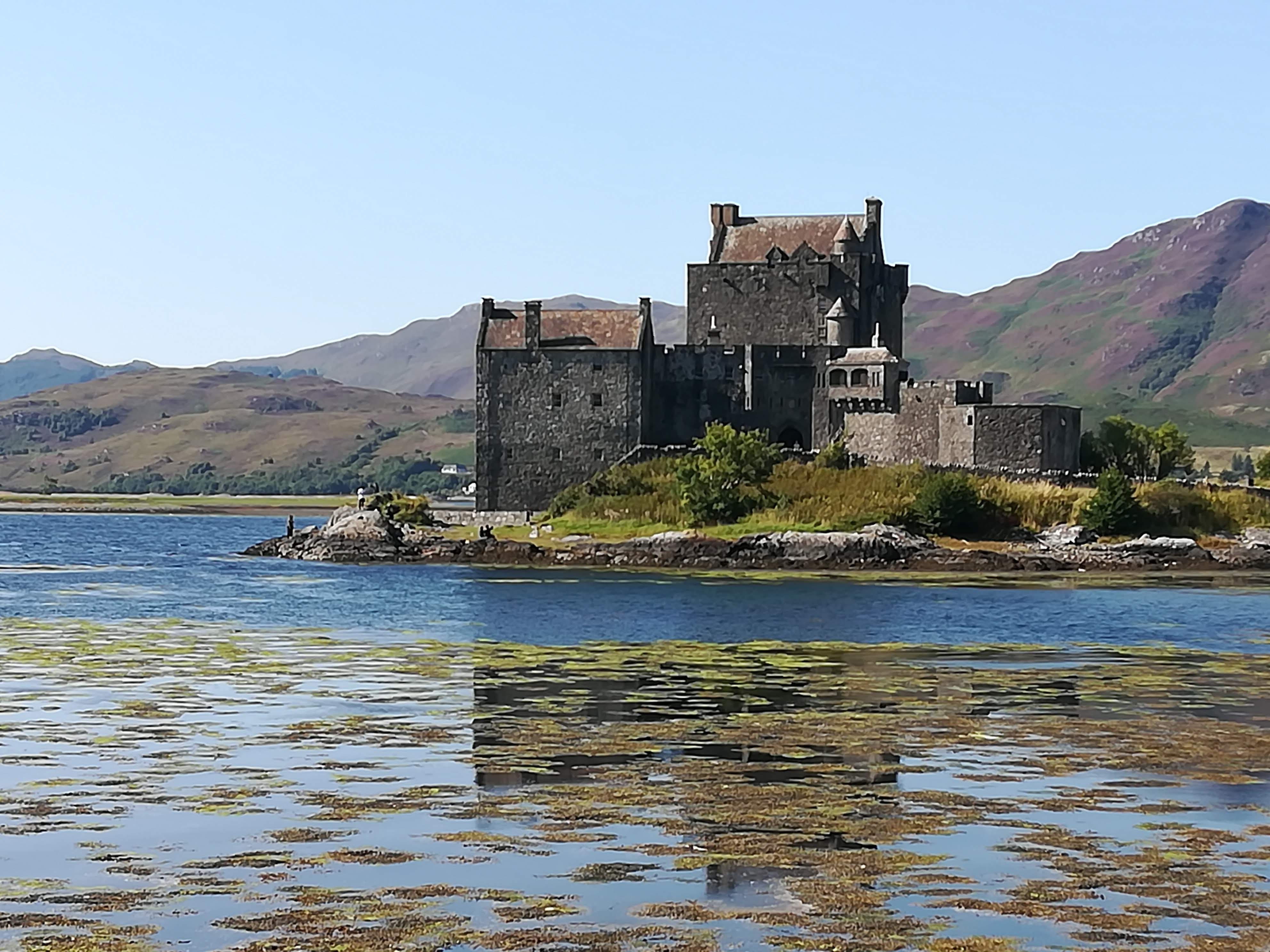
We passed the well-known Eilean Donan Castle (as seen on many a postcard and any Scottish tourist information). For those of you with an interest in history, this is a castle on an island (a bridge now joins it to the mainland) originally built in the 13th century but destroyed in 1719. The castle that we see today is a 20th century re-creation!
Crossing the bridge onto the Isle of Skye, we arrived in Uig in the far north-west by late afternoon. Plenty of time for a good walk whilst watching the ferry come and go on its evening sailings.
North Uist:
We were blessed with a smooth, calm crossing with very few passengers onboard, in brilliant sunshine, to Lochmaddy on North Uist.

Deciding to take advantage of the changed ferry booking, we visited a couple of historic sites on our journey south. Sadly, we lost the sunshine pretty quickly and returned to the ‘grey’ skies we’d been used to at home! After two long days drive, exercise was needed! We walked uphill to Barpa Langass, a burial chamber thought to be 5000 yrs old and that of a Neolithic chieftain. He certainly enjoys wonderful views from his resting place!

We walked on to an ancient stone circle – said to be the oldest and finest in the Western Isles – and known (in English) as Finn’s People. It’s in a beautifully wild location overlooking one of the many sea lochs.

Further south we stopped at Trinity Temple. This ruin was originally a medieval monastery and college founded (believe it or not!) by a woman in the 13th century. It is a peaceful and atmospheric site and is listed as ‘possibly’ being Scotland’s oldest university.
Religion:
Much of the population in the south of the islands is Catholic. There are many small statues of the Madonna, but Our Lady of the Isles takes your breath away. At 30 ft tall, she is the tallest statue in Britain and is cleverly placed alongside the Ministry of Defence Rangehead. Islanders want the army to remember that there is a spiritual world as well as a military/materialistic world.


Note that the Madonna holds Christ by her shoulder as a child, rather than cradling a baby in her arms.
South Uist:
Loch Druidibeg Nature Reserve
The possibility of seeing local birds and wildlife encouraged us to take a signed walk across this nature reserve. Open moorland in the Outer Hebrides signal bog! The familiar spongy ground, peppered with the odd squelch as our boots sank into the wet peat, over some 5 miles, woke up some underused leg muscles! A multitude of grasses and heathers delighted the eye. The waters of Loch Druidibeg gently lapped against the rocky inlets. Did we see any wildlife? NOTHING! Apart from some Shetland-type ponies which roam the islands in a controlled manner so that they don’t eat the wildflowers before the flowers have dropped their seeds.
Round Houses:
Nestled in the sand dunes on the east coast of South Uist are the archaeological remains of several Bronze Age round houses at Cladh Hallan. Recent analysis has unearthed (excuse the pun!) human bones thought to be the first ever mummified skeletons in Britain. Composite skeletons make up one child and two adults. . .yes, you read that correctly! Each ‘mummy’ is comprised of a head, a jaw and a torso from different bodies. When research is completed each ‘body’ will have a new home – one in the Kildonean museum on South Uist, one in the museum in Stornaway and the third in the National Museum of Scotland in Edinburgh. Make a note in your diaries if you’re passing in years to come!
Having had a day of NO WILDLIFE we were thrilled to spot a huge pod of dolphins playing out to sea (too far away for photos I’m afraid). We then enjoyed watching literally HUNDREDS of rabbits playing in the dunes – a proper Watership Down it was!
Loch Eynort:
We couldn’t resist the lure of a woodland, so ventured down an extra narrow side road, with fingers firmly crossed that we would be able to turn Molly around at the ‘dead end’.
We discovered a good parking area and set off to explore this area of forest restoration. The vision of one man – Archie Macdonald – who has planted more than 100,000 trees over many years, proving that trees will grow on the Outer Hebrides if you keep the deer and sheep away from the saplings.

It was to be our lucky day! As we walked along the 5 km of paths enjoying the variety of trees, and some birdsong, we noticed an elderly gentleman working away within a fenced area. We stopped to chat – only to discover that we were speaking to THE gentleman himself! As you can imagine . . .a wise old chap, born and bred in the area and returned after the war – he now lives in a lovely bungalow alongside his ‘project’, which spreads across the hillside behind him. Views to the south overlooking Loch Eynort complete the scene. His vegetable plot had plenty of seasonal vegetables – his main complaint was the lack of rain (yes! We really ARE in the Outer Hebrides!) and the local rat and rabbit population who firmly believe the veg are for them!
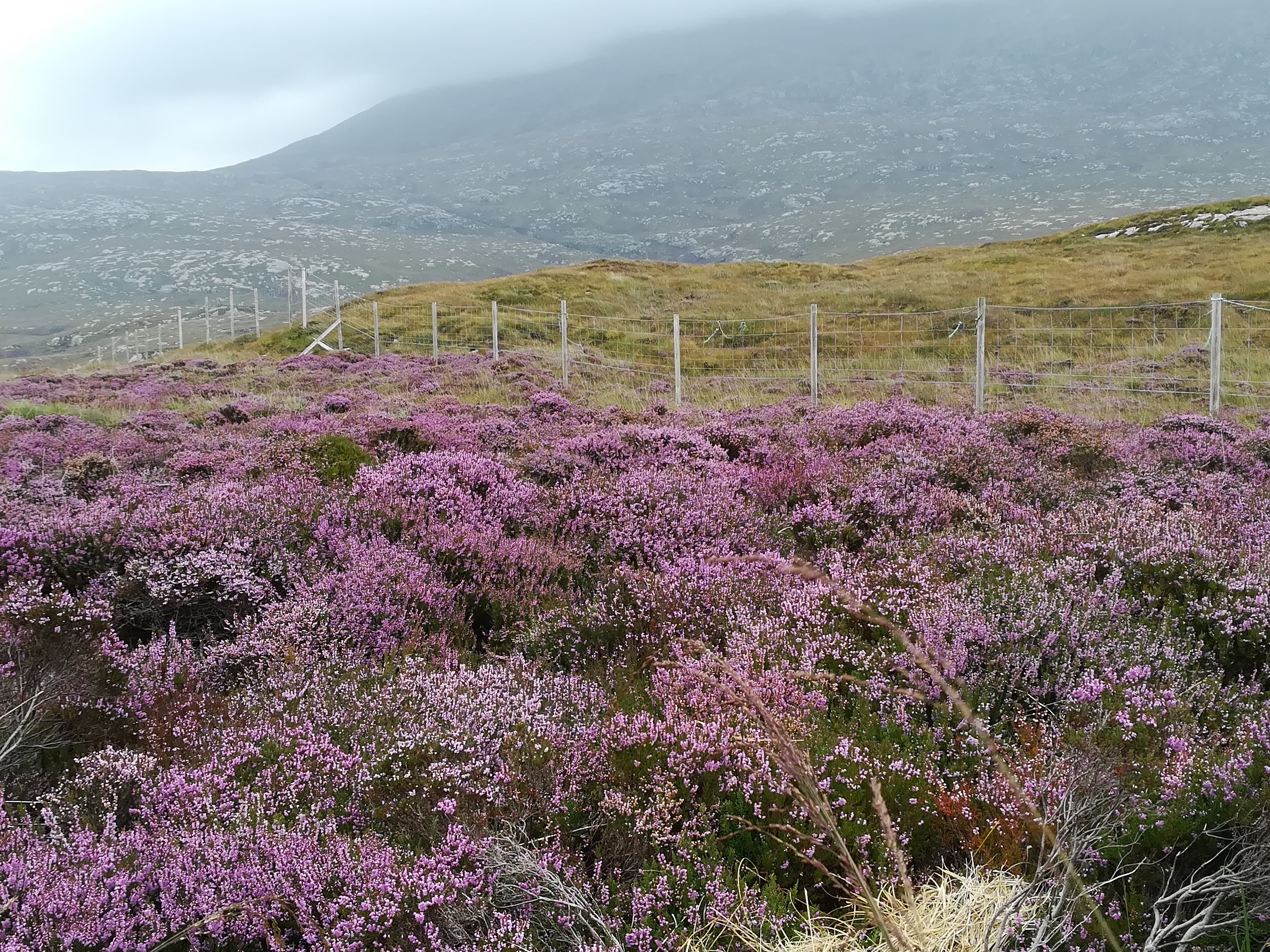
We walked the entire outer path of his plantation, relishing the wonderful swathes of purple in the heather.
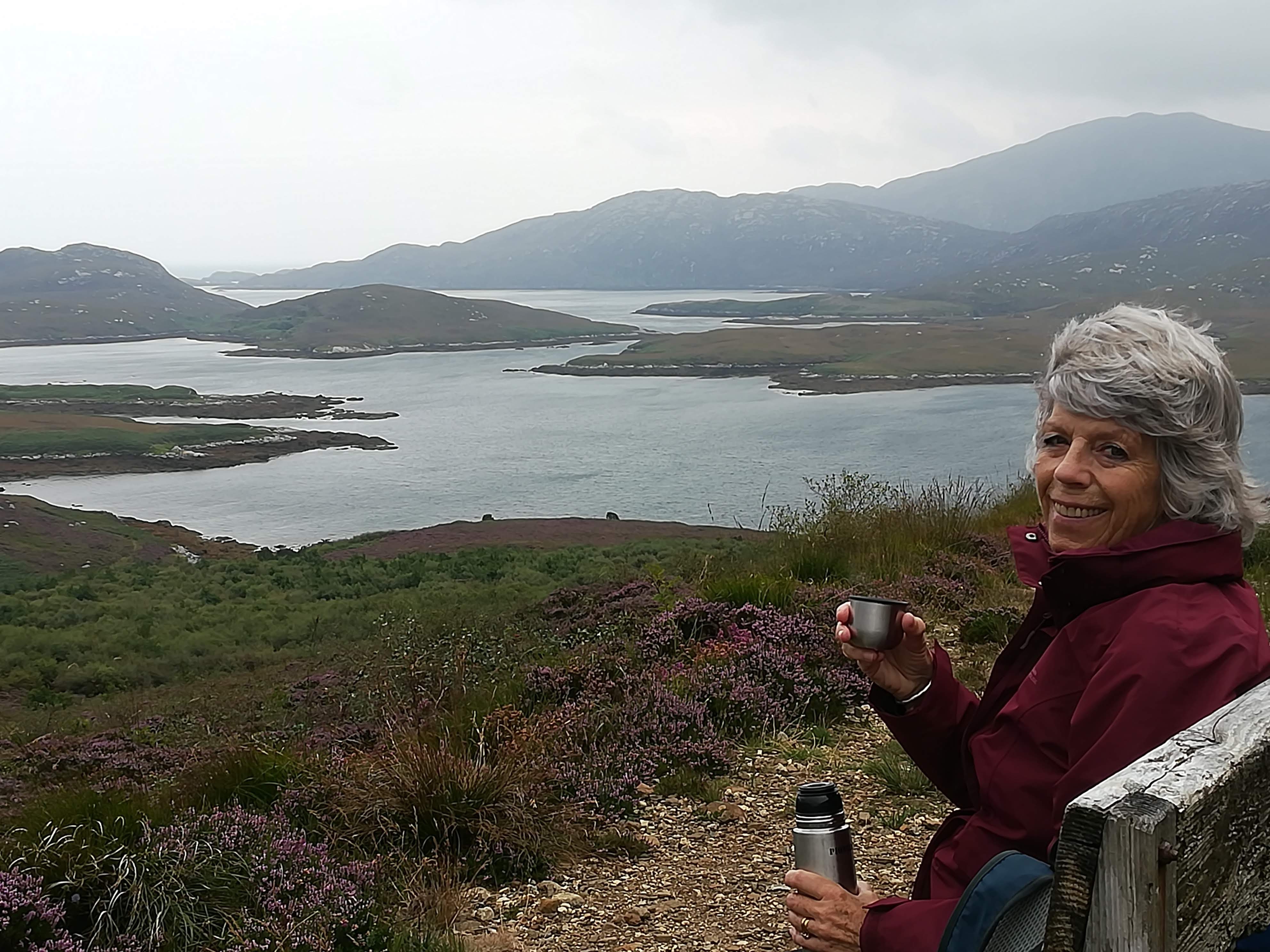
Then ‘drinking in’ the fabulous views both of the inland lochs and out to sea from the highest point.
Kelbride campsite on the south coast of South Uist made a perfect stop for our few days in this area – far reaching views across the Sound of Barra – large pitches and all facilities spotlessly clean.

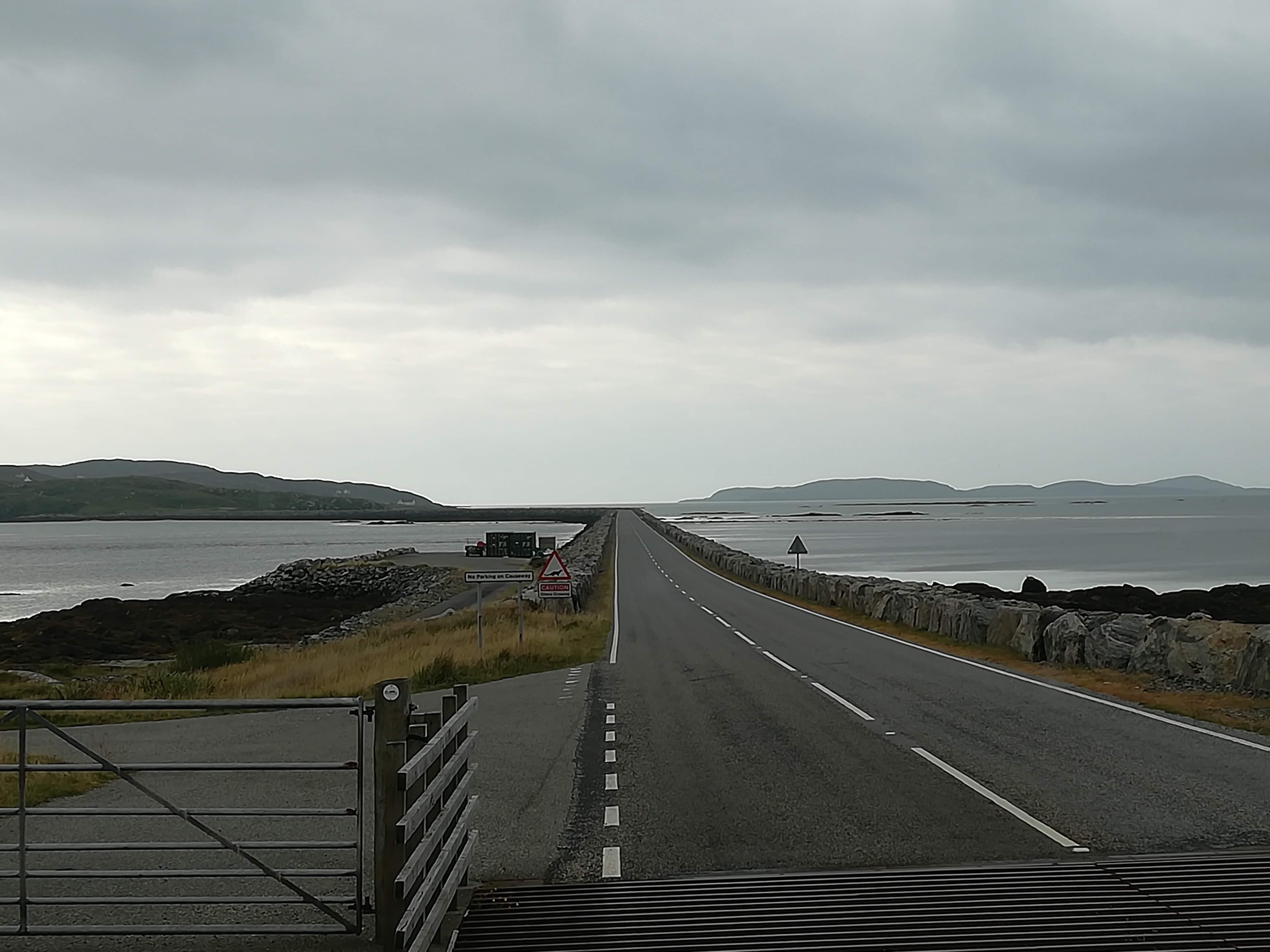
Eriskay Island: A causeway (built 2001) links Eriskay (south and slightly east of South Uist), a tiny island of about 200 people which spreads 3 miles north to south, and only 2 miles east to west! Leaving Molly overlooking one of the many pure white beaches,

we headed across the moorland following a walk recommended for seeing wildlife. Plenty of scrambling through waist high bracken, and clambering up rocky slopes rewarded us with a good number of grey seals lying about in the rocky inlets.

An Overview of the Islands so far:
This chain of 119 islands (only 14 are inhabited) off the west coast of Scotland can only be described as wild and wonderful. The few trees that exist have been carefully planted as small, forested areas to attract wild life. Otherwise, there are miles of low rolling hills – the highest being just under 800 metres above sea level – interspersed with many lochs of both sea and fresh water. Acres are peat bog give way to huge rocky outcrops. Long white sandy beaches appear at every turn.

Houses are well separated, each crofter having their own parcel of land. Many ruins still stand as evidence to the historic clearances. Nowadays, later generations are returning to the family land and settling into their recently built modern-day houses. Gardens are low maintenance but always neat and tidy. Strong and sturdy shrubs – heathers, montbretia, fuchsias – are planted to withstand the ever changing and often violent weather.
And then there are the roads – often single track with passing places, but a good number of passing places. The locals are not only friendly (everyone waves at EVERYONE) but also very happy to give way to us foreign motor homers with a smile and a wave. Road surfaces are good (way better than Herefordshire!) and the undulating landscape gives a roller coaster type ride as Molly negotiates the little peaks and knolls.


Causeways link most of the inhabited islands, making our journey down the islands a doddle. Isolation must have been a major problem when the only means of crossing was to wait for low tide, or later by ferry. Nowadays islanders from the south can work/shop/visit the north with ease.
We move onto Benbencula now – more later . . . . .
Lincolnshire – June 2021
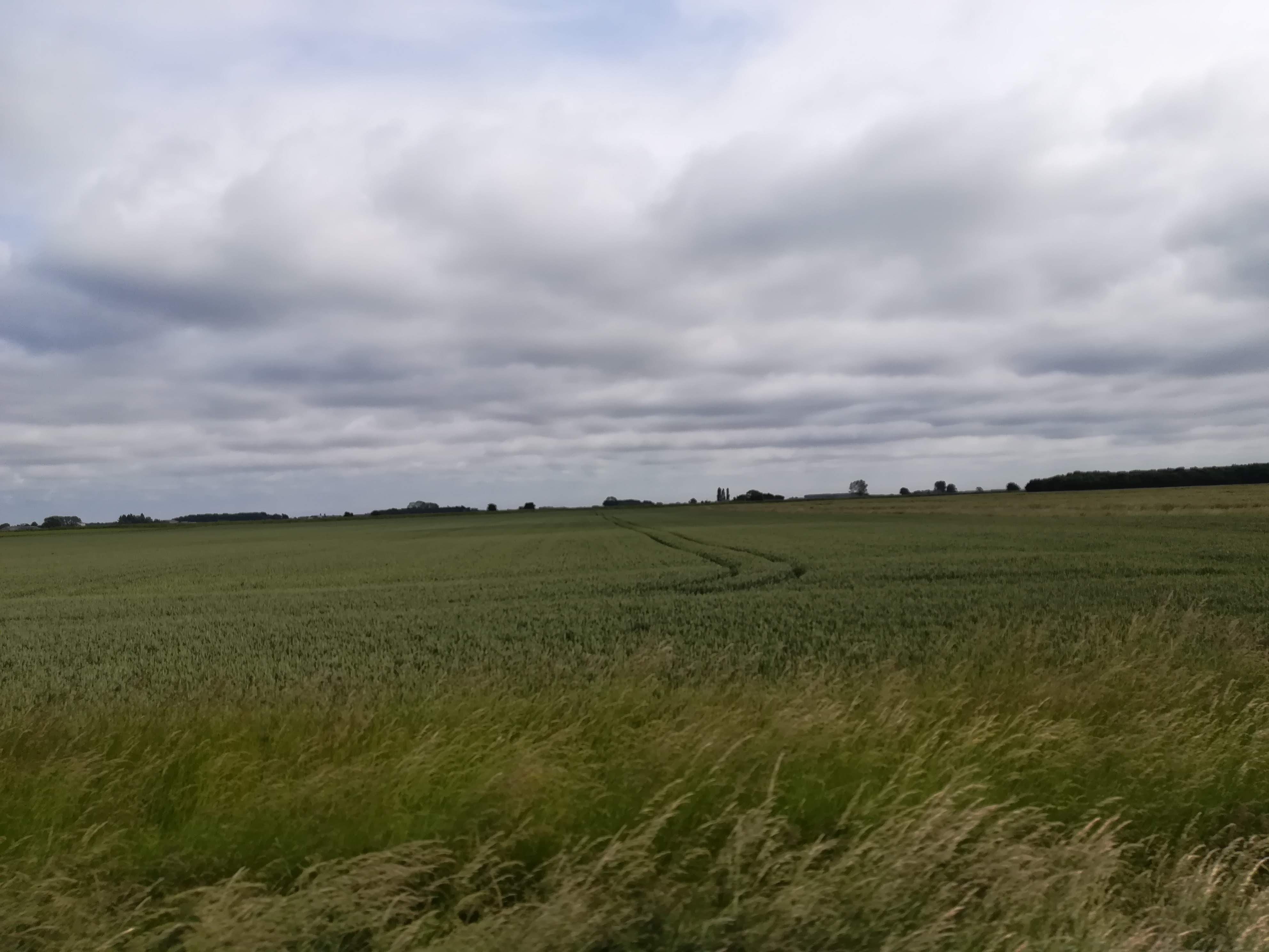
Driving north-east from Kings Lynn, we motored into Lincolnshire. The weather was NOT on our side for this journey – it was dull, grey, and misty with clouds of rain sweeping across the VERY flat fens. As the weather lifted, we enjoyed the odd splash of colour as we passed fields of poppies – such a welcome boost in the otherwise unending shades of green in this fertile area.

A visit to Lincoln Cathedral was our main goal and we were not disappointed. For those of you who have not visited Lincoln, imagine any one of the many impressive cathedrals this country boasts – but then multiply that splendour ten-fold! The sheer size of this spectacular building is astonishing. From its beginnings in 1072, it is rich in history, all of which I shall leave you to research if you’re interested. We were lucky enough to attend Evensong – which took place in the choir stalls of St Hugh – listening to six excellent lay vicars singing (often in six parts!) – and pinching ourselves that we really were taking part in a service in one of the most magnificent cathedrals in the world.
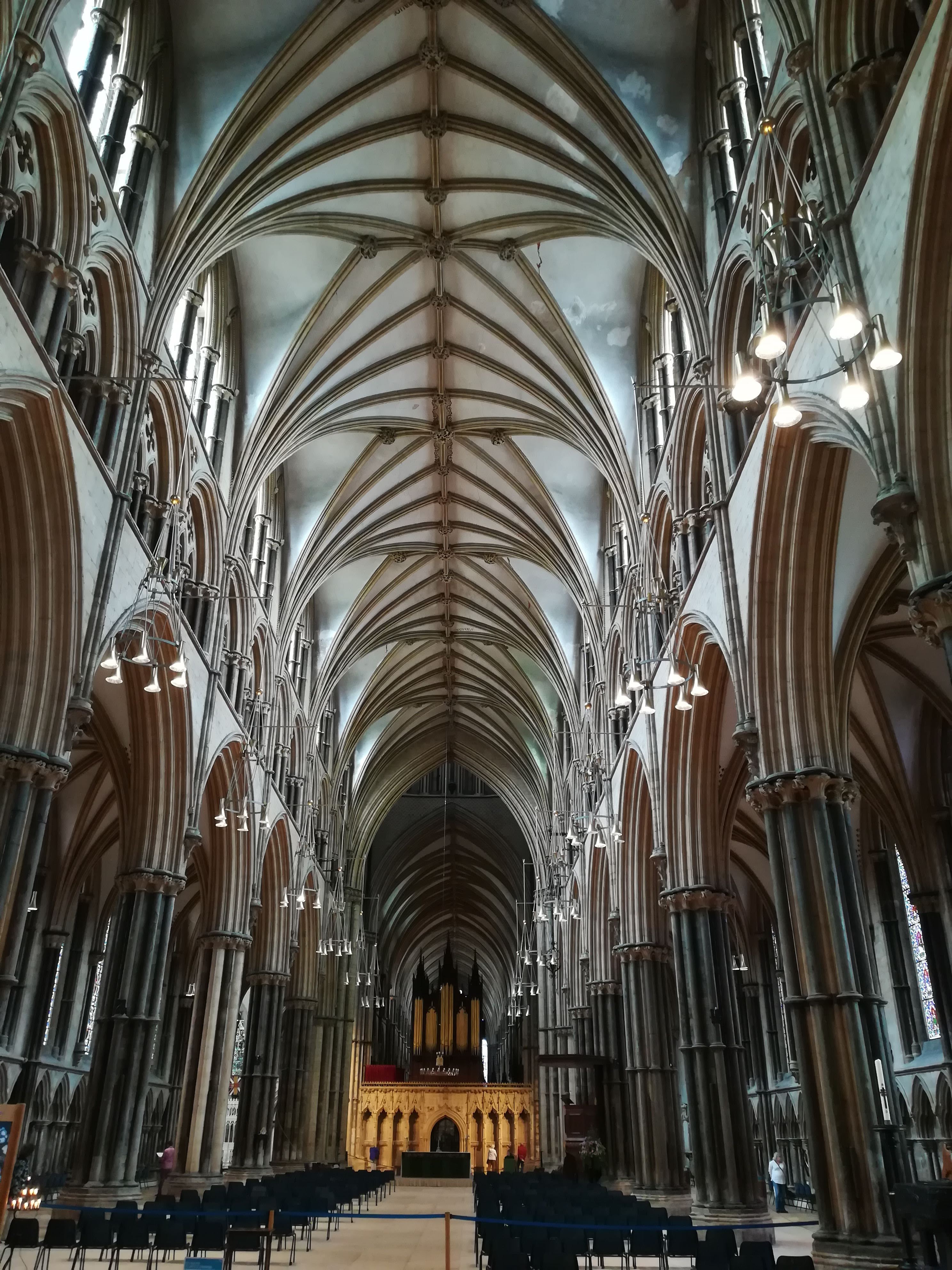
Lincoln Cathedral Nave 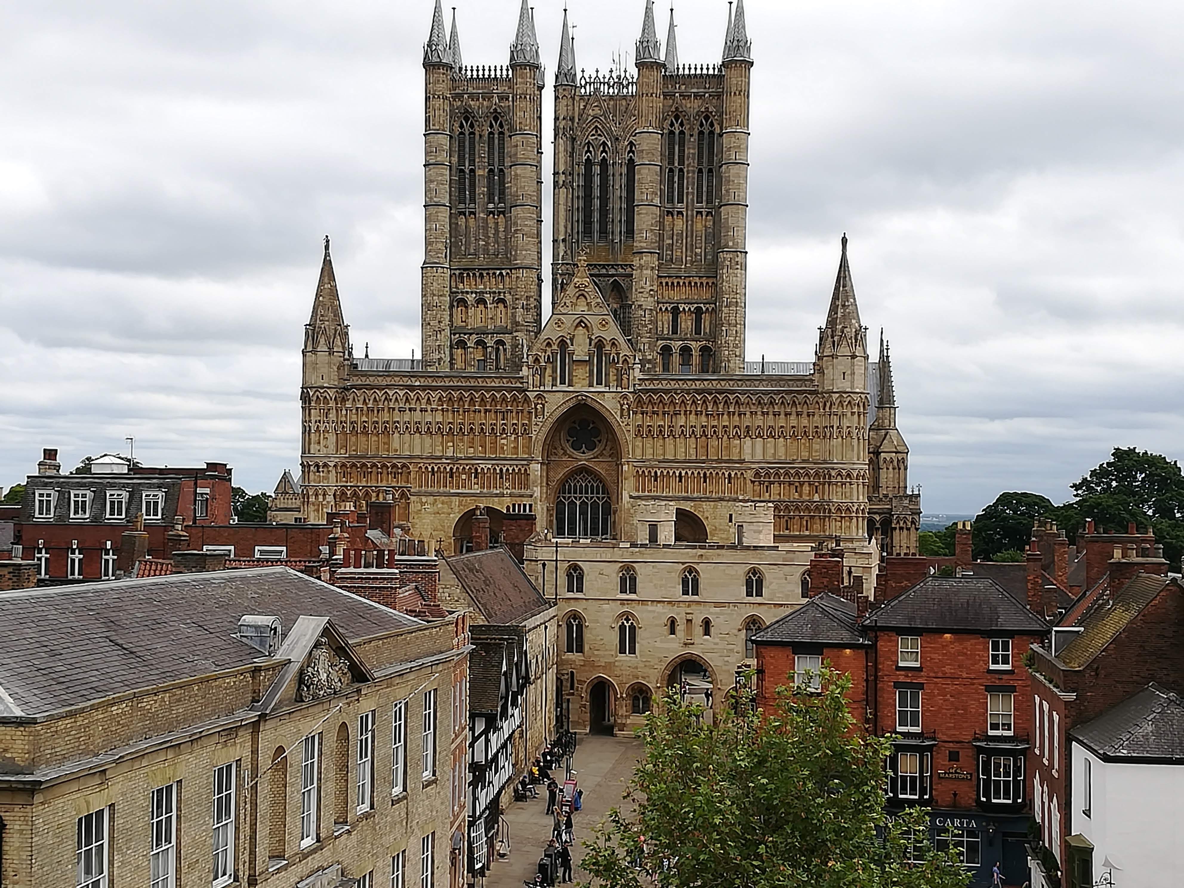
West End of the Cathedral
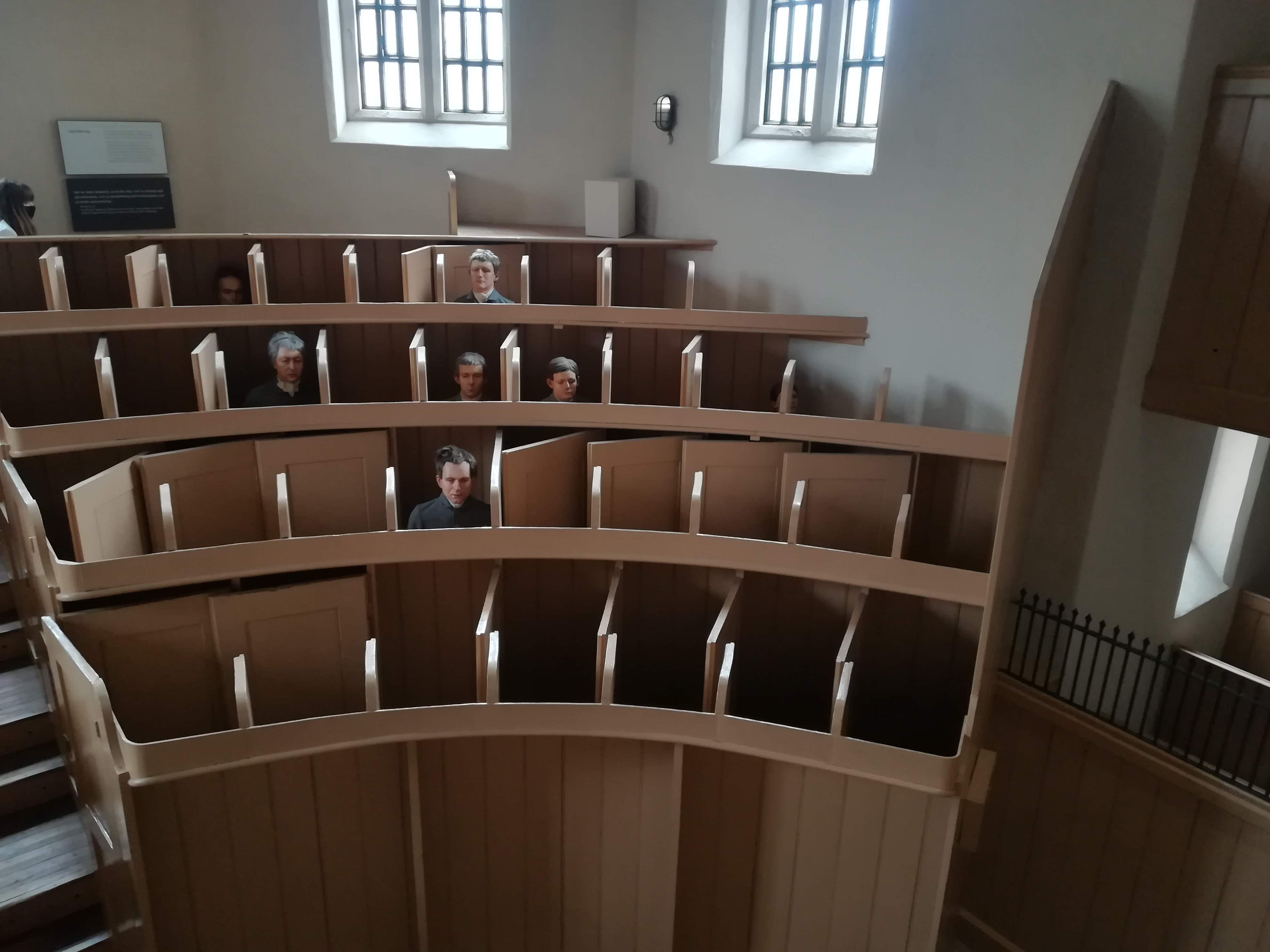
The cathedral is built high on a hill, alongside the castle. Lincoln Castle was built by William the Conqueror in 1068 on a site that has been occupied since Roman times. Again, the history is ‘heady stuff’ (including some beheadings!) and worth some research. A walk around the medieval walls was informative as well as offering breath-taking views in all directions. The Castle prison was set up with a ‘separate system’ which was an isolation regime to keep prisoners from ‘corrupting’ each other. This included a daily visit to the chapel where prisoners sat in ‘separate’ divided seats. Our tour guides divulged all sorts of stories over the continuous power struggles, as well as the clever building techniques of the 10ft thick walls.

Castle Observatory Tower / Prison in foreground 
Castle Walls
The Castle and Cathedral areas can be approached by the famous ‘Steep Hill’ route, which is just what it says on the tin! A very steep hill, lined with all manner of shops, boutiques and cafes. The cafes do a roaring trade mostly from exhausted tourists who stop to catch their breath and have a drink!
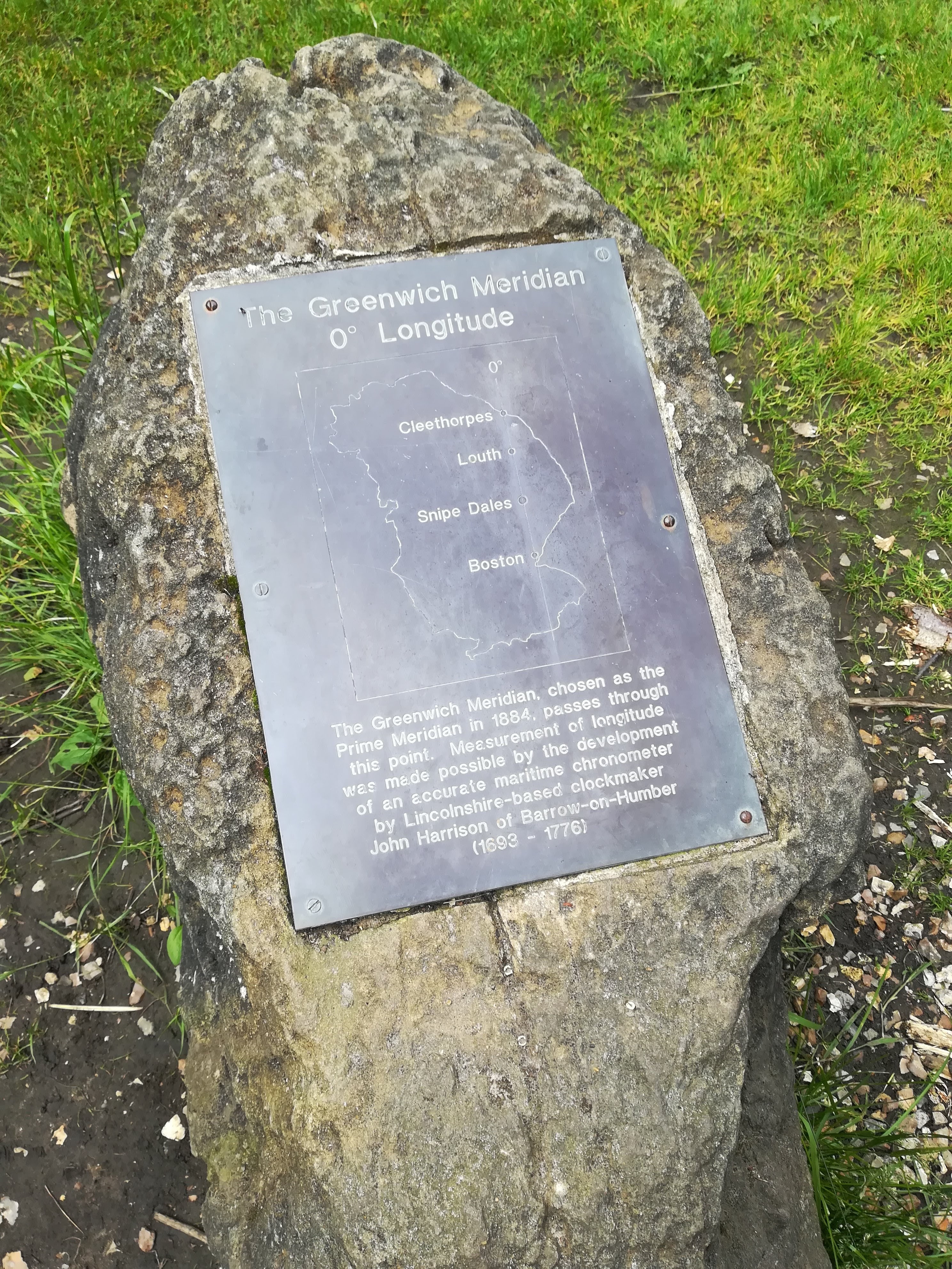
Snipe Dale Nature Reserve gave us a little insight into the Lincolnshire Wolds. Wonderful to experience some hilly land again – and in this case, particularly wild and uncultivated land. Cattle are used to encourage the wildlife – but otherwise, nature is left to its own devices. We were amazed to find that we crossed the Greenwich Meridian – another little gem to add to our many memories of this trip.
Home tomorrow – and we’re already planning our next trip! Watch this space. . .
Discovering Norfolk – June 2021
Hello again to friends and family!
Thanks to Covid, we’ve been out and about in Molly far less than we would have wished. A long weekend in Pershore enjoying the sunshine and numerous beautiful walks – and a full week on the south coast staying in Weymouth, where we managed to catch up with friends and family, but also to support and cheer on daughter Sarah and her partner Matt who were doing the Jurassic Coast challenge – 100 km over two days. We had a great time, despite high winds and driving rain for most of the week.
And so to Norfolk – one of many places in the UK that we’ve never visited. Friends who’ve lived here in the past said we were missing a treat . . . . and they were correct!
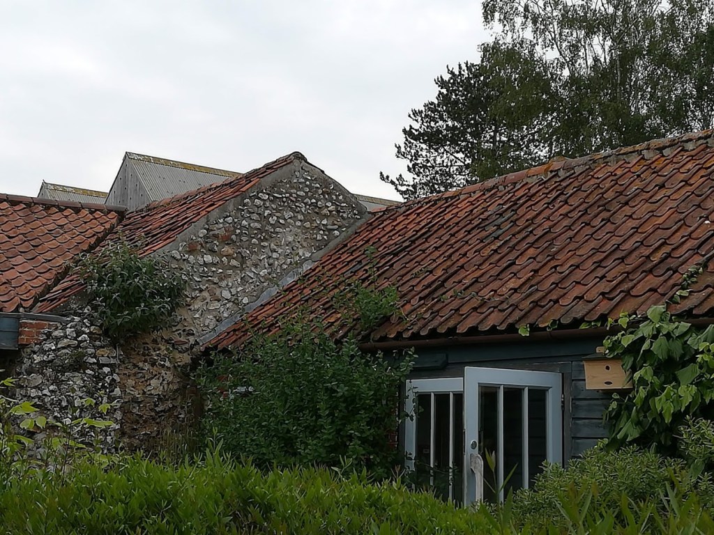
Yes, it’s very flat (in some areas) but beautifully green and lush, with acres of bountiful crops. Farm shops and road side stalls are full of freshly picked fruit and veg – what a wonderful excuse to be gluttons of healthy food! The countryside is dotted with pretty villages, all beautifully kept with colourful gardens, and with many of the local traditional houses constructed of flint with a red pantile roof. Pantiles originally came to UK from the Netherlands in the 1700’s, and are a type of fired roof tile normally made of clay. Apparently the colour is controlled by the degree of reduction in the kiln. The glorious terracotta tiles appear from some distance away (thanks to the flat land!). These days, houses are built of the local red brick, which sets of the tiles very well.
We’re staying on an idyllic campsite here – it’s a CL – for those non-campers among you this is a Certified Location. ie Certified by the Camping and Motorhome club as having fresh water on site, as well as chemical and rubbish dumping facilities. There are only 5 pitches on these sites – hence they’re very quiet and peaceful. This one is in a small orchard with each pitch bearing the name of the tree that used to (or still does) grow here. We have enjoyed relaxing here each evening, after a day’s exploring.
We’ve barely scratched the surface of Norfolk – there is so much to see and do. Sandringham Estate was a ‘must do’ for us and what a joy it was. We felt privileged to visit the very rooms where the Queen and the Royal family retreat to every Christmas. We were not allowed to take photos indoors, so you’ll have to look on Google! The grounds were a delight as well – not formally laid out, but neatly kept and in tune with nature.

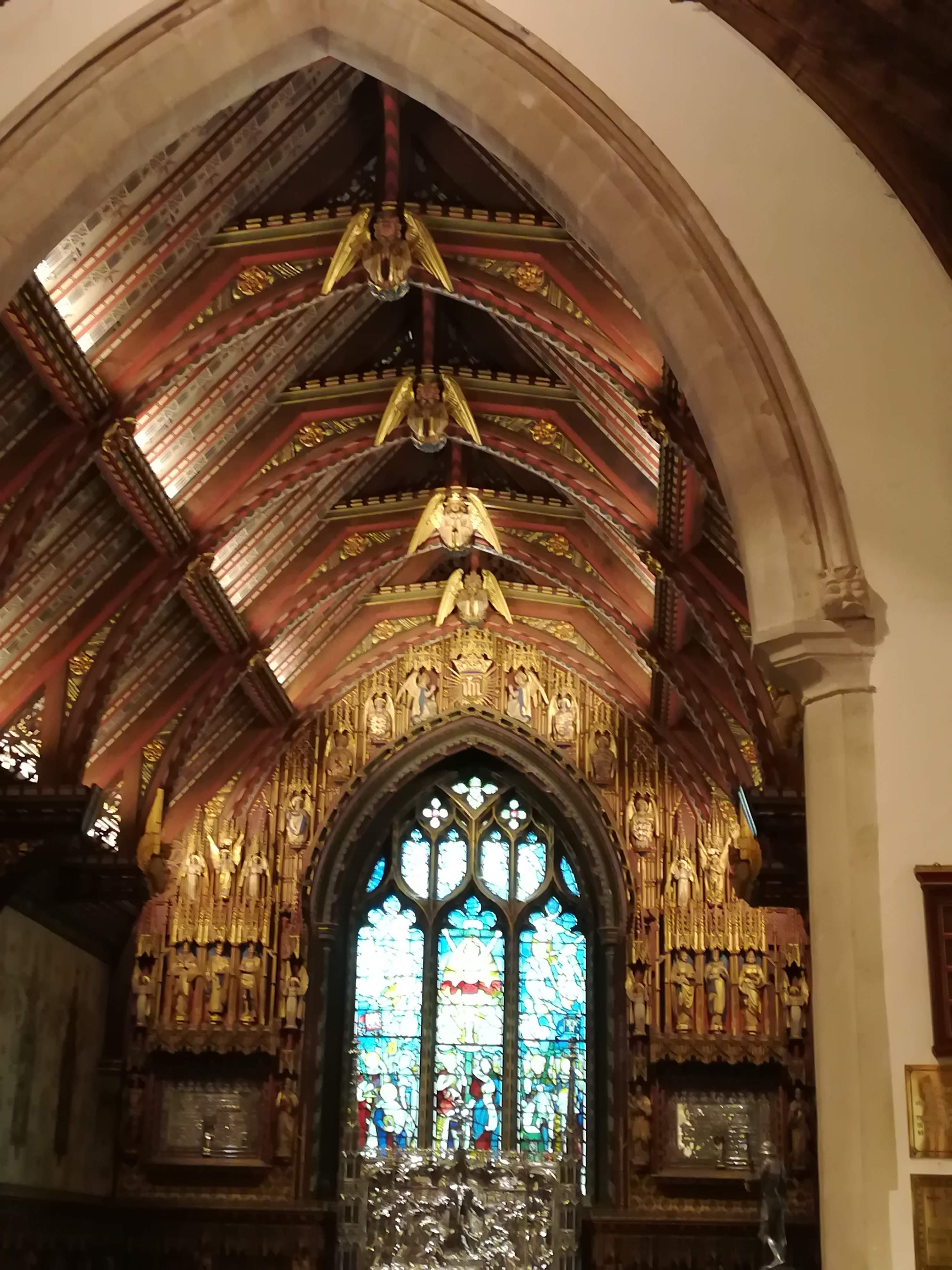
We were lucky to visit on a day when the church was open. I’m sure we’ve all watched the Queen arriving here on TV, but we were astounded by how tiny the church is. The intricate wood carvings – many angels with musical instruments – and the stunning silver engravings on the pulpit and the altar are breath taking.
Kings Lynn proved an interesting visit – far too much history to absorb within one visit – the town began in the early 1100’s and was an important trading post thanks to the waterways which stretch inland from The Wash. The narrow streets near the harbour house some stunningly restored buildings, very few of which were open thanks to the pandemic.
Our journey to Castle Acre Priory was a bit of adventure! Valiantly following the English Heritage signs, we had not noticed the warning for a narrow road . . .we were already committed when a further sign warned us of no access for anything wider than 6’6” (Oh Dear! Molly is 7’7” even with mirrors pulled in!), so with much cursing and gnashing of teeth, (not to mention the disgusted looks from other drivers) we had to turn around and find another entrance to the village. Note to anyone who ever visits Castle Acre – avoid the Bailey Gate – it’s very narrow!!

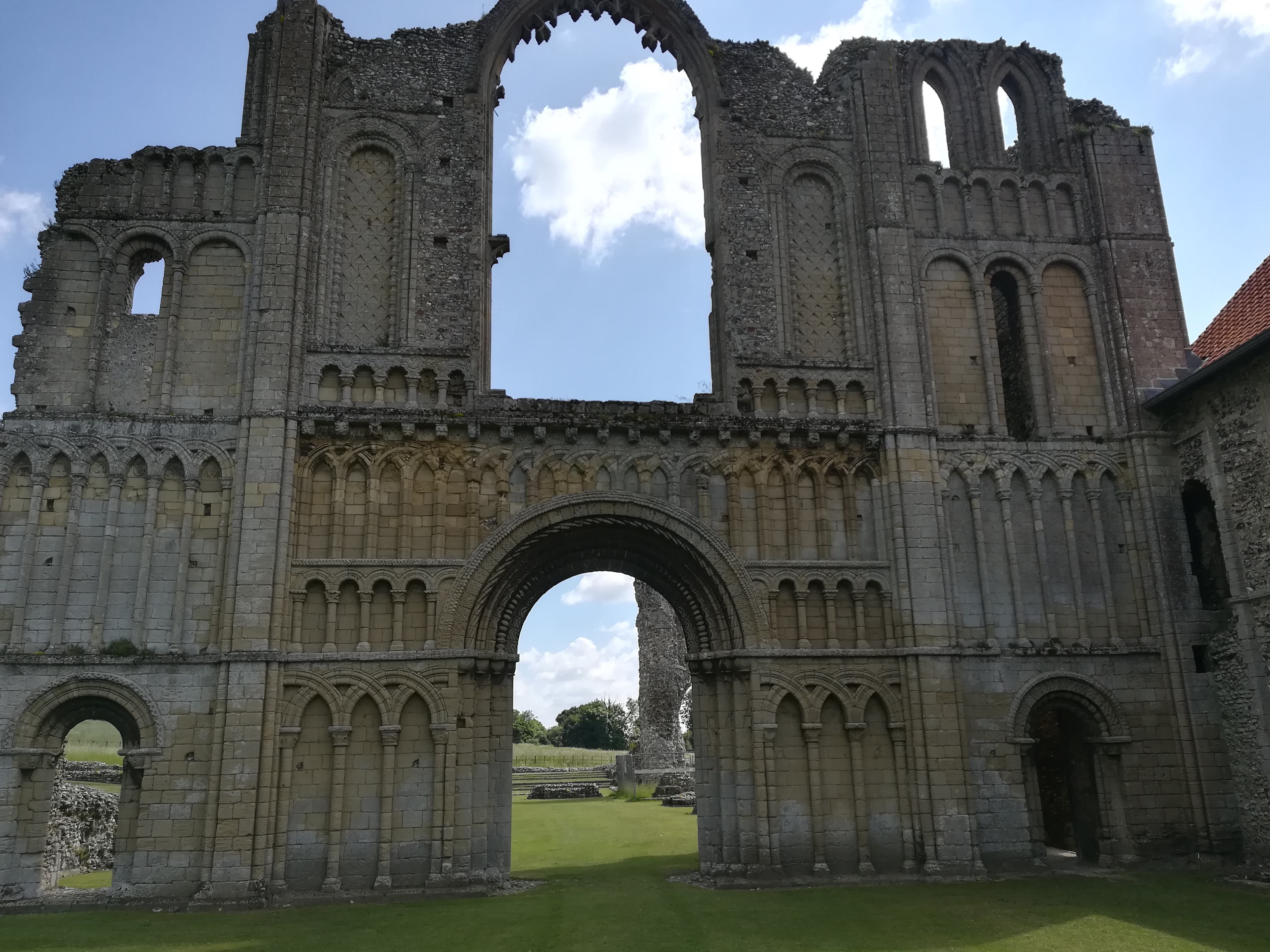
Worth the aggro however – the Priory dates back to 1090 and is one of the best-preserved monastic sites in UK. It was home to the Cluniac order of monks whose divine adoration led to the extensive decorations throughout. Much of the splendid west end door remains, along with exquisitely preserved flint walls stretching over a huge area. As with any ecclesiastical setting, the sense of peace was overwhelming and we were uplifted and calmed by our visit.
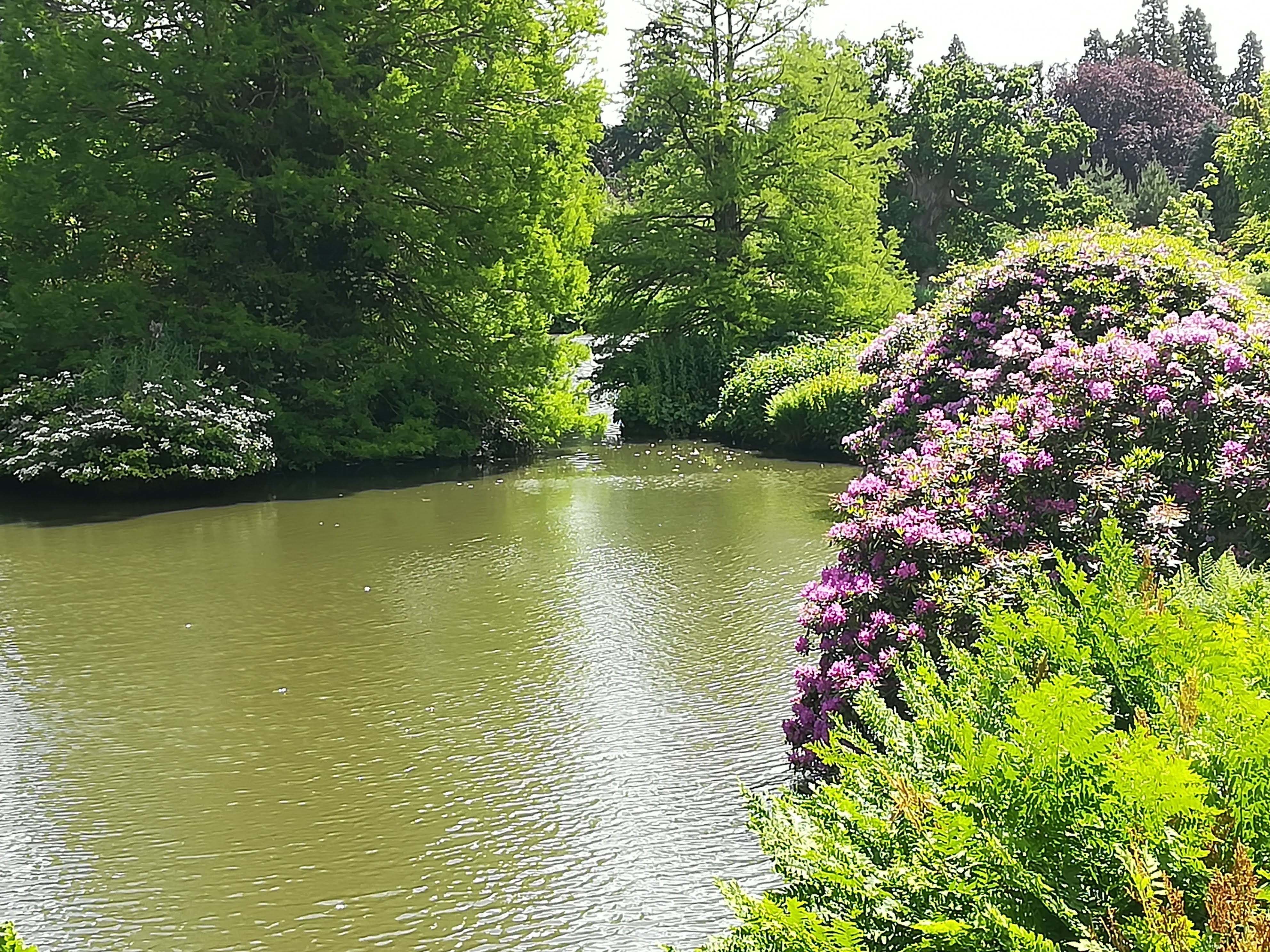
As we explored along the (highly recommended in tourist guides) coastal route from Blakeney to The Wash, we were disappointed by the height of the hedges. Despite the height that we sit in Molly, we were unable to see the sea views in many places. Our patience was rewarded however, when we reached Holkham. One of many nature reserves in this area, spreads across wetlands, through the sand dunes and onto an enormous beach. A 20 minute walk led us from the enormous car park, over the Norfolk coastal path and down to the sea. Miles of wonderful white sand – and notwithstanding the hundreds of cars in the car park, the people had all but disappeared into this vast space.

We were delighted to discover a sea (excuse the pun!) of wildflowers just behind the dunes . . . nature as wonderful as ever!

Pensthorpe Nature Reserve is a 700 acre woodland conservation park, absolutely brim full of wildlife. It was a pleasure to meander along the many paths, through the various gardens, and in and out of enclosures which protected many bird species. This place needs many more visits – it would be a great place to take a picnic to enjoy on one of the many benches whilst taking in the many birds around you.


Today we’ve moved on from Norfolk to Lincolnshire – more later. . . . .
Homeward Bound
Sadly, all good holidays must come to an end . . . . . . I’m quite sure that most of you (‘my readers’ as the regular bloggers call them!) will have travelled through mid-Scotland, through the borders and down the M6, so I’m not going to bore you all with details of the journey. A few highlights and a few more photos will be sufficient, before you nod off to sleep . . . . . .
In Ullapool, the previous night’s storm gave way to clear skies and sunshine – stunning scenery and weather for the remainder of our trip home. From Ullapool, we headed south east towards Inverness, having decided to leave the last section of the NC500 (Gairloch circuit) for another planned trip to Skye and the outer islands. We had a coffee stop and a good walk at Corrieshalloch Gorge, where there is an impressive 45 metre high waterfall which was cut through, NOT by the present river, but by an underground glacial river during the IceAge! A suspension bridge and various viewing platforms helped us to get a true idea of the sheer force of water. . . .


We spent the night on a site at Foyers on the eastern side of Loch Ness. When we arrived everyone was sitting outside enjoying the afternoon sunshine (again, we were really in Scotland on 23rd Sept?) There were notable changes in the countryside from rolling hills and agricultural farmland to more mountains, lochs and forested areas. The journey through Glencoe is breathtaking – if you haven’t done it, you’re in for a treat.


If anyone finds themselves in need of a break from driving whilst on the M74, south of Glasgow, we can recommend the little town of Lochmaben, near Lockerbie (junc 17/M74). There is a very nice 5km walk around Castle Loch – and a good bakery in town (Graham’s Bakery) who do quiches etc for lunch. Drive into town and use the carpark near the church – easy access to both the walk and the town.

A further recommendation would be for the campers amongst you. Go to the tiny campsite near Crooklands – Kaker Mill Farm – ring ahead to book. This is five minutes off the M6 at Kendal, and makes a perfect stop going north or south.
Safely home (and busy planning our next trip!), we are so thankful for a wonderful journey of discovery and good weather to boot! See you next time . . . . . .
