Living the Dream

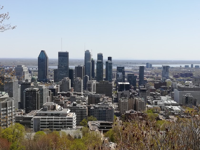
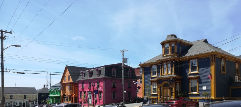
Cottage life is one of Canada’s jewels.  As a child I was always envious of friends who disappeared ‘to the cottage’ every weekend during the summer.  My father being a farmer, meant we had to wait until the last two weeks of the summer holidays, before we packed up and excitedly headed for a rental cottage somewhere to the north of Toronto.  Advance fifty years, and we are lucky enough to have good friends who have chosen to live out their retirement in their family cottage.

Situated north of Ottawa in the Gatineau valley, this ‘gem’ was built in 1963 as a ‘kit house’ made of Western Red Cedar logs.  Anecdotes of childhood fun have kept us fully amused during our visit – walks in the woods, climbing trees, larking about in boats on the lake, jumping off rocks into the lake and generally only turning up at the cottage when it was meal time!

On retirement, our friends decided that they would like to enjoy cottage life all year round and took on the monumental task of winterizing the cottage. It was literally lifted by crane, and a basement was constructed underneath.  Bearing in mind that winter temperatures can drop as low as -40C!!, insulation was added to walls, followed by vinyl siding.  Also a new roof (insulated), new double glazed windows (with argon gas for extra insulation), new doors, and new floors. A septic tank and indoor toilet facilities, help with full time living ‘at the lake’.  Decking and a fully screened sun room mean you can enjoy the sun or the shade, and escape the ever present bugs when necessary.  Mosquitoes, black flies and ‘no see ‘ums’ are part of life ‘at the cottage’.

dav

There is a further tiny cottage on site, built in 1920, and recently modernized to provide picturesque guest accommodation.  Wonderful patchwork quilts adorn the beds, their colours set off by the beautiful logs of the cabin walls.  The original quirky angles and slopes on the stunning wooden floors still exist – or perhaps the G&T’s were stronger than I thought!  With lights out, and lying in the heady silence, we were captivated as the fireflies came out to play.  Dozens of tiny twinkling lights danced outside in the woods.

dav

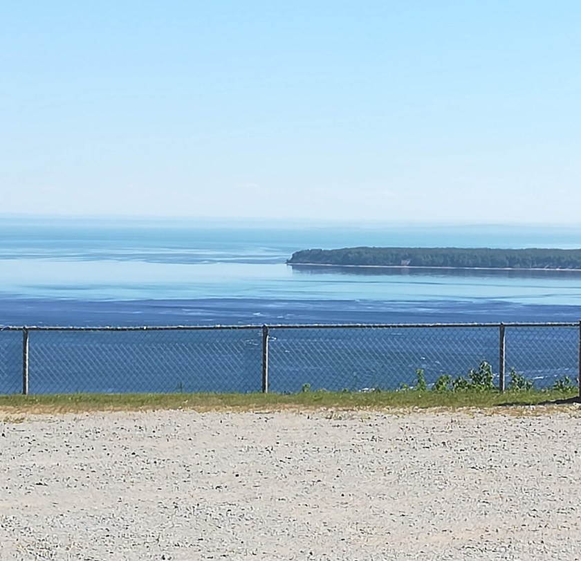
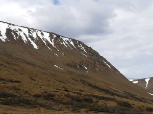
Set back from Blue Sea Lake, the cottage is surrounded by 4.5 acres of boreal forest (consists mostly of pine, spruce, larch, and birch).  A quick geography lesson – most North American bird species rely on boreal forest, for both nesting and a migratory stopover.  Canada accommodates about a third of the world’s boreal forest, mostly north of the 50th parallel. Lake Blue Sea is at 46 degrees north.  The lake itself covers some 20 sq km and is dotted with a dozen islands.  Each cottage has its own boat house and dock. Sunny days are idled away swimming off the dock, or paddling on the lake.  Paddle boards and kayaks provided us with good entertainment (and balance issues!)

dig

Winter brings heavy snow falls, but modern snow blowers soon make a track to the road, which in turn is kept clear for children to be transported to school.  Snow shoeing, cross country skiing, skating or snowmobiling on the lake keep the ever present outdoor activities going year round. Log burning stoves and a recently installed heat pump keep the cottage cosy and warm.

dav

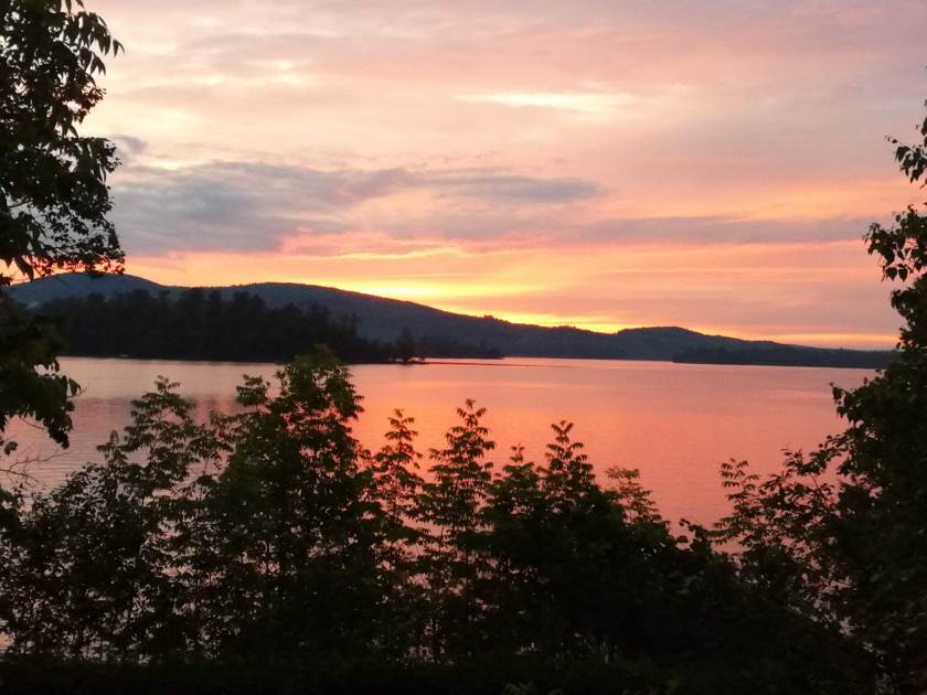
It was wonderful to see our friends ‘living their dream’.  A stunning sunset completed our delightful visit.  And we’re now all set to ‘head west’.

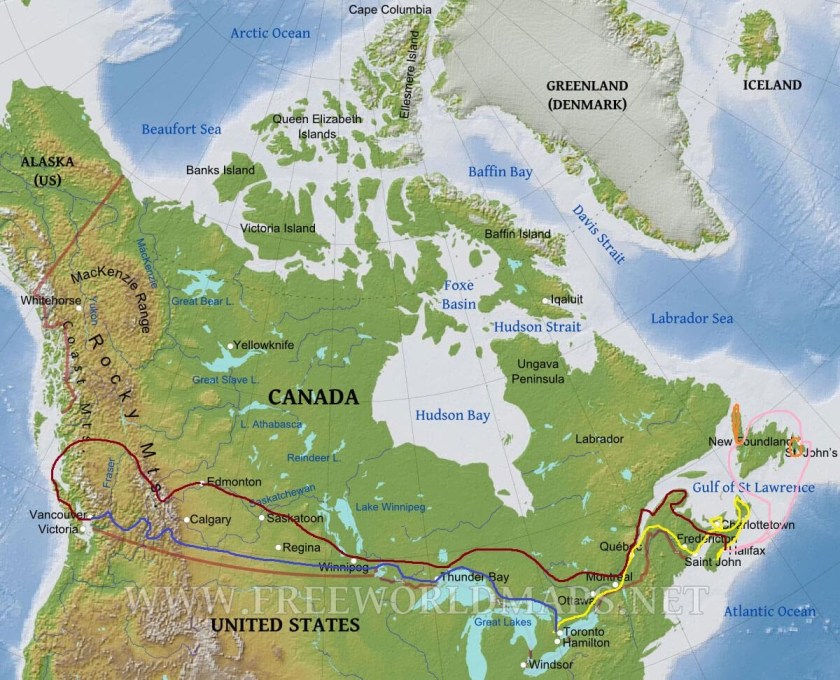
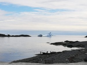
For those of you setting your ‘clocks’ by the blog, my apologies that this is late!  We are presently crossing the wilderness of Northern Ontario, where there is very little WIFI.


Whale Sightings on the St Lawrence River

A few days to retrace SOME of our steps, and to negotiate the mighty St Lawrence River.

halifax-to-tad-with-route

From Halifax to Campbellton (on the River Restigouche on the New Brunswick/Quebec border)  is five hundred and seventy seven kilometers on straight, fast roads with a fairly good road surface  (all things being relative!).  Apart from the odd glimpse of sea, we saw very little, thanks to pouring rain and low cloud the entire way!  We discovered a huge power ‘outage’ around Campbellton which had lasted all day, and put all shops and businesses out of service.  Apparently a problem with a big high tension wire in the middle of nowhere, created a logistical nightmare for engineers trying to reach it.  Lulu works on a battery and generator if necessary, so we smugly sat it out!

Sunshine and warmth greeted us as we entered Quebec province and drove further north to Matane, to take a two hour (smooth) ferry across the mighty St Lawrence River, to Baie Comereau.  Suddenly, we were back in civilisation – a city with lots of industry, big houses, smart cars and lots of shops.  Lulu coped well in the rush hour, as we headed OUT, and onto the northern shore of the river.  We were rewarded with spectacular views in all directions, idyllic river valleys, and majestic hills of mixed forest.  Warm sunshine helped to intensify the colours – the numerous greens of the trees, the blue of the lakes, the brown peaty water of the rivers – all of this interspersed with pretty little settlements with half a dozen tiny timber framed houses, each with their own huge area of ‘yard’.  Canadians have a ‘yard’ not a garden.  Thanks to the unending space,  yards are always huge.  Particularly in the countryside, yards are just grass, perhaps with a vegetable plot and a shrub or two.  Any colour, comes from annual flowers which are being hastily put in about now, for the relatively short summer season.  Remember, my comments are all relative . . . . . . . .in comparison to our gardens and growing season(s) in UK.

Forestville campsite had a space for the night – backing onto the beach, so good for an evening leg stretch!

dig
Family of ‘bay’ ducks, (perhaps of the Scoter variety)

Along this shore of the St Lawrence Estuary there are 1246 square kilometers of Protected Marine Park.  The Cap-De-Bon-Desir Interpretation Centre (one of several throughout the protected area) provided us with close up sightings of Minke whales as they passed the rocks.  I should explain that the river depths here vary from just a few metres to over 400 metres. Add to that the various underwater currents (Source, Saguenay and Atlantic) that meet in the area, and you have a salty, cold environment rich in nutrients that whales love.   A three hour boat trip out to where the currents meet gave us lots of fabulous sightings of Minke, Beluga and Humpback whales – what a treat!  There are 13 different kinds of whale who come to feed in the area  – depends on the time of year, as to what you see.   Sorry no photos  – I could only stand in awe of these beasts – they eat around 400kg of food per day, and yet can glide gracefully under the water, briefly showing us their fins as they surface to breathe.  One of nature’s gems.

sdr
The ‘wrinklies’ ready for a COLD boat tour

Tadoussac campground provided us with the best view so far from Lulu.

dig
Our View

The town is on the main Hwy 138, and has a very impressive FREE FERRY SERVICE across the mouth of the Saguenay Fjord.  The ferry runs 24/7, three times an hour, and there are 2/3 ferries in service at all times  – it’s a ten minute crossing.  Everything from huge log-carrying lorries, to small cars use the ferry – it is the only way travel the north coast of the river.  Very efficient service and presumably provides employment for quite a few locals.  The fjord is very deep and we can only assume that the extortionate cost of putting a bridge across, far outweighs the cost of running the ferry.  On a good day, you can see whales from the ferry – sadly, it was pouring rain and thick mist when we crossed!!

dig
Tadoussac Marina – on a sunny day!

The next few days will take us back to, and around Quebec City and Montreal, before heading north-west to visit some dear friends near Ottawa.  Domestics and mundane jobs such as giving Lulu a ‘grease job and oil change’ will be incorporated on the way.  We’ve driven just over 5000 km now, so she’s ready to be ‘refreshed’.

See you next week, when I’ll tell you about life in a log cabin on a lake . . . . . . .

Newfoundland – Icebergs and Vikings

Lulu has had a week’s rest whilst she enjoyed a secure site in Shubie Campground, near Halifax.  Meanwhile an hour’s flight saw us arriving in St John’s, Newfoundland, where we met up with Peter’s sister, Wendy, who had arrived direct from Heathrow to join us for the ‘Newfie Week’.

nl-map-with-routes


St John’s greeted us with thick fog and drizzle.  It equated to arriving in the dark – we had little idea what was around us.  Thankfully, the fog lifted a little as we made our way to the Alt Hotel in the centre of town.  A brand new modern hotel (and NOT cheap)  – very comfortable, and by far the most ‘sound insulated’ that we have ever stayed in.  However, we could not comprehend why they provided paper cups in the room with the coffee machine, and plastic cutlery with the buffet breakfast!  Feedback duly given . . . .

Despite the weather, we ventured out to visit the most easterly point of North America at Cape Spear.  This was our introduction to what was to be a truly cold week – several layers of clothing, winter coats, woolly hats, scarves and gloves kept the cold north winds at bay throughout our stay.  The locals assured us that June is normally warmer in Newfoundland  – we even had snow flurries!  But we were lucky to have quite a lot of sunshine too – which just brought the sensational scenery alive.

digdig

A fabulous boat tour out to Gull Island and Green Island from a little harbour called Bay Bull’s, took us across Witless Bay where we were rewarded with 1000’s (literally!) of birds – Puffins were the star attraction, but there were also guillemots, several sorts of gulls, fulmars, and bald eagles to name but a few.  The icing on the cake was seeing several Minke whales enjoying the abundant fish in the bay.   The fantastic commentary from a very knowledgeable crew made for a memorable trip.

dig
Yes, these are puffins, not penguins!

Driving further south to La Manche Provincial Park set us up for a walk to the site of a village destroyed in the 1960’s from a terrific storm.  The suspension bridge over the steep gully enabled us to see (and hear) the rushing torrent and waterfall below.  Sites such as this, underline the power of the sea.  Incredible!

dav

dav
Far below the bridge!

A very early start (4:30am!) meant we were through security at the airport by 5:45 am ready for our move to the east of Newfoundland.  Saving us 6 hours of driving (12 if you count the return journey), a small (16 seats) plane flew us over miles of wilderness to Deer Lake.  As so often happens, queuing for car hire took longer than the flight itself!  Our destination was Gros Morne National Park, which is a UNESCO world heritage site, because of its unique geological features.  A fascinating three hour walk ensued, helped by the provision of an IPad, which gave lively and interpretative explanations of what was around us.  The Tablelands is one of very few areas on earth where the earth’s mantle has come up through the earth’s crust (do hope the geologists amongst you are keeping up!).  We were captivated with the different sorts of rock on view ( peridotite,serpentinite ) not to mention the wild flowers that manage to grow in this inhospitable environment.

dig
Tablelands – Mantle
dav
Serpentinite Rock

It was definitely one of those occasions when I have to pinch myself to believe that I really was there, and seeing this phenomenon at my feet.  The National park scenery is second to none  – snow capped mountains, beautiful lakes – yet rugged and untouched.   Newfoundland’s  reputation for being welcoming and hospitable came through in spades at the Candlelight B&B in Rocky Harbour, where nothing was too much trouble for our hosts.  Big thick pancakes, oozing with maple syrup and wild blueberries set us up for the day.  A 3km walk through the hinterland, led us to an inspirational two hour boat trip on Western Brook Pond – an unusual way of describing an inland ‘fjord’, with a depth of 165 metres and 600 metre sheer cliffs with some spectacular waterfalls.  There was quite a bit of snow still lying in the gulleys – and despite beautiful sunshine which improved the photos, our many layers of clothing were much needed against the cold winds.  Rain swept in during the 3km return walk to the car, making us very thankful for the heating and warmth at our B&B.

dav

The 366km Viking Trail, follows the east coast of Newfoundland all the way to L’Anse aux Meadows, at the very northern tip of Newfoundland.  With great excitement, (and whilst dodging numerous potholes) we stopped to photograph both moose and caribou during our journey.   Yet another UNESCO world heritage site awaited us.   On this desolate rocky coast, Leif Ericsson and his Viking friends first landed from Greenland more than 1000 yrs ago.  Excavations carried out in the 1960’s have helped piece together the Viking way of life.  Once again, the interpretation centres and guided tours were inspirational and helped us understand why on earth ANYONE would want to land/live in such an isolated, bleak and barren place.  In the case of the Vikings, they needed wood to take back to Greenland, and to build their boats.  Now-a-days, the local population (31 people) exist on fishing and tourism.

dav
Recreated Viking Village

Even the provincial news channel got excited when a polar bear appeared in a village ten miles south of where we were staying!  News travels fast and we followed several cars hurtling down the road to try and spot the infamous bear.  Apparently several ‘polars’ have been sighted this year – this one had been filmed wondering through the little settlement, (even putting his paws up on someone’s window!).  Facebook and social media weren’t quite fast enough however – when we arrived half an hour later, the bear had taken his leave, swimming across the harbour to an island, where there are (or were!) three moose.  The locals assured us that those moose would have been his supper!

The promise of seeing passing icebergs was certainly a draw for visiting Newfoundland and we were not disappointed.  We christened them ‘iceberglets’, and their turquoise-blue colour was exquisite.  Larger ones out to sea, smaller ones in the numerous little harbours, these stunning chunks of ice have broken off the pack ice and glaciers further north.  Every year they pass by on the coast of Newfoundland, to the point where there is now an Iceberg Festival.  Anything for a celebration!  It says something for the temperature of both air and water that they are still floating past in June!

digdig

Sadly it was time to say our goodbyes to Newfoundland (province No 6!).  We’ll miss the hospitality, and the stunning scenery  – but we won’t miss the weather!

Week 4 – A Canadian History Lesson

Acres of pine, birch and hemlock forest dotted with beautiful lakes.  Provincial Parks and picnic areas off the beaten track.  Some good road surfaces , some bad (really bad!).  But it’s Nova Scotia’s outstanding coastlines, both on the Bay of Fundy to the north, and the Atlantic coast to the south that have really taken our breath away.

nbpeins-c-route
Week 3 & 4

South and west from Louisbourg,  St Peter’s Tidal Locks, (the only tidal locks in North America) rewarded our ‘canal freak’ with a chat with the lockkeeper. The Lock system runs with the tides, and links the Bras d’Or Lakes with the Atlantic Ocean.  Used now mostly by fishing and pleasure boats, the drop is only three to four metres.  Lunch always tastes better if you have a nice view!

sdr

The huge tidal range on the Bay of Fundy, continued to fascinate us.  The only access to and from Cape Breton is via the Canso Causeway.  Retracing our steps we inadvertently arrived at the Causeway, just as they were closing the bridge for a 15 minute repair, to the locks.  Cue . . . . one excited ‘canal freak’!

sdr

Antigonish was our destination – an ‘in town’ campground, meant we could actually walk into town and eat out!  Not a cheap pastime here (unless you want fast food) – but trying the local fish is an absolute must, throughout Nova Scotia.  Antigonish is a university town, so lots of life and energy.  The campground, though central, was attractively laid out and beside a river.  Opting to follow ‘B’ roads (as we would call them), meant a visit to the Tidal Bore interpretive centre at Maitland.  We were blown away by the racing waters here – it was as if a sluice gate had been opened – and vast amounts of muddy water were rising in front of our eyes.

dig

Interpretation centres here in Canada are VERY WELL done.  Very knowledgeable volunteers are always welcoming and on hand to answer any questions (stupid or otherwise!) that may come to mind.  Informative boards are placed in appropriate places.  This has helped considerably with our travels along the Bay of Fundy (on both sides!), but even more so with our look at Canadian history on the shores of Nova Scotia.   Grande Pre campground on the Bay of Fundy proved a turning point weather-wise.  Sweaters and jeans were replaced by shorts and T shirt – hurray!.  Leaves were fully out on the trees, gardens were in full bloom.  450km from North Sydney, west to Grande Pre had changed spring into summer – Oh! The bliss of feeling the warmth!

sdr

Grande Pre (meaning Great Meadow) is a National Historic Site, and was the centre of an Acadian Settlement  (Acadians being a mix of Indian and French descent – come on! Keep up!)  between 1682 and 1755.  These settlers came up with the ingenious idea of building dykes to keep the sea water out – allowing previously flooded land to become fertile agricultural land.  They thrived until the British and French began to want control of the lands.  Because the Acadians refused to take sides, the British (bullies, in my feeble opinion!) deported them – ghastly stories abound of how these people were treated.  And to think that humans are still treating each other in such despicable ways (think Syria, Gaza Strip, Yemen, Afghanistan), makes me want to weep.

Annapolis Royal is another historic site – changing hands from Indian, to French, to Scottish, and finally British in 1710.  These days, it’s a quaint little community with many restored houses, a lovely boardwalk along the bay, lots of arts and crafts, and several footpaths to keep up those 10,000 steps!  Its Historic Gardens are well documented, and with good reason.  The rhododendrons and azaleas were out in force, so much so that we had to keep reminding ourselves that we were in Canada, and not visiting a National Trust garden in UK!

dav

The Tidal Generating Plant at Annapolis Royal kept ‘the other half’ happy, where he was able to witness the incredible power of the Bay of Fundy’s world-renowned tides.  It generates enough power for 4500 houses over five hours in each tide cycle.  That’s quite enough figures for you!  I’m sure he’ll be answering questions when we get home!  We spent two comfortable nights at the campsite on the edge of town aptly named Dunromin.  Our site overlooked the water and like everywhere so far, was very quiet.

The highlight of the week has been our visit to Lunenburg – another UNESCO world heritage site on the southern Atlantic coast of Nova Scotia.  More history, and this time enhanced by a guided walking tour of the town.  Our guide, a descendant of the first settlers here, was very informative and kept us entertained with numerous anecdotes.  A British Colonial settlement was established here, ( an extension to their control of Halifax) in 1753, recruiting German, Swiss and French (protestant) farmers.  Whilst farming proved almost impossible (very poor rocky soil),  the sea provided a much needed income.  Fishing was the making of Lunenburg, along with boat building.  As with any fishing community, there was much hardship and loss of life. Line fishing out of dories (launched from the schooners), in the fierce storms and/or thick fog of the North Atlantic was a very dangerous task in the 1800’s.  Despite the recent crack down on cod fishing, the town still thrives not just from a huge fish processing plant, but several other industries as well. The UNESCO recognition encourages tourism.  As does the famous Bluenose II – a replica of the Lunenburg schooner who beat the Americans in every race she entered from 1921 to 1939.  Bluenose has national recognition on the face of the ten cent piece – known here as a ‘dime’.

Beautifully restored houses, many of which are original, show wonderful examples of the various forms of architecture. A bit of rivalry and one-upmanship have created some quirky additions over the years.    The Widow’s Watch – a dormer-type window built into the roof with a view far out to sea, to watch for the fishing boats returning.  Black flag meant there had been loss of life, white flag meant all safe and well.  The well-known Lunenburg Bump, which is a five-sided dormer window protruding over the central doorway, was originally for ladies to sit and sew with some natural light – but also to keep an eye out for any gossip!

sdr
Lunenburg Bump
dav
The UNESCO fresco!  Note Widow’s Watch on the Blue House. 

Two nights on the Board of Trade Campground, allowed us to walk into town and explore to our hearts content.  Sadly the warm weather deteriorated, and a cold north westerly wind reared its ugly head.  Sweaters, jeans and winter coats accompanied us as we moved along the coast.  Peggy’s Cove is an idyllic little fishing village, seemingly built on huge lumps of granite.  My mother often related happy memories of a holiday here with my father, so this little side trip was done in her memory.  Thanks Mum!

dav

dig

There will now be a lull in blog entries.  We’re flying to Newfoundland on Wednesday for a week – without the computer!  See you in about 10 days . . . . . . .

Lulu – Home on Wheels

One of my followers, has asked for a bit a low-down on Lulu.  Given that quite a few of you are Motor Home users, this post will be an ‘extra’, rather than risk the odd yawn from a lengthy weekly update!

Lulu – 24 ft long, 9ft wide, 12ft high –  (these measurements are etched on the brain, as they are needed for ferry bookings!)  officially sleeps four, which includes a double bed above the driver’s cab, which makes for good storage.

sdr
Lulu “hitched up”  – water, electricity, dump pipe, and the ‘slide out’ 

mde  
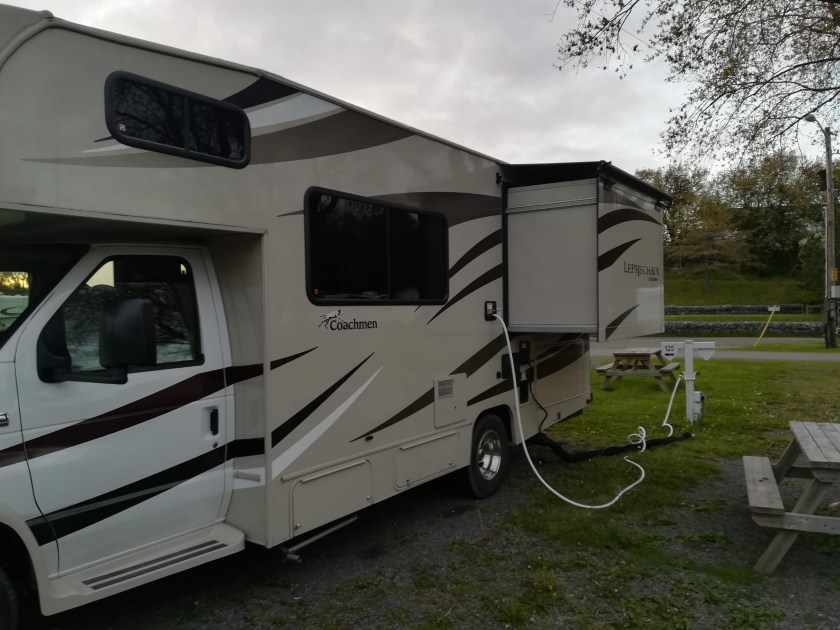
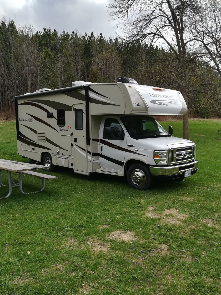
The slide-out creates our queen-sized bed, mattress folds in half from bottom to top for travelling

dav The all-important shower room.

sdr  Kitchen area – sink, cooker, microwave

sdr  Sitting and Dining Area

sdr  Good sized Freezer and Fridge  (sorry about reflection!)

sdr  Cab area – both seats twist around to face inwards, when not travelling.

There is an awning, which we have yet to use, and central heating/air conditioning. Also screened windows to keep the mozzies at bay.

Each individual campsite is provided with a picnic table and a campfire pit, and there is normally somewhere to string up a washing line if necessary.  Two fold-up sun chairs  provide a welcome relax, with a cup of tea (or G&T!), as soon as we’re hitched up!

Given that we’re travelling for four months, we’re cooking onboard – or barbecuing. Eating out is not cheap here and four months of fast food would play havoc with the waistline!

So . . . . this is life . . . . . Chez Reynolds!

Week 3 – And the North Wind Doth Blow

Prince Edward Island (province No 4 for us)- known locally as PEI – is a large island in the Gulf of St Lawrence, known for its rich red soil,  red and white sandy beaches, and very fertile farmland.  25 % of Canada’s potatoes are produced in PEI.  The Confederation Bridge – an amazing eight mile long structure, which includes an extra high bit in the middle for the big ships – provides access to the island from New Brunswick. Charlottetown is the capital, where we enjoyed a self guided tour of neat and tidy streets with the usual timber framed, wooden clad, colourful houses.  It’s clear that the more wealthy house owners stick to white!  Note that there are no garden fences or obvious boundaries.

davdav

Charlottetown KOA campground allocated us a lovely sheltered site on the West River – and with G&T’s to the fore, we watched the sun go down! An easy day’s driving saw us covering a large chunk of the island, from lovely sandy beaches in the north

dig

to a quiet walk along the Trans-Canada-Trail,

dig

which goes quite literally from one side of Canada to another  ( we will be getting our 10,000 steps in all the way across the country!).  Sadly the temperature has dropped steadily as we’ve traveled east.  The first campfire of the trip at Ocean View Campsite, near Murray’s Harbour, was abandoned after half an hour.  Despite the heat of the fire, it was just too cold to enjoy sitting out there!  Perhaps we should have been ‘Canadian’ and wrapped up in blankets!

A small version of our cross-channel ferry provides access from the east end of PEI to Nova Scotia (province No 5).  The 45 minute journey takes you from Wood Island to Caribou.  Lulu seemed tiny compared to the enormous articulated lorries surrounding her.  dig

Coffee and lunch stops are always a challenge.  Picnic areas are fairly common, but they never seem to appear when we’re ready to stop (a common problem, I suspect!)  Peter’s  love of maps normally finds us somewhere off the beaten track.  North Eastern Nova Scotia, is sparsely populated and heavily forested, but full of Provincial Parks.  Beaver Mountain Provincial Park provided us with a good two hour walk through the trees  – spring violets were everywhere -before lunch.

dig

Linwood Harbour campsite near Monastery was our destination that night.  Again we overlooked the water – but the proximity of water plus the threat of rain, meant the mosquitoes and black flies were out in force.  Damp wood on the campfire smoked ’em out!  With temperatures dropping to near 0C at night, we hunkered down.  Heavy rain and high winds rocked Lulu all night.

Sunshine greeted us the following morning however, and the Cabot Trail beckoned. (John Cabot having discovered the North American coast in 1497)  The trail is 298 km long and winds up, down and around the Cape Breton highlands.  Having been very much a part of my school geography lessons, we couldn’t wait to experience it.   Before settling into our campsite at Cheticamp, we took advantage of the brilliant evening sunshine and walked the Skyline Walk – along a ridge with beautiful views over the sea and the highlands.

digdav

Weather forecasts had warned us of heavy rain – they weren’t kidding!  Local shops and a gallery kept us occupied, and eavesdropping in a local cafe reminded us that we were in an Acadian area.  (17th century descendants of the French and/or Indigenous people of Acadia). The locals talk in a very natural mix of French and English. The Scottish influence was also noted – lots of Celtic folklore, not to mention Royal Wedding Fever!

Twenty four hours of rain left the Highlands shrouded in mist, but our itchy feet got the better of us, and we decided to push on.

dig

We had read that driving the trail has it’s challenges  – hair pin bends, steep inclines and descents  – all part of the Reynolds adventure!  Intermittent heavy rain continued throughout the day, and there was thick fog/cloud over every high point.   Add to this the hundreds of runners (on our side of the road!) tackling the Relay for Life  (running the whole of the Cabot Trail in 24 hours in Relay Teams) – and you will get the picture!  A very friendly policeman stopped us right on top of a mountain.  He was dripping wet and must have been cold, but with a big welcoming smile “Well, you guys have chosen a ‘real good day’ to come up here!”  and laughingly sent us on our way.  Probably thinking – Crazy Brits!!

In an effort to get away from the rain and fog, we stopped for the night in another KOA at North Sydney, still on Cape Breton Island, and overlooking the entrance channel to Bras d’Or Lake, which is a huge UNESCO biosphere reserve.


dig
Seal Island Bridge, North Sydney

Evening sunshine lifted our spirits, as did a fellow RV’er who was practicing his bagpipes outside!  Given that it was close to 0C and with a cold north wind, I’m afraid none of us dared to escape the warmth of our RV’s to cheer him on!  His hands and lips must have been frozen . . . . .or maybe there was some whiskey involved?

Peter’s wish was fulfilled today as we visited Louisbourg French Colonial Fort on the south eastern shores of Cape Breton.  Louisbourg was a thriving French colony in the 1700’s, but two British invasions destroyed it completely.  In the 1960’s, the Canadian government started a huge project to reconstruct about one quarter of the original town and fortifications.  It’s an impressive effort – and provided us with several hours of exploring and walking around the coastal ruins.

davdav

We’ve clocked 3,150 km as of today . . . . . inbuilt propane tank has been refilled (central heating has been a real boon) . . . . . don’t even think about the amount of petrol we’re getting through!  Hopefully Canada’s wide open spaces can absorb our heavy carbon footprint!

The adventure continues . . . . . . .

Week 2 – Heading East

Travelling east from Montreal to Quebec City was a joy.  The Trans Canada Highway proved its worth, in that it is fast and fairly smooth going.  We used the more scenic routes through smaller towns when it was time for coffee, lunch  and/or a change of driver.  Passing through several ‘English’ named towns – Sherbrooke, Richmond, Warwick – we stopped for a coffee in Waterloo.  In typical Canadian style, we were warmly greeted, told to sit ‘where you like’ and within seconds the waitress appeared at the table with two mugs of steaming, hot, black coffee.  She’s happy to change them for something else, but perhaps this country is more caffeine driven than we knew!

Toronto NB 1 with route.jpg


Whilst on the subject of drink, some of you may not know of the archaic licensing laws in Canada  – and they change, from province to province.  To buy a bottle of wine in Ontario, you need to go to the LCBO – Liquor Control Board of Ontario.  In Quebec, we discovered it’s the SAQ – Societe de Alcol de Quebec. In New Brunswick, it’s the Alcohol Store!  A little research needed in each province, but I’ll drink to that!  Not so easy as buying a bottle of wine, or gin, from the shelves in Morrisons!

Camping de la Joie near Quebec City was not just a lovely quiet, tree lined site, but provided an excellent shuttle service into the city – a very comfortable car, driven by the owner – so no need for taxis or buses.   A Guided Walking Tour of the old walled city, with an inspirational guide, rattled my brain as I was reminded of my school history lessons – Samuel de Champlain, founder of Quebec, (and the beginnings of the Canadian nation) and nasty battles on the Plains of Abraham between the British and the French.    Walking the Walls, gives a bird’s eye view of  brightly painted tin roofs (which show up in the snow), tiny windows (due to the cost of glass which was originally shipped from France), stone walls covered with mortar (to protect from the freezing weather) and an astounding array of architecture.

IMG_20180515_182412.jpg

From the world famous Chateau Frontenac Hotel, built by the Canadian Pacific Railways in 1893, to the first Anglican Cathedral outside Europe, a copy of St Martin’s in the Field, built in 1804.  All with a very French atmosphere – almost Parisian like.

IMG_20180516_154315.jpgIMG_20180515_175917-EFFECTS.jpg

Our cholesterol levels must have gone through the roof as we sampled a local delicacy – Poutine – every house has its own recipe!  Bite sized pieces of rabbit, tiny curds of local cheese, and French fries – all covered in thyme and garlic flavoured gravy – I rest my case!

Continuing north east along the southern side of the St Lawrence River, and turning south following the US border, we crossed into New Brunswick.  Beautiful scenery with the Laurentian mountains on one side and the beginnings of the Appalachians on the other.   Lakes and huge swathes of Silver Birch and Pine Forest, as far as the eye could see.  Mulherin’s Campground, near Grand Falls had a nice lakeside site for us – the owners were happy to allow us to park for the night, even though they were not officially open.  The high-pitched call of the night frogs around the lake certainly signaled springtime, even if the locals weren’t ready for us tourists yet! IMG_20180517_175754.jpg

Further south and east, the incredible amounts of water flowing over Grand Falls provided an impressive site – Visiting so soon after the devastating local floods, meant that water levels were very high.  The St John River drops over a cliff edge here and into a deep gorge – totally unspoiled by tourism (unlike Niagara!) we felt privileged to have seen it. IMG_20180518_095501.jpg

Stopping to see the longest covered bridge in the world at Hartland was a further treat.  Sadly Lulu is too high and wide to travel through any of these bridges – shorter versions are dotted all over New Brunswick.

IMG_20180518_130231.jpg IMG_20180518_125955.jpg

Fredericton, the capital of New Brunswick, boasts wide, tree lined avenues with beautifully maintained Georgian and Victorian houses.  The Beaverbrook Art Gallery gave us a real insight into Canadian art. Lord Beaverbrook’s collection (he was born in a tiny village not far from my childhood home) was a gift to the town, and includes many international artists as well.  Sunbury Oromocto Campground near Fredericton, provided another lakeside site – just opened for the season, as it’s a bank holiday weekend here.  Queen Victoria’s birthday has always been celebrated.  Fitting that Harry and Meghan’s wedding should fall on the same weekend, although I had to be content with internet coverage, as the TV signals from Lulu, are almost non-existent!

Fundy National Park has been high on Peter’s bucket list.  Inheriting some of his father’s love of geology, Hopewell Rocks on the Bay of Fundy, was our weekend destination.  Ponderosa Pines campground has proved its worth, with good hard standing for Lulu (much needed as it is now raining!) and only 3 km from the Rocks.  At this point on the Bay of Fundy, the tidal range can be as much as 14 ft.  For three hours either side of low tide, you can walk on the “ocean floor”, looking almost skywards to see the high tide line on the rocks. At high tide (and in season) you can kayak around the tops of the rocks, in 14 ft of water, very near the shoreline!

IMG_20180520_112401.jpg

IMG_20180520_160657.jpg


We left home two weeks ago – and have covered 2050  km, so far.  Onwards we go!

Meet Lulu – and Lessons Learnt

Lulu  (the Leprachaun), will be our home for the next four months.  Spending our first night in a campsite very near the Motor Home depot, proved very useful.

IMG_20180510_163114.jpg

The very helpful staff at Motor Home Travel, sorted out various niggles, and sent us on our way rejoicing!  As you will see from the map below, we plan to do a big figure of eight  – from Toronto, east, to Newfoundland – then back across northern Ontario, and west, to Vancouver – and back to Toronto.

Revised  Map Canada Route.jpg

Stopping for a photo call outside my childhood home, proved a poignant moment  – such a tiny little place, but full of happy memories   – long hot summers, snowy yet sunny winters – wonderful that we all remember the good times, and not the bad!

IMG_20180511_105946.jpg

Heading east, we kept well north of the busy roads around Toronto, travelling mostly on Hwy 7/21 and 40.  First lesson is that Canadian road surfaces are terrible. Thanks to extreme frosts in the winter, with constant snow ploughing and salting, followed by extreme heat in the summer, the roads heave.  Believe me, the potholes in Herefordshire are nothing compared to Canada! The Motor Home Owners amongst you will know, that everything must be stowed safely before hitting the road. Despite this, we’ve had the fridge door fly open (not locked properly), and the cushion above the driver’s head, landing on the driver!  All part of the fun!

By far the quickest route for us would have been Hwy 401, which is part of the TransCanada Highway.  The road surface is kept in pretty good nick, and you can travel at motorway speed (100km/hr).  Miles are covered quickly, but conversation is well nigh impossible, thanks to the road noise!  To keep our sanity, we took several detours.

We loved the Thousand Island Parkway – a blissful area, of little islands dotted about in the St Lawrence River.  Gorgeous houses (both mansions and cottages) –  some enjoying an island to themselves and only reached by boat.

IMG_20180512_113721.jpg

Too much time on the back roads meant we were too late to get to the intended campsite for the night.  Second lesson of the week, is to ring ahead and book, even though this is low season and campsites (if open at all) are practically empty.  In the end, we located a KOA  – Kampgrounds Of America.  These are huge sites, with all facilities, and have a much longer season than some of the smaller sites that we would prefer.

Third lesson of the week, is that Mother’s Day, is a HUGE commercial celebration here in North America.  There was one space left on the KOA site at Brighton – yes, you read this correctly.  Most of the names in this area are either English or Scottish.  This was a fabulous introduction to the Canadian love of the outdoors.  Despite quite cool temperatures and a chilly wind, every family had lit their campfire (every site has its own fire pit), and huge families were huddled around the fire, with winter coats and woolly hats on.  Rather like the Brits on a beach holiday, cuddling up behind a windshield . . . . . . if that’s your plan for the weekend, then ignore the weather and get on with it!

The TransCanada Hwy was our principal route again yesterday, but with a very pleasant detour along the Long Sault Parkway, which skirts the St Lawrence River.  Glorious sunshine, bright green grass and trees just bursting into bud, ripples glistening in the sun, and the odd honk of the Canada Geese made a very memorable stop for lunch.

KOA Montreal South has been our refuge for two nights.  Warm, bright sunshine made sightseeing in Montreal all the more pleasurable.  A horse and buggy tour gave us an insight into a bit of history.  Exercise became the aim of the day, as we huffed and puffed our way up Mont Real (Montreal’s very own mountain) – but were rewarded with some fantastic views.  Pavement cafes and very French architecture adorn every street.  Every language in the world being spoken on every corner.  Despite it being a Sunday, there was a real buzz – from student to tourist, from street vendors to taxi drivers – everyone very helpful and friendly.

IMG_20180513_131141.jpg

Is it really only a week since we left home?

Ready to Go!

After a year of planning, research and excitement, we are finally on our way!  Why is there always so much to do when preparing to go on holiday?

IMG_20180507_115010.jpg
Packing for four months – collapsible cases ready for the Motor Home.

Tick list complete . . . . . Hair cuts, dentist visits, garden sorted, allotment handed over (thanks Phil!), house sitters organized (thanks Wendy),  emails and contacts made for the blog, emotional goodbyes to gorgeous grandchildren and wonderful daughters.  Our ears are ringing with “When is it you go?” and “Haven’t you gone yet?”.  Huge thanks for all your heartfelt messages to send us on our way.

IMG_20180507_200315.jpg
Celebratory ‘bubbly’ at Sofitel, Gatwick.

So, here we go!

Packing for the Four Seasons


sdr

Peter and Marilyn – Retired and wrinkled, but with a sense of adventure – taking an opportunity as it arises, and thanking everyone involved for supporting our numerous activities whilst we’re away.

In two weeks time we set off for the trip of a life time.  Having spent seventeen formative years of my childhood on a farm north of Toronto, Ontario, I have always dreamed of visiting every province in Canada.  Given the length and breadth of this wonderful country, this will be quite a feat.  Approximately 25,000 km of driving over four months in a 24 ft Motor Home! With military precision, maps have been studied, campsites researched and endless lists have been created.

We dream of rocky coastlines, majestic mountains, miles of swamp and bush, mirages over the prairies, all intercepted with campsites on quiet lakes or rivers, and the ever friendly Canadian people making us feel at home.  The reality may be laced with the odd hiccough, not least the Monstrous Mosquitoes!

As I prepare to publish this, Toronto has been brought to a standstill by a three day ice storm and most campsites east of Toronto are still closed due to cold weather and snow.  Hence, we are packing for four seasons!

Feel free to join us on our travels via the blog – we’d love your company.

See you in September.