Benbecula – Flat and Foggy!

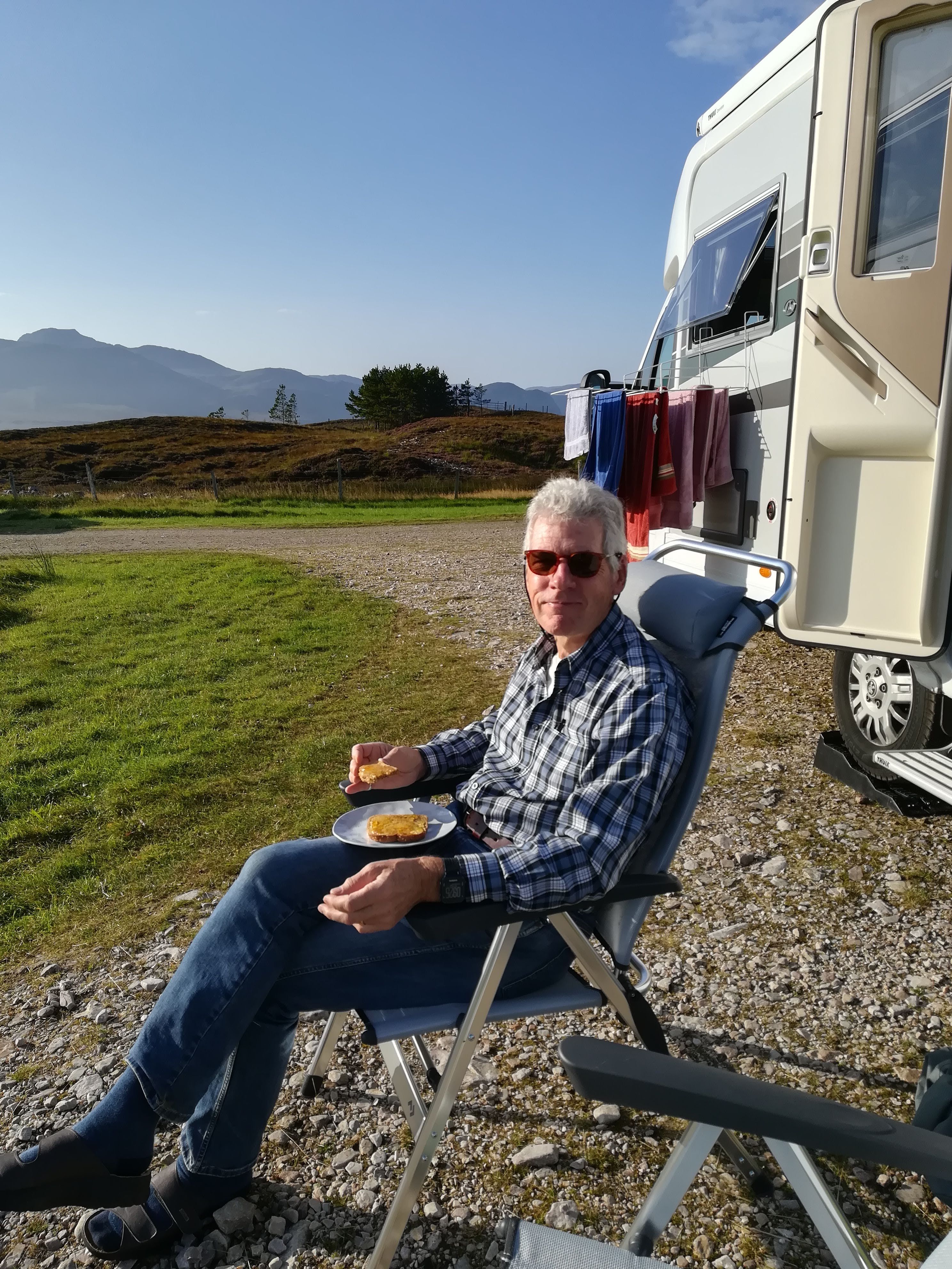
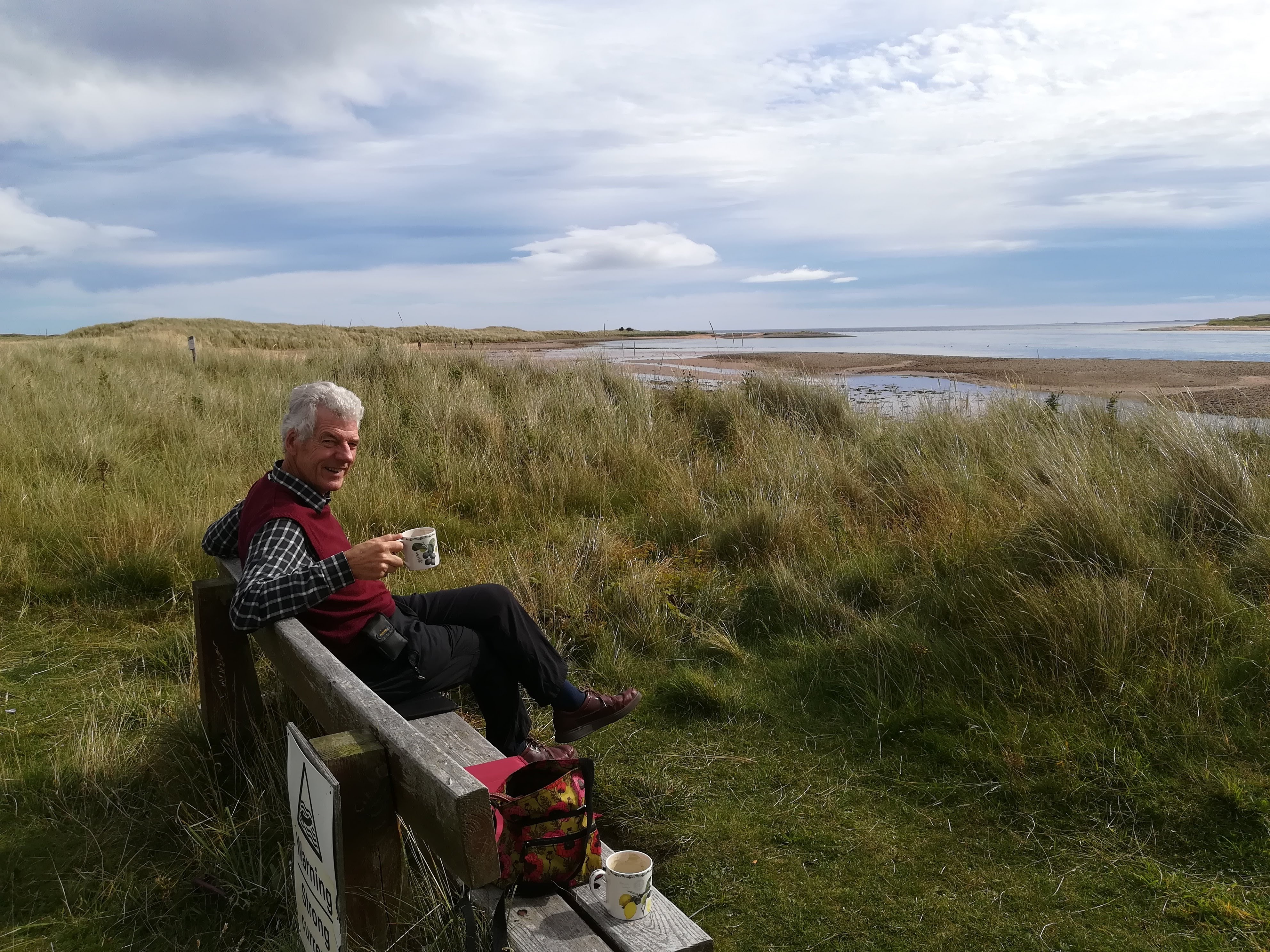
Our campsite on Benbecula was called Otter’s Edge – ‘that sounds hopeful’ we thought.  Silly us!  Having taken advice from the owners (and he gave the same advice to everyone) we got up very early and walked 40 minutes out onto the beach, to a carefully placed bench where we could expect to see sea otters – two hours either side of hide tide was the advice.  NOTHING!  Are we jinxed? The campsite owners like to remind us of how far we are from the rest of the world..

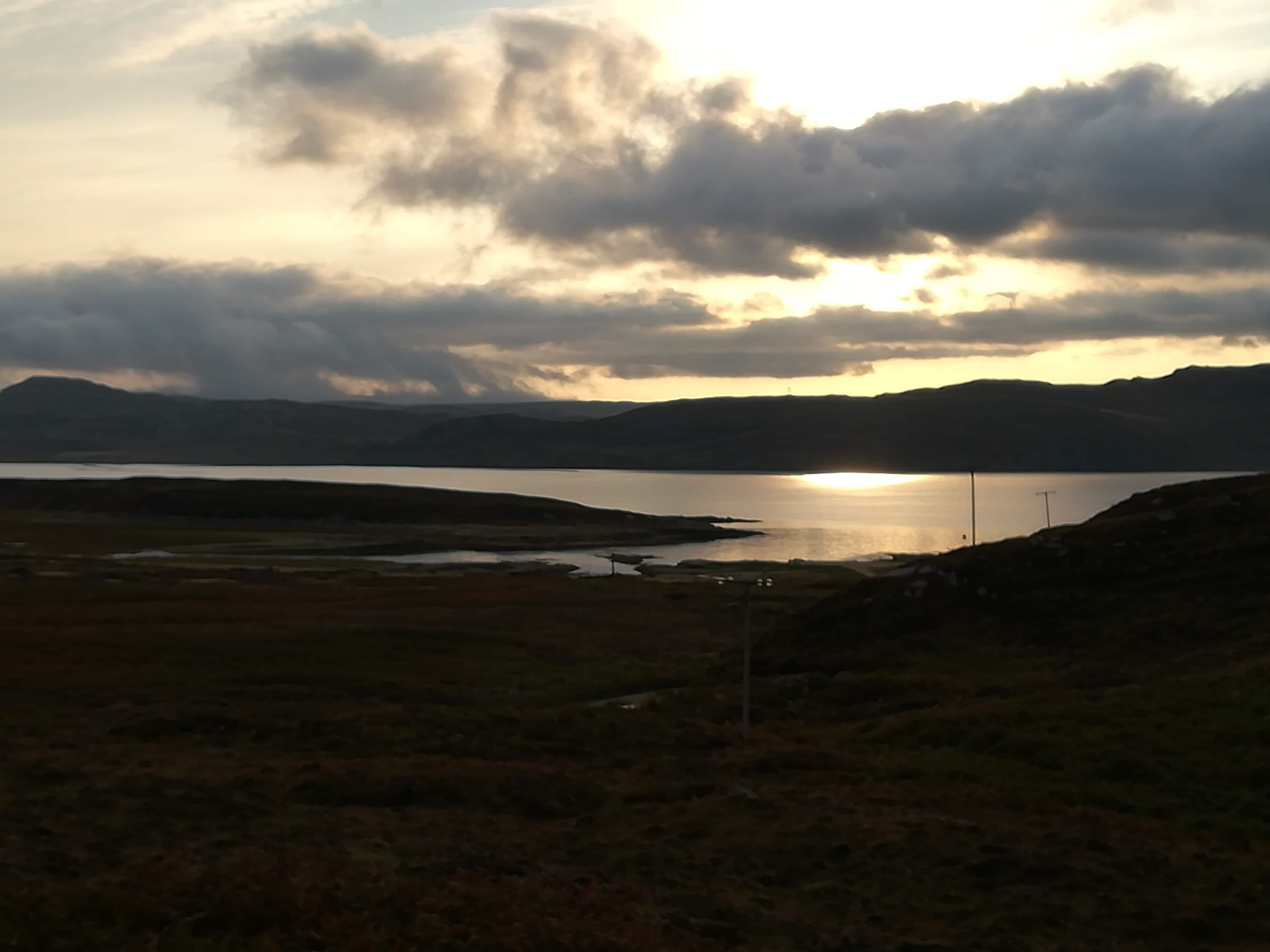
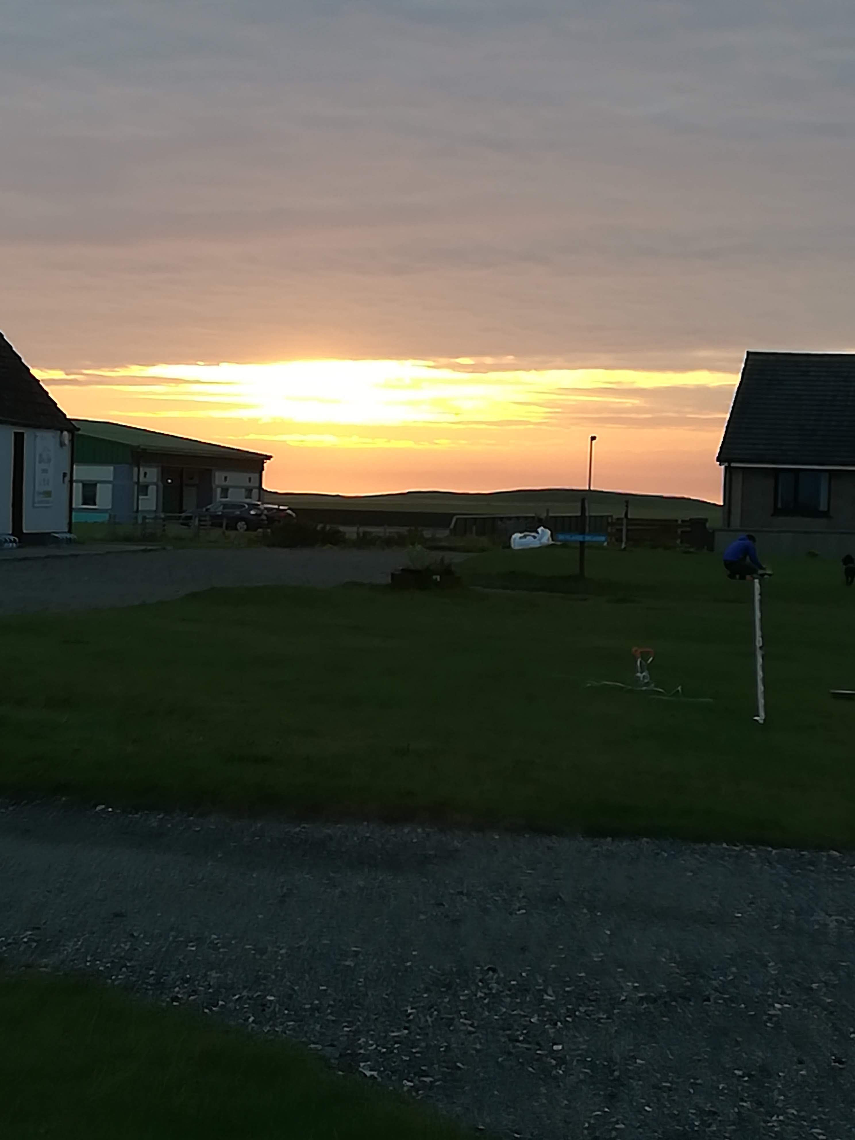
Our planned walk for later in the day never happened due to thick fog/sea mist rolling in and blanketing everything in all directions. The fog became rain at times and then just reverted to damp, all encompassing yuck!  BUT . . . . you don’t come to the Outer Hebrides expecting sun and warmth.  The Islanders assure us that they’ve HAD lots of sun and warmth and now they need rain!  A brief respite from the rain, produced a wonderful sunset which lifted our spirits.

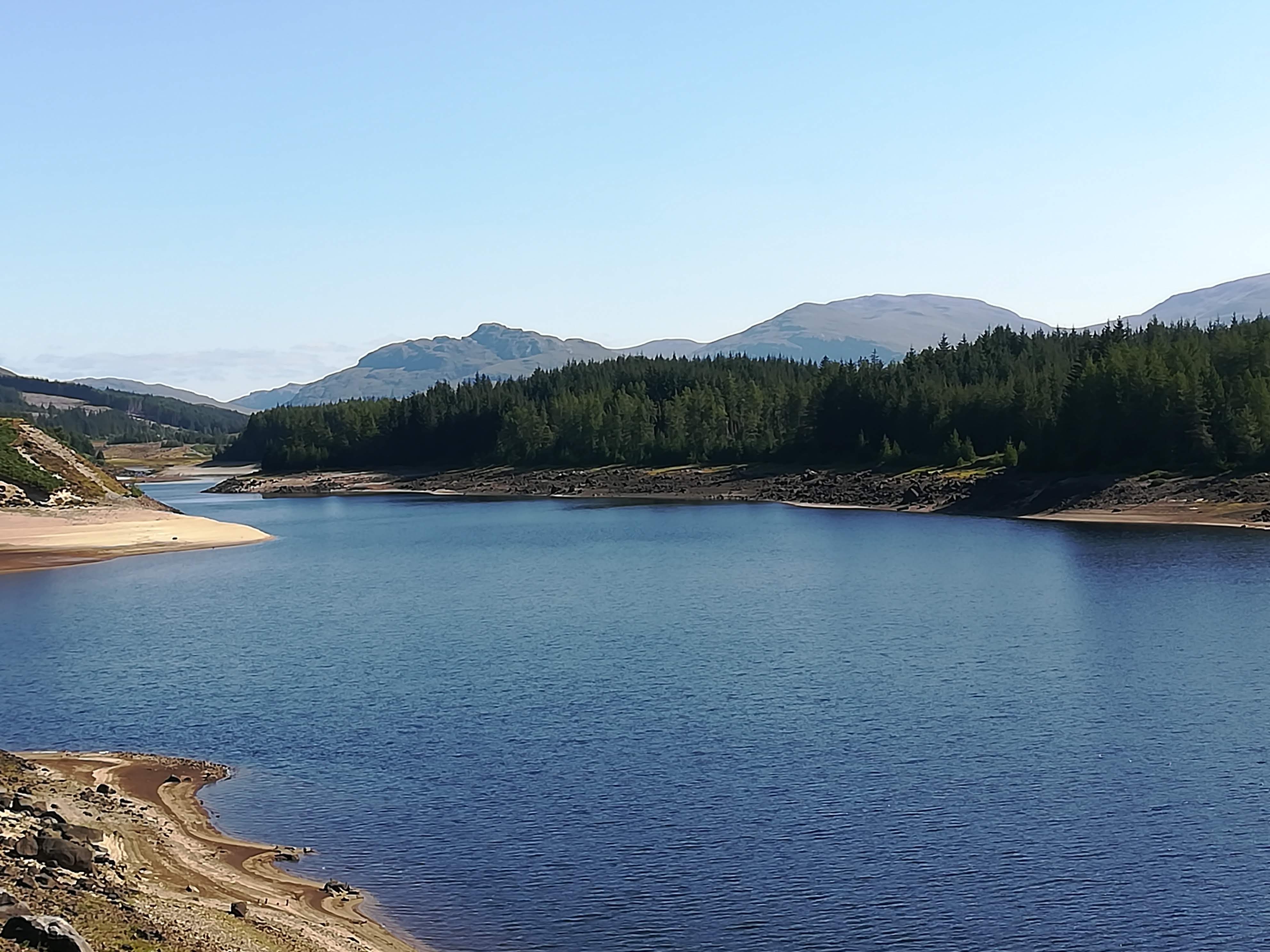
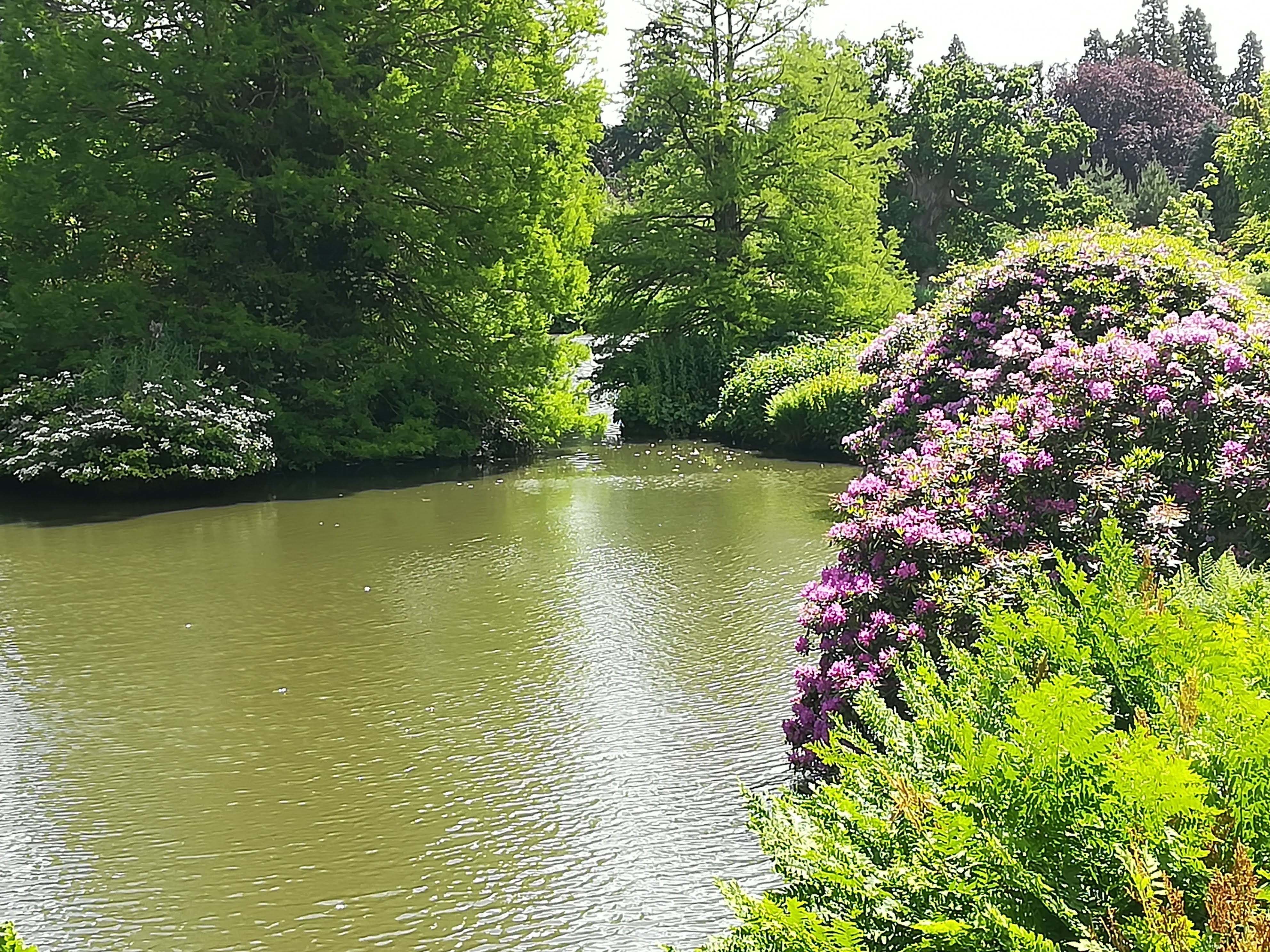
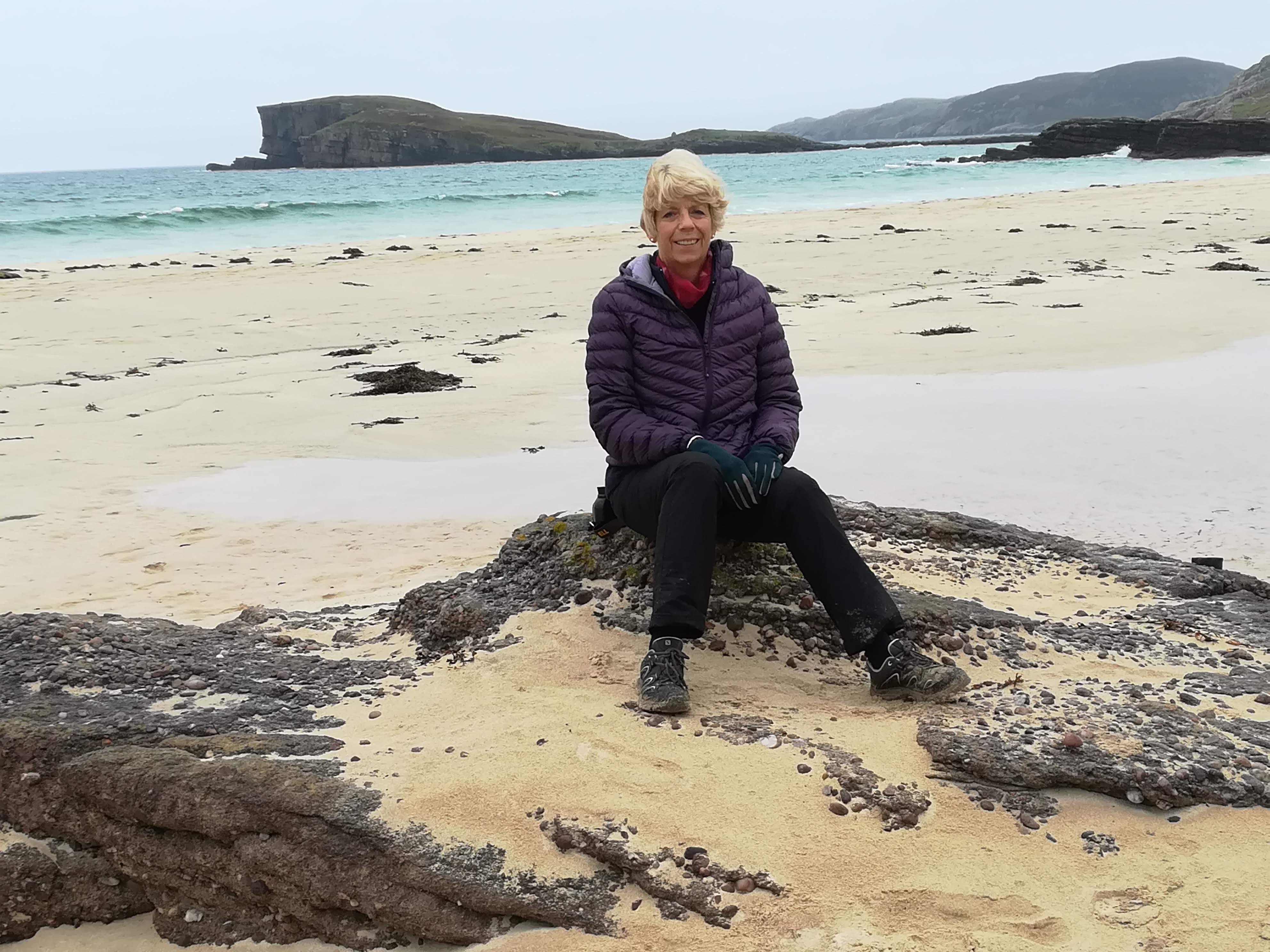
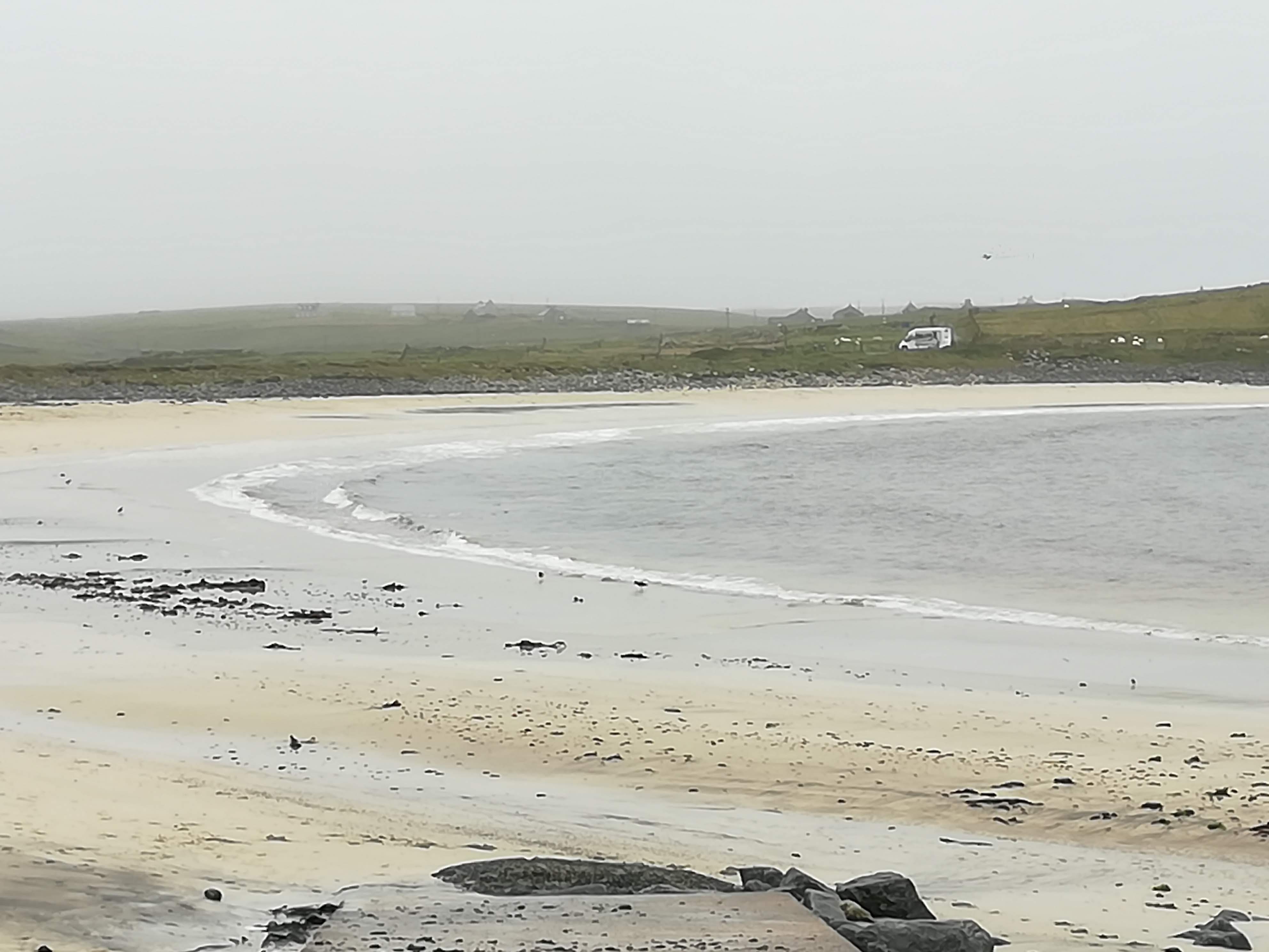
As with most of the islands, Benbecula boasts many miles of white sandy beaches.  A brisk walk along any beach in a strong wind is a sure-fire way of improving one’s zest for life. 

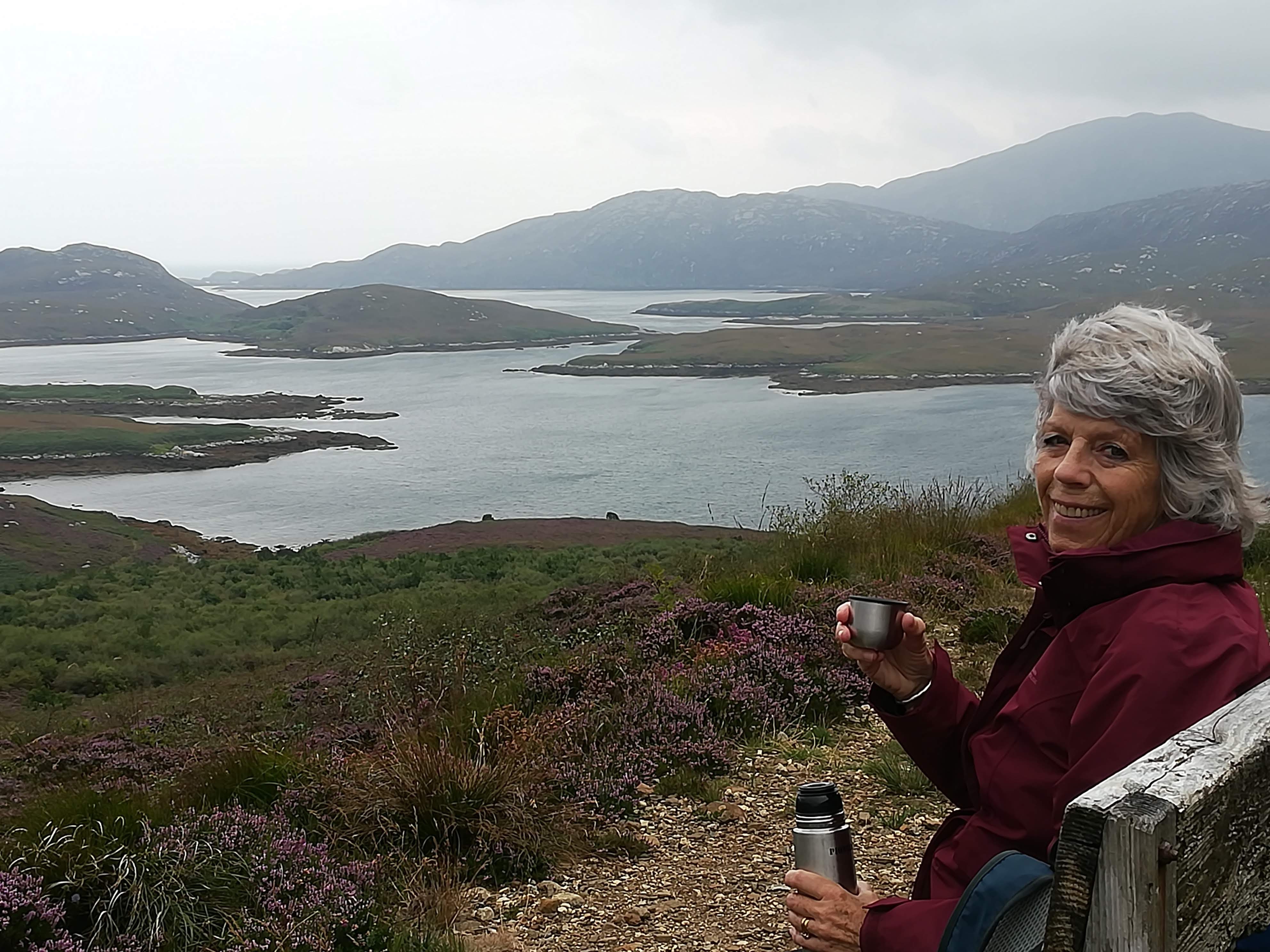
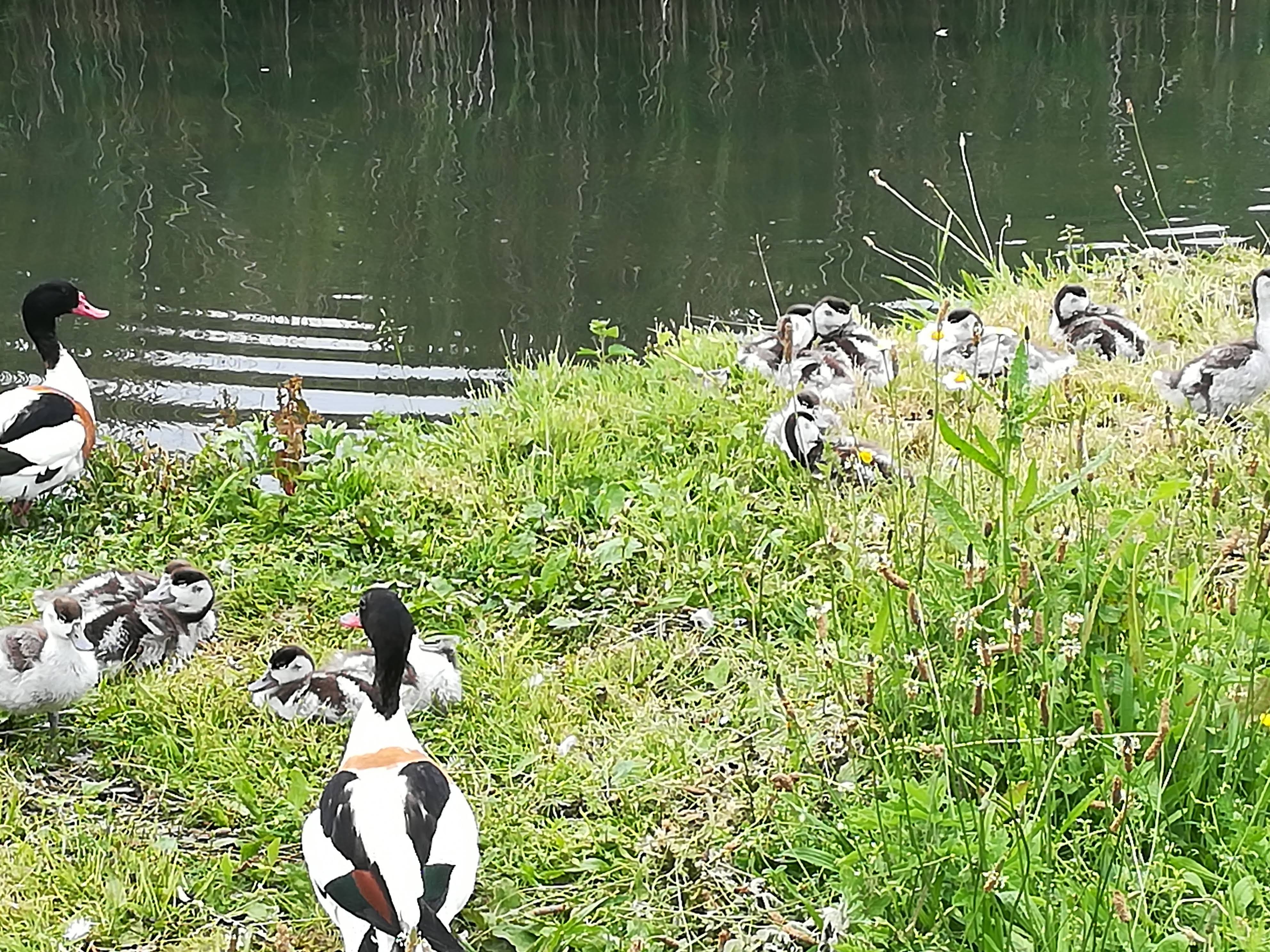
A Boat Tour was recommended from the little island of Grimsay – just to the east of Benbecula.  Ten of us took to the seas on Lady Anne, with much promise of wildlife ‘as seen on every trip’.  A happy two hours passed by, as we pottered about the inshore lochs and inlets. . . . seeing many red deer and numerous sea birds.  Yet the famous sea eagle, who normally ‘poses for the camera’ was nowhere to be seen.  Told you we were jinxed!

Moving North:

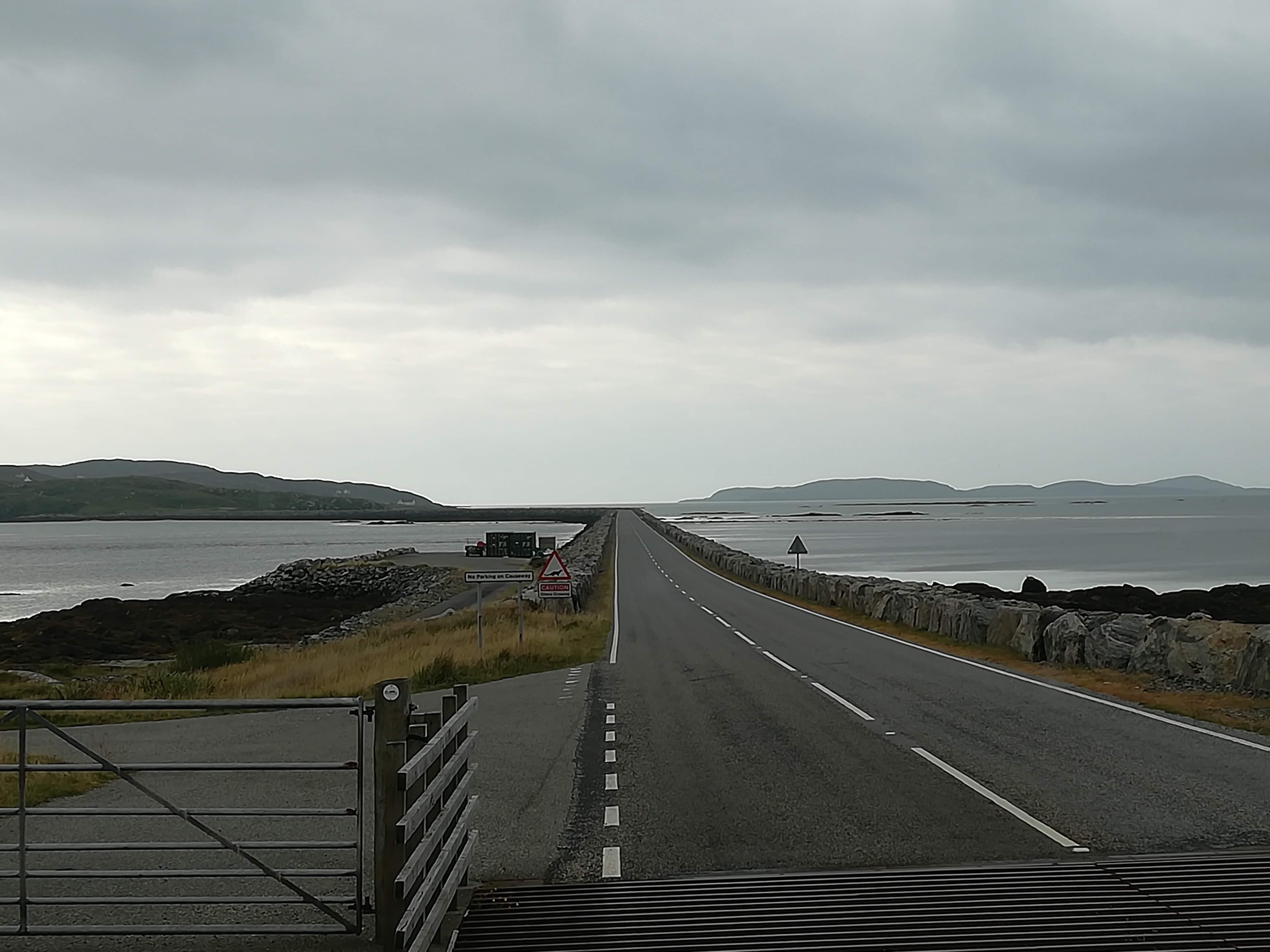
As recommended, we ‘wild camped’ amongst the sand dunes on the little island of Berensay, ready to catch the 07:15 ferry to Harris.  Joining the queue at 06:45, little did we know what a long day we were going to face. . . . . Thick fog meant our ferry was cancelled.  Spring tides meant fewer ferries were running.  A few lucky cars and MOHO’s were squeezed onto the 10 am, but the rest of us had to wait (with fingers firmly crossed) until 4pm.  Not only were we praying to get on the ferry, but that the much-threatened fog would not close in again!  No one moved from the queue – we didn’t want to lose our place and perhaps miss out on a crossing.  There is NO OTHER WAY to cross to the Island of Harris.  Not only was the weather vile, but the midges were horrendous – no wind and thick fog meant the midges had a party!  Creeping outside to stretch our legs, required large amounts of bug spray AND the (very fashionable) netted head cover!  What a motley sight we must have made!  Chat with other people in the queue just didn’t happen, thanks to the midges, and not daring to sit inside one another’s MOHO’s because of COVID restrictions.   Cups of tea, too many biscuits and many a crossword kept us going . . . . .

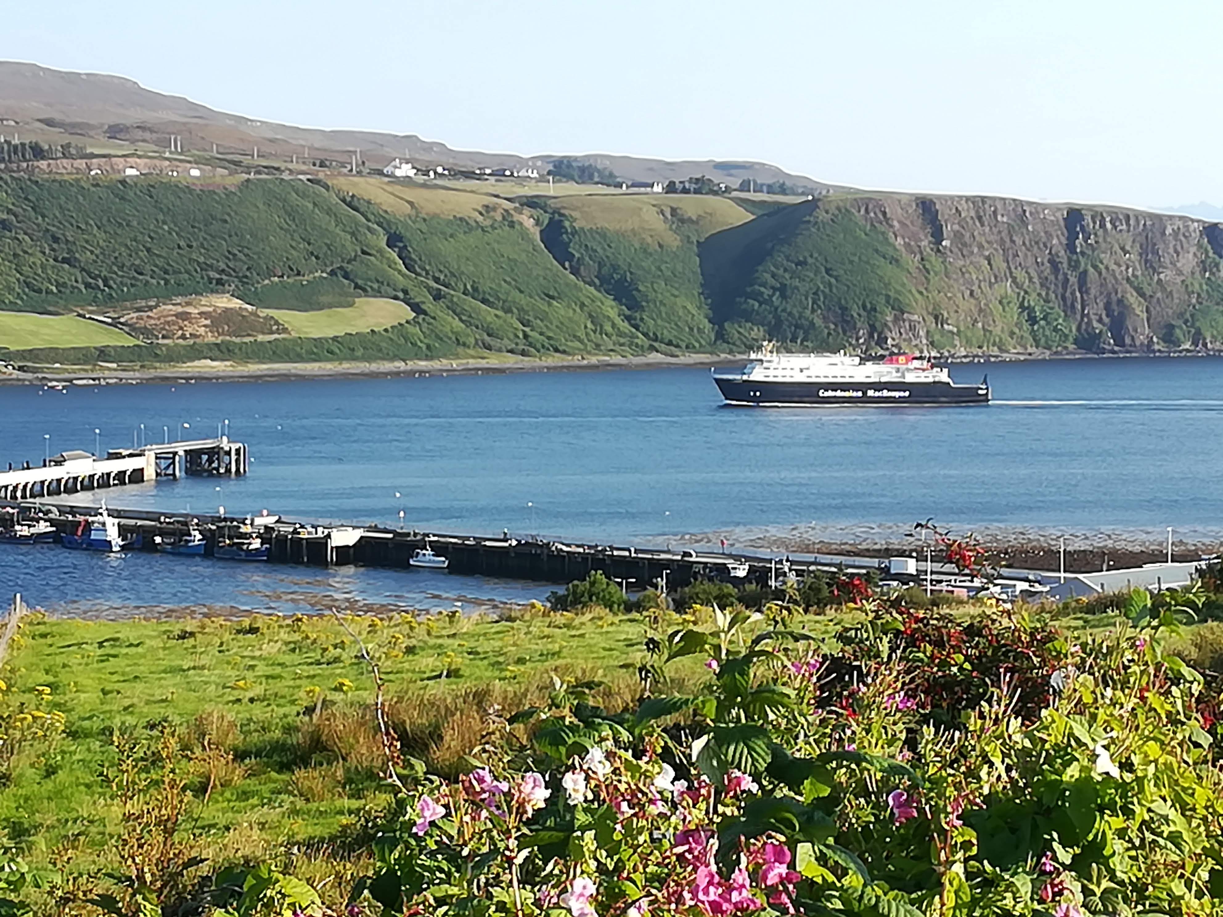
The Sound of Harris is a notorious crossing because of the many rocks that make navigation a nightmare.  Not being a good traveller, I was relieved that the waters were calm, and the fog had lifted sufficiently for the captain to see the buoys marking this hazardous journey.

Harris & Lewis:

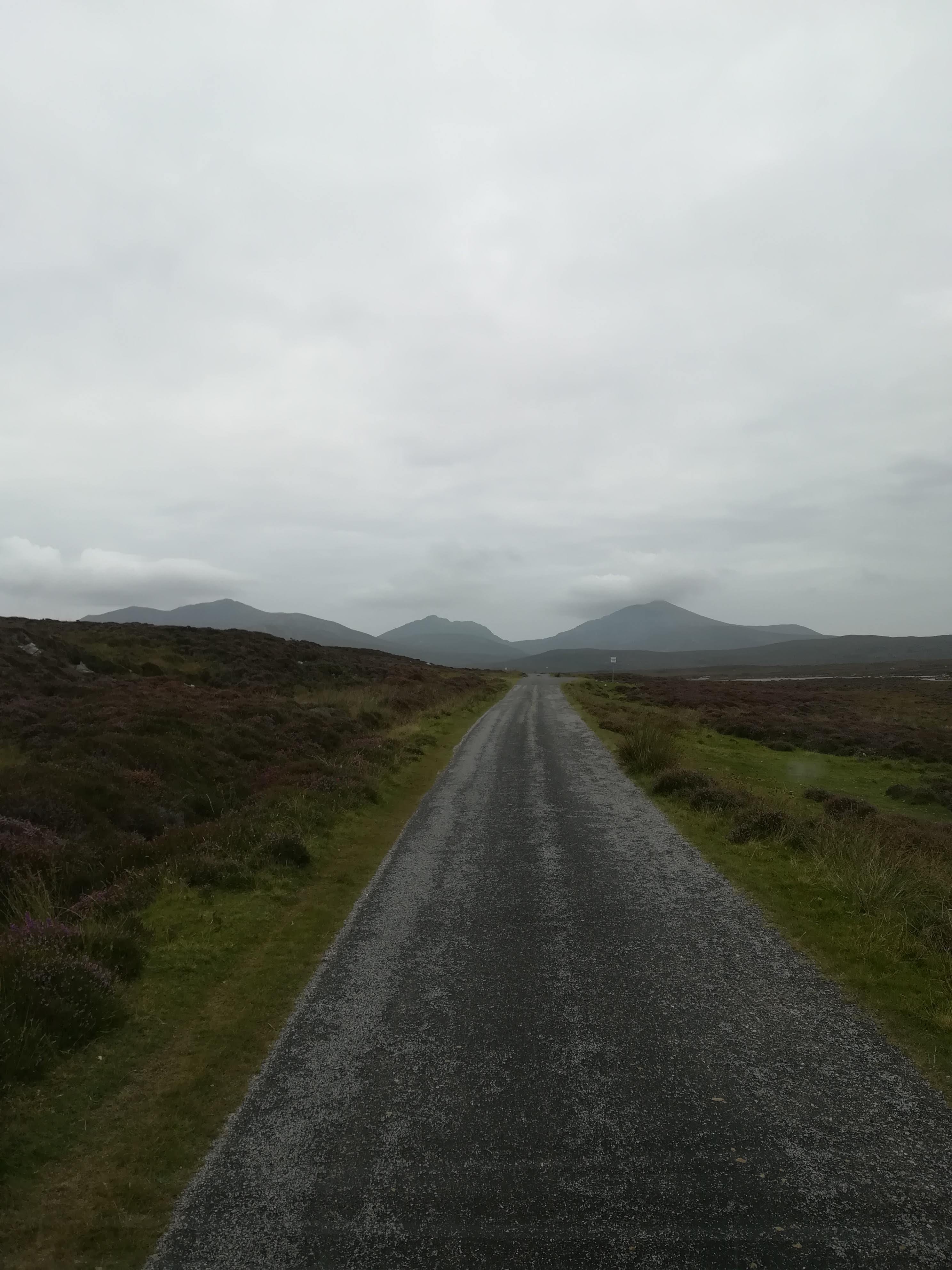
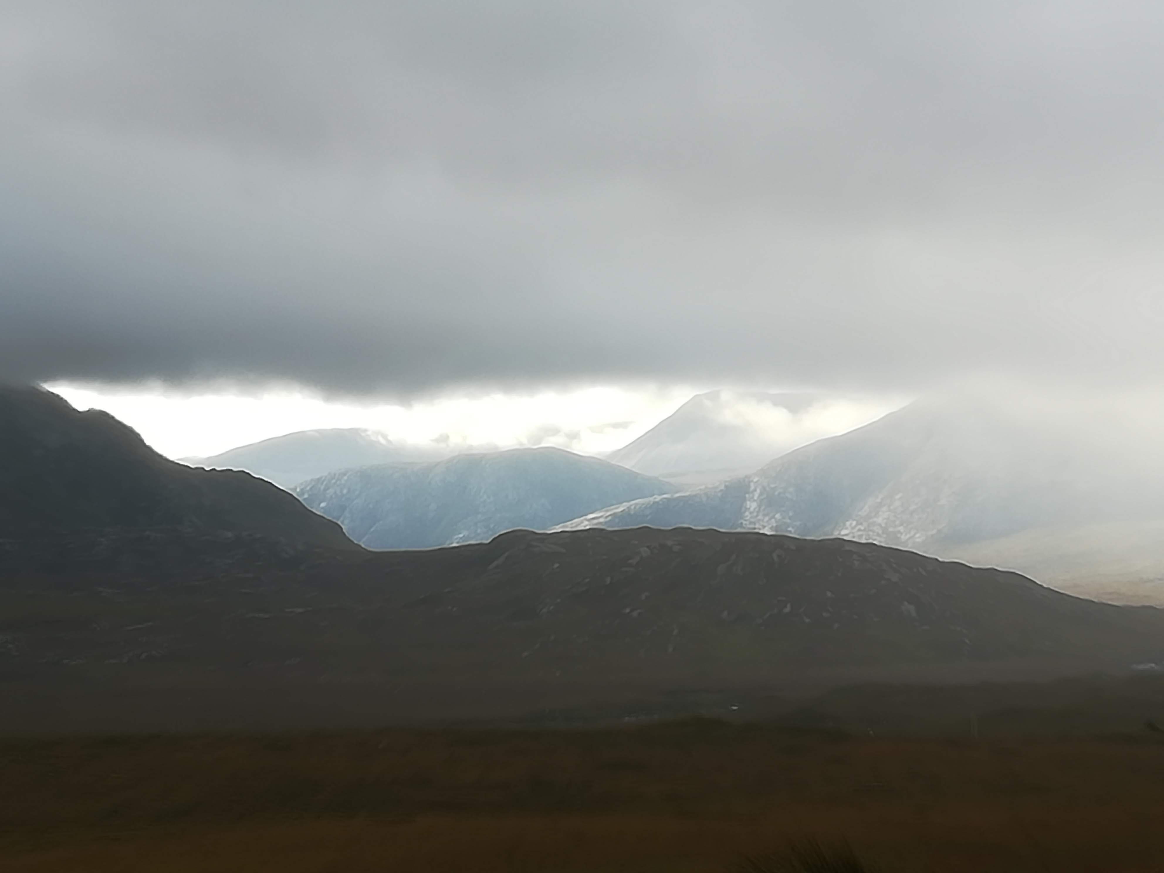
Very heavy rain and fog greeted us at Leverburgh.  Two hours of difficult and tense driving followed as we made our way north through the mountain roads which effectively divide Harris and Lewis.  As the rain became heavier AND fog became thicker, our full attention was needed on the road – all the peaks were covered in thick cloud.  Peering ahead through the mist to check for oncoming cars on single track roads was the order of the day.   

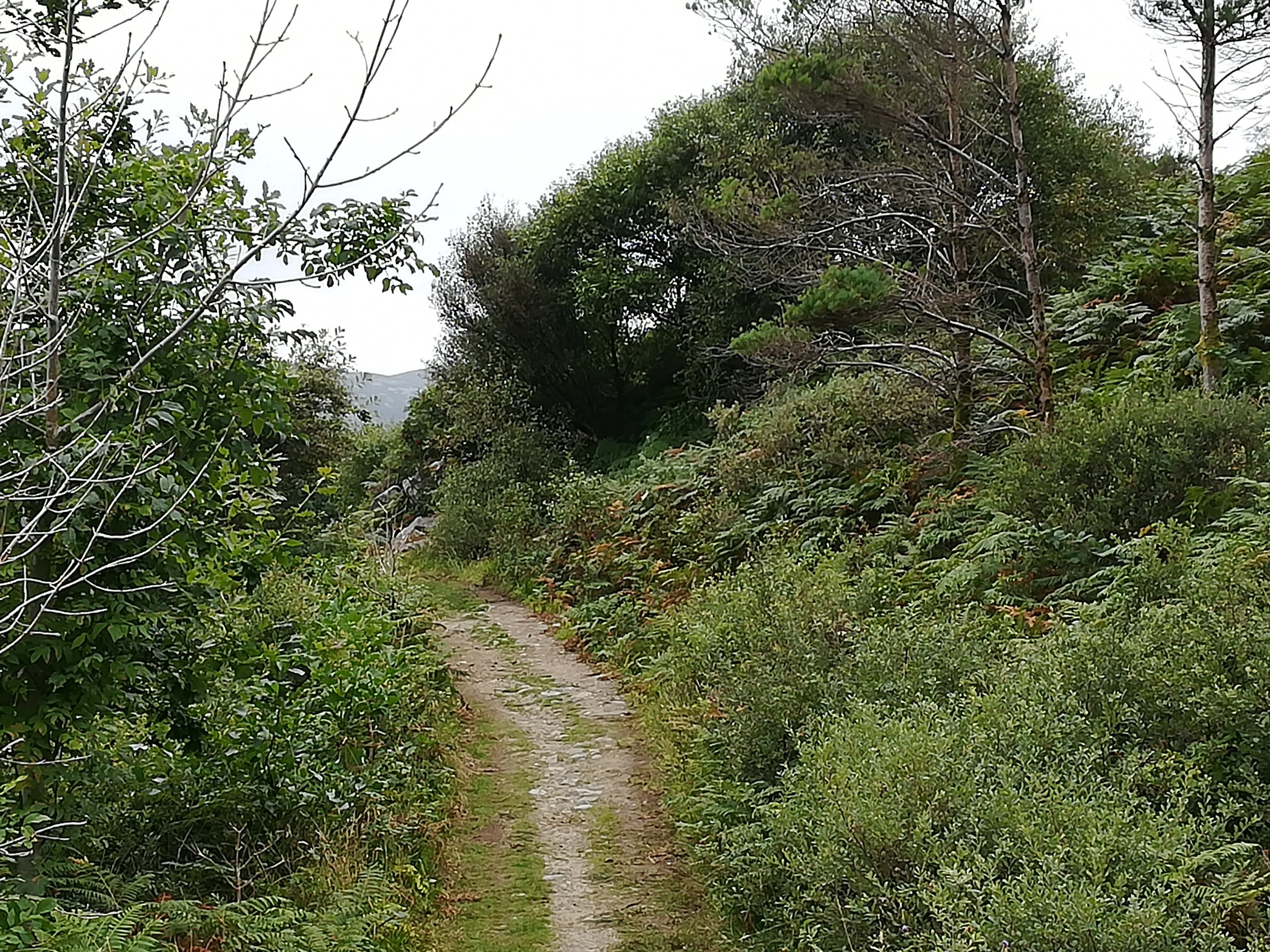
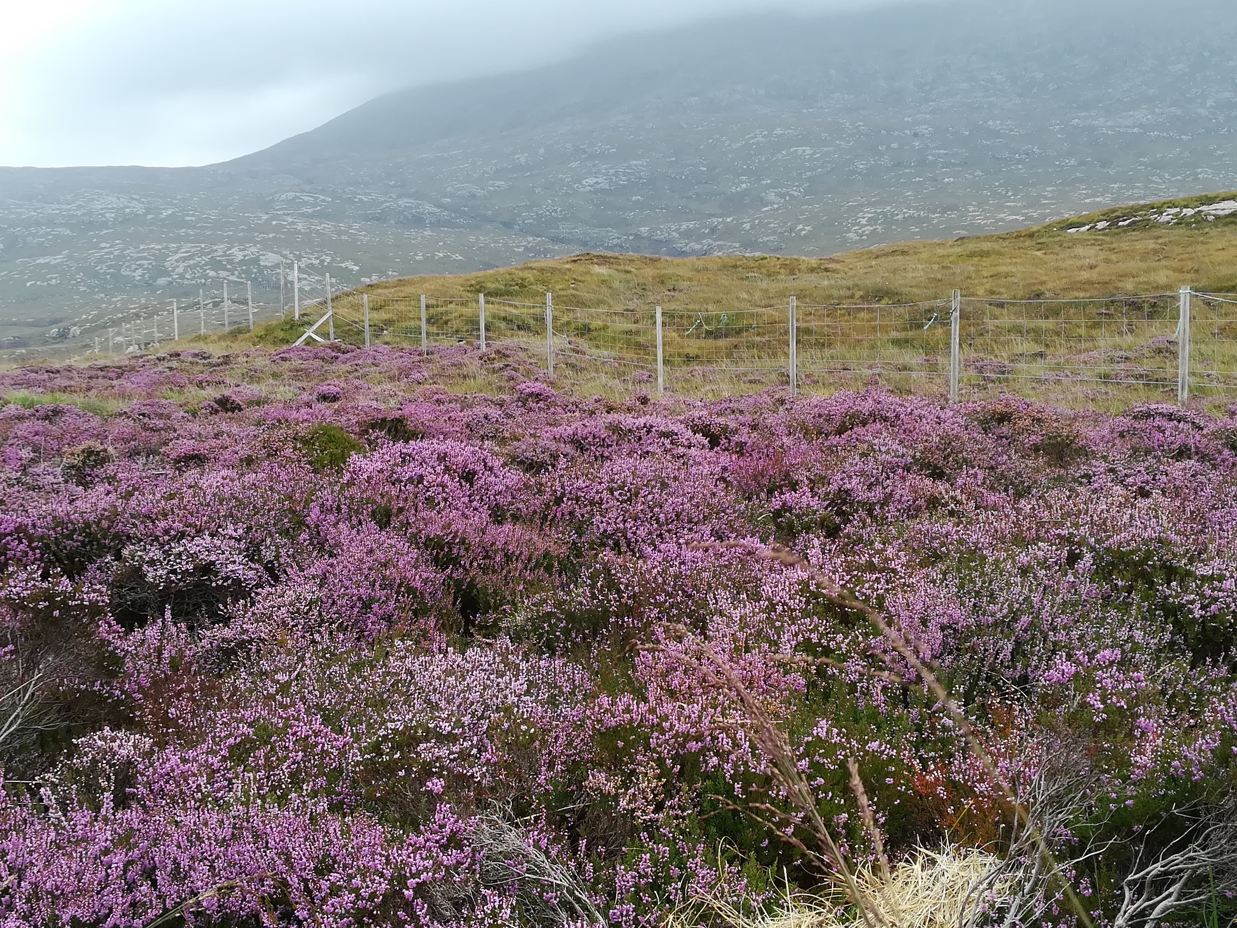
Making our way up to our booked campsite near the north-west coast of Lewis, we passed through many little villages.  All with unpronounceable Gaelic names, the villages are well spread out with majority of the houses down the main road.  Plots extend back onto the ‘machair’.  This is the low lying arable or grazing land formed, over many years, by deposits of sand and shell fragments near the coast.  The Machair is the focus of what little agriculture there is in the Hebrides.  Houses are bigger and in general, built to a higher standard than the tiny crofts in the Uists. 

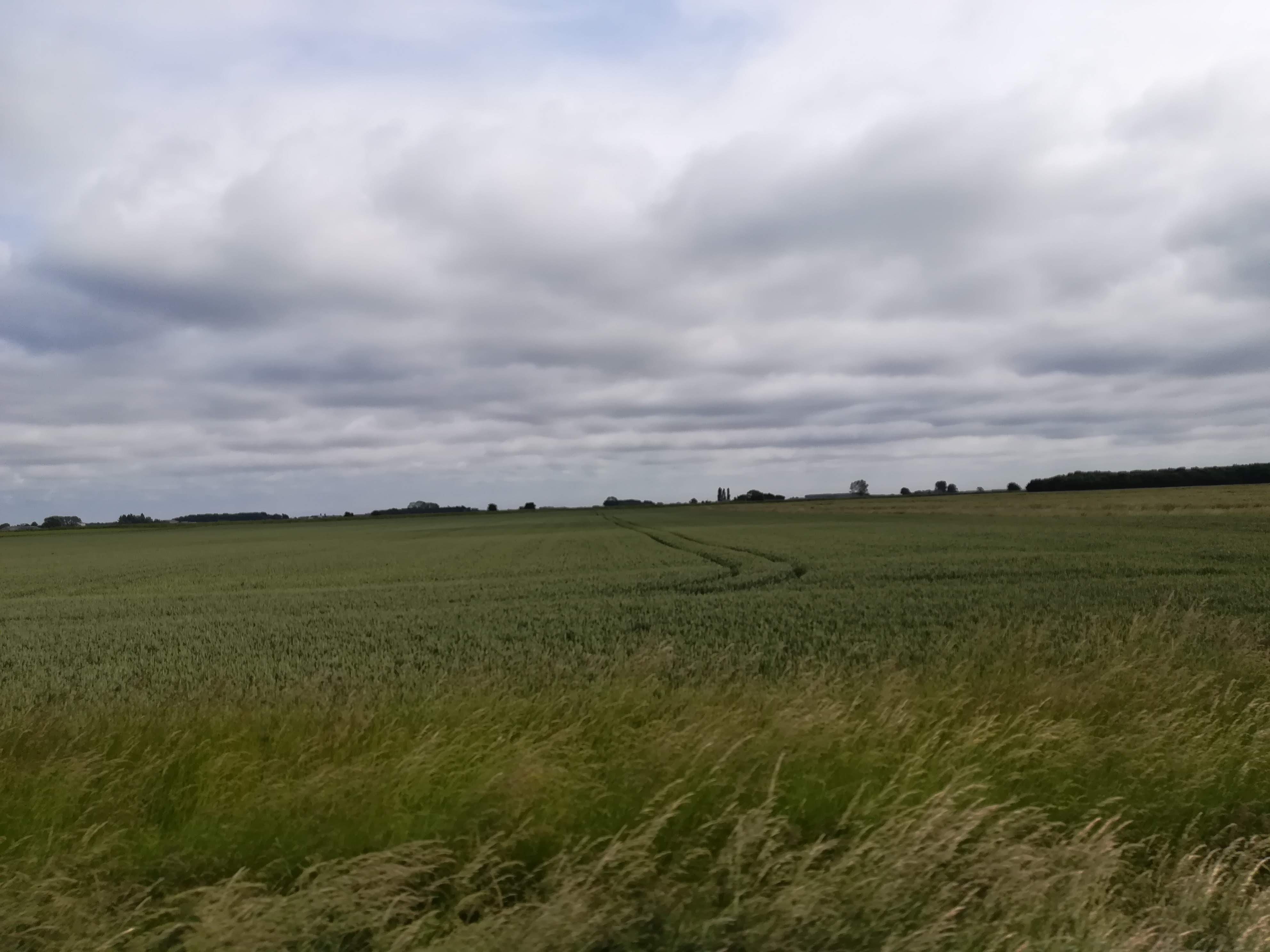
It was the change from trees and mountains in Harris, to open moorland in Lewis that really stood out for us.  North of Stornaway the peat bog (known as blanket bog) covers an area of nearly 59,000 hectares.  There are no crofts and no livestock as far as the eye can see.  Not only one of the world’s largest carbon stores, but the bog is also a haven for water birds and plays a big role in water management.  Driving across it however, makes one feel like you’re approaching the end of the world!   

Sites of Interest on Lewis:

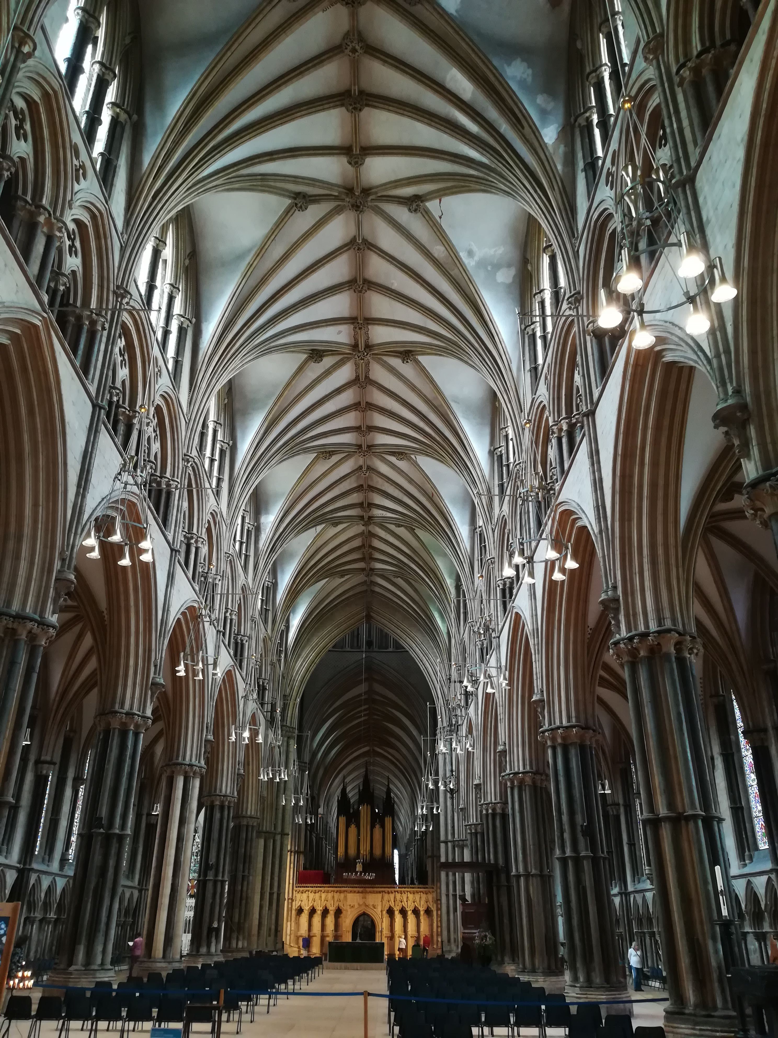
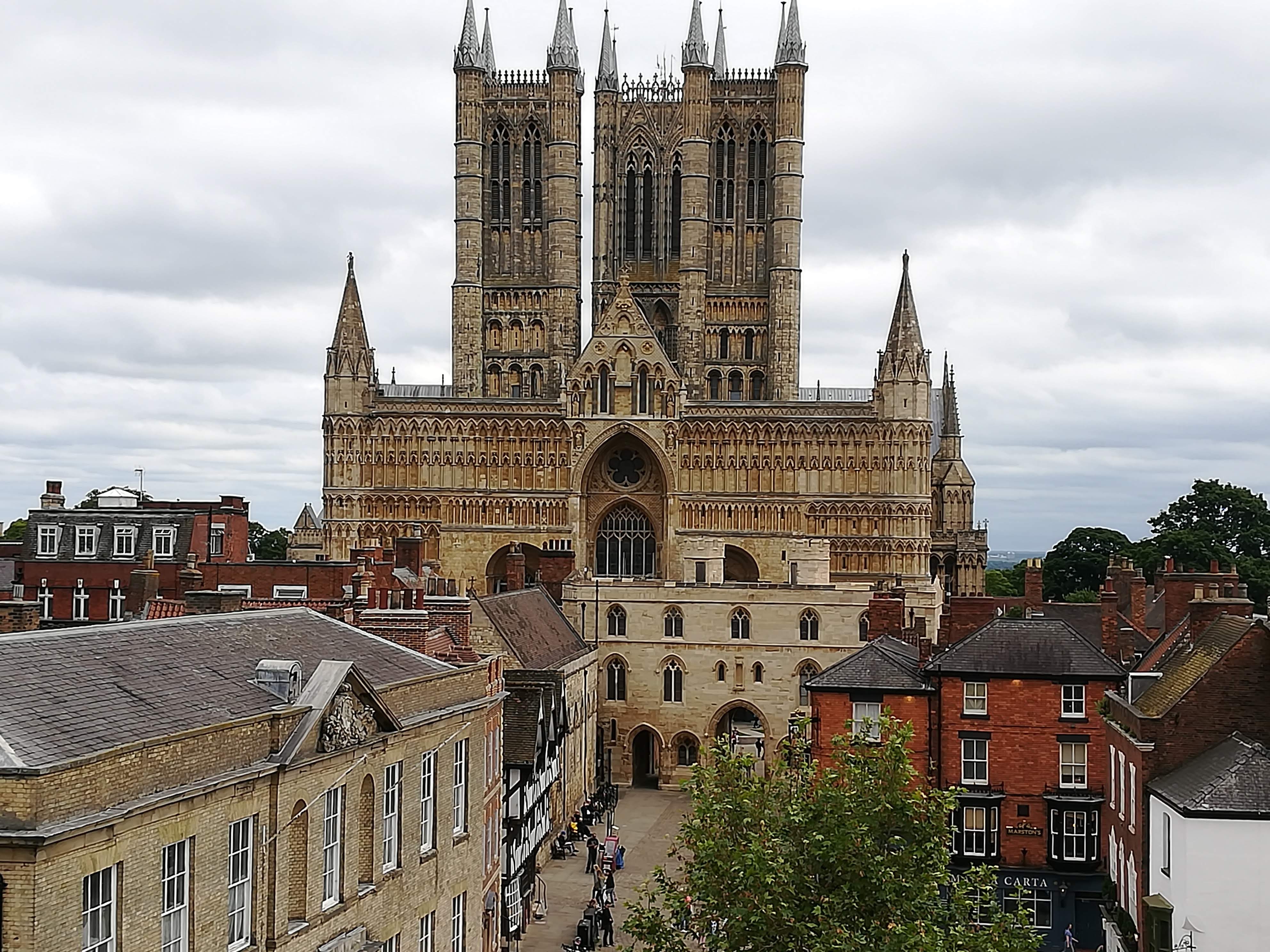
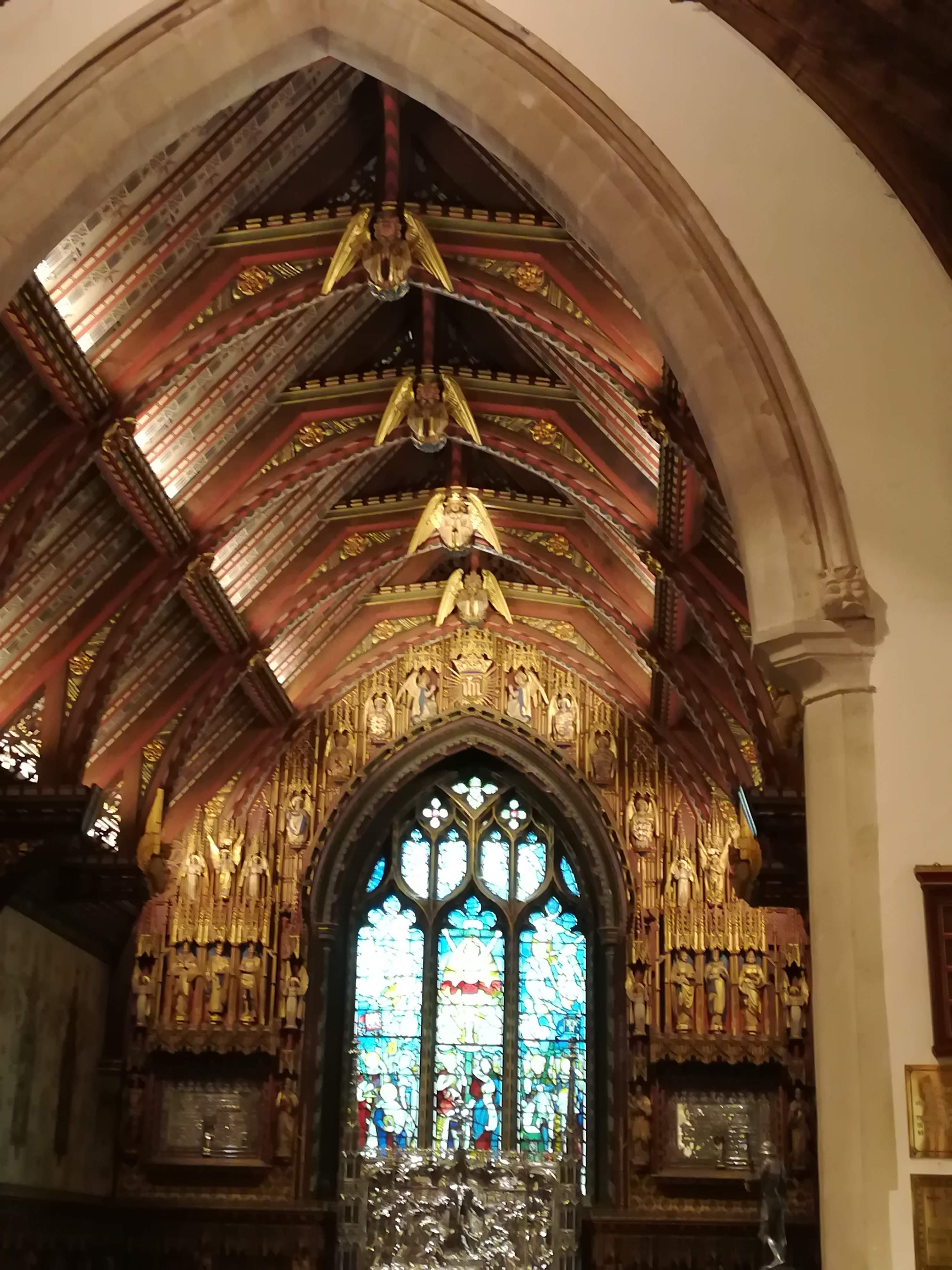
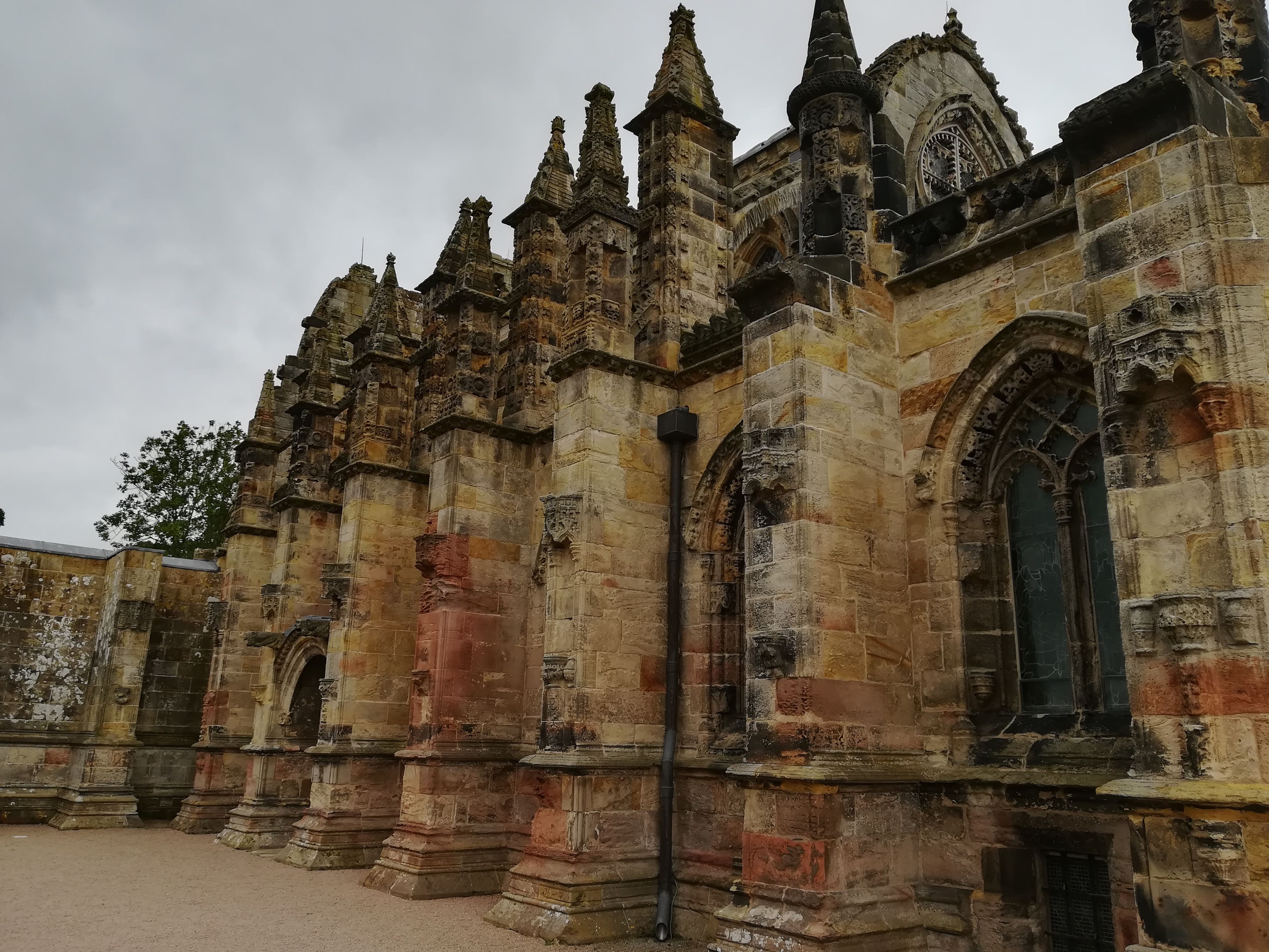
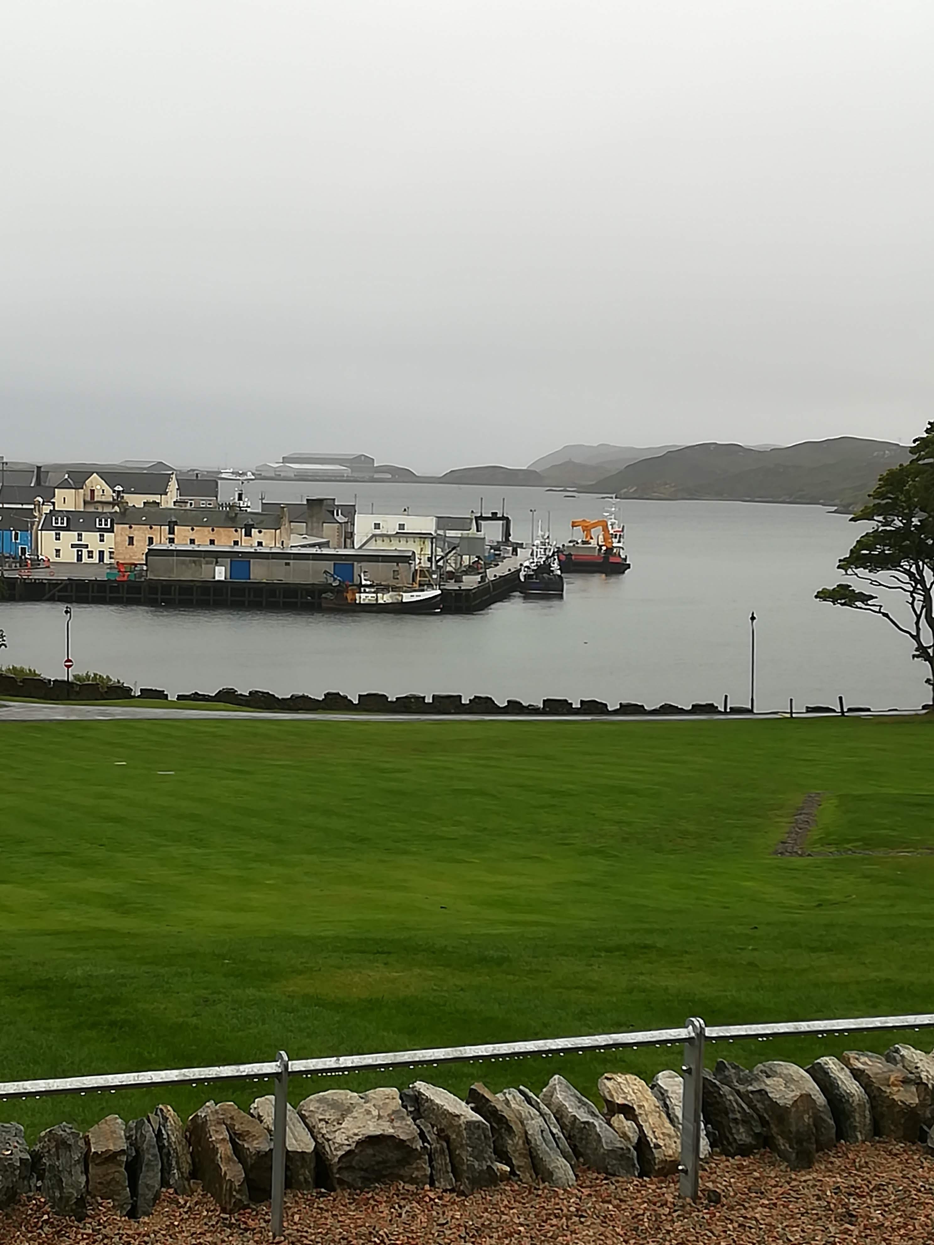
Stornaway serves as a jolt back to reality.  It has tree lined streets, big houses, lots of business and industry, as well as a busy port.  Heavy rain necessitated a day indoors, so we headed for the Museum nan Eilean.  What a find!  Opened in 2016, with interesting displays and galleries, the museum manages to humanize the many stories of fishing, farming, and singing which bring the islanders together. They have learned to live with what they’ve got and take the inclement weather into consideration at every turn.  If nothing else, the six Lewis chessmen, found in the sands of Uig in Lewis, (on permanent loan from the British museum) and thought to be 12th century are worth seeing.  Carved from walrus ivory, they are a stark reminder of just how long the intricacies of the game of chess have been testing the human brain. 

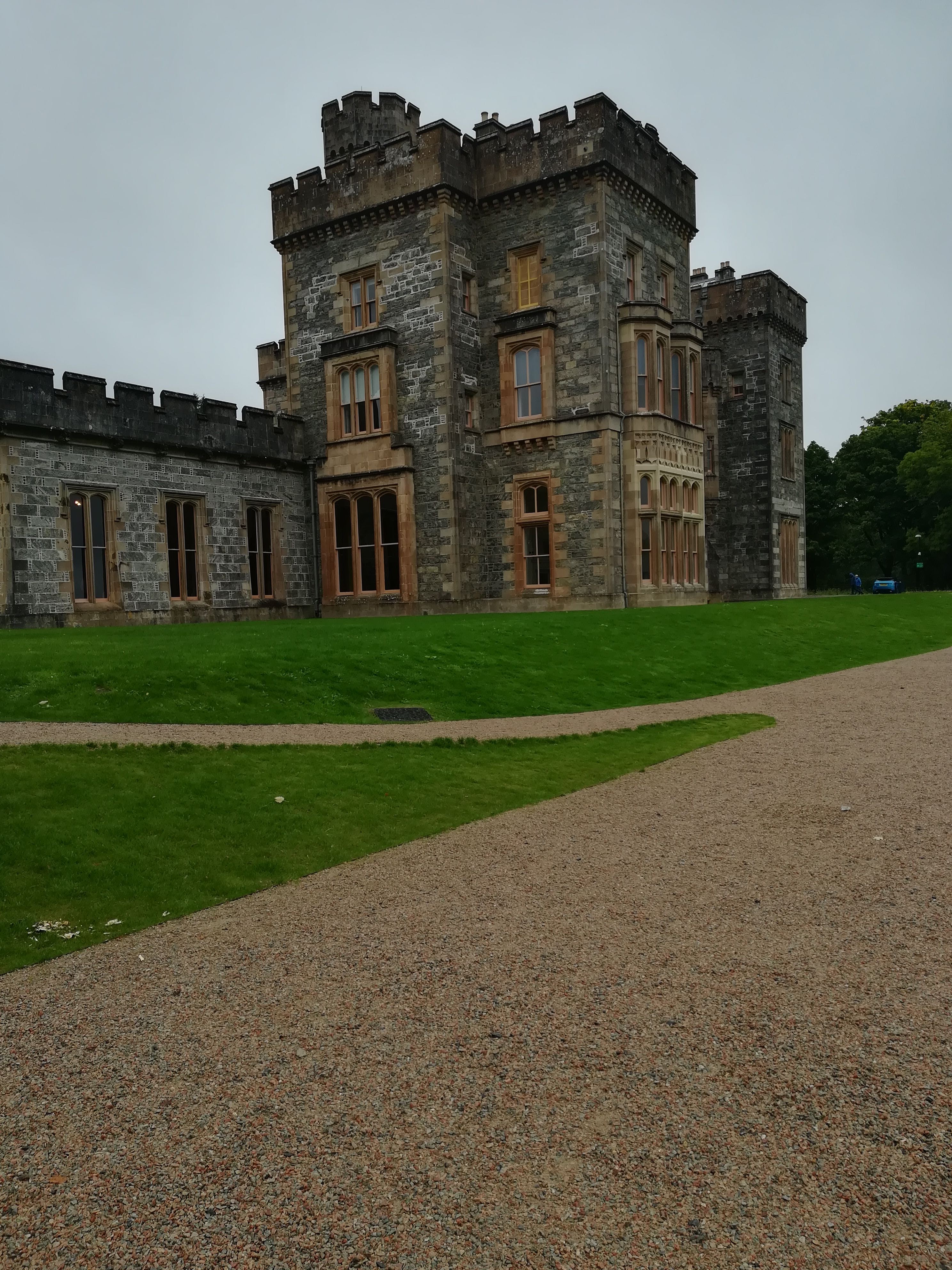
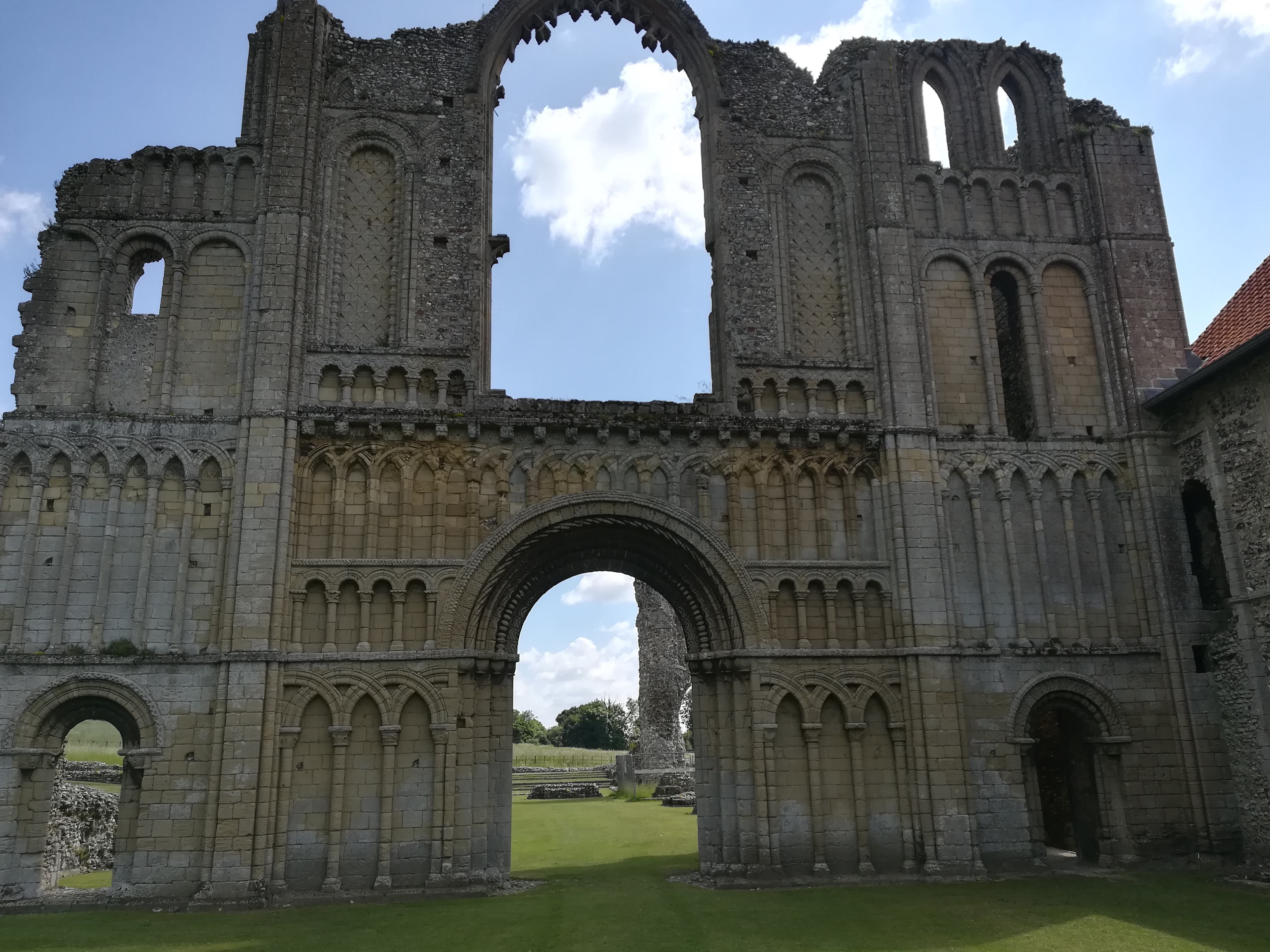
The museum is a clever addition to Lews Castle, parts of which are medieval, and recently restored. Nowadays it is run as an events centre and has accommodation on offer.  Beautiful grounds surround the castle, including a golf course (you can all guess who was looking at that with interest!) with panoramic views across the harbour.

Trushal Stone – the tallest monolith in Scotland at 5.8 metres, this stone was once part of a 5000 yr old stone circle.  Sadly, the other stones have been used over the centuries to build the surrounding walls.  The stone now stands in splendid isolation between crofts.

Livestock   – what little livestock there is live on the various crofts scattered about on the machair.  Hebridean black sheep often grow two sets of horns making them easy to identify.  Highland cattle survive well in the inclement weather conditions.

Community Centres are commonplace in the Hebrides.  Bragar, on the west coast of Lewis, has just such a centre – recently opened in an old school building.  It now has an excellent café (visited twice for its coffee and CAKES!), an exhibition room, accommodation, AND a launderette (which saved our ‘bacon’ when trying to deal with wet washing in the rain!) 

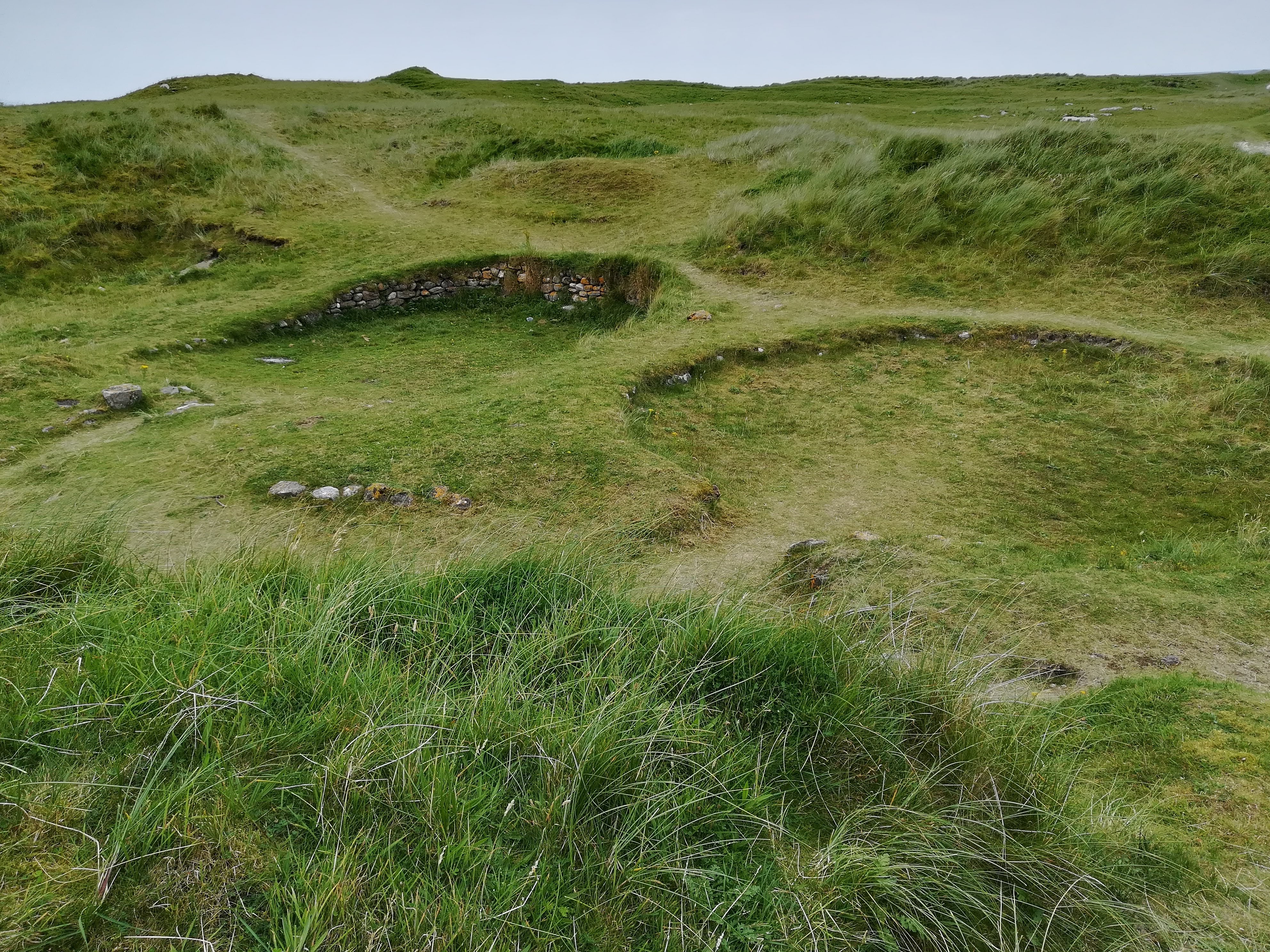
Restored Ancient Houses

A Shieling is a hut (or several) situated out in the mountain pasture, into which the family would move for the summer months to keep watch over their livestock on the higher ground.

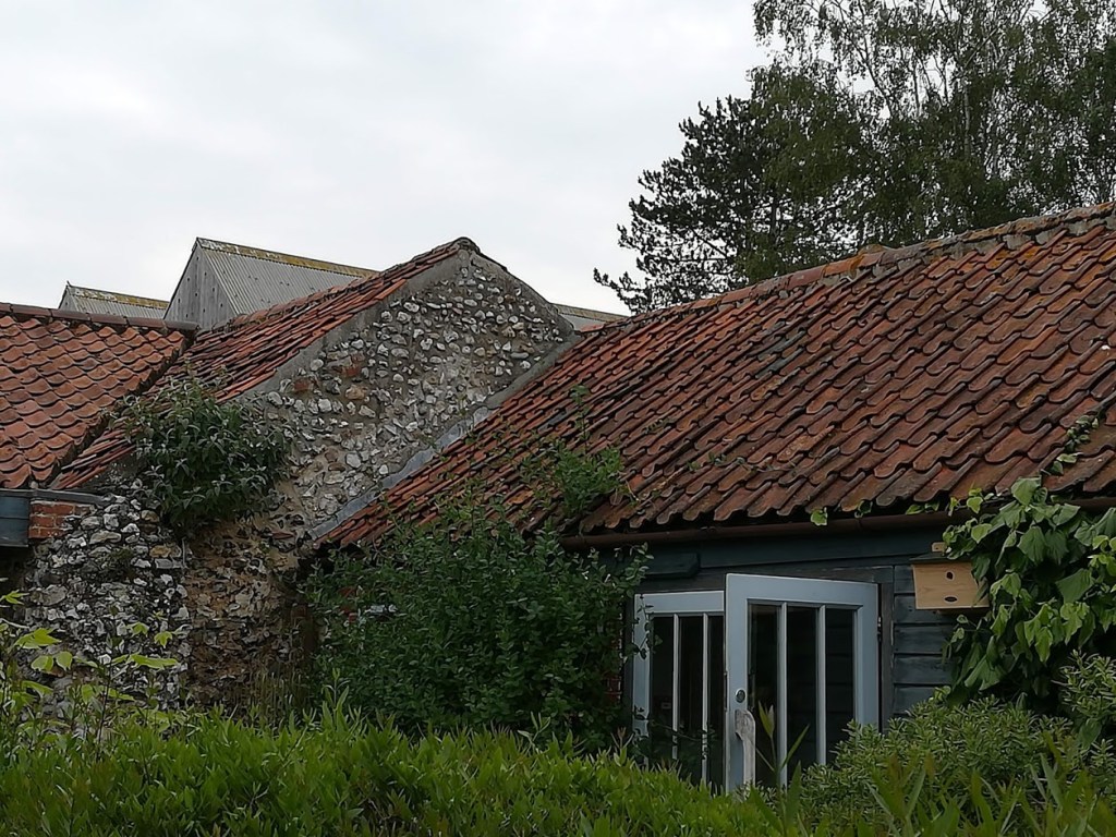
Blackhouse is the term used to describe the original dry-stone longhouse which existed here in the islands more than 1000 years ago. Double stone walls filled with peat helped to keep the families warm.  The peat fire in the living area was always kept burning.  The livestock lived in an adjoining wing on the side.  Cattle provided dairy products and meat, hens were kept for eggs and meat, sheep provided mutton.  The proximity of any livestock provided extra warmth.

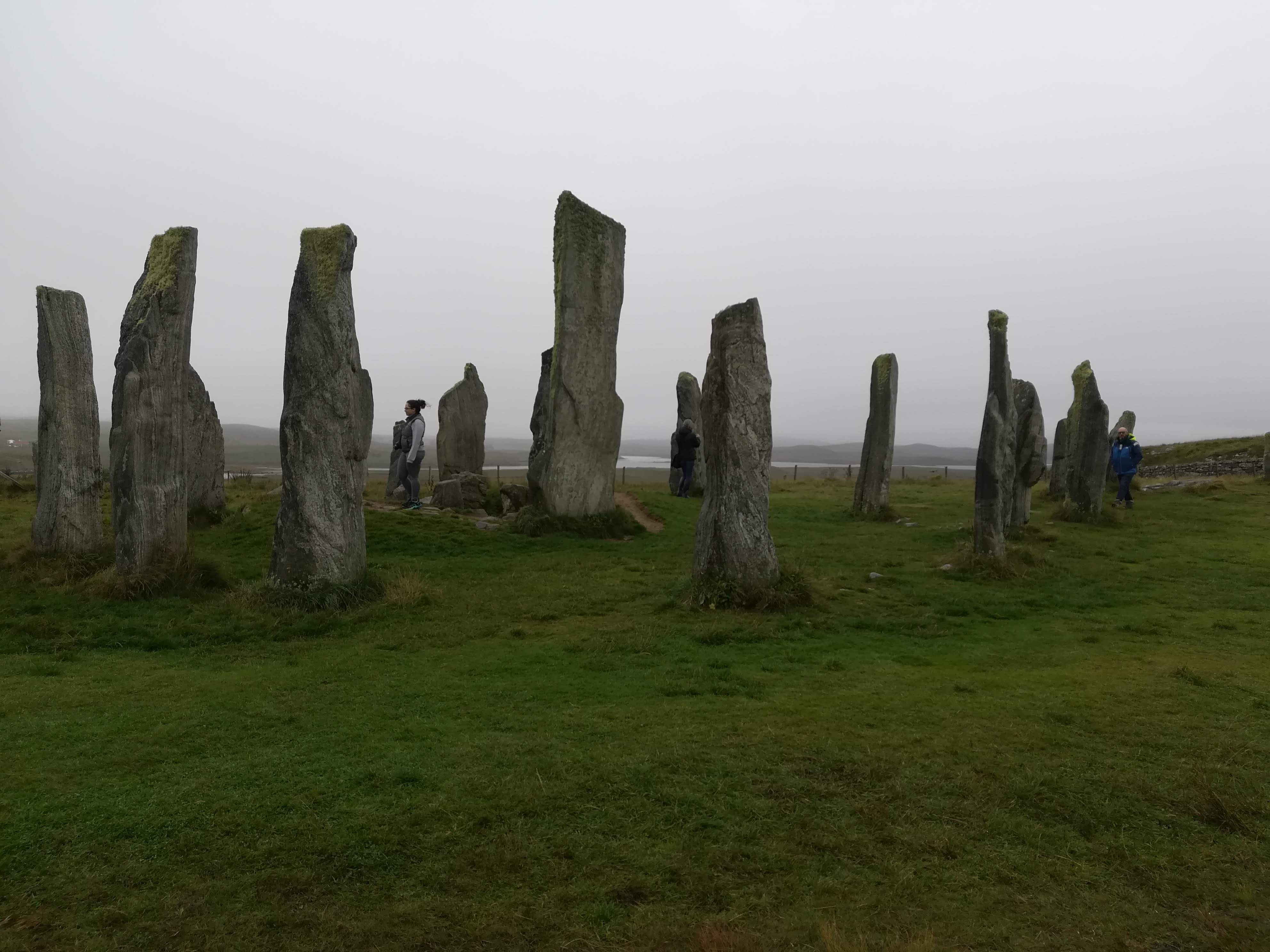
Callanish Standing Stones – said to be older than Stonehenge, this circle has a central monolith at 3.5 metres tall, which is surrounded by 13 stones, whilst avenues of other stones lead away to the points of the compass.  Built in the local Lewis Gneiss stone, it is an unbelievable triumph of strength and determination by whoever created it.  The purpose is a mystery . . . . .
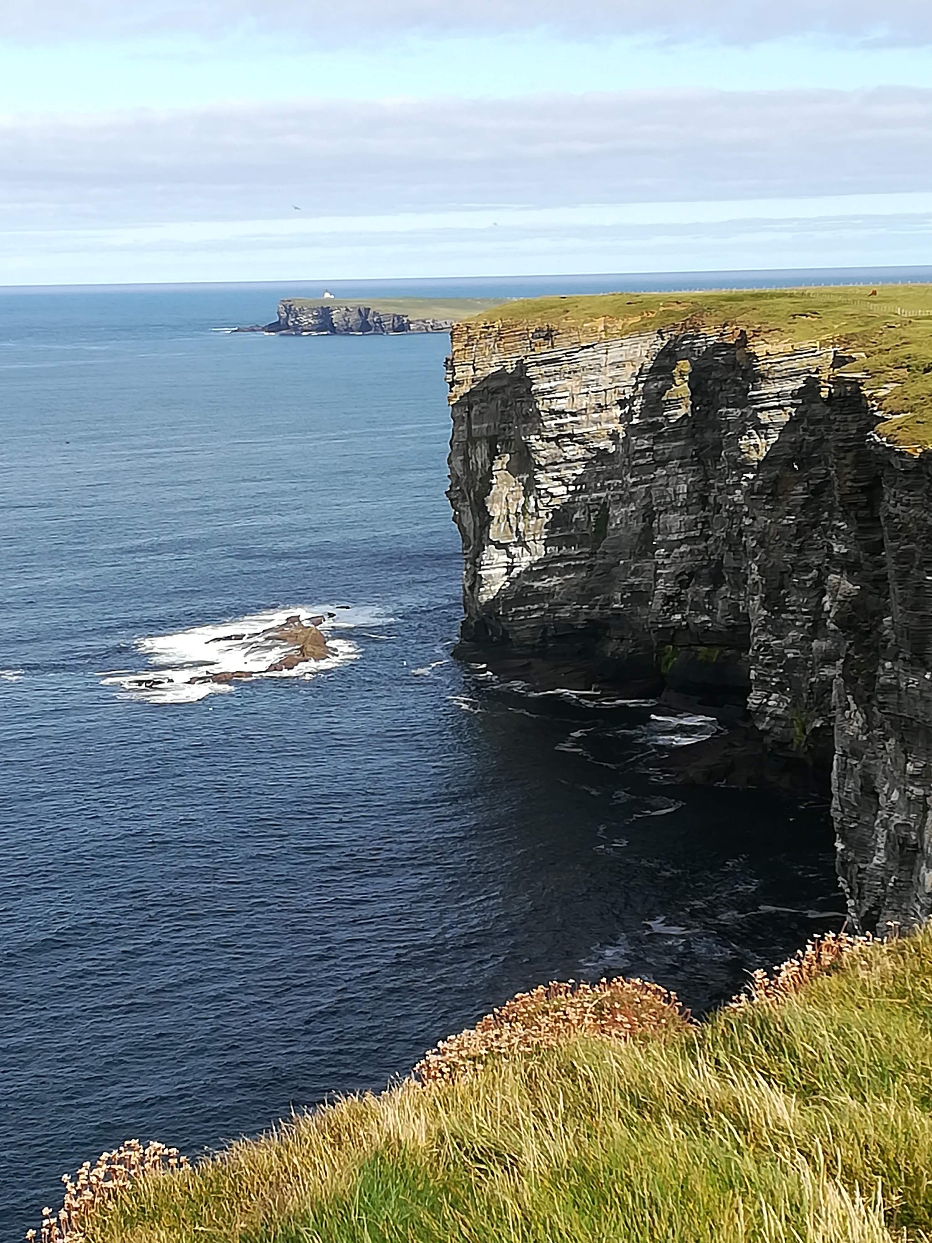
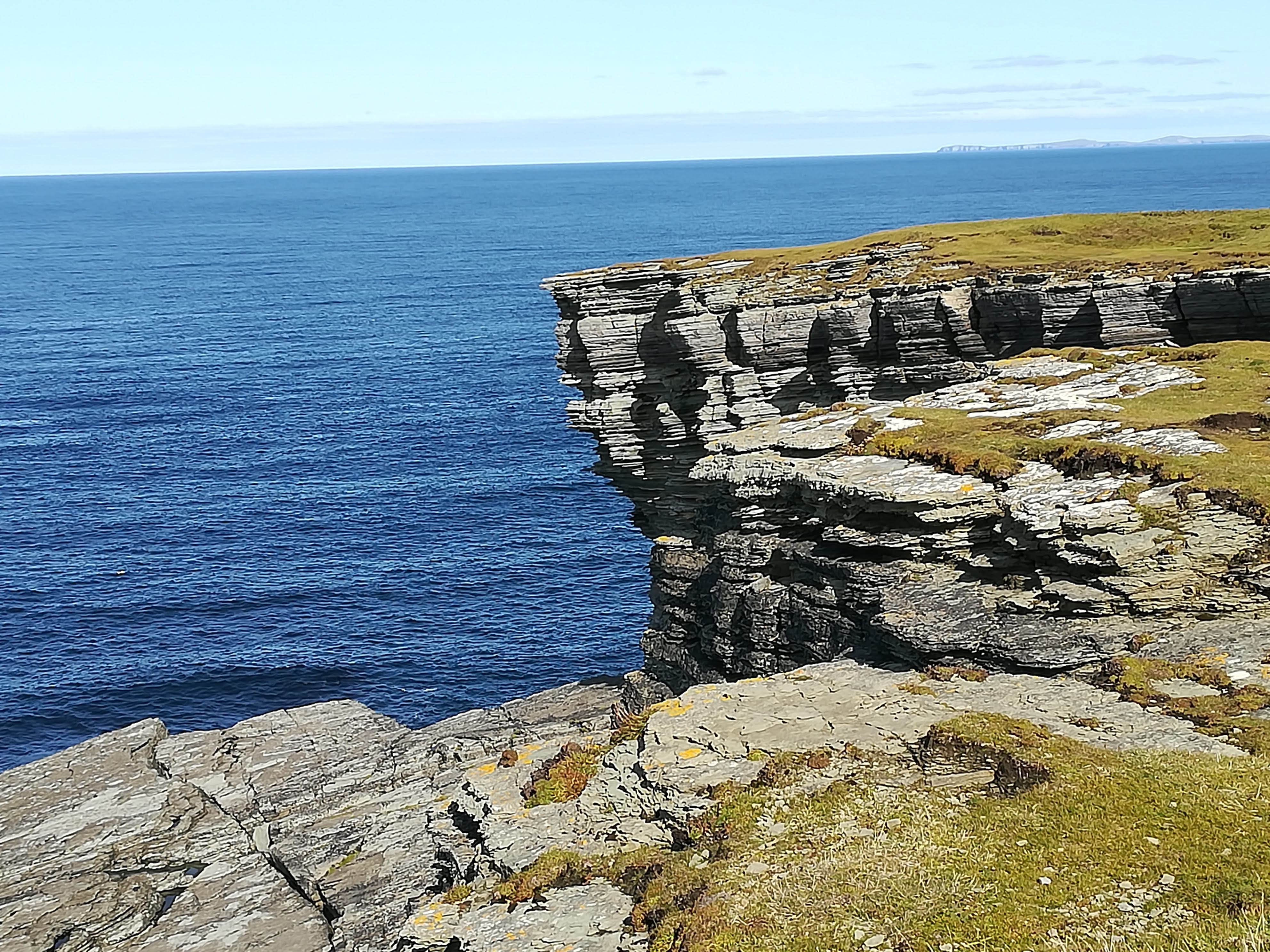
Butt of Lewis

Standing on the most north-westerly point of the British Isles and of Europe was a real ‘pinch me’ moment.  Known to be the windiest place in the UK, we were (almost) relieved that rain and fog were the order of the day.   The 60-to-80-foot cliffs tower above the broiling seas whilst seabirds swoop and slice through the winds and the waves.  The 36-metre red brick lighthouse, built in 1862, is now fully automated and controlled from headquarters in Edinburgh.  It would have been a lonely existence for the lighthouse keeper in days gone by. 

We are promised better weather tomorrow – the photos may improve!

Outer Hebrides – Sept 2021

Outer Hebrides – September 2021

Well, we wouldn’t be Marilyn and Peter if we didn’t want an adventure!  “Let’s head for the Outer Hebrides” we said.  “That’ll give Molly a good run!” 

A last-minute change by CalMac, to our ferry booking (both time and departure point!) meant two longer days travel than planned.    Setting off from Penrice at 06:30 gave us a good start and we happily pulled into a friend’s driveway near Stirling at 5pm having taken good breaks for breakfast, coffee, lunch and tea!  Thank you Alice and Clive, for providing Molly with electricity and water . . . . .

In brilliant sunshine and warmth (were we REALLY in Scotland??) the journey across the Highlands . . . Stirling to Perth. .to Spean Bridge. . to Kyle of Lochalsh was spectacular.  Scottish news is full of the lack of rainfall and their freshwater lochs are indeed very low. 

We passed the well-known Eilean Donan Castle (as seen on many a postcard and any Scottish tourist information).  For those of you with an interest in history, this is a castle on an island (a bridge now joins it to the mainland) originally built in the 13th century but destroyed in 1719.  The castle that we see today is a 20th century re-creation! 

Crossing the bridge onto the Isle of Skye, we arrived in Uig in the far north-west by late afternoon.  Plenty of time for a good walk whilst watching the ferry come and go on its evening sailings. 

North Uist:

We were blessed with a smooth, calm crossing with very few passengers onboard, in brilliant sunshine, to Lochmaddy on North Uist. 

Deciding to take advantage of the changed ferry booking, we visited a couple of historic sites on our journey south.  Sadly, we lost the sunshine pretty quickly and returned to the ‘grey’ skies we’d been used to at home! After two long days drive, exercise was needed!  We walked uphill to Barpa Langass, a burial chamber thought to be 5000 yrs old and that of a Neolithic chieftain.  He certainly enjoys wonderful views from his resting place! 

We walked on to an ancient stone circle – said to be the oldest and finest in the Western Isles – and known (in English) as Finn’s People.  It’s in a beautifully wild location overlooking one of the many sea lochs.

 Further south we stopped at Trinity Temple.  This ruin was originally a medieval monastery and college founded (believe it or not!) by a woman in the 13th century.  It is a peaceful and atmospheric site and is listed as ‘possibly’ being Scotland’s oldest university. 

Religion:

Much of the population in the south of the islands is Catholic.  There are many small statues of the Madonna, but Our Lady of the Isles takes your breath away.  At 30 ft tall, she is the tallest statue in Britain and is cleverly placed alongside the Ministry of Defence Rangehead.  Islanders want the army to remember that there is a spiritual world as well as a military/materialistic world. 

Note that the Madonna holds Christ by her shoulder as a child, rather than cradling a baby in her arms. 

South Uist:

Loch Druidibeg Nature Reserve

The possibility of seeing local birds and wildlife encouraged us to take a signed walk across this nature reserve.  Open moorland in the Outer Hebrides signal bog!  The familiar spongy ground, peppered with the odd squelch as our boots sank into the wet peat, over some 5 miles, woke up some underused leg muscles!  A multitude of grasses and heathers delighted the eye.   The waters of Loch Druidibeg gently lapped against the rocky inlets.  Did we see any wildlife?  NOTHING!  Apart from some Shetland-type ponies which roam the islands in a controlled manner so that they don’t eat the wildflowers before the flowers have dropped their seeds. 

Round Houses:

Nestled in the sand dunes on the east coast of South Uist are the archaeological remains of several Bronze Age round houses at Cladh Hallan.  Recent analysis has unearthed (excuse the pun!) human bones thought to be the first ever mummified skeletons in Britain.  Composite skeletons make up one child and two adults. . .yes, you read that correctly! Each ‘mummy’ is comprised of a head, a jaw and a torso from different bodies.  When research is completed each ‘body’ will have a new home – one in the Kildonean museum on South Uist, one in the museum in Stornaway and the third in the National Museum of Scotland in Edinburgh.  Make a note in your diaries if you’re passing in years to come! 

Having had a day of NO WILDLIFE we were thrilled to spot a huge pod of dolphins playing out to sea (too far away for photos I’m afraid).  We then enjoyed watching literally HUNDREDS of rabbits playing in the dunes – a proper Watership Down it was!

Loch Eynort:

We couldn’t resist the lure of a woodland, so ventured down an extra narrow side road, with fingers firmly crossed that we would be able to turn Molly around at the ‘dead end’. 

We discovered a good parking area and set off to explore this area of forest restoration.  The vision of one man – Archie Macdonald – who has planted more than 100,000 trees over many years, proving that trees will grow on the Outer Hebrides if you keep the deer and sheep away from the saplings. 

It was to be our lucky day!  As we walked along the 5 km of paths enjoying the variety of trees, and some birdsong, we noticed an elderly gentleman working away within a fenced area.  We stopped to chat – only to discover that we were speaking to THE gentleman himself!  As you can imagine . . .a wise old chap, born and bred in the area and returned after the war – he now lives in a lovely bungalow alongside his ‘project’, which spreads across the hillside behind him.  Views to the south overlooking Loch Eynort complete the scene.  His vegetable plot had plenty of seasonal vegetables – his main complaint was the lack of rain (yes! We really ARE in the Outer Hebrides!) and the local rat and rabbit population who firmly believe the veg are for them! 

We walked the entire outer path of his plantation, relishing the wonderful swathes of purple in the heather.

Then ‘drinking in’ the fabulous views both of the inland lochs and out to sea from the highest point.

Kelbride campsite on the south coast of South Uist made a perfect stop for our few days in this area – far reaching views across the Sound of Barra – large pitches and all facilities spotlessly clean.

Eriskay Island: A causeway (built 2001) links Eriskay (south and slightly east of South Uist), a tiny island of about 200 people which spreads 3 miles north to south, and only 2 miles east to west!  Leaving Molly overlooking one of the many pure white beaches,

we headed across the moorland following a walk recommended for seeing wildlife. Plenty of scrambling through waist high bracken, and clambering up rocky slopes rewarded us with a good number of grey seals lying about in the rocky inlets. 

An Overview of the Islands so far:

This chain of 119 islands (only 14 are inhabited) off the west coast of Scotland can only be described as wild and wonderful.  The few trees that exist have been carefully planted as small, forested areas to attract wild life.  Otherwise, there are miles of low rolling hills – the highest being just under 800 metres above sea level – interspersed with many lochs of both sea and fresh water.  Acres are peat bog give way to huge rocky outcrops.  Long white sandy beaches appear at every turn. 

Houses are well separated, each crofter having their own parcel of land.  Many ruins still stand as evidence to the historic clearances.  Nowadays, later generations are returning to the family land and settling into their recently built modern-day houses.  Gardens are low maintenance but always neat and tidy.  Strong and sturdy shrubs – heathers, montbretia, fuchsias – are planted to withstand the ever changing and often violent weather. 

And then there are the roads – often single track with passing places, but a good number of passing places.  The locals are not only friendly (everyone waves at EVERYONE) but also very happy to give way to us foreign motor homers with a smile and a wave.  Road surfaces are good (way better than Herefordshire!) and the undulating landscape gives a roller coaster type ride as Molly negotiates the little peaks and knolls. 

Causeways link most of the inhabited islands, making our journey down the islands a doddle.  Isolation must have been a major problem when the only means of crossing was to wait for low tide, or later by ferry.  Nowadays islanders from the south can work/shop/visit the north with ease. 

We move onto Benbencula now – more later . . . . .

Lincolnshire – June 2021

Driving north-east from Kings Lynn, we motored into Lincolnshire.  The weather was NOT on our side for this journey – it was dull, grey, and misty with clouds of rain sweeping across the VERY flat fens.  As the weather lifted, we enjoyed the odd splash of colour as we passed fields of poppies – such a welcome boost in the otherwise unending shades of green in this fertile area. 

A visit to Lincoln Cathedral was our main goal and we were not disappointed.  For those of you who have not visited Lincoln, imagine any one of the many impressive cathedrals this country boasts – but then multiply that splendour ten-fold!  The sheer size of this spectacular building is astonishing.  From its beginnings in 1072, it is rich in history, all of which I shall leave you to research if you’re interested.  We were lucky enough to attend Evensong – which took place in the choir stalls of St Hugh – listening to six excellent lay vicars singing (often in six parts!) – and pinching ourselves that we really were taking part in a service in one of the most magnificent cathedrals in the world. 

The cathedral is built high on a hill, alongside the castle.  Lincoln Castle was built by William the Conqueror in 1068 on a site that has been occupied since Roman times.  Again, the history is ‘heady stuff’ (including some beheadings!) and worth some research.  A walk around the medieval walls was informative as well as offering breath-taking views in all directions.  The Castle prison was set up with a ‘separate system’ which was an isolation regime to keep prisoners from ‘corrupting’ each other.  This included a daily visit to the chapel where prisoners sat in ‘separate’ divided seats.  Our tour guides divulged all sorts of stories over the continuous power struggles, as well as the clever building techniques of the 10ft thick walls. 

The Castle and Cathedral areas can be approached by the famous ‘Steep Hill’ route, which is just what it says on the tin!  A very steep hill, lined with all manner of shops, boutiques and cafes.  The cafes do a roaring trade mostly from exhausted tourists who stop to catch their breath and have a drink! 

Snipe Dale Nature Reserve gave us a little insight into the Lincolnshire Wolds.  Wonderful to experience some hilly land again – and in this case, particularly wild and uncultivated land.  Cattle are used to encourage the wildlife – but otherwise, nature is left to its own devices.  We were amazed to find that we crossed the Greenwich Meridian – another little gem to add to our many memories of this trip.

  Home tomorrow – and we’re already planning our next trip!   Watch this space. . .

Discovering Norfolk – June 2021

Hello again to friends and family!

Thanks to Covid, we’ve been out and about in Molly far less than we would have wished. A long weekend in Pershore enjoying the sunshine and numerous beautiful walks – and a full week on the south coast staying in Weymouth, where we managed to catch up with friends and family, but also to support and cheer on daughter Sarah and her partner Matt who were doing the Jurassic Coast challenge – 100 km over two days. We had a great time, despite high winds and driving rain for most of the week.

And so to Norfolk – one of many places in the UK that we’ve never visited. Friends who’ve lived here in the past said we were missing a treat . . . . and they were correct!

Yes, it’s very flat (in some areas) but beautifully green and lush, with acres of bountiful crops. Farm shops and road side stalls are full of freshly picked fruit and veg – what a wonderful excuse to be gluttons of healthy food! The countryside is dotted with pretty villages, all beautifully kept with colourful gardens, and with many of the local traditional houses constructed of flint with a red pantile roof. Pantiles originally came to UK from the Netherlands in the 1700’s, and are a type of fired roof tile normally made of clay. Apparently the colour is controlled by the degree of reduction in the kiln. The glorious terracotta tiles appear from some distance away (thanks to the flat land!). These days, houses are built of the local red brick, which sets of the tiles very well.

Pantile roof and flint building – typical of Norfolk

We’re staying on an idyllic campsite here – it’s a CL – for those non-campers among you this is a Certified Location. ie Certified by the Camping and Motorhome club as having fresh water on site, as well as chemical and rubbish dumping facilities. There are only 5 pitches on these sites – hence they’re very quiet and peaceful. This one is in a small orchard with each pitch bearing the name of the tree that used to (or still does) grow here. We have enjoyed relaxing here each evening, after a day’s exploring.

We’ve barely scratched the surface of Norfolk – there is so much to see and do. Sandringham Estate was a ‘must do’ for us and what a joy it was. We felt privileged to visit the very rooms where the Queen and the Royal family retreat to every Christmas. We were not allowed to take photos indoors, so you’ll have to look on Google! The grounds were a delight as well – not formally laid out, but neatly kept and in tune with nature.

We were lucky to visit on a day when the church was open. I’m sure we’ve all watched the Queen arriving here on TV, but we were astounded by how tiny the church is. The intricate wood carvings – many angels with musical instruments – and the stunning silver engravings on the pulpit and the altar are breath taking.

Kings Lynn proved an interesting visit – far too much history to absorb within one visit – the town began in the early 1100’s and was an important trading post thanks to the waterways which stretch inland from The Wash.  The narrow streets near the harbour house some stunningly restored buildings, very few of which were open thanks to the pandemic. 

Our journey to Castle Acre Priory was a bit of adventure!  Valiantly following the English Heritage signs, we had not noticed the warning for a narrow road . . .we were already committed when a further sign warned us of no access for anything wider than 6’6”  (Oh Dear! Molly is 7’7” even with mirrors pulled in!), so with much cursing and gnashing of teeth, (not to mention the disgusted looks from other drivers) we had to turn around and find another entrance to the village.  Note to anyone who ever visits Castle Acre – avoid the Bailey Gate – it’s very narrow!! 

Worth the aggro however – the Priory dates back to 1090 and is one of the best-preserved monastic sites in UK.  It was home to the Cluniac order of monks whose divine adoration led to the extensive decorations throughout.  Much of the splendid west end door remains, along with exquisitely preserved flint walls stretching over a huge area. As with any ecclesiastical setting, the sense of peace was overwhelming and we were uplifted and calmed by our visit.

As we explored along the (highly recommended in tourist guides) coastal route from Blakeney to The Wash, we were disappointed by the height of the hedges.  Despite the height that we sit in Molly, we were unable to see the sea views in many places. Our patience was rewarded however, when we reached Holkham.  One of many nature reserves in this area, spreads across wetlands, through the sand dunes and onto an enormous beach.  A 20 minute walk led us from the enormous car park, over the Norfolk coastal path and down to the sea.  Miles of wonderful white sand – and notwithstanding the hundreds of cars in the car park, the people had all but disappeared into this vast space. 

We were delighted to discover a sea (excuse the pun!) of wildflowers just behind the dunes . . . nature as wonderful as ever!

Pensthorpe Nature Reserve is a 700 acre woodland conservation park, absolutely brim full of wildlife. It was a pleasure to meander along the many paths, through the various gardens, and in and out of enclosures which protected many bird species. This place needs many more visits – it would be a great place to take a picnic to enjoy on one of the many benches whilst taking in the many birds around you.

Today we’ve moved on from Norfolk to Lincolnshire – more later. . . . .

Homeward Bound

Sadly, all good holidays must come to an end . . . . . .   I’m quite sure that most of you (‘my readers’ as the regular bloggers call them!)  will have travelled through mid-Scotland, through the borders and down the M6, so I’m not going to bore you all with details of the journey.  A few highlights and a few more photos will be sufficient, before you nod off to sleep . . . . . .

In Ullapool, the previous night’s storm gave way to clear skies and sunshine – stunning scenery and weather for the remainder of our trip home.  From Ullapool, we headed south east towards Inverness, having decided to leave the last section of the NC500 (Gairloch circuit) for another planned trip to Skye and the outer islands.  We had a coffee stop and a good walk at Corrieshalloch Gorge, where there is an impressive 45 metre high waterfall which was cut through, NOT by the present river, but by an underground glacial river during the IceAge!  A suspension bridge and various viewing platforms helped us to get a true idea of the sheer force of water. . . .

Sunshine & blue skies at Ullapool – Ferry to Stornaway in the background
Corrieshalloch Gorge
A typical Scottish scene!

We spent the night on a site at Foyers on the eastern side of Loch Ness.  When we arrived everyone was sitting outside enjoying the afternoon sunshine (again, we were really in Scotland on 23rd Sept?)  There were notable changes in the countryside from rolling hills and agricultural farmland to more mountains, lochs and forested areas.  The journey through Glencoe is breathtaking – if you haven’t done it, you’re in for a treat. 

Glencoe
Glencoe

If anyone finds themselves in need of a break from driving whilst on the M74, south of Glasgow, we can recommend the little town of Lochmaben, near Lockerbie (junc 17/M74).  There is a very nice 5km walk around Castle Loch – and a good bakery in town (Graham’s Bakery) who do quiches etc for lunch.  Drive into town and use the carpark near the church – easy access to both the walk and the town.

Castle Loch at Lochmaden
One of many clever carvings on the walk around Castle Loch

A further recommendation would be for the campers amongst you.  Go to the tiny campsite near Crooklands – Kaker Mill Farm – ring ahead to book. This is five minutes off the M6 at Kendal, and makes a perfect stop going north or south. 

Safely home (and busy planning our next trip!), we are so thankful for a wonderful journey of discovery and good weather to boot!  See you next time . . . . . .

Thurso to Ullapool – NC500

Thurso to Ullapool – The N 500

Having read lots of glowing reviews of the NC500 route across the north of Scotland, we were eager to drive it, but concerned that it may not live up to reviews.  NO WORRIES!  This route gets an A* rating every step (or mile) of the way! 

From Thurso, heading in an anti-clockwise direction (as advised in the guidebooks), we crossed miles of spectacular moorland.  From the purple hues of the heather to the yellowy-bronze of the autumnal bracken, the acres of peat bog never failed to please the eye.  Known as ‘blanket bog’, this 1544 square mile expanse is reputed to be the largest in the world.  The peat can be up to ten metres deep and acts as a valuable carbon ‘sink’ in the fight against climate change. 

Heathers and bracken
The Autumn colours

Of interest to our military friends, we passed the Dounray Nuclear Power Station, now being decommissioned, but originally built to trial the reactors for the first of the British nuclear submarines.  Local unemployment figures will rise sharply in 2025 when it closes – there must have been 1000 workers cars in the carpark! 

Strathy Point was our lunch spot, and we enjoyed a good walk out to the cliffs where we sat watching seals playing close to shore.  The tide was turning and we hoped to see dolphins (or a whale or two) but no luck, yet! 

The rocky climb out to Strathy Point

Driving west, mountains began to appear in the distance.  The rolling hills around us became higher and rockier.  This amazing road sweeps around bends, over rivers, and up and down hills.  In many places it is single track with passing places which kept the adrenaline levels high as Molly constantly pulled in to let oncomers through (often other MoHo’s!).  But the awe-inspiring vistas around every corner and from the top of every hill far outweigh any challenges in the driving.  Bettyhill is a pretty little settlement these days, but with a very sad history – it was originally settled by tenant farmers who had been kicked off their land during the Scottish Clearances (google it!).  Unfortunately, none of the museums along the way were open, due to Covid, so we ‘made do’ with Google.

Breathtaking views around every corner

The moors slowly disappear making way for rocky outcrops, velvety green fields, and stunning lochs and inlets.  The weather was still dry with no wind hence the reflections on the water were exceptional.  Many of the inlets boast long white sandy beaches.  The tiny settlement of Laid on Loch Eriboll was our next stop.  This little CL (certified location for the non-campers amongst you) is a gem – just the five pitches, all overlooking the loch with mountains in the distance.  We had two nights there and were again blessed with a glorious warm, sunny day during which we were delighted  to sit reading in the sunshine, and take a stroll along the water’s edge!  More ‘pinch me’ moments as I sat in sun top and shorts – am I really in the far north of Scotland in mid-September??

Breakfast in the sunshine
Deserted white sandy beaches

Setting off before breakfast (we were eager to see more!), we were rewarded with the sun peeking through the early morning mist in places. 

The early bird gets the worm! The sun just peeping out . . . . .
Mountains appear out of the morning mist

We took a VERY challenging sideroad out to Kinlockbervie – a walk among the sand dunes eventually led to a magical white sandy beach – deserted!  Lots more single track road along the N500, and many more WOW moments as we came across another amazing view. 

Challenging narrow roads . . . . lead to good things!
Stunning vistas – note road going off in the distance.

Scourie is a tiny hamlet about half way between Durness and Ullapool.  We spent a week here in 1974 for our honeymoon!  The discovery of a campsite made a return visit seem very fitting – for old time’s sake, you understand!  There are a few more houses in Scourie these days, AND a very good campsite, right on the edge of the harbour (if we let the handbrake off, we’d be in the ‘oggin’!)  Sadly the hotel where we stayed has closed after a very short season (thanks to Covid).  Instead, we enjoyed a long lunch at the Kylesku Hotel just along the road, which not only produced delicious food, but had wonderful views down the Loch.

Scourie
View from Kylesku Hotel

Today’s journey from Scourie to Ullapool continued on much the same theme – stunning countryside with mist covered mountains looming in the background.  Sadly the weather has become very ‘Scottish’  . . . . . . . high winds and rain showers.  Ullapool is a thriving community.  The campsite is enormous, but right next to the sea – all toilet and shower facilities on site are closed due to Covid (as we have seen in many places),  but it is still a place to safely spend the night, plugged into electricity, and with facilities to empty toilet ‘cannister’s, dump ‘grey water’ and fill up with fresh water.  As I sit here, ready to post this out to you, Molly is being buffeted by the gale force winds (you’d think we were at sea!) and heavy rain is pounding on the roof!  What a change from just two days ago . . . . . .

Our pitch at Ullapool – Couldn’t get closer to the water!!

The Magic of Orkney

Continuing up the east coast . . . . . We spent a night on a campsite on the Black Isle  (‘Black’ because it used to be covered in dense woodland and ‘Isle’ because two bodies of water may have originally made it an Island)  We were located half way between Rosemarkie and Fortrose  – Rosemarkie, in particular, took our fancy!  Lovely houses overlooking the Moray Firth and a feeling of great community spirit  – (a little too far from the grand children though!) 

Two of the negative effects of the pandemic have been plain to see as we’ve travelled along the coast.  Lots of oil rigs are now moored just offshore, currently redundant – a cruel reminder of the numbers of workers who must be waiting at home with fingers crossed that their jobs will survive.  The other effect which perhaps we notice more as MotorHomers, is the ENORMOUS number of MoHos on the road.  People have realized that it is a safe and fun way to get around the country.  Sadly there are not sufficient campsite places to match the number of motorhomes. The result is that they are parked all the way along every seafront and in any space possible!  All this is understandable,  but leaving piles of rubbish by the roadside is beyond comprehension.  (enough of my ranting)

Back to the positives!  Travelling in your ‘home’ as it were, allows you to stop and make a coffee when you fancy it – don’t forget that I’m married to a retired Royal Marine, who just LOVES his map reading!  Winding our way along a very narrow road, we found our way to Lock Fleet Nature Reserve where we spent a happy time drinking our coffee in the sunshine, whilst watching seals frolicking in the sea.  (no photos! too far away!) 

Coffee overlooking the Moray Firth – seals were frolicking in the bay

The road up the east coast is fairly narrow, though very easy to drive.  That is, until you get stuck behind not one, but two VERY large wide loads complete with police escort! Two industrial units were being moved, and any oncoming traffic was stopped and moved to the side – big lorries certainly gave us a few ‘breath in’ moments!  However, it did ensure that we went at a snail’s pace, allowing lots of time to enjoy the countryside and views as we went.  Some 40 minutes later, (by which time there must have been a three-mile queue behind us!), the police were able to let us all through on a conveniently wide piece of road. 

Reaching John O’Groats was a bit of a let-down, and I’m afraid we didn’t bother to find the famous signpost to take the usual selfie!  Instead we continued out to Duncansby Head and had a lovely walk in the afternoon sunshine, watching thousands of seabirds nesting on the sheer cliffs.  The sandstone ‘stacks’ in this area are impressive, but difficult to get the right affect with the camera.

Sandstone stacks at Duncansby Head near John O’Groats

A visit to Dunnet Head was a must.  The most northern point of the UK mainland, its sandstone cliffs can be seen from many other parts of the coast.  Molly has done well, so far, at negotiating the tiny roads out to these headlands!  AND Peter does well at spotting a parking space, and then directing me as I reverse into the tiniest of spaces  – team Reynolds at work!

Dunnet Head, the most northern point on mainland Britain

An early start was required in order to catch the ferry to Stromness in Orkney from Scrabster on the mainland.  Needing to be in the queue by 07:15 meant that we had time to put the kettle on and have our breakfast whilst waiting to board.   Having heard horrific stories of the Pentland Firth being known for its rough seas,  we were so thankful that there was VERY little wind – a lovely smooth crossing of just 90 minutes.  There were good photo opportunities whilst passing the Old Man Of Hoy as we neared Stromness.  And, for the first time ever, in all our years of travel, we were first off the ferry – Molly just happened to fit directly in front of the drive-off ramp – perfect!

The Old Man of Hoy

 Orkney is often described as ‘magic’ or as a ‘taste of heaven’.  I cannot put my finger on what makes it so, but IT IS BOTH OF THE ABOVE AND MORE!  It is blissfully peaceful, made all the better with Covid rules, which means that there are presently NO busloads of tourists visiting the islands.   It is not flat, but undulating, there are no trees, but many shrubs (all leaning in the direction of the prevailing winds), many miles of arable farmland with little crofts dotted about.  Healthy looking cows and sheep enjoy the green pastures.  The bulls are all ENORMOUS & MEAN looking – is there something in the grass here?  The sheep often cling to the clifftops, and yet seem to know just how close to the edge they can go!

Kirkwall was our first stop – it’s the capital of Orkney with a population of only 9500.  St Magnus’ cathedral dominates the centre of town with its beautiful sandstone walls.  It was founded in 1137, and presently belongs to the people of Orkney.  A light rain shower drove us into The Daily Scoop  (what a great name for an ice cream shop!) where we enjoyed a panini and watched the locals – socially distanced of course! 

St Magnus@ Cathedral, Kirkwall

But a visit to Orkney is really a history lesson in the making!  Scapa Flow looks like any other body of water yet is well known for the scuttling of 52 German ships during WW1, so that they ‘couldn’t get into enemy hands’.  Seven of those ships remain on the seabed.  Remains of shipwrecked blockships are still visible above the water.  Despite the blockships used during WW2,  a German UBoat managed to enter Scapa Flow and sink HMS Royal Oak, killing 833 crew.   Churchill immediately ordered the construction of four permanent barriers.  Over four years, thousands of tons of rock were dropped into 59 feet of water as a base.  66,000 concrete blocks both small and large make up the core and the sides of these spectacular causeways.  An impressive engineering feat.  These days the causeways connect five of the islands of Orkney, making movement and transport very easy. 

One of the Churchill Barriers, Orkney

There were many Italian POW’s housed on Orkney.  Not only did they help with the construction of the Churchill barriers, they also created a chapel as their place of worship.  Two Nissan huts were put together, end to end, to form the Italian Chapel.  An artist among them provided the inspiration for the beautiful and thought- provoking painting.  As you enter the chapel, you think the walls are brick and that there are clever stone carvings everywhere – No, it is all paint!  Brilliantly done, and now being preserved by the residents of Orkney.

The Italian Chapel

We have been truly blessed with the weather whilst on Orkney.  The blue skies and clarity of the air helped make our visit very special.   Skara Brae is a 5000 yr. old (yes, that’s 5000!) stone age settlement.  To put this in perspective, Stonehenge was 2100 BC whereas Skara Brae was 3100 BC.  This ‘village’ was uncovered by a big storm in 1850 – it had been buried under sand dunes for millennia.   Archaeologists have been able to piece together how the Neolithic peoples used to live. 

Part of the village at Skara Brae

A visit to the Kitchener Memorial – General Kitchener perished, when HMS Hampshire sank off the coast in 1916, when it hit a German mine.    The people of Orkney built the 48 ft tower in his memory in 1926.  Recent restoration work included building a commemorative wall with names of the 737 men who died.   Reaching the Memorial entails an empowering cliffside walk, but we were rewarded with far reaching coastal views in both directions – glorious! 

Kitchener Memorial
Views from Kitchener Memorial towards Birsay

The Brough of Birsay is the north-western tip of Orkney, a fraction above 59 degrees N Latitude (compared to Ross which sits at 51.9 N Lat)  The lighthouse here is on an island which is only accessible at low tide, via a manmade causeway.  As with everywhere we visited, it’s well maintained and well signposted.  Sitting out on the very point, looking 52 metres down to the swirling seas was a real ‘pinch me’ moment.  Also on the island of Birsay are the excavated remains of a Viking settlement, where Norse families lived and worshipped 1000 yrs ago. 

The Brough of Birsay – most northwestern point of Orkney

The magic of the Orcadian countryside continued to envelope us as we travelled all the way around the north and down the east side of the mainland.  Crafts are one of the mainstays of the Orkney people – indeed there is a ‘craft trail’ signposted throughout the island, enabling craft lovers to visit all manner of different workshops and galleries.  On recommendation, we stopped in Tankerness to visit the Sheila Fleet Jewellery Gallery and tea rooms.  I was NOT disappointed – beautiful jewellery designed along the varying themes of nature.  What a clever idea to include a tearoom where the ‘other-halves’ can sit and relax whilst we ladies swoon through the gallery!  Needless to say, even the jewellery was glistening in the afternoon sunshine! 

The rolling countryside of Orkney

We couldn’t leave Orkney without seeing some of the historic Standing Stones.  The Ring of Brodgar is thought to have been built 2500 yrs BC – 21 of the original 60 stones still stand, a couple of which are 5 metres high.  It’s believed to have been a place of ritual and worship during the Neolithic age – these days it’s very atmospheric – silent and mysterious. 

Ring of Brodgar

The Standing Stones of Stenness are said to be older (3300 BC) and higher at close to 6 metres.  How could they have withstood the elements for so long?  It is very humbling to stand among them.. . . .

Standing Stones of Stenness

Returning to mainland Scotland on the ferry gave us time to contemplate (the return crossing was EVEN smoother!) . Yes, Orkney gave us a ‘taste of heaven’  – beautiful countryside, easy driving with very little traffic and very few people (thanks to Covid!)  friendly locals, spectacular cliffside walks,  and oodles of jaw-dropping history.    We WILL return. . . . there are many other islands to explore! 

Heading North

Hi Everyone  – time to update you on our travels so far.  As we headed north through Yorkshire we took the opportunity to visit RHS Harlow Carr near Harrogate. Covid rules dictated that we had to pre-book our tickets, so we also prebooked a small campsite ten minutes drive from the gardens, so that we could fully enjoy our garden visit.  What a treat!  Some formal gardens, an alpine house, lots of woods, acres of perennial beds and an enormous kitchen garden.    Betty’s tearooms (from York) run both the onsite restaurant and the takeaway café within the gardens.  We were amused to note that all the girls still work in their frilly white blouses, black skirts, black tights and flat black shoes – so old fashioned, but so much a part of Betty’s!  What a lovely ‘escape’ made all the better by perfect ‘garden viewing’ weather. 

Leaves beginning to turn at Harlow Carr
The extensive gardens at Harlow Carr

Our campsite was ideallic – very well kept, and overlooking a field of sheep, who persisted in trying to prove that the ‘grass is greener on the other side’! 

Grass is greener on the other side!

For those of you on the look out for nice places to stop on the way up the A1, I can recommend Hardwick Park, nr Stockton-on-Tees, as an excellent place to stretch your legs (lots of walks through the park and around the lake) and a nice café for much needed coffee.

The moors of Northumberland did not disappoint, as we made our way north to the Scottish Borders.

Northumberland
Proof that we’ve crossed the border!

Being fans of the Da Vinci Code, a visit to Roslyn Chapel just south of Edinburgh was a must.  Any chances of the Holy Grail being hidden here have long been refuted.  However, the fact that some of the movie was filmed there means that (under normal circumstances) some 1500 visitors a day descend on this tiny chapel.  There are some good things to have come out of the pandemic!  We were part of a group of only 11 people who met at 9am and had a wonderful tour guide to ourselves.  The numerous ancient stone carvings in the chapel are exquisite – the history and many stories of the various conservation/renovation projects are very impressive.  As with everywhere we’ve visited so far, it was all very well organized and Covid safe.  Thank you Dan Brown for putting Roslyn Chapel on the map!

Ancient stone carvings around the main stained glass window at Rosslyn Chapel
The beautiful sandstone structure of the chapel (wish I could have ‘caught it’ in the morning sunshine)

We have made a point of meeting both family and friends on our way north.  As I’m sure you’ll all agree, family and friendships have become ever more important during these strange times. One such ‘meeting’ was at a restaurant very near the Forth Bridges!

The Forth Bridges – the old road bridge (used for taxis and buses now) and the railway bridge
The new Forth Bridge – Queensferry Crossing – impressive! 2.7 km long!

 Molly coped well with being buffeted by strong winds as we crossed the 1.4 mile Tay Bridge at Dundee.  A visit to friends in Arbroath was a thrill as it was the first time we’ve returned to the town since we lived there 30 years ago.  The sun glistened on the sea, as the yachts bobbed about in the new marina.  We made sure we drove past the Royal Marines barracks at RM Condor where we were based for two years, on our way north to Stonehaven.

 We’d forgotten how stunning the Fife countryside is. . . . . . . Rolling hills seem to drop into wide, meandering, peat-coloured rivers  – small farmsteads dot the countryside as Molly weaves her way along the open roads.  The acres of grain, recently harvested, look particularly golden when the sun peeps out from behind a big grey cloud.  Thousands of bales of straw sit waiting  (some rectangular, some round) to be collected before winter sets in.  Molly often takes a breather, as we pull in to one of the frequent laybys to allow the inevitable queue of traffic behind us to go through – we quietly giggle as we know they’ll all get held up behind one of the many tractors out collecting straw bales! 

Some of the thousands of straw bales waiting to be collected.

The North 500 now beckons!  We have settled in for the night, on a site overlooking the Moray Firth just north of Inverness.  With a bit of luck we may miss the worst of the bad weather currently hitting Scotland – for now at least!  More anon . . . . .

Introducing Molly’s Folks

img_20200808_112112

Meet Molly!

Hello Family and Friends

Many of you will have followed our travels in 2018, as we journeyed across all ten of Canada’s provinces – in Lulu.  We have hankered after having our own MoHo ever since.  Our dreams have been answered, and we’ve recently purchased Molly  (we are her ‘folks’!)

Molly will become our 2nd home – she is fully fitted with kitchen, toilet and shower, plus all mod cons.  We have no need to use a public toilet or any ‘onsite’ facilities, hence we can keep totally safe during the Covid Pandemic.

For those who like statistics, she is 21ft long (6.3 metres), and is within the 3500kg allowed, to be driven without an HGV licence.   She has central heating,  and aircon in the cab to make driving more comfy,  and a good sized awning to roll out when we get to sunny climes.

We spent a happy three nights at a Malvern campsite – practicing!  Getting our heads around how everything works, and finding the right space for all those bits and pieces that you think you should have ‘just in case’.  Four very rainy days and nights in mid Wales near Rhayader, not only proved that Molly is watertight, but also helped us to work out where to hang dripping wet clothes and how to deal with damp walking shoes!

img_20200820_103333

The sun DID shine, sometimes!  We were very near the source of the River Wye. 

And NOW THE FUN BEGINS . . . . . . . Thanks to COVID 19, trips across the channel have been put on hold.  However there is SO MUCH of UK that we have not visited . . . . .

Scotland and the North 500 route becons!  We’re looking forward to a three week touring holiday from next week.  I shall add to the blog every few days, to let you know where we’ve stayed, what we’ve seen, recommendations and what to avoid!  Needless to say, if you’re not interested, please ignore all this  – we will not be offended . . . . . .


And Finally . . . . .

Entering Ontario, we drove a few hundred kilometers of road that we’d already been on  – funny how the road and scenery always looks so different when driven in the other direction!  Kapakabeka Falls near Thunder Bay had been a lunch stop in July  – this time we headed for the campsite there and enjoyed our first campfire for many weeks  –  campfires had been banned due to the high risk of wildfires, and quite rightly so.  Ontario, on the other hand, has a much more humid climate than the western provinces, hence small campfires in their designated rings were considered to be safe.

tb-to-b-with-route

Hwy 17  – part of the Trans Canada Highway – follows the shore of Lake Superior, the largest of the Great Lakes, and had been recommended as being a beautiful route to take.  Sadly, the lake and surrounds were covered in thick fog and we spent a nerve wracking two hours driving very carefully, (no cats-eyes in this country – the snow plows would dig them up every winter!)  through steep sided rock cuttings  and negotiating some very sharp bends.  What should have been phenomenal views across the lake were banks of white cotton wool!  Sheer exhaustion and tired eyes (I know, we’re getting old!) meant we stopped at a pull-in for an early lunch followed by a siesta.  Imagine our delight to find that visibility had improved a lot during our sojourn!  Minutes later we had to do an emergency stop when a family of Moose decided to cross the road in front of us – mother and two young ones!  Prayers of gratitude all round!  A)It was lovely to see some wildlife B) Thank goodness they did not cross in front of us in the thick fog!

dig
Two young moose following ‘mum’ (already up the bank and in the bushes)

Stretching 7,821 kilometres across Canada, the Trans Canada Highway goes through some pretty rugged country.  The area through the Canadian Shield is no exception.  This link was finally completed in September of 1960 after twenty years of political wrangling.  Wawa, a mining town (gold and iron) was finally connected to the rest of the country.  A local entrepreneur wanted to encourage tourists to stop in the town, and created a giant Canada Goose statue  (Wawa translates to ‘wild goose’) which towers above the intersection of Hwys 17 and 101.  Interpretation boards in various parts of the town relate stories of local residents and what they’ve contributed to the town – a wonderful way to tell visitors the history.

dav
Canada Goose statue at Wawa

After two nights in Wawa campground the fog finally lifted and we had a glimpse of Lake Superior on our way south to Sault Ste Marie.

dig
Lake Superior – on a clear day!

From the ‘Soux’ (as the locals call it) the road turns east and goes a little inland from the shores of Lake Huron through further forests and smaller lakes.  We spent a very comfortable night at Brownlee Lake Resort near Thessalon.  Probably the most peaceful of all the campgrounds we’ve stayed in, our site overlooked an idyllic lake, the only sound been that of a loon or the fut-fut of the odd fishing boat.  No sooner was the campfire alight and wine in hand, than thunder started to roll in the distance!  Half an hour later, we had to retreat inside – heavy rain, very loud claps of thunder and scary lightning flashes kept us awake for hours – but on the positive side, Lulu was given a good wash!

dav
Brownlee Lake Camping – note firepit.  Also note whole cloves in dish with nite lites ready to light when we eat  –   keeps the wasps away!  (Try it – it works!!)

A visit to Lively near Sudbury, provided the perfect opportunity for me to look up an old school friend.  Forty years seemed like ‘just yesterday’ as we reminisced about our childhood days together and caught up on family news.  One last night in Lulu, in Bolton just north of Toronto, and then it was time to do a ‘deep clean’ and hand her back.  After 20,000 km, we were assuming she would be given a rest and a good going over.  All that was going to be done IMMEDIATELY as she was due to go off on more travels within a day or two!  No rest for LULU then, but a long weekend’s rest for us!  Time to savour all those memories whilst enjoying the hot summer weather and the friendly Canadians for just a bit longer!  Will we come back again?  You betcha!!  Yukon and the Northwest Territories are drawing us like a magnet. . . . . . . . .All that being said, we’re so looking forward to our own bed, and to catching up with family and friends.

Thanks for taking this journey with us – see you on the next holiday!