Reaching Stockholm

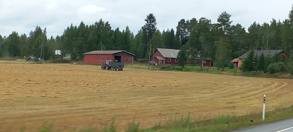
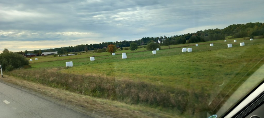
Heading South East, the vistas opened up to much more farming. The farmers have been very busy collecting sileage which will be food for their animals when they are kept indoors during the snowy winters.

Large rolls of sileage – various types of grass and clover are fermented – more nutritious than hay
Ready to be collected and taken to the barn for the winter

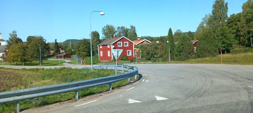
The majority of country dwellings in Sweden are red wooden houses, with white framed windows – these have become a symbol of Swedish pastoral life.    The red paint originates from a copper mine (now defunct)  in Falun  – hence is known as Falu red.  Both iron and copper dust are used to make up the paint. Their fungifying properties help to preserve the wood. The bonus is that homeowners only need to brush off the loose pigment and dirt before reapplying the paint. (no laborious paint stripping and sanding necessary) 

Typical red wood Swedish dwelling

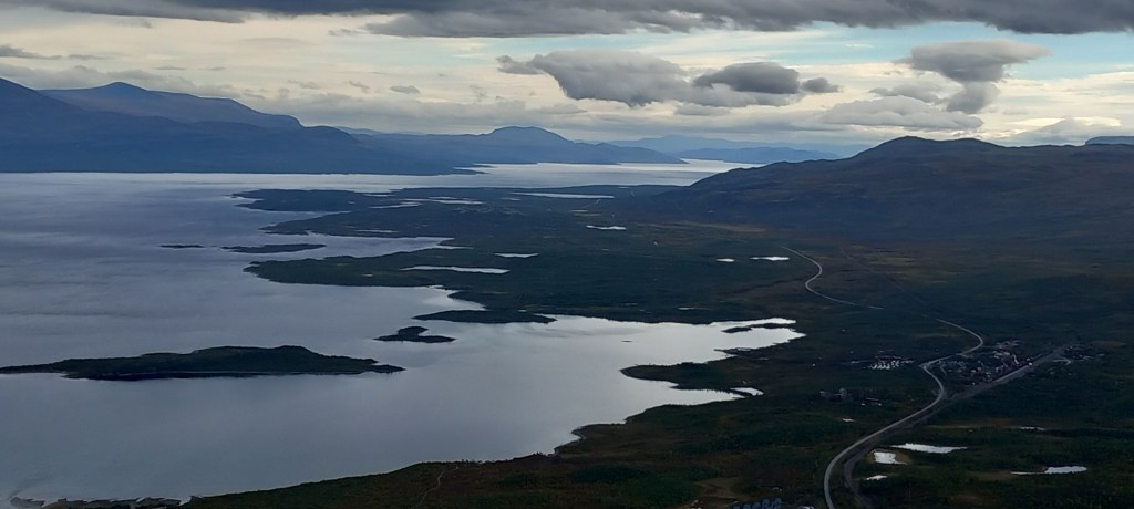
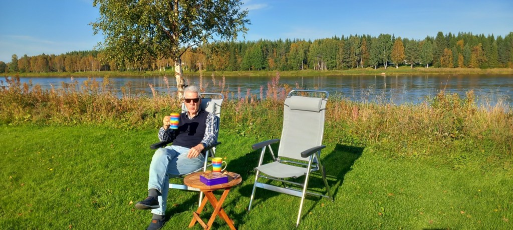
  We were so looking forward to reaching the east coast and seeing the sea – our campsite was in Ljusne, where we discovered that a series of little inlets and islands are characteristic of this coast.  The water is brackish, and it’s rare to get a clear view straight out to sea.  We spent a pleasant two days exploring the area on foot and relaxing in the sunshine.

Between those islands is the view out to the Baltic Sea

Moving down the coast to Harghamn (meaning Harg port), our campsite was right by a little beach and jetty.  After so many nights of standing in the cold, hoping to see some movement in the sky, we FINALLY SAW THE NORTHERN LIGHTS!  Now, don’t get excited – it is still too warm (they say), and we are too far south, to see a panoramic, colourful show – just a green glow which flashed across the sky from time to time.  (we still need to do the threatened trip to Iceland to see them properly!) The few photos I took were hopeless – you’ll have to wait until next time!

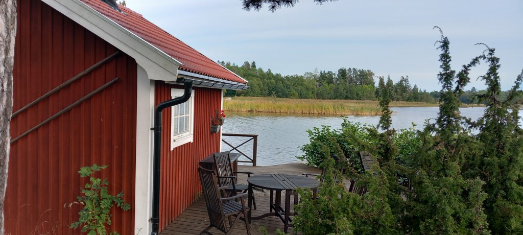
As we approached Stockholm, we enjoyed a visit with some Swedish friends who we met during our RTW cruise.  Living on the archipelago just north of Stockholm,  they enjoy all the benefits of being by the sea – the essential sauna (every Swedish house has one!) by the jetty, along with a wonderful BBQ area and a boat (of course) which takes them out to a little cabin on an island for summer visits.  The house has been passed down through the generations and been modernized and extended over the years.  We were treated to a typical Swedish lunch of locally caught perch (it’s a fish!) cooked in butter and dill, with potatoes and salad – followed by home baked cinnamon buns.  What more could we ask for?!

The lovely house by the sea
Sauna and BBQ area, leading to jetty to swim from

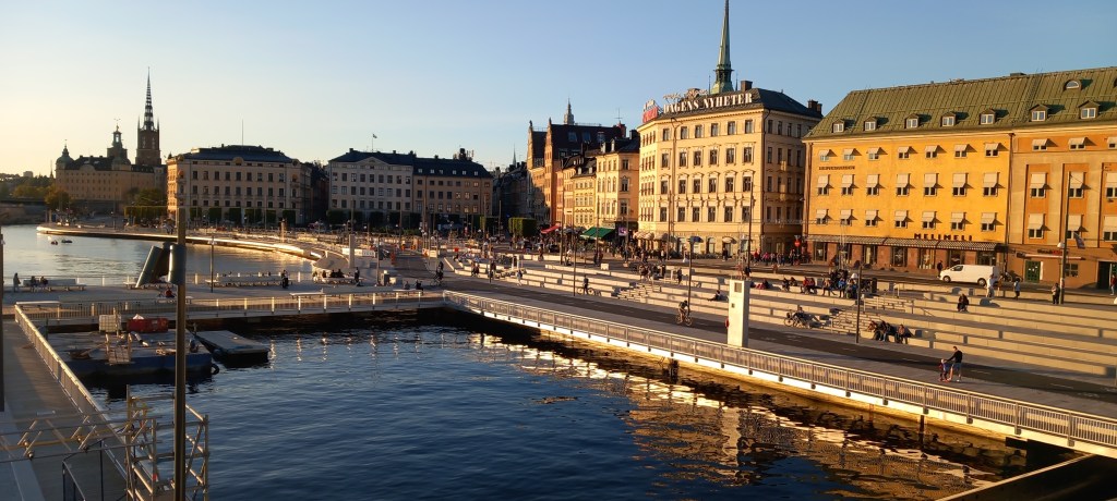
And so to Stockholm!  We’d prebooked a campsite here which is perfectly situated for access to the city.  We walked EVERYWHERE.  There are cycle and walking routes universally on all fourteen of the islands that make up Stockholm.

Footpaths and cycling routes are everywhere
Dog walkers are kept busy, as most Stockholmer live in apartments

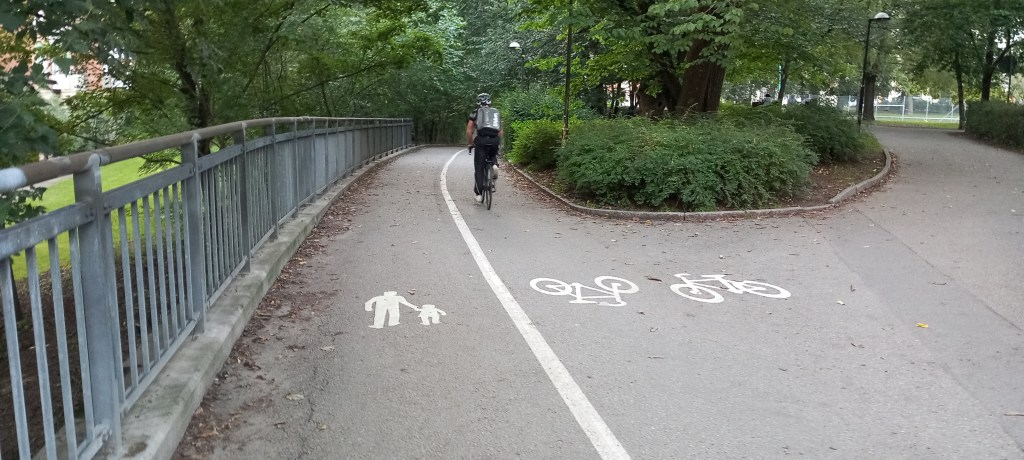
The old town, Gamla Stan, wowed us with its narrow streets, colourful buildings and pretty little squares.  Wide tree-lined avenues are interspersed with a multitude of parks, everything beautifully kept and with cafes and restaurants spilling out onto the pavements at every turn.  Stockholmers are “outdoor people” – they walk, cycle and use their boats during the summer.  The city parks are set up with ice skating rinks and cross country skiing routes for the winter. 

Narrow streets in the Old City
Colourful tall houses against the blue sky
Pretty squares
Stockholm skyline in the evening sunshine

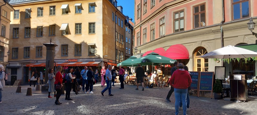
Coffee and cake (more cinnamon buns!) is the norm! And EVERYONE spills out of their offices and shops and into the pavement cafes for light supper and drinks from 5pm.  I suspect that ALL the locals are making the most of any sunshine before the long dark winter days begin.

This quiet residential street comes alive at 5pm when the locals meet after work

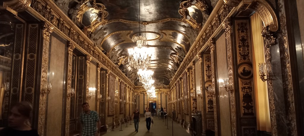
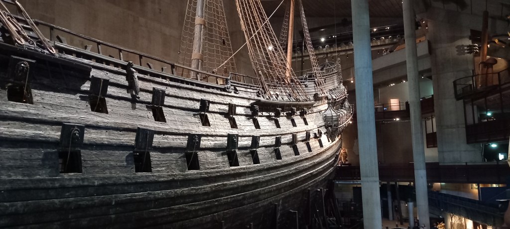
The Royal Palace is ENORMOUS and palatial (as it should be!).  We managed to catch an organ recital in the cathedral, allowing us time to stare in awe at the ornate Royal pews!  We were blown away by the Vasa Museum.  The Vasa is a 17th century ship, built to what was a very high standard in its day, with literally hundreds of amazing carvings all of which gave the message of Sweden and its King being a very powerful.  Sadly, it sank on its maiden voyage only a few hundred yards from the dock!   Three hundred and thirty three years later (yes! 333 yrs!)  it was found, salvaged from the seabed and a museum was built around it.  98% of what we see today is the original  – very impressive, particularly for the military chappy in my midst! 

Royal Palace – apparently this parlour can seat 170 people for dinner!
The Vasa – 98% of the original (oak wood) ship salvaged after 333 years – impressive!

At the risk of making some of you cringe, MY favourite museum was the ABBA museum!  We are booked to see the ABBA voyage show in London very soon.  We knew that they’d won Eurovision with Waterloo – a song which was forever playing in the local pub we frequently visited when we were first married.  What we hadn’t realized was that Eurovision had been held in Brighton AND that it was on the very night of our wedding!  As with every Scandinavian Museum we have visited, it was VERY well interpreted, with so much information, and great fun too!  

ABBA recording studio with many of the original instruments – think Mama Mia or Waterloo!

We set off tomorrow to explore over to the west coast and down to Gothenburg  – more later. 

More Swedish Experiences

Continuing to head south through Moskosel and Arvidsjaur, still enjoying the many lakes and beautiful landscapes.

Too much traffic!!

It’s always a bonus to find a campsite that offers a good walk to stretch the legs – Hotings Campsite had a nature walk which took us across a causeway in the middle of the lake and then through the woods.  An old hunters hut still exists along with a ‘pine-cone’ loo!

Old Hunters Lodge
“Pine Cone” Loo

Sunsets have been marvellous throughout – but we’ve had some heavy downpours as well. 

Sunsets have been out of this world!

We decided to explore part of the Wilderness Road (well written up in the Lonely Planet guide) from Storuman out to Gaddete.  More beautiful views, and fantastic roads alongside the many lakes. 

Lakes and mountains on the Wilderness Road

We did a quick flit into Norway just to say “I’ve been there too!”  Unfortunately, in this particular corner of Norway, the roads are narrow and bumpy, and there were no nice ‘pull offs’ where we had been hoping to park overnight.  In the end, we found a spot off the very quiet road, beside the trees, and made do.  Sunset was good there too! 

Sunset from our overnight spot

The first vehicle to come past in the morning was the ‘snowpole’ lorry.  Very clever machine which drill a hole in the ground and drops the pole in.  These poles are obviously removed for the summer months so that the verges can be cut.  (how to keep your roadmen in employment all year round!) 

Snowpole Lorry

As you can imagine, some campsites have been much better than others.  Back in Sweden we headed south east to Gallo where we stopped for a couple of nights.  Nice quiet site on a lake (of course!) and with a lovely walk 435metres up what is normally a ski slope – good views at the top.

Lovely quiet site at Gallo
View from the top in Gallo (Campsite in the trees to the left)

However the real thrill was following a challenging path through the trees to a mountain tarn. What a beautiful discovery.  Wonderful reflections on the tarn, but also the provision of a BBQ hut, complete with logs, axe, matches, firelighters and a grill pan.  If you had the energy to cart everything up the mountain, you could have a brilliant family BBQ there!  There was also a very nice bench outside, facing south, where we sat and enjoyed our flask of coffee.

BBQ hut
Everything provided – just bring the food!
The beautiful Lillt tarn (reflections were perfect)

Lunch stops have been a joy – Peter studies Google Earth to find a good spot.  Mostly regular picnic sites, which are often beside a rushing river, or a lake.

One of many special lunchstops

Finding a ‘nature place’ (naturplats) is a bonus – these are normally down a narrow track and well off the road.  A quiet lake with rapids at both ends along with some fantastic skies was today’s treat. 

Rapids at the Nature Place
Impressive skies

I’ve mentioned before how marvellous the roads have been  – after 2700 miles of driving, (90% of which I have done, due to Peter’s eye complaint) we were brought down to earth today as we came upon 30 km of road works!  VERY bumpy gravel road, deep gravel in places and VERY dusty.    After 15 km we came across the lorries actually working.  No indication was given as to where I was to drive – they just carried on, as I drove around them!  Eventually there was a section with traffic lights, where cars have to wait to be escorted through –  we had joined two other cars by then – heavy traffic for us!  Our journey took much longer than expected, but Molly seems to have survived unscathed. . .

Gravel, gravel and more gravel!
2 cars – traffic!! and dust . . . .

Heading for the Baltic Coast and then south to Stockholm over the next week – until then . . . .

North of the Arctic Circle

We crossed the Finland/Sweden border at Pello and headed north-west.  The roads have wider verges, but are becoming increasingly bumpy due to ‘frost heave’ .  I have to be extra vigilant with stowing things away in Molly, as everything gets shaken up!   We passed through many tiny hamlets, most of which seemed to have red wooden houses.  Drivers need their wits about them, as the reindeer still persist in prancing across the road! 

Red wooden houses everywhere – note remaining snow on the hill behind!
King of the road -( there’s a 60mph speed limit here ! )

Kiruna sits on the 67th parallel and was a ‘must stop’ for us to top up our LPG – we have a refillable tank, and LPG is not sold in Finland!  The town proved to be fascinating.  It is home to Europe’s largest iron mine, founded in the early 1900’s.  Enormous terraces of slag surround the entire area – in several places these are now used as ski slopes! 

Slag heaps become ski runs in the winter

However, due to years of mining, the town is sinking, hence many buildings are being moved.  A friendly lady in the book shop  (Him indoors, has to buy a map wherever we are!) gave us a map showing the future moving plans.  Huge sections have already been moved  – a brand new centre, with up-to-the-minute shops and offices – a fantastic Town Hall – in the round – which had a very good model showing the proposed moves.

The red wire shows the area of the town which is still to be moved (you may need to blow up the photo)

  Everyone is given ample compensation for a new house or apartment – and they all accept the move because the mine brings so much employment and business to the area.  Apparently the church, which is very large, is to be moved IN ONE PIECE to its new position shortly – worth watching out for on Swedish news or on You Tube! The campsite on the edge of town was attached to a hotel which served a very nice supper – Arctic Char (very like salmon) and Reindeer meat were enjoyed!

The NEW townhall – note the mine shaft clock tower – symbolic of the town

 It was whilst shopping in Kiruna – chatting to the very friendly chap on the till in the supermarket.  “Wow! You’re a long way from home!  Why drive all this way?”  My answer is always that we love touring and discovering new places, but that we’ve come this far north in the hope of seeing the Northern Lights.  Great guffaws of laughter from both the cashier and the chap in the queue behind me  “You won’t see the Northern Lights!  It’s far too warm – and there’s too much cloud around – Come back in November!” they said.   

Feeling somewhat deflated, we decided to head further north anyway,  to the Abisko National Park – known to be a particularly beautiful area.  We were not disappointed.  Lakes, rivers and mountains combined with glorious autumn colour make this place a real gem.  Only 30 km from the Norwegian border, it sits on latitude 68.4 and is a mecca for skiing in the winter.  We enjoyed a 25-minute ride up a mountain on the ski lift, made all the better by good weather with barely any wind.  Splendid views from the top.

25 min ride on the Chair Lift
View from the mountain top ( 950 m)

A well-marked 5km walk alongside the rushing Abisko river, through spectacular yellow mountain birch, gave us a good dose of ‘forest bathing’ – and some great photos! 

Abisko river with an old Marble quarry on the left
Autumn colour in the Abisko National Park

Heading south, we broke our journey in both Gallivare and Jokmokk.  We were fascinated to find out about the Sami people, who were the original inhabitants of this area (i.e. Lapland)  At the end of the Ice Age, the reindeer followed the retreating ice sheet from central Europe, northwards to Scandinavia.  Humans adapted to the ways of the reindeer and followed.  (A similar movement took place in North America, where reindeer are called Caribou.)  As in all places where settlers have had to adapt to modern day life, the Sami feel a little put out.  In Gallivare, a memorial statue dedicated to the Sami culture reads “Mine was the land in the past – preserve my people in the future” 

Statue dedicated to the Sami culture

Jokkmokk has an excellent museum devoted to the history and culture of the Sami people.  Judiciously laid out, with excellent interpretation, this little treasure has won many awards.  Two things stood out for me – the brightly coloured traditional costumes, with their different patterns and colour depending on what area of Lapland they come from.  Also, the multitude of crafts – originally everything had a use, these days things are made to pass on the expertise through the generations.    Intricate designs are beautifully woven into bands, worn as belts or hat bands.  Many things were embellished using pewter thread – imagine the painstaking work involved!

The Sami costume from the Gallivare area (taken through the museum glass, which I’m sure was forbidden!)

We are now just south of the Arctic Circle.  Did you know that the position of the Arctic Circle is defined by the inclination of the earth’s axis, which varies under the influence of the sun, the moon and the planets?  In other words, it is always moving  VERY slowly northwards and southwards   – who knew? 

A tiny cairn marks the Arctic Circle
  •  

Lapland, here we come!

Kuhmo was our next stop, a small town, about 80 km from the Russian border.  We enjoyed a two night stay here, in another idyllic campsite ‘beside the lake, beneath the trees’.

Our morning view from Molly at Kuhmo

This area was devastated by the Winter War which took place between Nov 1939 and March 1940, when Russia invaded Finland.    A museum has been built and is run by the local council in honour of the thousands of local people who lost their lives.  Excellent photographs with good English translation, show the true horrors of war. . . . . all displayed in a very modern building which blends into the countryside. Indeed any war is ghastly, as is summed up in the words of Uuno Tarkki  “War is not a heroic story.  It is a physical and mental struggle for your own and the enemy’s life in awful conditions”.  Never a truer word . . . .

Gorgeous sunny weather encouraged us to walk out along a spit where we found a peaceful little beach.  The silence was ‘deafening’  – no bird song, no traffic, no wind – utter peace . . . .until we were rudely interrupted by the Finnish Airforce doing an afternoon training run straight down the lake in front of us – F18’s for anyone who wishes to know!

Our peaceful beach which was shattered by the Finnish Airforce!

Continuing north, we needed to stretch our legs, so drove across some islands which necessitated using bridges, causeways and another ferry, before stopping for a walk in open woodland where there were plenty of lingonberries – the locals eat these like a blueberry. 

Ferry approaching to take us across the lake to another island
Lingonberries

Small farmsteads appear in the middle of the bush – such a lot of effort must have gone into clearing these areas to produce arable land. 

Small farms pop up in the middle of nowhere

Instead of watching out for moose (a very common road sign here), we are now watching out for reindeer!  We’ve seen several on the side of the road –  they don’t seem to be spooked when  a huge lorry or a motorhome invades their quiet space.  (No chance of getting a photo from a moving vehicle)

We could tell that we were approaching civilization again when the traffic began to increase as we approached Rovaneimi, the capital of Lapland.  The campsite here was fairly busy – perhaps with locals taking advantage of the weekend?

The Lumberjack’s Candle Bridge in Rovaneimi – note campsite – Molly is furthest to the right

  It bucketed with rain through the night, and the temperature dropped – this IS Lapland after all!  The Arktikum museum gives very good coverage of life in the Arctic over thousands of years of history.  Rovaneimi is a very modern town (mostly apartment blocks) having been rebuilt after the Germans destroyed 90% of the buildings in 1944.   We were pleased to visit the Lutheran church, also destroyed by the Germans, but rebuilt in 1950.  It has a huge altar fresco (14 m x 11 m) which took our breath away.

Rovaneimi church Altar Fresco – The Fount of Life

We crossed the Arctic Circle today (another tick for the bucket list!) and just HAD to visit Santa Claus village!  All the usual souvenir ‘tat’ that you would imagine, but fun to do, and made all the better with such friendly Finnish staff.   We had an interesting chat to a chap in his 30’s, who confirmed that conscription is very much still the norm here – one year at the age of 18, and then a two-week refresher course every two years.  27,000 conscripts are trained every year.  Makes you think . . . . . .

Crossing the Arctic Circle
Entrance to Santa’s Village

We’re now on the Finland/Sweden border at Pello, on the river Tornio, having driven north-west from Rovaneimi.  The autumn colours are much more advanced up here, and we are expecting the temperature to plunge tonight.

Changing autumn colours – note snow poles!

  Fingers crossed that we see some Northern Lights whilst we’re up in this area. 

Our afternoon cuppa in the late afternoon sun on the River Tornio – Sweden is on the opposite side

Finland’s Lake District

Within moments of leaving Helsinki, we entered the ‘real Finland’ – the land of trees and lakes.  It is SO LIKE Canada that I feel quite at home.  Easy to drive, long straight roads with no traffic.  Very strict speed restrictions though – it’s just as well we have seven weeks for this adventure, you can’t go anywhere in a hurry! (unless you wish to drive on motorways) 

Timber is the main industry – huge logging lorries are prevalent on the road. Trees here are mainly of three types – Pine, Spruce and Silver Birch.  Silver Birch is the national tree.  Rowan trees are also common and are considered a ‘sacred tree’.  There are lakes everywhere – large and small – often with a few cottages in the trees on the lake edge.  Most houses are built of wood – and presumably well insulated against the harsh winters.

OMG! The traffic is terrible!!

Yesterday’s thrill was a visit to a rock face, with 7000 yr old rock paintings.  This involved a fairly challenging 3 mile walk, over a rooted and stoney path, through the woods.

Stones & tree roots make for challenging walking

 We enjoyed beautiful reflections over the lake before reaching the very ancient site.

Stunning reflections on the lake

Estimated to have been painted in 3000 – 2500 BC, it is remarkable how clear some of the paintings are.  This is apparently due to a naturally forming thin layer of silicon dioxide on the rock surface  (who knew?).  The paint itself was made up of iron oxide (which come from rocks), blood, animal fat and birds eggs.  The paintings included animals, people and hands.  The meaning of the paintings is, as yet, unknown but it is assumed they were, in some way, sacred. 

7000 yr old rock painting

Savonlinna is a pretty little town in the eastern lake region which boasts a 15th century castle.  We were pleased to take a free one-hour tour with a very informative guide, who led us up many challenging, uneven and narrow steps to various towers, balconies and courtyards. 

Olafinlinna Castle in Savonlinna

Apparently the ‘summer season’ is now over in Finland!  Kiddies have gone back to school, and many cafes and restaurants are closed.  However, we found a little hotel/restaurant run by a Finnish lady with her British husband (the chef).  Imagine our amazement, when we discovered that his mother used to live in North Road, Ross on Wye!!  (it’s a small world) Our campsite put on a huge firework display last night to celebrate the ‘end of season’.  They remain open for another month but are very quiet (a bonus for us!)   

Hmmm, looks a bit chilly for a swim!

For those of you following us on Google Maps . . . . . today we headed north from Savonlinna, via Enonkioski (where we caught a little ferry across the lake). 

Little ferry across one of the bigger lakes

We stopped at one of many National Parks and enjoyed a ‘nature walk’ through the woods to the lake – absolutely beautiful with the sun glinting on the water.

Nature Walk in National Park

We continued north-east towards Liperi, and then avoided Joensuu by travelling on more scenic back roads to reach our campsite near Koli. Yet another idyllic site, in the trees, next to a lake.  What more could a girl want??

Campsite at Koli

Handsome Helsinki

We arrived in this lovely seaside city after a 30-hour ferry crossing from Travemunde in Northern Germany.  We couldn’t have asked for smoother seas – very little wind and gorgeous sunny skies allowed us to sit/lie out on deck in the sunshine.  The buffet style food was delicious and the beds comfortable – a nice introduction to Finnish culture. 

The Helsinki campsite (Rastila) is a 20 minute ‘Metro’ ride from Helsinki city centre.  We carefully bought a three-day ticket, which allows travel on ANY mode of public transport – Our tickets were never checked.  Locals assured us that they do spot checks from time to time, but rarely during summer holidays! 

Helsinki boasts a good variety of churches.  The Cathedral dominates the central square – built in 1852 its architecture is very much in the simple Lutheran style.  The outside is being cleaned this summer, so visitors are greeted with the sound of high-pressure machines. 

Kampii Chapel was a real treat.  Known as the Chapel of Silence, this gem is very modern, and treated as a place for peace and quiet in the middle of a busy area in the city.  Its unusual conical shape overlooks one of the many city squares.  Three different types of wood were used – the external walls are spruce – the beautiful internal walls are of alder and milled into the curved shape – fittings and doors are made of ash.  The ceiling contains plasterboard which adds to the sound proofing effect – you could have heard a pin drop . . . until the next tourist rustled in! 

Chapel of Silence
Kampin hiljentymiskappeli – Kamppi chapel of silence in Helsinki, Finland designed by K2S architects.

The Helsinki public move about by tram – tramlines are everywhere and their metallic rumbling sound makes for part of the city experience.    

Helsinki Tram

Bicycle is the other mode of transport – one has to be VERY MUCH on the lookout for bikes hurtling past carrying suited gentlemen on their way to work!  There are literally thousands of shops and restaurants and all seemingly doing good business.  The Finns pride themselves on healthy eating – lots of fresh produce – open sandwiches, local cheeses, local fish and the cinnamon buns are to die for!  Wonderful large floral tubs grace every corner.  Finns really enjoy the summer months, as winters are long and very cold.  Every request for help, whether in a shop or the street, has been greeted with a smile and an eagerness to help. 

Floral tubs and cobbled streets

Helsinki has 330 islands in its archipelago, making up 130 kilometres of coastline.  Gorgeous weather inspired us to take a 20-minute ferry ride to Suomenlinna Sea Fortress, which was built by the Swedes in the 1740’s, later captured by the Russians, and in 1918 taken over by the Finns. It is now a Unesco World Heritage Site.  Old military barracks, gun powder stores and cannons are dotted amongst the rocky outcrops that make up the island.  Some 800 residents live here throughout the year – their houses cleverly hidden from the marauding tourists.  Miles of pleasant paths, and lots of good sunbathing areas make this a popular place for both locals and we tourists who fancied getting out of the city buzz for a while.

Ferry journey to fortress
Peter enjoying his military history

Uspenski Cathedral is the largest Orthodox Church in both Northern and Western Europe.  After the simplicity of the Lutheran churches,  the extensive décor of Uspenski is almost overwhelming.  Consecrated in 1868, it is built on a hill, overlooking the harbour – its golden cupolas are symbolic of the Russian impact on Finnish History. 

Uspenski Orthodox Cathedral

We could not visit Helsinki without seeing the Sibelius Monument – set in one of the many beautiful parks, the monument consists of some 600 hollow steel pipes welded together in a wave-like pattern – apparently the sculptor’s aim was to capture the essence of Sibelius’ music.  I’ll let you decide what you think . . . . . . .

Sibelius Monument

One last church  (this really is the city of churches!) that we wanted to visit is known as the Church of the Rock – and with good reason.  It was excavated and quite literally built into the rock.  Natural surrounding rocks were used to extend the height of the walls, huge skylights atop the walls and a copper plate covered dome makes up the roof.  The internal ceiling is finished with 22 kilometres of copper thread.  The acoustics are marvellous – no microphones necessary!

Church of the Rock

All in all, a great city to explore. It would be fun to visit again in the winter, to experience the chilly climate and see the harbour frozen over.

A quick admin message to you all – I know some of you struggle to see the photos. I’m assured that you need to look at the blog on your computer to see the photos at their best – a quick glance at the blog on your phone will not highlight the photos.

We’re heading north-east tomorrow – more anon.

Touring Scandinavia

August 2024

Hello dear followers!

Yes, Peter and Marilyn are off on another adventure!  We plan to explore Finland and Sweden over the next seven weeks.  Molly (our MOHO) is loaded to the gills with four seasons worth of clothes – it may be chilly when we get north of the Arctic Circle! 

We relaxed on the overnight ferry from Harwich to Hook of Holland – it was our lucky day (?night) as we were almost the last to board, but that meant we were third to disembark, and there was a passport control man waiting for us!  .  Brexit rules dictate that we should not bring any meat products, dairy products or plant products into Europe.  Absolutely NO MENTION OR CHECKS of what we had onboard! We would recommend this ferry link – you arrive at 8am, the local supermarkets are already open, you can stock up with delicious Dutch food, and set off on your adventure. 

We had forgotten how much we like The Netherlands  – everywhere – even the industrial estates! – are clean, tidy and beautifully kept.  The roads are good, the traffic (even on a Saturday in high season!) is not heavy, in contrast to the dreadful traffic we had in UK yesterday!  There are frequent service areas on all main roads – clean and well laid out with plenty of parking.  Because there are so many, they don’t seem to get overcrowded.  The open countryside is lush and green with huge dairy herds on every farm.  Beautiful weather has added to our enjoyable journey today – we’ve travelled past Rotterdam to Arnhem, where we stopped to visit a very good Open Air Museum. 

We then turned north past Zwolle and Emmen and have stopped for the night at a favourite campsite (used twice in the past) in Bourtang on the Dutch/German border. 

We continue across Northern Germany tomorrow, to catch a ferry from Travemunde to Helsinki.  Lots more to come  – good to have you back with us.

Last Leg – Homeward Bound

Tenerife, Canary Islands

After leaving Cape Verde, a further three days at sea brought us to Tenerife in the Canary Islands.  We chose to wonder the streets and enjoy the pavement cafes.  Santa Cruz comes alive on a sunny Saturday morning.  We were transported back to our eight happy years living in Spain  – good weather and happy people, along with parks and flower troughs full of colour. 

We were one of FIVE cruise ships berthed along the jetty.  A pleasant kilometre’s walk along the ‘blue line’ led us into the centre of town. 

Family life is paramount to the Spanish.  We saw a wonderful example of this when a tiny battery driven car, ably manoeuvred by a little three-year-old, (complete with his car radio blaring!!), drove past us, along with proud father, uncle and sister! 

Our six hour stop over came to an end with Borealis doing a spectacular 360 degree turn within her own length, before we set sail.  Our bows swung very close to another British ship – the Ventura – but without incident, happily confirmed with an exchange of BIG white hand waving and ship’s hoots! 

Homeward Bound:

And so, this wonderful voyage draws to a close – we’re just entering the ‘rock and roll waters’ around Cape Finisterre and we’ve been warned of a bumpy night in bed tonight as we enter the Bay of Biscay.  All this of course, is now ‘old hat’ – we’ve had plenty of time to find our sea legs!  Lots of happy memories to store away, or regale you with for many months to come  – we’ll try not to bore you to death! 

My personal highlight would have to be Snorkelling on the Great Barrier Reef  – a dream come true.  A close second would be our three day safari from the luxury Biyela Lodge where we were ‘up close and personal’ with Africa’s wild animals.  We felt honoured to be amongst them.  The journey has made us even more determined to preserve this wonderful planet for our grandchildren, and many generations to come. 

Thanks for joining me, and for all the lovely comments.  I hope to be with you again in late August, when we plan to take Molly (our motorhome) through Finland and Sweden.  

Cracking Cape Verde

The Cape Verde Islands are an archipelago of ten islands lying in the Atlantic Ocean, 570 miles off the coast of West Africa.  Borealis berthed at the Island of Saint Vincent in the northern port of Mindelo.  St Vincent is one of the driest islands receiving less than five inches of rain per year – and all of that during a short period of three months.  92% of the islands population of 80,000 people live in the town of Mindelo. 

A guided tour of the Island’s highlights gave us a good insight into the history and culture of the area.  Founded by the Portuguese in 1462 and later in 1838 used as a coal depot by the British to supply their ships on the Atlantic routes, the islands boast a mixture of influences – Portuguese, Brazilian, English, African and Spanish being the main ones. 

Water on this small island of only 87.5 square miles area, is produced through desalination units.  Many houses are only half built – the families live on the lower floors until they can afford to pay the higher taxes charged for more area of living space.

The main road surfaces are very good (no frost to ruin them!).  The road to the top of Mount Verde (744m) was very impressive – strongly built, well maintained and topped with slates.  Built by locals over a number of years, it now provides stunning views for we tourists!

Catfish Bay, a holiday area for the locals, provided a stopping place on our tour, where we were given local food and drinks and treated to some local music and dancing – some passengers were invited to dance!!

The coastline near Catfish Bay afforded us a good view of huge sand dunes created purely from sand blown in by the continual cyclonic winds from the Sahara Desert – which then settles along with the black volcanic lava sand. 

Mindelo itself had several pretty little squares with brightly coloured buildings, and a plethora of street markets. 

The gorgeous white sandy beach right next to the port was too good to miss.  We enjoyed a walk in the evening sunshine to a friendly café where we watched the sunset, before beating it back to the ship ready to sail after a short ten hour visit to a ‘cracking’ place!

Only one stop left before we reach Southampton  – where have those three months gone?

Cape Town & Namibia

Cape Town:  A two-hour flight from Durban to Cape Town, enabled us to rejoin the ship late on day one of a two day visit.  One day was not enough  to explore such a beautiful city – however, a hop-on/hop-off bus tour gave us a good feel.  Sadly, the cloud was down over Table Mountain so our views over the city were from lower down. 

As in most big cities, great areas of poor housing were a massive contrast to the wealthy areas.  Camp Bay is not only a select place to live, but enjoys white sandy beaches, up market restaurants and (so we were told) a hide-away for celebrities! 

Borealis berthed near the Waterfront, which is a maze of shops and cafes which proved (on Easter Sunday) to be a magnet for locals to take their families for a day out.  This is certainly a city to be revisited and explored in more depth. 

Walvis Bay, Namibia:  The Namib Desert covers an area of 13,000 square miles along the coastline, and for 140 miles inland, in Namibia.  It is the oldest desert on the planet and receives less than two inches of rain per year.  The Benguela Current runs along the coast.  The meeting of this cold current with warmer tropical waters means that coastal fog is a daily occurrence.  However, the fog has become the lifeblood of the desert, as it provides sufficient moisture for small mounds of greenery to form, which in turn gives various small creatures water and a place to hide. 

With their ingenuity, our guides could recognize any signs in the sand of something buried, then carefully dig with their hands to unearth several creatures who have adapted to life in the desert. 

Tyres on the 4 x 4 vehicles were lowered to maintain a better grip, before we delighted in a hair-raising ride up, down and around the dunes!

Iron deposits are spread on the wind, giving a black hue to the dunes.  This is eventually oxidized turning the sand to a red, terracotta-type colour.  Another ‘pinch-me’ moment, when I realized that I was in the middle of the oldest desert in the world, and in the middle of Africa!

Mining provides income for the country – uranium, diamonds, gold and other minerals are exported via the enormous deep-water harbour in Walvis Bay. 

I must mention here the very friendly and highly accommodating immigration officials in Namibia.  The whole process (we had to be ‘stamped in’ and ‘stamped out’ again) took place onboard – the officials were all very welcoming and full of smiles – making the procedure the quickest and most pleasant that we’ve encountered throughout the entire voyage.  Well done, Namibia!