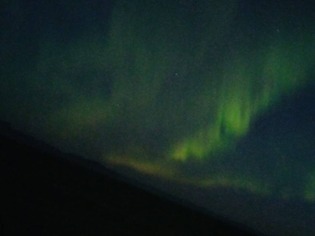
As promised, I just had to tell you all that we FINALLY SAW THE AURORA BOREALIS last night. Getting up and dressed at 1am was a shock to the system, but so worth it! Peter’s mobile phone is more up to date than mine, but our onboard astronomy/photographer had all the correct camera kit and urged us to download his photos.
From the deck of Bolette with Peter’s mobile phonePhoto by our onboard astronomer/photographerAnother from our onboard photographer
This ‘compensation cruise’ has only served to whet our appetite! Despite our previous misgivings over life on the oceans, we have now ‘got the bug’! Watch this space . . . more holidays planned both on land and at sea . . .
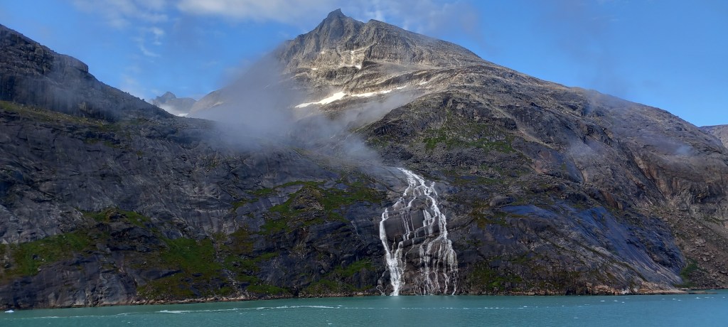
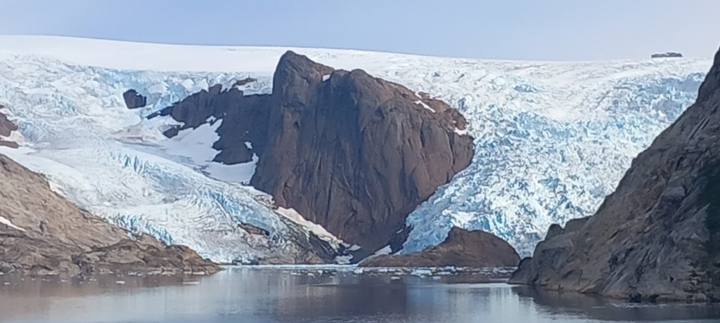
Yes! The cloudy skies and mist began to lift for us, as we made our way back through Prins Christiansund. This waterway wiggles through the inlets and islands of the Cape Farewell Archipelago. Once again, we were ‘blown away’ by the beauty of pure, untouched nature.
Glacial ice melt pouring down the mountainsideGlaciers melting much more quickly with climate changeLeaving Greenland near the exit from Prins Christiansund
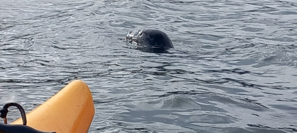
Isafjordur (pronounced Is – SAF – fjor – dur) and which translates to “fjord of ices” is in a spectacular location nestled between high mountains on one of the many inlets along Iceland’s north coast. With a population of 2500, its community have learned to live with huge amounts of snow – normally 15 metres annually – along with glorious summers during which their economy is given a gentle boost with incoming cruise ships! Avalanche barriers protect the town – avalanches being very frequent due to the steep mountain sides. We really enjoyed two hours of kayaking in the afternoon sunshine, especially as one of the local seals decided to join us for most of the way around the fjord.
Isafjordur – avalanche barriers behind the green swathes protect the residential areasSummer flowers adding a shot of colour before the cooler weather comesA seal enjoying the company of our kayaks
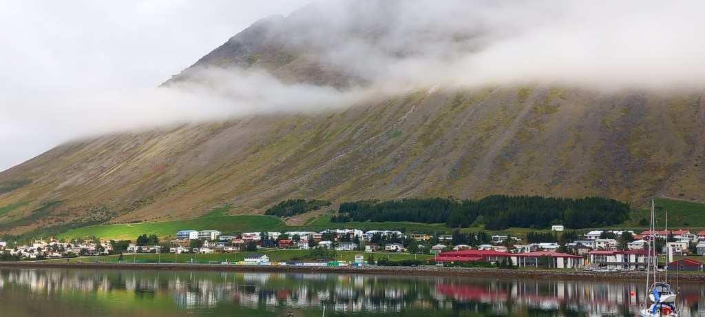
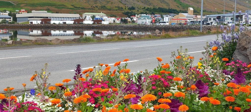
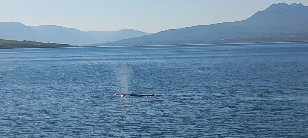
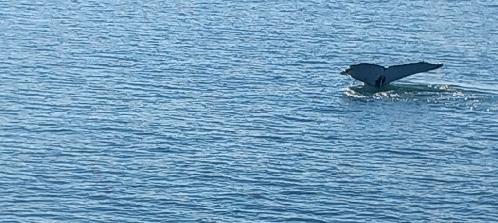
Akureyri is a city (pop 20,000) situated at the end of the 60 km long Eyjafjordur fjord further west from Isafjordur. Mountains tower above the town and along the fjord, with heavily farmed lowlands along the water’s edge. Magnificent green fields stand out against the rugged mountainsides. During the summer the fjord becomes a feeding ground for whales and dolphins. We were thrilled to see humpback whales busily feeding before they migrate to their winter breeding grounds in the Caribbean (16,000 miles round trip!)
Humpback Whale surfaces to fill his lungsHumpback whale about to ‘dive’ for food
Sadly, we are now homeward bound – two & a half days sailing to reach Liverpool early on Friday morning. We hope (fingers crossed for good weather) to see the Northern Lights tonight as we briefly cross the Arctic circle. Our onboard astronomer says there is a ‘high chance’! I shall return to report on our success (or not) later on . . . . .
Greenland, (which translates to ‘fertile land’) is the world’s largest island. The south of the island has many little inlets and islands, and we were lucky enough to enter Prins Christiansund on a sunny day. Very cold (winter coat, woolly hat and gloves) temperatures accounted for the numerous icebergs floating past us, but the clear sunny skies gave us a wonderful cruise alongside dramatic mountains and glaciers. Sadly, we had to turn around halfway along the Sound because of ice floes blocking the route.
Where the southern Icefield meets the seaBeautiful reflections in the sunshine
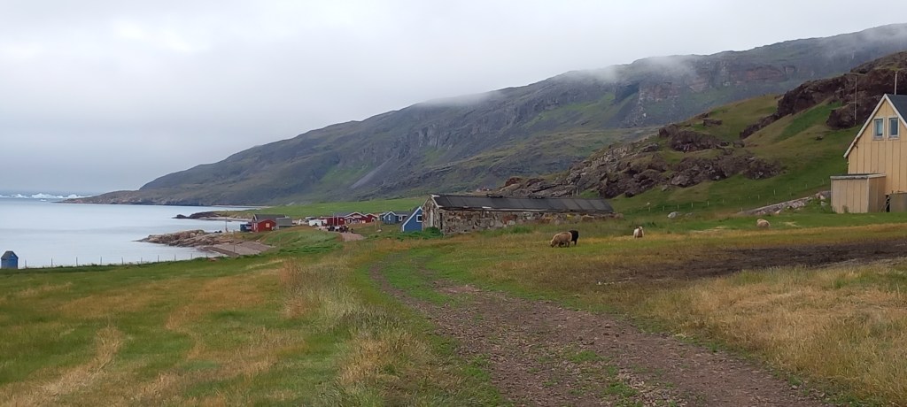
Our first port of call was Narsarsuaq (nar-sar-suak), a settlement of 125 inhabitants, where Bolette dropped her anchor offshore and we were ‘tendered’ ashore. Sheep farming and fishing sustain the community. The little school has eight pupils with two teachers. A supply ship arrives every 14 days. 90% of the island’s electricity is hydroelectricity. I’m sure the odd visit from a cruise ship helps the local economy no end – the local tour company and the one supermarket do a roaring trade!
May the two never meet!!
Narsarsuaq increased in size dramatically during WW2, when the Americans built an airbase here. A very informative museum and a few little houses still exist along the runway which now deals with small light aircraft from other parts of Greenland.
Just a few houses left near the runway
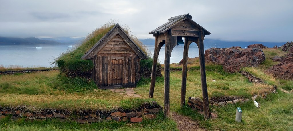
We enjoyed a boat ride across the fiord to the tiny hamlet of Qassiarsuk, where Eric the Red first settled in the late 900’s. Ruins of the Viking’s long houses are still visible, along with a replicas of a long house and the first Christian church.
A replica of the first Christian church in GreenlandThe tiny hamlet of Qassiarsuk
Our luck ran out with the weather as we travelled along the south coast – the Captain announced that for our safety AND our comfort we would spend 24 hours in the quiet harbour of Narsaq, in order to avoid a VERY strong swell and thick, pea-soup fog. This deep harbour used to be where foreign trading ships would anchor. Seal blubber and skins would be traded for coffee, sugar, bread and buckwheat. Again, the local economy must have benefitted from our arrival. The brewery was opened as were the two cafes and were doing a roaring trade. We chose to walk out of town and upwards towards a viewpoint looking over the ship and back to the town. Thick mist and frequent, heavy rain showers did nothing for the photos!
Bolette safe in Narsang’s deep harbourNarsung – ancient trading post
Qaqortoq was our last port visit in Greenland. It is Southern Greenland’s largest town with 1300 inhabitants. Very colourful houses were on show through the mountain mists. The colours were explained to us as follows: Red for ‘official people’, Blue for any businesses, Yellow for hospitals and caring. People would paint their houses according to where they worked. Sadly the tradition is dying out, but people still like to paint their houses in bright colours.
Blue for business – even the polar bears do their shopping here!!The colourful town of Qaqortoq (Bolette passengers boarding the tender to return to the ship)
We chose to do a guided walk around the Great Lake. As you can see from the photos, the weather closed in on us! Very heavy rain persisted – the only plus of the rain is the resident mosquitoes don’t come out in the rain!!
the Great Lake emerges from the mist during a brief break in the rain
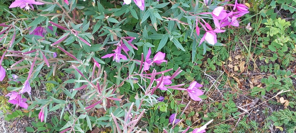
Fascinating place – uncanny to be bothered by mosquitoes when icebergs are still floating on the fiords. The wildflowers are beautiful, if you can find them in the mist!
Greenland’s national flower – “little girl” given to young ladies upon their engagement
We now make our way back to the northern shores of Iceland. The Captain has just announced that we will go through Prins Christiansund on our way as the ice floes have moved and we can journey all the way – will the mist lift? Fingers crossed!
Hello again folks: I felt I must share with you our journey north . . . . . .For those of you who like to ‘track’ us, we are on Bolette (not Borealis) – they are ‘sister-ships’ and the lay-out is exactly the same (and I still don’t know my way around!!)
For the non-cruisers amongst you, the check-in system is very organized and straight forward. No standing in long queues for hours! Seats are provided and we are called forward according to the colour of our luggage labels. Our luggage is collected from the car by a porter who takes it away to go through security, and we next see it standing outside our cabins a couple of hours later. We were onboard and enjoying lunch within an hour of arriving at the port drop-off point.
We sailed at 5pm on the dot . . . much noise from the ship’s hooters to say goodbye to Liverpool. I only wished that Tanya had been in her office – it’s so close, we could have waved! By now, the earlier rains had cleared and we enjoyed a sunny evening. The first evening is all about unpacking, settling in, finding your dinner table and ‘eyeing up’ who your neighbours are going to be!
They say it takes a few days to find your ‘sea legs’ – however . . . .we were dropped in at the deep end!! A force 8 gale with driving rain greeted the ship as we left the protected waters of the Irish Sea and the North Channel. . . . VERY rough seas with 6 – 8 metre waves stayed with us throughout our first day at sea. Walking about on the ship was a challenge, as we were lurched from one side of the corridor to the other – grabbing handrails or standing firm with your legs apart and knees bent (very unlady-like but very Elvis Presley!) became the norm. Huge thanks to my dear friend Rose, who introduced me to Echinacea tablets for seasickness – along with wrist bands, the echinacea worked a treat. (Yes, I know that echinacea is normally a herbal cold remedy, but in this case, I’m guessing it also settles the balance in the middle ear). We noticed that the dining room was fairly quiet for dinner – many people had a miserable day. As you’ll remember from our last cruise, during rough seas, the swimming pool is emptied, and the gym and walking promenade are closed for safety reasons.
What a change on Day 2 as we awoke to sunshine and a much calmer sea.
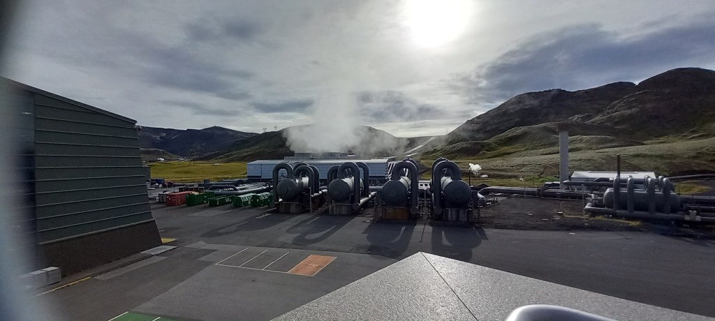
Day 3 – Reykjavik (meaning Smoky Bay)from where we enjoyed a full day’s guided tour, much helped by beautiful weather and a very knowledgeable guide. Iceland is the ‘youngest’ country in the world and has been independent since 1940. Two tectonic plates run through Iceland, (the North American and the Eurasian) which are separated by a huge fissure. (read on, to find out more!) Much of the island is a hot spring . . . plumes of steam can be seen billowing out of earth. The islanders take full advantage of this by producing geothermal power for 99% of their population. In simple terms, the steam is used to produce electricity, then sent back underground to heat water – 3000 km of pipe work provides residents with hot water. The impressive power station is the biggest in Europe and the 8th biggest in the world.
Plumes of steam in the lava landscapeBiggest Geothermal Power Plant in Europe
Two thirds of the island’s 400,000 population live in the Reykjavik area. No one lives in the mountains – which of course, are fairly active volcanoes. There have been 12 volcanic eruptions since 2001 and earthquakes are almost a daily occurrence! Icelanders are made of strong stuff! There are 200 glaciers spread over 11% of Iceland. The countryside to the south of the island appeared quite flat, but always with jagged mountains nearby. The native tree is the birch which is very slow growing and rarely gets very high. Lava fields are the norm – those that we saw were covered in a thin layer of moss.
Native birch trees The ‘Long’ Glacier spreads for miles behind these mountains
Large areas have been cleared for farming – sheep roam for the summer but are brought to shelter for the long, cold, dark winters. The Icelandic horse is very much revered – it is very strong, despite being smaller than our horses, and has five ‘gates’ (I’ll let you look that one up!) Apparently, if Icelanders take their horses out of the country (eg for a competition) they are NOT permitted to bring them back to Iceland because of the threat of disease being carried. It must be so sad to have an award-winning horse which one must sell on. Leaving it behind must be so hard – or maybe I’m just a softie!
Geysir is an area – you guessed it! – of bubbling geysers, one of which spurted forth every 6/7 minutes. Did you know the Icelanders created the word ‘geyser’?
Smelly bubbling mud!
The Golden Waterfall was a spectacular sight – two waterfalls totalling 31 metres in height, plunge into a 70-metre-deep canyon which stretches for 2.5 km. Colossal amounts of water thundering through the valley make an awe-inspiring sight.
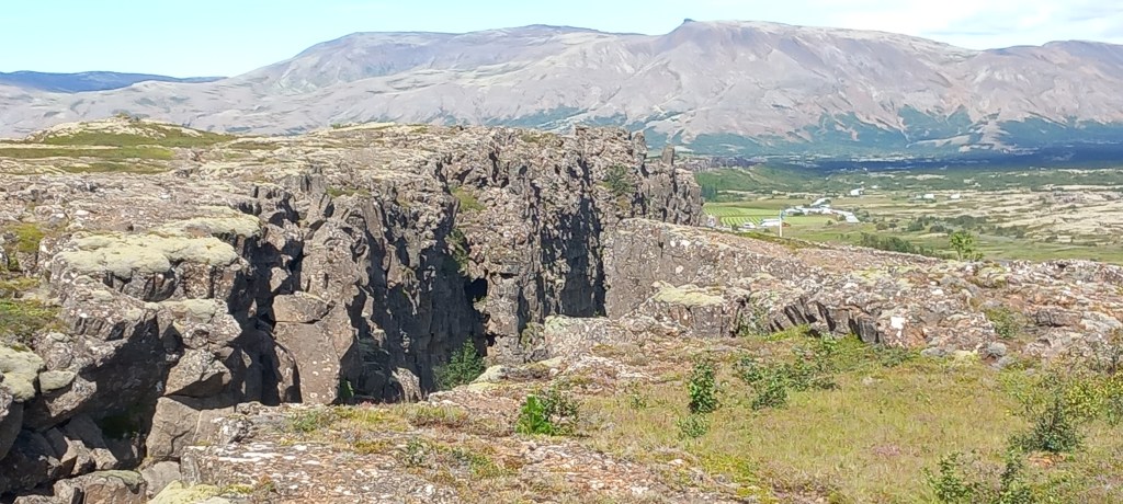
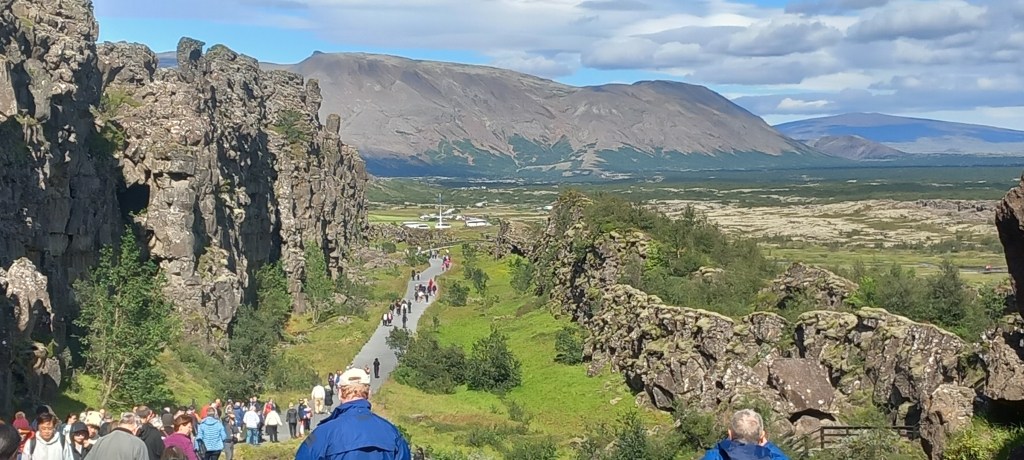
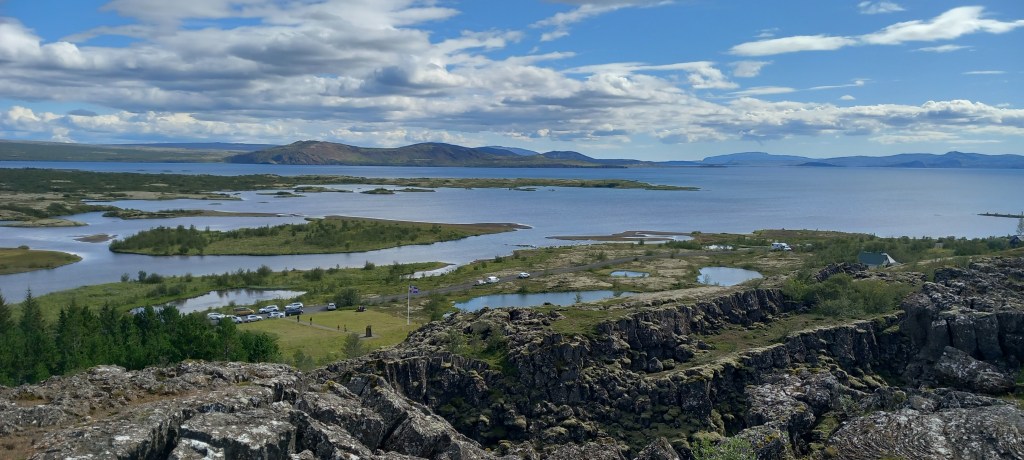
Our last stop was to one of three National Parks in Iceland. Overlooking a huge lake (84 sq km) of pristine clear but VERY cold water (glacial melt), is the Silfra fissure. This huge fissure separates the two tectonic plates mentioned above which are moving apart by 2 cm per year. Walking through the fissure, surrounded by mounds of lava was, I felt, quite a creepy experience!
The Silfra Fissure – North American Plate on one side, Eurasian Plate on the otherWalking through the fissureFissures everywhere – creepy!
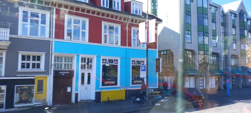
A very quick drive through Reykjavik on our way back to the ship, gave us a taste of a modern and very carefully built city. Older wooden houses are now covered in corrugated iron for insulation and protection against the harsh weather – they’ve been painted in bright colours, symbolic of their history.
Brightly painted houses in Reykjavik
We return to Iceland later in the cruise, but today we are bouncing around at sea again (Force 6 gale today!) on our way across the Denmark Strait to Greenland – very jealous of the reported English heat wave!!
Hello again trusty followers: Just to give you a heads-up that we will set off shortly for our ‘compensation cruise’. To remind you . . . . . that due to our round-the-world itinerary being changed thanks to problems in the Red Sea, we were all given generous amounts of compensation . . .but only to spend on Fred Olsen! So . . . . . thinking that it would be rather difficult to take Molly up to Iceland and Greenland (although I have been told it is possible!), we’ve chosen this cruise . . .hoping we get there before Trump does!!
It’ll be interesting to see how we feel about cruising after a two week holiday, compared with our three and a half month one! By the way, a little plug . . .Peter and I will be giving a talk on our Round-the-World cruise at the October U3A meeting – 20th October, 2:30pm at the Larruperz. Non-members are always welcome (they ask for a £2 donation)
You’ll hear from me again, once we’ve got the WIFI set up onboard, and there’s something interesting to tell/show you. . . .See you then
We are enjoying a quiet ‘mooch’ around Auckland – having visited this time last year, we don’t feel the need for rushing to see all the sights. It’s grey and cloudy here today, so not even worth going up the Sky Tower!
To summarize our New Zealand adventure, I must mention a few things that we’ve noticed . . . .
Kiwis (that’s the human sort!) have a wonderful accent – legs become ‘leegs’. . . .yes become ‘yees’. . . “How are ya GUYS?” “Have a wonderful day GUYS?” “What can I geet ya GUYS?”
One Lane Bridges are the norm – built in the days of horse and cart.
Coffee caravans are everywhere and they carry ALL types of coffee and ALL types of milk and always have a delicious array of cakes (yes, the waistline has grown!) – FABULOUS
Public toilets are abundant and 99% of the time – clean!
Pulling over to allow other cars to pass is normal – And you’re thanked for doing so!
Every stream, river, and culvert has a name! Even in the middle of nowhere!
Every park and public footpath is well maintained and well signposted.
The mountain ranges that go all the way down both islands are criss-crossed with amazing mountain roads -Numerous VERY sharp bends are taken at speed by the locals, but take some getting used to for all the rental cars and motorhomes!
The scenery never fails to impress and the locals couldn’t be more friendly and welcoming.
It’s well worth the LONG & TIRING journey to get here from the other side of the world.
I can recommend Audley Travel if you’d like a problem free holiday – no worries, all accommodation and tours prebooked – all we had to do we had to do was drive there!
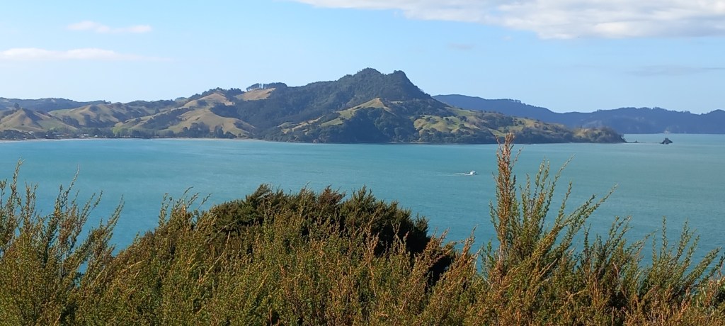
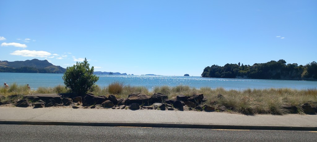
Typical North Island sceneryA Kiwi Grove – always hidden behind high hedges for wind protectionMercury Bay
And drive we (mostly I!) did – 3840 km / 2386 miles – wonderful.
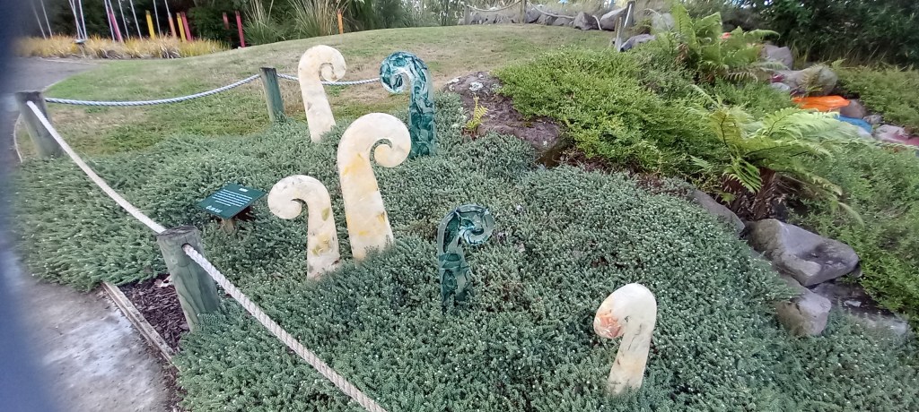
Rotorua – A last minute decision to visit a Glass Blowing Workshop proved worthwhile. Not only do they make and sell beautiful glassware – all inspired by the surrounding landscapes – they have also set up a glass sculpture garden. A clever idea for allowing the glass blowers to experiment and show off the results. Note the furled ferns, seen everywhere we’ve been. Also, the ingenious flowers shrewdly placed to create a waterfall feature.
Furled ferns – a symbol of hope . . .Glass flowers cleverly positioned to form a waterfall
Another visit to a geothermal park was on the cards. First, a little bit of science . . . New Zealand has a huge supply of geothermal energy due to the fact that it sits on the boundary between two tectonic plates. Geothermal energy taps the earth’s natural heat flow from the hot mantle up into the cooler crust. Power stations abound in this area!
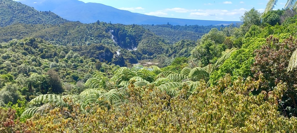
Waimangu Volcanic Valley was awe inspiring. In 1886 the Mt Tarawera Volcano erupted, causing a huge split in the land and forming 22 craters. Everything in the valley was decimated. Hot springs and geysers continued to bubble in the valley and still do today. Thirty years later (1915) plants and trees began to grow again, with no human input. It is easy to see that the native forests have completely re-established themselves.
Native Forests have regenerated – *note steam rising from various craters in the valley
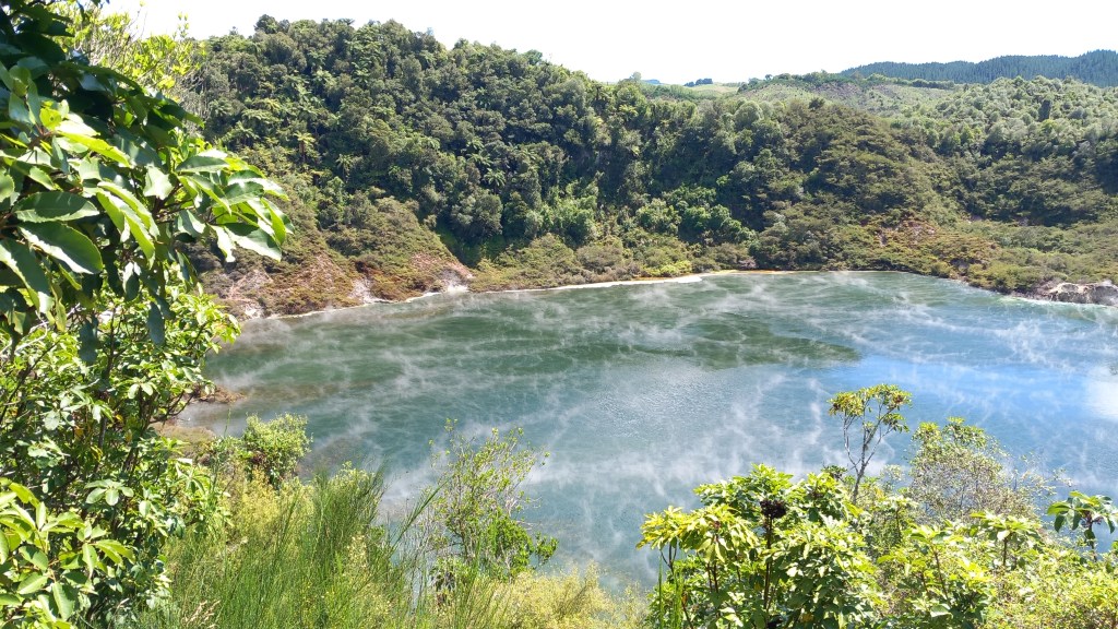
In 1917 one of craters erupted violently, deepening and enlarging itself significantly. Known as Frying Pan Lake, the crater quickly filled with water and now has an area of 38,000 square metres, making it the world’s largest hot water spring. It averages 6 metres deep with a temperature of 55 degrees C.
Frying Pan Lake
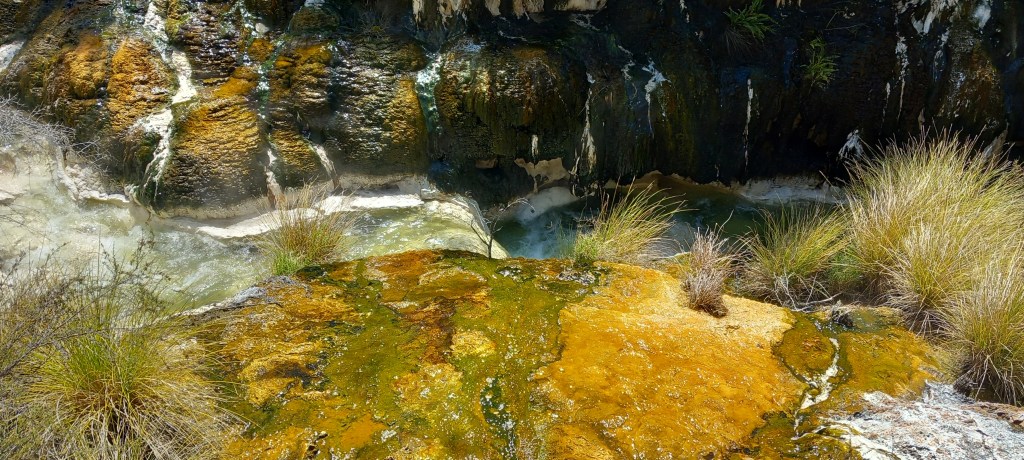
As we have found throughout New Zealand, the park was really well interpreted, footpaths were well kept with clear signage, and everyone showed respect for their surroundings. We followed the river valley, enjoying the brightly coloured hot spring algae and noting the plumes of steam erupting all around us. A challenging climb up many steps took us to Inferno Lake where we caught glimpses of the turquoise water under masses of steam. An unseen geyser ‘plays about’ at the bottom of this crater . . . .spooky or what?!
Hot water loving algae & silica deposits make a colourful display
Needless to say, the ‘rotten egg’ smell takes some getting used to in this area. Not only in the geothermal parks, but throughout the town – I was aware of the smell in the hotel! A guided tour of ANOTHER geothermal park, included watching a geyser in motion. Many moons ago, local Maoris used to stand washing themselves with soap. It didn’t take long for them to realize that the soap was setting off the geysers. Hence today, a geyser is set in motion by a ‘feed of soap’ every morning at a set time, to entice the tourists – they come by the bus load!
Lady Knox Geyser – set off with soap!
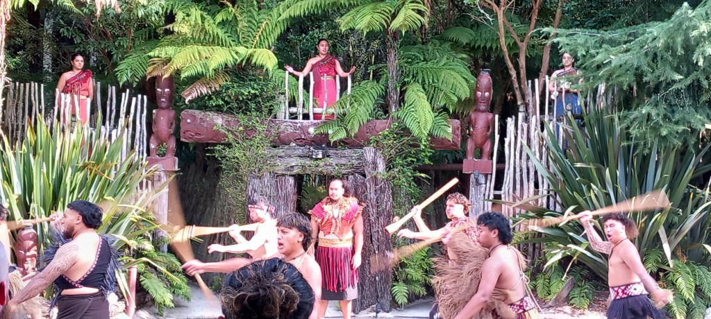
We spent an interesting evening learning about Maori culture and customs. Lots of war battle cries, lots of chanting and dancing. We were served a full three course meal, some of which had been cooked in a “hangi” ( heated stones in an underground pit) – all of which was absolutely delicious!
The Maori’s welcome us!
Coromandel Peninsula has been our last stop on this epic adventure. More spectacular scenery accompanied us on our journey north from Rotorua. Well kept farmland with the ever-present mountain ranges in the background. Much more dairy farming on the North Island, compared with many more sheep farms in the South. We stopped to have a walk up to Wairere Falls. A strenuous 45 minute walk, each way. through the forest, climbing over and around huge boulders led us to the base of this 153 metre cascade. Impressive to see during the drier summer months . . . this must be even more spectacular to see during the rainy winter months.
Wairere Falls
Our accommodation in Whitianga is a three bedroom apartment on three floors – Peter NOT amused to be carrying heavy suitcases up three flights of stairs! However, it is one minute from the idyllic seafront.
Whitianga Sea Front
We caught a little ferry across the inlet to be met by our mini bus and guide for a full day’s tour of the area. We visited an old gold mine in the forest at Puketui – the present government is keen to begin mining gold again – as you can imagine there is a lot of objection from nature lovers!
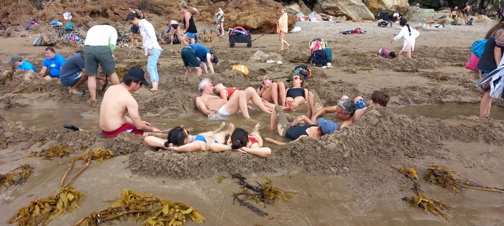
Hot Springs Beach was an eye opener. When the tide is out, many hot springs can be found by gentle digging with a spade (sold on the beach, of course!). A few hours relaxing in your own little hot spa is what the locals enjoy!
Hot Springs Beach
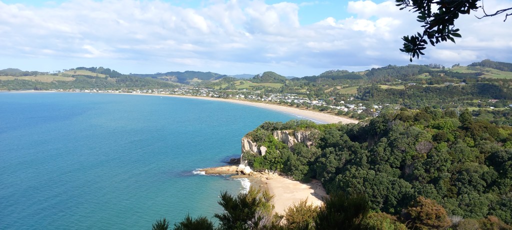
A long (up & down!) walk in the hot afternoon sunshine led us to Cathedral Cove – an idyllic beach only accessible by foot – which gets cut off by the incoming tide.
Cathedral Cove
Our last stop was Shakespeares Cliff, where we had our final history lesson, looking over Cook’s Beach – where Captain James Cook came in HMS Endeavour in 1769 on a mission to record the Transit of Mercury, as well as taking lots of plant specimens. Cook named the bay where he was moored . . . Mercury Bay.
Cook’s Beach
A quiet day today before we make our way to Auckland. I’ll send a final summary from there. . . . . .
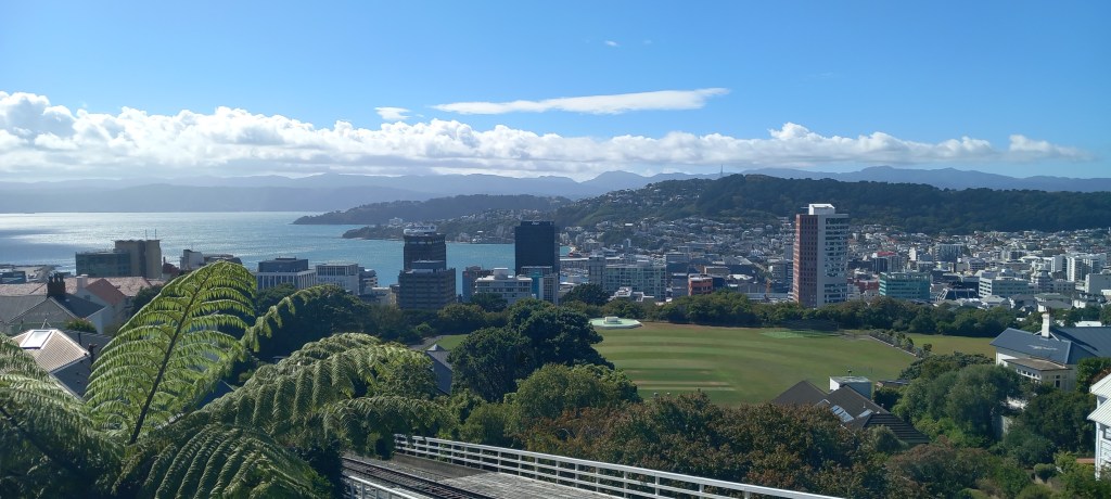
Wellington: Wellington is New Zealand’s capital city. With a population of just 427,000 (compared to London’s 9 million!), it is nicely compact and easy to get around. The parliament buildings are known as The Beehive, with good reason. The harbourfront is full of atmosphere with many shops and cafes. A tiny red cable car chugs up the hill to the Botanical Gardens and some wonderful views over the city. A leisurely walk twists and turns, through various themed gardens, back down to town. Of course for me, the rose gardens were the best!
The Beehive – New Zealand’s parliament building!
Wellington city from the top of the Cable CarRoses – and I’m happy!
A rainy afternoon was a perfect time to visit the Te Papa National Museum. Inspirational displays led us through New Zealand’s history, including a very moving exhibit on the battles at Gallipoli. Stories from young refugees gave wonderful accounts of how New Zealand’s population has developed over the years. One of the ‘fun’ aspects was standing in a small wooden house, experiencing an earthquake. For those of us lucky enough to live away from major faults in the earth’s surface, this gave real insight into just how terrifying this phenomenon can be!
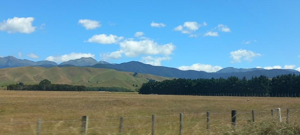
Napier: A full days driving took us north and east up the rugged east coast, passing through deep river valleys, and a couple of amazing mountain passes. Lots of sheep and dairy farming intermingled with the odd vineyard, and always with a range of mountains in the distance.
New Zealand scenery
Napier is world renowned for its Art Deco (1930’s) style architecture. Allow me to fill you in . . . . .In 1931 Napier was all but flattened by a huge earthquake, heaving the lagoon two metres higher than it was before and making Napier 40 square kilometres bigger than it was previously. Few of the central buildings survived. A huge rebuilding project was quickly established, influenced by the architectural styles of the day. These 1930’s streetscapes are protected today by the Art Deco trust. We enjoyed a guided tour with a lovely 80+ year old lady, who championed everything Art Deco with great aplomb!
Art Deco style bank – note the Maori influence in the decorative carvingArt Deco style – bright colours, geometric, borders
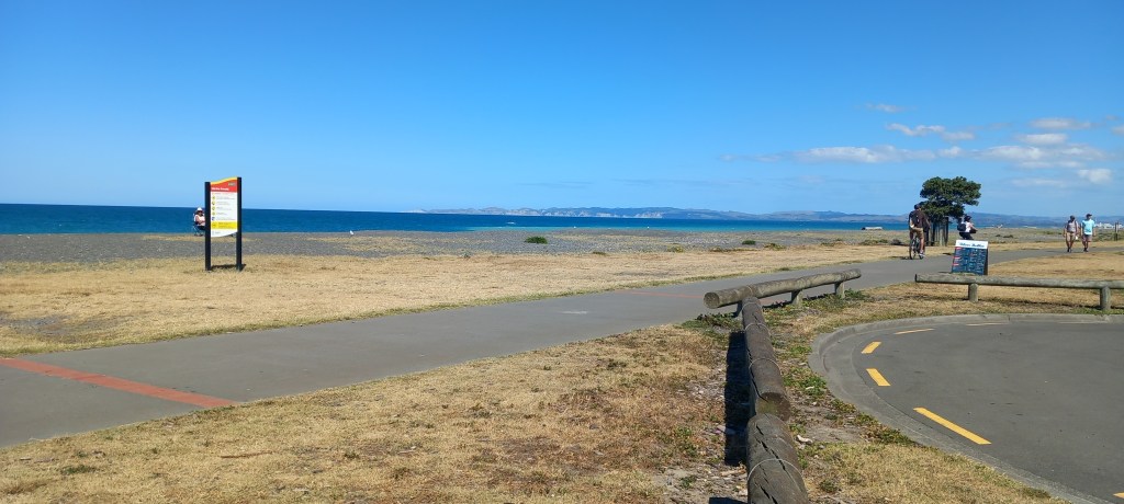
With a population of 67,000, it’s a vibrant city. Many streets of thriving shops and restaurants, along with a wonderful seafront walk stretching for miles (good for my morning run!) and wall-to-wall sunshine! What more could we ask for . . . . .
Napier Seafront
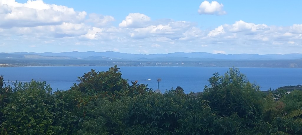
Taupo: From Napier, we headed inland across the wide Esk Valley and through another range of mountains – yes, another winding mountain pass! – before enjoying the plantation covered flat plains which lead to Taupo. The enormous lake here, the largest volcanic caldera in North Island, provides for the usual array of water sports whilst the surrounding geothermal fields are known for their hot springs and geysers.
Lake Taupo – pronounced “toe-paw”
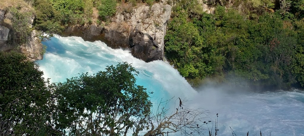
We took another nail-biting Jet Boat ride along the Waikato River (the longest river in NZ) to the foot of the Huka Falls, where about 120 cubic metres of water per second (yes! you read that correctly) were cascading over the rocks.
Huka Falls from above
Adding the tremendous force of water to the numerous 360 degree spins the boat did gave us enough adrenaline surge to last the rest of our holiday!!
Huka Falls from the boat – only 40% full at the moment!
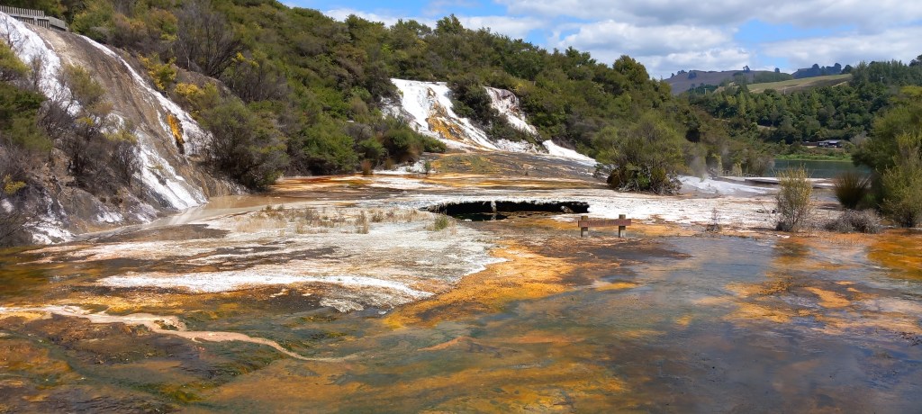
The Orakei Korako Taupo Thermal Area, proved to be just as exciting but in a much quieter way . . . a tiny ferry took us across the lake to some of the largest silica terraces in the world. There are 23 active geysers in this area – none of which performed for us today – but there was plenty of steam and bubbling going on in the numerous craters. This enormous terrace varies in thickness from just 20 mm to 20 metres in places. What’s more, it continues for another 35 metres under the lake!
Steam and bubbles from the huge silica terrace
Colourful algae growing in the hot water
Nearly 20 million litres of hot water per day trickles across the terrace and into the lake. I’ll leave you all to imagine the smell – rotten eggs anyone?? Unbelievable colours (orange, green, brown, pink) are formed by the algae growing in hot water with temperatures up to 60 degrees.
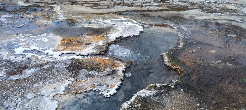
Bubbling boiling water from various craters
Mud pools have formed in places where the thermal fluids have chemically decomposed surface rocks to form clay. Underground energy heats the clay and boiling mud pools are created. The shop sold all sorts of beauty creams containing the mud, purporting to have marvellous results. Having witnessed the repulsive bubbling mud, I’m afraid the shop didn’t get any business from me!
Kaikoura: Continuing north from Christchurch, we passed through many miles of vineyards. Wonderful high hills, deep river valleys, along with an odd glimpse of the sea.. . . . A fabulous coastal road, winding past a turquoise blue sea, with impressive jagged rock formations, led us the final 12 miles into Kaikoura.
Our accommodation here was at the top of town, but with a very convenient 10 min walk DOWNHILL to shops and restaurants. This meant we ‘walked off our supper’ on the way back up the hill! Our host was a retired Army Police-dog handler – as you can imagine there was a lot of military talk going on!
Kaikoura is known for its seal colonies. All along its rocky coast it is easy to watch literally hundreds of fur seals. Luckily for us, there were many seal pups to watch frolicking in the water, lying sunning themselves on the rocks, or suckling from mother.
Fur Seal Pup feedingFur Seal pup and mother – enjoying a post lunch siesta!
We were prebooked on a whale watching cruise but sadly high winds overnight had woken the sea up! 35 passengers on the trip before ours had been seasick!! Only one whale had been spotted over the past couple of days . . . . it was an easy decision to cancel our whale-watching trip!
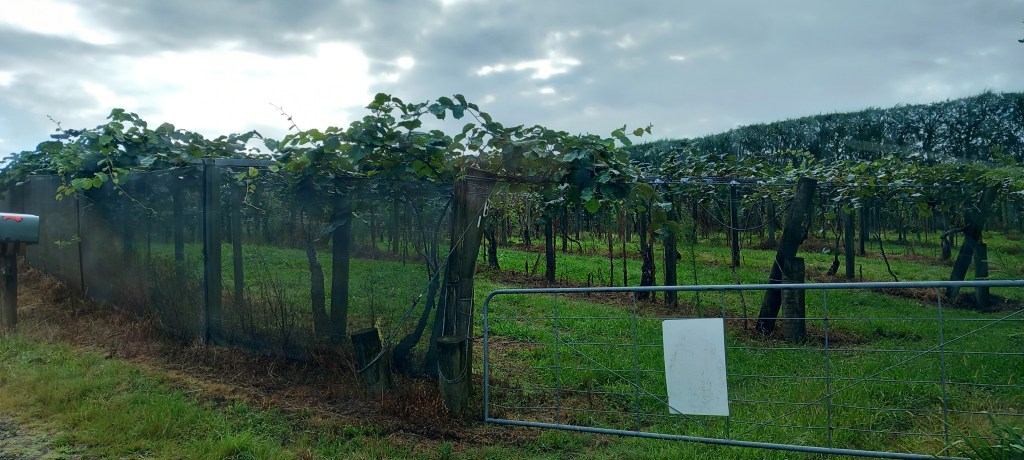
Nelson: Continuing north through Marlborough County, we noticed changes in the countryside. The deep greens of the south gave way to very dry grassy slopes. Browns and yellows were interspersed with odd rectangles of green pine forest or huge windbreak hedges. Vineyards covered all the north facing slopes (remember, we’re in the Southern Hemisphere!) and many valleys too. The vines are carefully irrigated so that the grapes fatten up and ripen, according to the acidity needed.
Passing over yet another mountain pass, we encountered RAIN! Yes, that wet stuff that UK is fed up with, finally arrived on our holiday here in sunny NZ! We descended into the city of Nelson (population 56,000) on the Tasman Sea and found our way to the lovely apartment of a golfing friend of Peter’s, who kindly offered us accommodation for our time in Nelson. Despite the inclement weather, our very hospitable hosts took us for a walk on Nelson beach, as well as leading us to the top of the hill to take in the views from the geographical Centre of New Zealand. Coffee in the Queen’s Gardens, was followed by a short trip up the coast to the Wharf at Mapau, where we disregarded the rain and enjoyed a good lunch.
Nelson from the Geological Centre of New Zealand
Abel Tasman National Park is renowned for its golden beaches, granite cliffs and its many walking tracks. Sunshine and fluffy clouds accompanied us as we took a cruise with commentary, all the way up the coast of the park. On the return journey we were dropped off and walked through thick native forest for two hours to another pick up point. The park is administered by the Department of Conservation – tourism is their income. Yes, the boat was crowded but there was space for everyone. We saw relatively few people on our walk and were able to sit quietly on the beach waiting for our return boat journey. The monitoring of where everyone was at all times was efficient but unobtrusive.
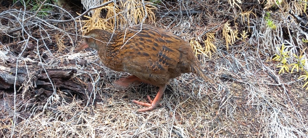
Cruise-Boat Vista – ramps are lowered onto the sand Footpath through the thick native forestA Weka – waiting nearby to see if he can nick our lunch!
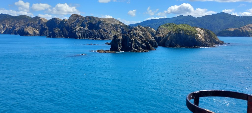
Picton & The Interislander Ferry: Today, we concluded almost four weeks of breath-taking travel on the South Island. Once again in brilliant sunshine with never-ending blue skies, we journeyed up and over two mountain passes from Nelson to Picton on the North-East coast. We returned our hire car to a site immediately adjacent to the ferry terminal. Yet again, we were lucky – we had a SMOOTH CROSSING to Wellington! The Cook Strait is notorious for rough seas, but today we treasured a relaxing time in the sunshine on the top deck.
Hikapu Reach leading into Pelorus Sound West Head – leaving the South Island
See you again soon with our adventures on North Island.
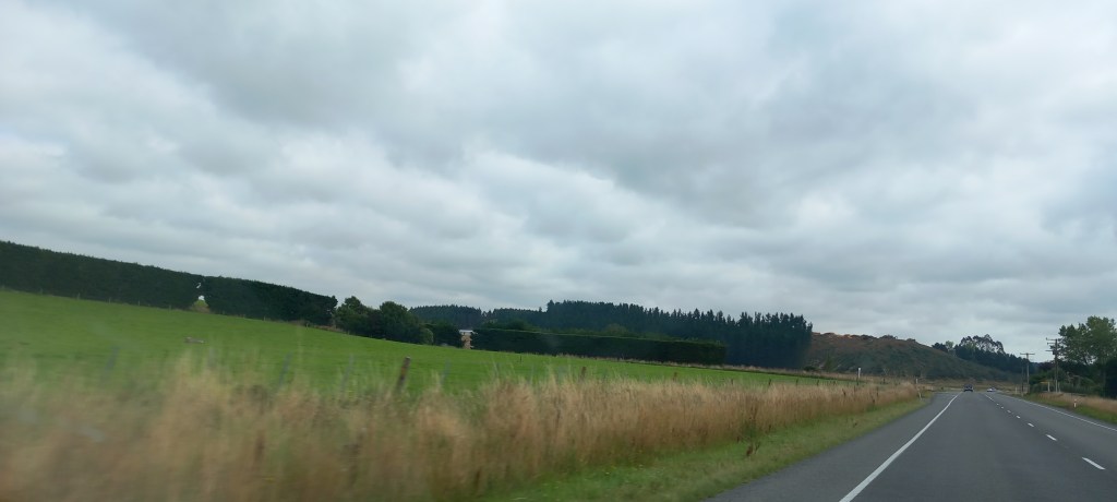
Dunedin: Driving north-east along the Southern Scenic Coastal Route, the flat farmlands of the very south progressed to rolling hills with wonderful wide valleys. Long straight roads took us past farmsteads hidden behind vibrant, thick hedges often on three sides of the property, acting as wind breaks. Free standing hedges often stand erect in the middle of a field to provide shelter from the wind for the animals. Wonderful views along the coastal cliffs and or beaches were interspersed with long bridges over wide river beds.
High hedges everywhere for windbreaks – for houses & livestock
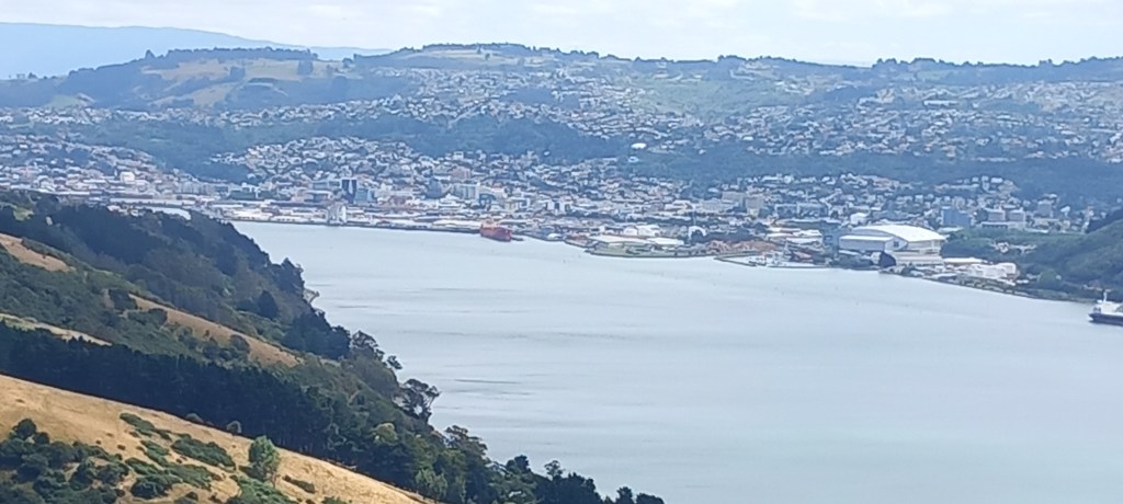
Our ‘boutique hotel’ in Dunedin was very central, allowing us to walk everywhere. It was a shock to our senses to be in a busy city after the tranquillity of the mountains and Stewart Island.
Dunedin Harbour
We were delighted to leave the city for a seven hour wildlife tour of the Otago Peninsula.. Our multi-talented mini-bus driver/guide took us all over the peninsula, giving us a full history and enchanting us with all the flora and fauna. Huge varieties of birds enjoy this quiet peninsula and Rob swept us away with his incredible knowledge of every plant, animal and bird. We walked through sand dunes and down onto the beach at Allan Bay which is full of fur seals. Several were lounging on the beach, but we gave them wide berth as they can get quite aggressive.
Fantasic beach at Allan’s Bay
Out on the furthest point of Otago Peninsula is a Southern Royal Albatross Colony. Carefully monitored and protected by the Department of Conservation, these magnificent birds come in to breed every two years. The male and female (who mate for life) take turns sitting on the nest for up to a year.
Southern Royal Albatross nesting on the point of the Otago Peninsula
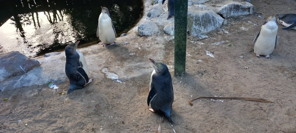
They can fly, staying in the air, for 10 – 12 months covering 120,000 miles thanks to their huge wingspan allowing them to fly without using much energy. They can even ‘lock’ their wings so that they can rest and sleep in the air. A visit to another beach had us watching the incoming tide at dusk to spot yellow eyed penguins coming in on the waves. Sadly, we weren’t lucky, but we did spy several who were already in their little man-made shelters dug into the dunes.A marvellous Rehabilitation Centre was set up in the 90’s for sick, starving or injured penguins. We saw yellow-eyed, blue, and crested penguins being gently improved and reoriented, ready to be released back into the wild.
Yellow-eyed penguins in rehabilitation unit
Oamaru: Continuing north and enjoying the winding coastal route with its lack of traffic and wonderful views, we arrived in Oamaru for the night. This ‘whitestone city’, has several Victorian buildings which sit resplendent in the local white limestone.
White limestone buildings in Oamaru
Koekohe Beach was a good find, both for its excellent coffee and its gift shop. However, a visit to the beach was more important to see the Moeraki Boulders – these perfectly spherical boulders date back 60 million years. No one knows yet, just how these boulders were formed – although there are plenty of theories!
Moerakiboulders
Banks Peninsula: This peninsula to the east of Christchurch is another little piece of paradise. High hills and sweeping valleys with many a winding road along the way, lead to the village of Akaroa.
LytteltonHarbour – where the first settlers from Britain arrived in 1850
We enjoyed a couple of nights in a farmhouse B&B nestled in a valley – beef and sheep are reared on this farm. Beautiful views over the hills along with splendid gardens just added to the effusive welcome from the hosts.
View from our bedroom at Croombe farm B&B
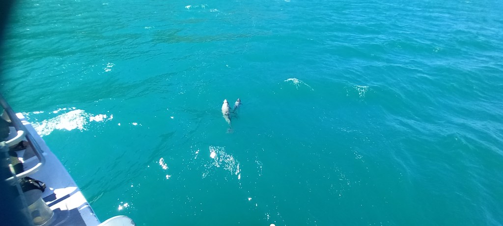
A two hour cruise took us out into the harbour to look for dolphins – we were not disappointed! Even saw a couple with calfs (known to Kiwis as rugbies, as they are about the size of rugby balls with fins!)
Hector Dolphin – mum & baby
The fabulous weather continues . . . . see you soon!