A ‘Quick Flit’ Through Florida

Port Canaveral

We will remember Port Canaveral as the ‘lucky’ port – at least, it certainly was for us!  We took a boat trip through the mangroves along Cocoa Beach hoping to see some wildlife.  Our very knowledgeable guide pointed out several different types of cormorants, herons and ospreys along with the multi-million-dollar houses along the opposite shore.  A manatee came close enough to the surface for a photo!  But the highlight (for the boat’s captain and guide as well as us!) was coming upon a ‘feeding frenzy’.  A shoal of fish must have gathered in one particular area . . . . .pelicans from all sides descended, and began ‘dive-bombing’ the fish!  Several pods of dolphins got in on the act, nipping round in circles, surfacing for just long enough to draw air and then giving us a real show of acrobatics as they dove in all directions for the fish.  Sorry! No photos of all this – it was one of those moments to savour, without trying to snap a photo at the same time!

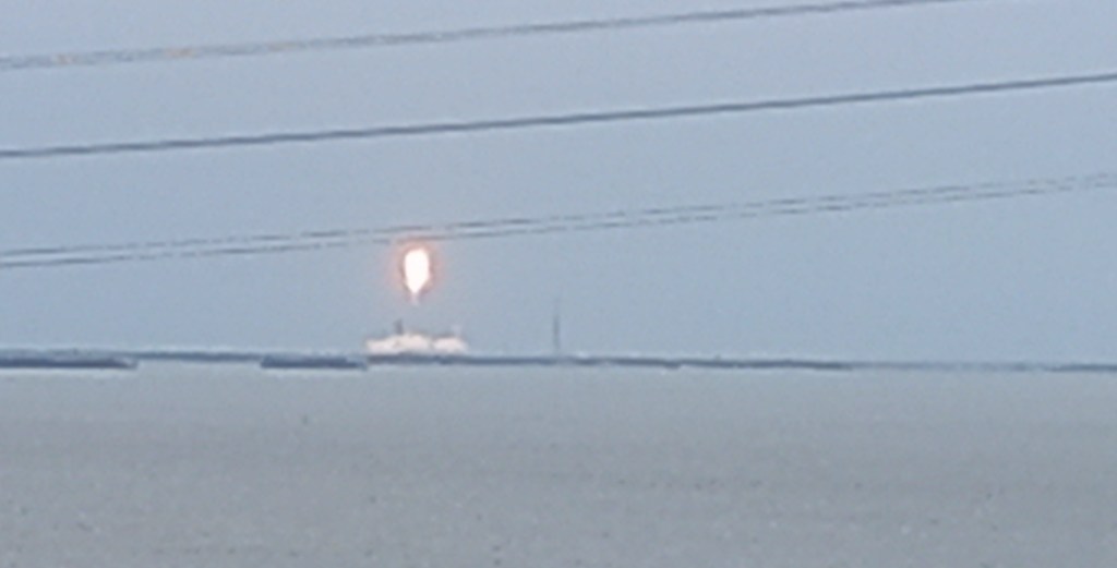
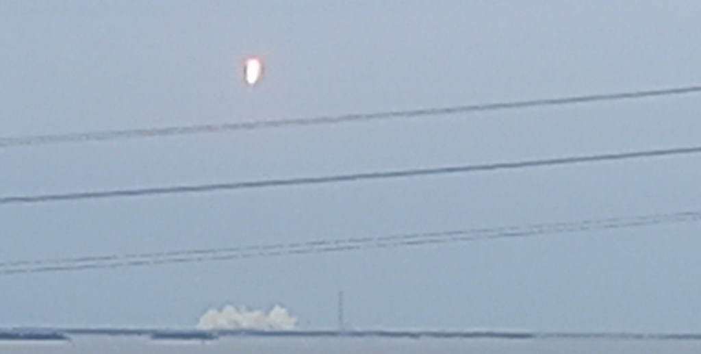
But our luck was doubled on our return to the ship.  A rocket launch, delayed from the previous day, was due to take place shortly.  You can imagine the excitement as people gathered on every possible outside space of the ship.  Borealis was conveniently moored facing towards the Kennedy Space Centre.  With fingers firmly crossed, we held our breath and were rewarded with the flash and up it soared.  Space X Falcon 9 has four Europeans on board, on their way to the International Space Station.  Five minutes later the booster returned, and we glimpsed the blaze of flame as it landed just out of our sight.  And then the Sonic Boom!  Luckily, we had been warned to expect it, as it shook the ship!!  Incredible experience. 

Fort Lauderdale

We were sharing the port with three other enormous cruise ships, so any ideas of a ‘quick shifty’ into town to the local mall were put on the back burner!  However, we enjoyed a journey out to the Everglades where we were treated to an airboat ride. Powered by enormous motors which propel two big fans, there are no operating parts below the waterline.  An exhilarating 35 mph ride took us to different areas where we then quietly looked for wildlife.  Amazingly the wildlife seems to be quite used to the noise!

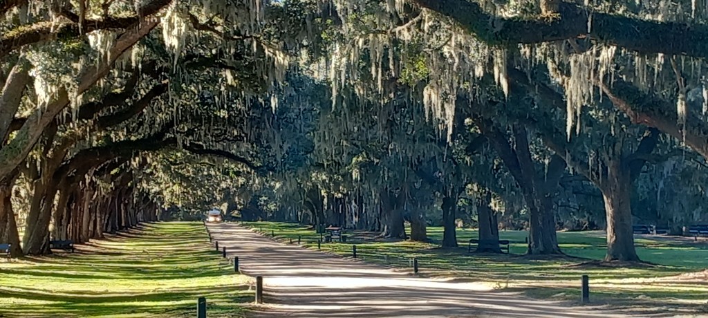
This preserved wetland stretches for 1.5 million acres across the southern tip of Florida.  Very slow-moving fresh water makes its way through estuaries to the salt water of the ocean.  Crocodiles live in the salt water near the coast whilst alligators prefer the fresh water.  Sadly, it was a cool day with no sun (again!) – alligators like to bask in the sunshine, but otherwise tend to keep themselves warm underwater.  However, one graced us with his presence by showing just his eyes above the water – apologies for the bad photo, but at least I proved we saw one! 

We also spotted plenty of bird life – vultures, osprey, cormorants, and the little purple gallinule.  The yellow flowered Spatterdock serves as a floating perch for the gallinule, but also makes good cover for an alligator’s head – hence the locals call it Gator Bonnet! 

Key West

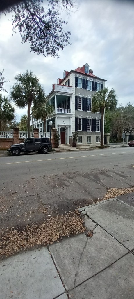
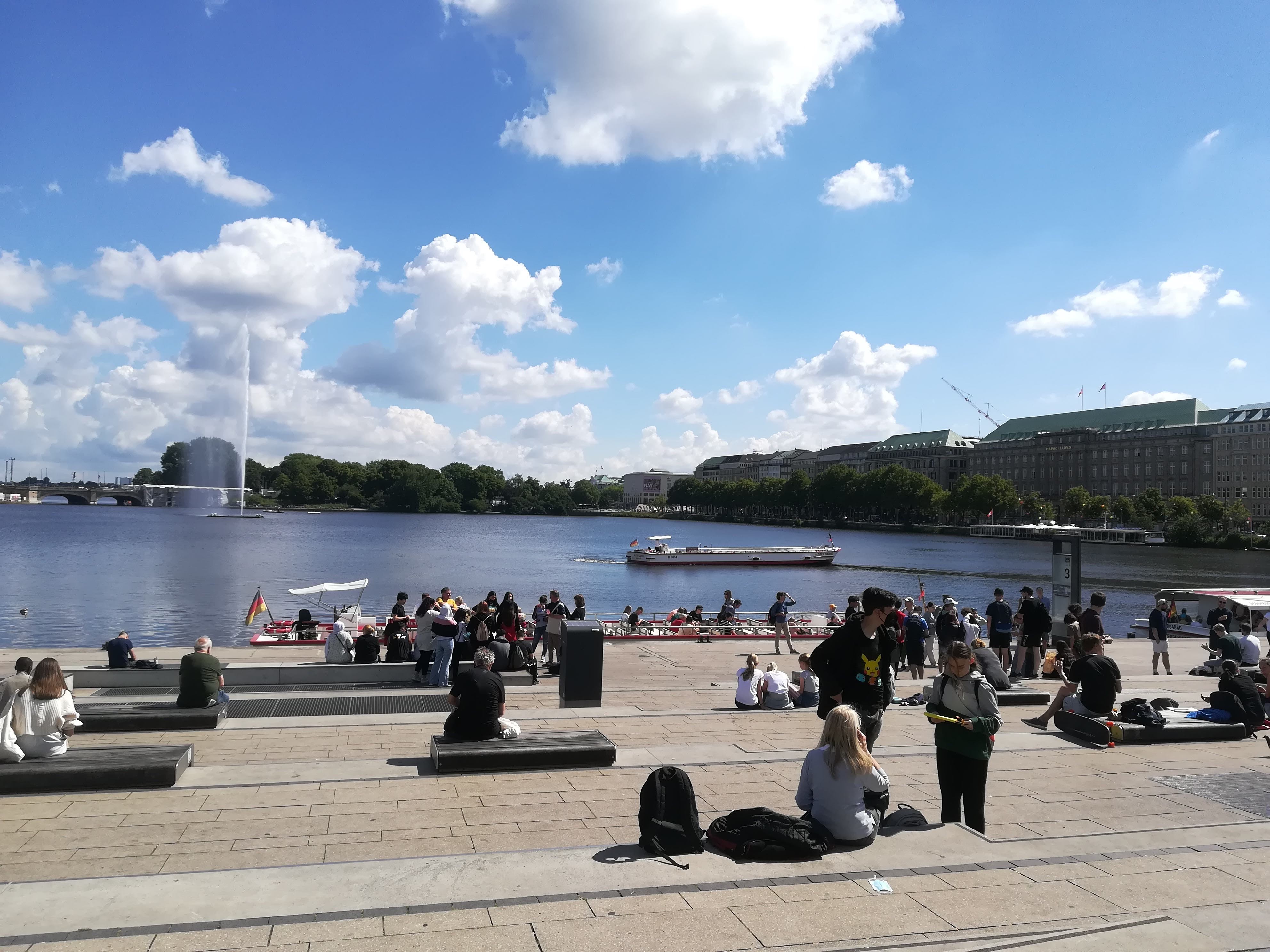
Sunny blue skies greeted us in Key West – hurray! One of the many islands that make up the archipelago (known as the Florida Keys) on the southern tip of Florida, Key West is a winter haunt for many North Americans who flock down from the cold northern states for a bit of sunshine and warmth.  Known as Snowbirds, they double or triple the local population and boost Florida’s economy substantially.  Borealis was able to moor within five minutes’ walk of the centre.  We were greeted with a plethora of restaurants, cafes, souvenir shops, beach shops, clothes shops, museums, and churches.  The streets were awash with tourist trains, open sided tour buses, golf carts, and bicycles all tussling for a space amongst the enormous American pick up trucks.  Live music lambasted us from popular local cafes, whilst commentary from tour buses slated us from the streets. 

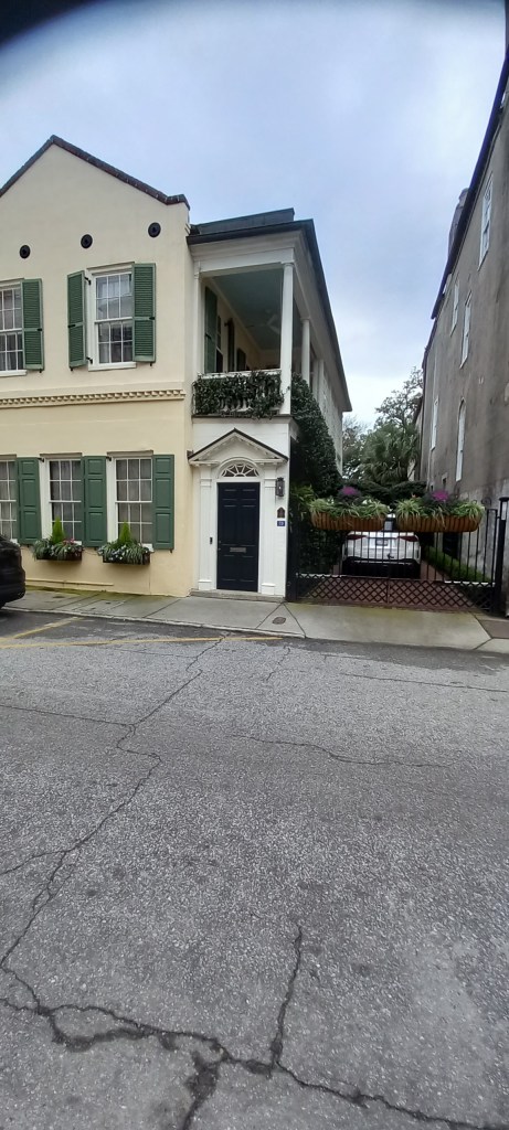
Quieter side streets were just as full of people happily sauntering along enjoying the atmosphere.  Houses here are mostly timber framed, but all with regulation tin roofs, as there is such a huge fire risk.  Palm trees and lots of greenery protect the houses from the fierce summer sunshine. 


On two occasions we were asked where the ship had come from. . .”Geez! You’ve come all the way from England? No kiddin’!  How long did that take you? Wow!”  Just to rub it in, we mentioned that we were continuing Around the World . . .”No Way!! All the way around?  Where are you visiting?  How long is it taking?  Geez, you guys are lucky! Oh Wow!”

Just about sums it up really – but I must admit, we’d had enough after a few hours.  Oh, to be 30 years younger!

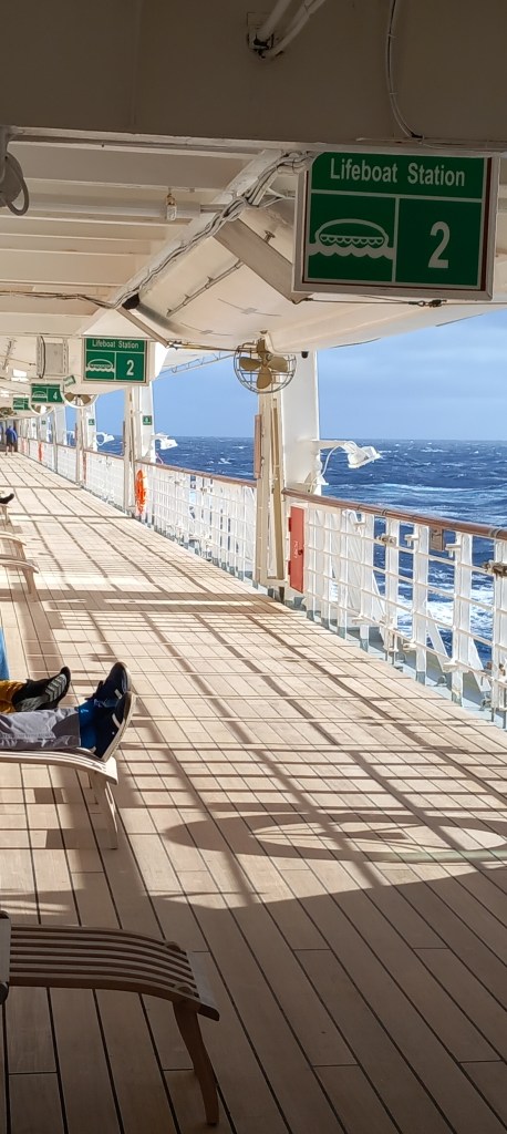
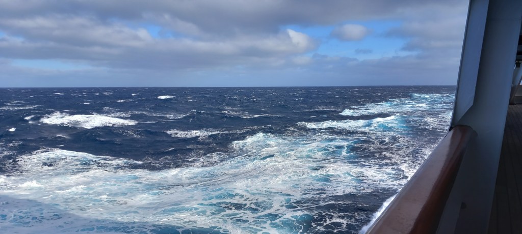
And so, we sail on . . .two days at sea now until we reach the Panama Canal. 

Bermuda & Charleston

Bermuda

Approaching our first port of call after 7 days sailing certainly created an electric atmosphere on the ship  – despite Bermuda being covered in low cloud! We were mega-impressed by the efficient and speedy method of getting us off the ship and into the correct tour bus – Bermuda immigration rituals are very low key  (we expect it to be VERY different when we enter USA for the first time!) Tiny, windy roads circumnavigate 22 inhabited islands of the 170 that make up Bermuda.  A population of 65,000 make up these tiny islands which lie 600 miles from mainland USA.  Life here is very expensive as everything needs to be flown/shipped in.  The many famous people who own impressive residences here are not deterred however – our guide assured us that ‘they just come here to chill!’ Lush green hillsides are dotted with colourful houses – Bermudans are permitted to paint their houses in ANY colour, but roofs must be white and are all constructed of ridged concrete.  The ridges collect rainwater which is then fed into underground water storage tanks – the only source of fresh water on the island.  There are no high-rise buildings – everything is built to withstand the frequent hurricanes that plague the islands.

The tour highlight was a visit to the awe-inspiring natural grotto of stalactites and stalagmites which make up the Crystal Caves.  Discovered by two young boys looking for a lost ball in 1907, we were blown away by the sheer beauty of nature – each stalactite begins with one drip of water and takes 100 years to grow 1 cubic centimetre! Stunning reflections glistened from the clear brackish water.  The water is tidal, fed from the sea but made brackish (a mixture of fresh and salt water) by the rain-fed limestone from above.  

A fascinating glimpse into life on the islands –  ‘Glimpse’ being the operative word – the ship was moored for just 5 hours! 

And we’re off to our next port of call . . . . .

Charleston

Despite being warned about possible delays through American immigration, there was still much chuntering to be heard, as many of us queued for an hour and a half before even entering the terminal building where immigration and security were taking place! 

Long delays did nothing to dampen the spirits of our American friends Bill & Cleo who were waiting patiently to sweep us into downtown Charleston – how lucky we were to have ‘local guides’.  Coffee in one of the multitude of cafes in this food paradise meant we could begin to exchange 15 years of news, before we set off on a self-guided tour of this historical city.  Cobbled streets and horse-drawn carriages add to the old-world atmosphere.  Pineapples are seen everywhere and are a symbol of hospitality. 

Founded in 1670, this area is renowned as the site of the first battles in the Civil War.  Lying at only 6 metres above sea level,  many houses  have a raised front door with stairs approaching it from either side – everything below the front door level (the wine cellar!) is built to survive flooding.  But it was the ‘single houses’ that we will remember Charleston for.  Very narrow lots inspired the design whereby the front door is actually to the side of the property underneath a balcony or two (known as piazzas).  The front door leads into a hall from which you reach a single room to each side. These rooms are literally the width of the house – just the two rooms to each floor.  The icing on the cake is the fake front door that faces the street, and provides privacy for the outdoor area under the piazzas. 

We were treated to a little trip out of town this morning  – the temperature here was only 7C!! but brilliant blue sky and sunshine. We visited the Boone Hall Plantation which was set up by an Englishman – John Boone in 1681 with 100 acres of land.   Just to make sure you know what I’m talking about  . . . a plantation was an estate or farm that produced a single market crop with the forced labour of enslaved people.     We learnt that various owners used the knowledge, skills and labour of enslaved people to produce crops, make bricks, serve the family and carry out the many tasks necessary to run such a huge affair.  Rice, cotton and indigo along with enforced  African slave labour are said to have made this area home to some of the richest families in the American Colonies.  It was an eye opening experience but we were comforted by the fact that slavery was abolished after the American Civil War. 

The camelias were in bloom in the extensive gardens and driving along the Live Oak Tunnel, as seen in so many movies, was a joy.  These Live Oaks are named as such because they are never without leaf.  They lose their leaves as the new ones form.  The swathes of Spanish Moss create a dramatic atmosphere. 

Huge thanks must go to our lovely friends Bill & Cleo – there’s nothing so special as being shown around by local experts! 

And so we sail on . . . . . .

Crossing the North Atlantic

The seasoned cruisers amongst you will have to skip this bit – it’ll be all old hat to you. 

We joined Borealis in Southampton on 7th January 2024, and many thanks to our elder daughter Sarah for offering to taxi us there – what a treat to have some ‘daughter’ time at the beginning of our exciting trip.  Within an hour, we were finding our way around our ‘home’ for the next three months.  We are delighted with our very comfortable cabin – and yes, we’ve found a place for everything!

Six full days at sea have allowed us to get into the swing of life onboard.  There are SO many activities offered, that one simply cannot get to them all – there are clashes (just like the u3a!), so priorities must be chosen.  Activities in the fitness area have been curtailed for the last two days – so no yoga, and no gym sessions.  Even the walking deck was closed yesterday.  It IS January and we ARE crossed the North Atlantic, so high seas are to be expected. Despite my worries about my past record with sea sickness, I’ve only succumbed on one afternoon, but I’m happy to say that an Echinacea tablet (of all things) has sorted the problem.  (take note anyone who suffers) Meanwhile, everyone staggers around as if drunk (and some probably are!) 

We thoroughly enjoy the many lectures that are offered – from history to wildlife, it’s all covered.  There is a daily cookery demonstration by one of the 96 (yes 96!) chefs onboard (we’ve learnt to skip breakfast if attending the cookery demo, as you’re handed a plate full of whatever has been cooked to sample at the end.) Morning coffee is always a joy in one of the many lounges onboard – one of the many chances to get chatting to whoever is nearby.  A good walk around Deck 3 is a must  – three times around equals a mile – filling the lungs with sea air (and sometime a load of spray as well!) sets us up for the day. 

**

We’ve both taken great pleasure in joining the Borealis choir.  Yes, even yours truly has found a voice – the choir leader is great fun, and the 80 of us have a good laugh.  We meet daily, and during rough weather have had to sit down.  Trying to sing through one song today standing up, the ship rolled suddenly and quite a few of us were thrown back into our seats! We hope to perform four concerts as we circumnavigate the globe.

 The food is every bit as good as everyone has promised us – the crew just couldn’t be more cheerful and helpful.  8 months on and 3 months off, working every day – and they never lose their smile!

And finally the evening entertainment – FANTASTIC. Borealis has its own theatrical dancing group who are very professional.  This week we’ve had a really good Soul group singing the songs that we all know – all this despite the stage, screen and curtains being thrown around by the sea swell!  The ship’s pantomime was hilarious complete with one of the entertainment managers performing as Widow Twanky in Aladdin.  6 inch chunky heels on a stage that was tipping from one side to the other was no mean feat!

We’re just about to berth in Bermuda - watch this space.

My lack of sense of direction!

Those of you with a beady eye may have noticed that I’ve stated below that we are heading east - Oh no we’re not! We are heading WEST! 

WordPress have made a few changes since I last used this site for my blog - I only write blogs if we’re going on a long holiday! Hence I have changed my domain name - mollysfolks.uk is what to tell anyone interested in following our travels. Until next time.

Around the World in 80 Days . . . make that 101 days!

We will shortly be setting off on a Holiday of a Lifetime.  Having read of the recent anniversary (1873) of Jules Verne’s famous novel ‘Around the World in 80 Days’, we discussed what fun it would be to follow such a route.  To our delight, we discovered that Fred Olsen was offering a Round the World Cruise, setting off in early Jan 2024 and taking 101 days to circumnavigate the world.  Given that 50th wedding anniversaries fall once in a lifetime, and we’ve decided to spend the kid’s inheritance (I’m told this is SKI – ing!) and fulfil our dream. 

A holiday blog is a must for me, as it’s the only way I shall ever remember where I’ve been (the memory cogs are getting a little rusty these days!) – so please join us on our journey.  Postings are bound to be intermittent, not least because we will be jolly busy enjoying all the activities that the ship offers – both onboard and ashore! 

Our ship is the Borealis – if you’d like to have an early ‘nosey’ at what we’ve let ourselves in for, google it.    We board in Southampton and head east – the itinerary is very exciting so I will keep that part as a surprise!  In the meantime dear reader, you should know that we have NEVER been on a cruise before, and I do NOT ‘sail’ well!  However, we are assured by absolutely everyone that we will LOVE cruising and my darling ex-marine husband promises that I will quickly find my ‘sea legs’  – here goes . . . . . . . . . .

Homeward Bound

We crossed the German border into The Netherlands at Bourtange.  The name should be familiar to you, as this is where we crossed on the way north.  Not only was it conveniently on our route, but we wanted to return to our favourite campsite.  The site at Bourtange is huge but divided into separate areas with good thick hedges.  It is also delightfully quiet (families seem to be put in separate areas) and it has lots of shaded pitches.  We were thrilled that the manager recognized us (well, let’s face it, we Brits stand out like a sore thumb!) and even happier to return to the self-same pitch that we’d used 2 weeks earlier.  Given that it’s high season, it was busier than before, but still far more space between campers than many of the other sites we’ve stayed on. 

Molly on ‘her site’!

The Hanseatic town of Deventer in the Central Netherlands was our next stop.  Once again, an enormous ‘quick-stay’ campsite with far too many campers squeezed in  (the motorhome next to us was about 2 ft away!), but with the convenience of being able to visit the town without driving.  In fact, there was an efficient and very frequent ferry which crosses the River Ijssel for foot passengers. 

Deventer from the ferry

It’s a delight to just wander the lovely narrow streets and take in the many styles of architecture.  Apart from the odd blip, Deventer seems to have maintained its prosperity for centuries.  The main square, known as The Brink, is full of cafes of all sorts which comes alive as the sun goes down. 

Part of the ancient fortifications in Deventer

Zwolle is another Hanseatic town (there are nine on the River Ijssel) which we visited by train (air-conditioned, Oh Bliss! We’re suffering the same heat wave as you are!)  Its original fortifications were a sort of star shape, as are the canals that surround the town.  Only one of the original gates is still intact – and very impressive it is too.  We spent some time in the museum (again, a good way to escape the heat) and looked at an exhibition of Nature & Humanity. It was eye-opening and reminded us very much of our visit to the Floriade, way back at the beginning of this holiday.

Double decker air-c0nditioned train – bliss!
Canal & One of the Original Gates in Zwolle
The Mosaic Dome on the Museum in Zwolle

We spent our final night on a small campsite, on a farm.  After the very busy site at Deventer, it was bliss to sit and watch the cows coming in to be milked!  Sadly our final day in The Netherlands was a wet one  – only the second rainy day of the five week holiday, so we couldn’t complain.  A good excuse to visit the local village of Oudewater – such a pretty little town with several canals running through it – and enjoy a long relaxed lunch. 

Peaceful scene of cows coming in for milking at our last campsite
Oudewater on a dull day

I’m happy to report that we had NO queues at the ferry terminal, NO problems with passport control and a thoroughly comfortable cabin for our overnight crossing of the North Sea from Hook of Holland to Harwich – we’ll definitely be using StenaLines again whenever we can!

Thanks to all of you for following our adventures – and for the many lovely comments.  See you again soon. . . . . . .

Working our way back south

We crossed the Jutland peninsula from east to west, enjoying the straight, well surfaced roads – even the back roads are well maintained in Denmark.  Just a few minor points about the Danish way of living (huge generalizations I know, but it’s what we’ve noted.)  1. The majority of Danish houses are bungalows – upstairs rooms are built into the roof space rather than having a full two stories.  Quite a few houses have basements. 2. The Danes being so hot on design, are also bang up-to-date with recycling – bins are provided for everything. 3. Huge anaerobic digesters are very common, and we’ve seen ‘Biogas’ lorries transporting the resulting gas.  4. Tesla cars are ’10 a penny’ here! This is not a poor nation!  5. There must be money in Christmas tree plantations – they are everywhere!  6. Danes are very patriotic.  Most houses have a flag pole and flags are flown for every celebration – family occasions as well as royal birthdays and official holidays.

Flagpoles on the majority of houses – pennants or full flags if there’s a family celebration (sorry for the poor photo)

From Auning we moved south-west to a campsite near Esbjerg, on Jutland’s west coast.  As part of the World Heritage UNESCO Wadden Sea National Park, we enjoyed some good walks through wetlands, woods, heathland, and sandy beaches. Annoyingly, it wasn’t warm beach weather whilst we were there!

Windswept beach on the west coast of Denmark

On our journey south, we stopped to see the town of Ribe – Denmark’s oldest town which dates from the 9th century.  It is full of half-timbered old houses, and idyllic narrow streets.  The splendid cathedral is the nation’s oldest (dates back to 948!) and sits proudly in the centre of town.  Its tower serves as a look-out point for approaching floods.  Ribe had a good vibe, crowded with happy tourists on a lovely summer’s day. 

Pretty streets of Ribe
A pretty courtyard off the main street in Ribe, where we enjoyed a coffee
Simple but beautiful interior of the oldest cathedral in Denmark

Moving south into Northern Germany, we spent some time in the state of Schleswig-Holstein.  Lots of villages, built around a farm or two, and many with some Geestharden houses – based on the original long houses, built alongside the barn, in the local red brick and with thatched roofs.  Interestingly the front door is always under a gable as a safety precaution.  If the thatch were to catch fire, the incumbents should be able to escape without burning thatch embers falling on their heads. 

Geestharden house in Schleswig-Holstein
Geestharden house

As a complete change, we stayed on a site next to the Kiel Canal.  As you’ll all know, Peter is keen on canals, so this was a ‘must visit’.  We were not disappointed.  This 98 km canal links the North Sea in the west with the Baltic Sea in the east.  It was originally built in 1890 and has been widened since.  Nowadays it has more ‘traffic’ than any other canal in the world.  Upwards of 250 ships per day, use this canal!  Very high railway and motorway bridges tower over the canal, small ferries take local traffic to and fro.  Well maintained towpaths run along both sides.  Walking along as a container ship passes, makes one realize how big these ships are, and just how small and insignificant we are.  Using the canal instead of sailing all the way around the Jutland peninsula,  saves the ships about 460km (250 nm)  of travel.

Container ships making their way along the Kiel Canal
Local ferry in the foreground is dwarfed by the towering railway bridge across the canal

We visited the locks at the North Sea end of the canal near the mouth of the River Elbe.  The locks are 45 m wide and 327 m long – a little bigger than the locks we passed through at Christmas in our narrow boat!  Two or three container ships can fit in the locks at any one time.

Ship about to leave the lock on its way to sail the Kiel Canal

In order to head southwest, we had to take a ferry across the River Elbe – this huge river only has two crossings – the ferry, or a tunnel in Hamburg.  Bad planning on our part meant that we joined the ferry queue on a Friday afternoon on the first day of the school holidays!  Two hours later we did the 20 minute crossing. No worries, we prepared and ate our lunch as we inched forward in the queue.   AND it saved more than 100 miles travel as well as facing traffic in Hamburg on a Friday afternoon.

Part of the two hour queue waiting for the Elbe ferry
One of the three ferries negotiates the sandbar, before heading to the southern shore of the River Elbe

We head further south and west tomorrow and cross back into Holland.  Cannot believe where the time has gone, we only have six days of holiday left.  I’ll add the final few days, and some summing up once we’re home. 

A Week in Denmark

We chose to enter Denmark by ferry.  Scandlines run a very efficient service from Puttgarden in Northern Germany to Rodbyhavn in Denmark.  We crossed an inlet of the Baltic Sea in full sunshine and with calm seas (thank goodness!)

Calm seas crossing Femern Belt

I shall profess my ignorance now  – I had no idea what to expect in Denmark – I’d not had time to research it and knew nothing about it.  Yet all three Scandinavian countries have always been on our bucket list!  Today’s geography lesson is as follows:  The peninsula of Jutland makes up Denmark, along with – wait for it. . . . . 1419 islands!  Seventy-eight of those are inhabited.  Zealand is the largest island and the most densely populated – and home to Copenhagen.  We arrived on Lolland, and spent a couple of relaxed days in a tiny town called Sakskobing – everything was within walking distance including the rather ‘fun’ water tower. 

Sakskobing water tower

A pleasant journey on quiet roads through open countryside took us most of the way to Copenhagen.  Twenty minutes of motorway-driving on the outskirts of the city led us safely to our campsite on the western edge of the city.  A huge field serves as a summer-only campsite – efficiently run, with clean showers and toilets and washing facilities.  A 10-minute walk to the bus stop – 10 minutes on the bus, and we were in the city centre.  Again, a city pass was a good deal for two and a half days of travel in and out.  (this time our passes were checked by inspectors doing spot checks!).

City Hall in Copenhagen

Yet another city built around a harbour and canals – we took a canalboat tour and enjoyed the banter of the guide (in three languages) and his historical input.  Nyhavn is probably the most photographed area, and quite rightly so – attractively coloured houses adorn the canal sides, with numerous cafes to quench your thirst.  If you’re thinking of visiting Copenhagen by the way, make sure you take out a second mortgage – it is NOT cheap!! But it has its charms.  Beautiful squares, and splendid buildings most of which have been rebuilt or restored since a huge fire swept through the whole city in the 1700’s. 

Nyhavn Canal in Copenhagen
Frederik’s church near the Royal Palace in Copenhagen
Canal Boat tours setting off
Beautiful carving on the ONLY bridge to survive the great fire that swept through the city in the 1700’s

Copenhagen is famous for its up-and-coming designs – many of its buildings endorse this.  Rain showers made photography a bit grey at times, but when the sun is out, the light here is wonderful.

The city library – known as the Black Diamond – the glass sparkles, like a diamond,when the sun shines on the water
View from inside the Black Diamond (top floor) out onto the canals below

It is also known for its Little Mermaid statue that ‘greets’ anyone entering the harbour (rather like the Statue of Liberty in New York).  Sadly, this little Mermaid has been badly maimed by vandals and demonstrators alike over the years and is more of an eyesore than an icon these days!  However Hans Christian Anderson himself is not forgotten . . . .

Hans Christian Anderson

Having been blown away by the bicycle culture in The Netherlands,  we were astonished to discover an even greater cycle culture in Denmark.  Known as the world’s best city for cycling, more than half the workers in Copenhagen do their daily commute by bicycle.  Huge investment has been made in cycle lanes, next to bus lanes, next to road lanes.  The cycle lanes are used to the full because they are safe.  Visitors using their ‘old-fashioned legs’ quickly learn to ‘look both ways’ for cyclists!

The cycle commute!

By sheer coincidence we followed this year’s Tour de France route west from Copenhagen and over the Great Belt Bridge which connects Zealand to Furen.  This link features a 256 metre high suspension bridge, followed by a box-girder bridge – the entire link totalling 11 miles in length!  Bicycles are not normally allowed to use this link (they have to cross by bus or train) but the link was closed to traffic for the Tour de France – the wind is VERY STRONG across the entire link – it must have been very hard work for the cyclists! 

The Great Belt Bridge – the entire link is 11 miles long

We spent a night near the town of Vejle – a starting point for another leg of the TDF.  Vejle makes an easy weekend getaway from Copenhagen (less than 2 hrs by motorway ), The town had lots of thriving restaurants, a marina full of boats (the cost of which would make your eyes water!), and some of the latest designs in modern apartment blocks. 

‘The Wave’ apartments in Vejle
Imagine having to cross a drawbridge to get to your apartment!
Vejle town centre & restaurant area

We’ve reached our furthest point north today – in the little town of Auning.  We’re on the quiet eastern peninsula which juts out into the Kattegat.  For those of you who love maps we’re at 56.5N (latitude), which happens to be parallel to Dundee in Scotland!  We have spent the day enjoying quiet country roads.  Huge open vistas of golden crops and enormous piles of timber from the abundant forested areas – all this interlaced with tiny villages.  Having decided we are ‘citied-out’, we avoided the summer crowds in Aarhus (sorry Ian), and plan a quiet day’s walking locally tomorrow before beginning our journey back south. 

Good road surfaces and far reaching views – highest point in Denmark is only 170 metres above sea level
Lovely straight back roads – very little traffic.

We have three more nights in Denmark which I’ll cover in next week’s blog.

Until then . . . .

Northern Germany

My apologies to those who missed a notification about the North Holland blog – I can never tell who’s received it as this is in the hands of WordPress!  Hopefully you can catch up this week. . . . .

Crossing the border into Germany went almost unnoticed – there was no ‘Welcome to Germany’ sign, just a sign for a change of province.  However, just as we tend to notice a difference between counties in UK, there were noticeable differences in the countryside in Germany.  Houses seemed bigger and appeared to be on bigger plots.  The crops were no longer all those vegetables which end up in UK supermarkets.  Now we saw grains of every type, as far as the eye could see.  Wheat, oats, barley, and maize.  AND . . . .very slight inclines in the landscape began to appear – the total flatness had disappeared.  Large, wooded areas became the norm, in contrast to The Netherlands, where it seems that every square metre of ground is used to grow things for market. 

We stopped and made coffee (as we do!), then took the opportunity to take a walk in the woods . . . .

Enjoying a walk in the dabbled sunshine

As mentioned before, all campsites have been prebooked for this journey, as we were warned that it was high season (only two have asked for a deposit in advance, so if we change our route for some reason, we can ring and cancel).  Imagine our surprise when we found ourselves on a German Camping Club site!  A tiny, wooded site in the middle of nowhere (very much our sort of site!) with 9 caravans parked for the summer.   Danny, with whom Peter had been communicating, had been quick at answering emails and was keen to welcome us.  However, he spoke no English and had pressed ‘translate to English’ on every email.  Lunch in the clubhouse was just ending, and a kind chap, who spoke some English, stepped forward to give us the site information.  We relaxed in the sunshine for a couple of hours but were then driven inside as the mosquitoes came out!!   The grass was not cut short – in fact, we were very much in a field!  We had a disturbed night thanks to the bugs and then a HUGE thunderstorm awoke us at 5am – all part of the excitement, but at least we were up and away in good time.

German Autobahn driving has been interesting – 130km speed limit feels SO FAST when Molly is running along sedately at about 100.  Even so, a 60 km loop to the south of Bremen seemed to take us no time.  We then returned to our beloved back roads through lovely wooded areas and spacious, tidy villages.  Our campsite on the edge of Hamburg, had lovely big spaces and good facilities – all of which made up (just about!) for the constant noise of the motorway which was right beside the site.  Luckily two long days of sightseeing in Hamburg meant we slept through any background noise! 

And so, to Hamburg – another city, in another country, and very different from Amsterdam.  Hamburg is a city of two lakes – the Inner Alster and the Outer Alster – which were created when the Alster river was dammed during the 12th century. 

Our first view of Hamburg as we exited the Metro – Inner Alster

There is a maze of very wide canals which link the lakes to the River Elbe, which flows out to the North Sea – hence the canals are tidal. Hamburg has more bridges inside its city limits than any other city in the world and more canals than both Amsterdam and Venice!  It is the country’s largest port and apparently, the third busiest port in the world. 

A busy port – ferries & freight – note cruise liner in dry-dock top left (British P&O cruise liner)

Monuments and interesting buildings abound, so I will cover just a few. 

Wide Canals, warehouses are now luxury flats

St Michael’s church is one of the famous landmarks in the city. We were lucky enough to hear one of the six (yes, six!) organs being played in rehearsal for a concert.  

St Michael’s Church -Interior
One of the SIX organs at St Michaels

Hamburg is being rebuilt in every direction and on every street.  Many of the old warehouses along the canals are being transformed into luxury apartments.  One set of warehouses forms the base of the Elbe Philharmonic Concert Hall, an amazing architectural feat with 1047 panes of glass.  There is a spectacular plaza at ‘top of warehouse’ height with far-reaching views of the city.  Visitors are taken there via a splendid 80-metre-long arched escalator.  The journey takes two and a half minutes and at no point can you see both the top and the bottom at the same time – amazing!

Elbe Philharmonic Concert Hall – built on top of a warehouse
Arched escalator at the Philharmonic hall

One of the main modes of transport are the ferries.  We enjoyed joining the locals on their way to or from work and found it a good way to enjoy views of the various parts of the city. 

A Hamburg ferry
A view from the ferry

Our journey from campsite to city centre involved a 5 min bus ride, followed by a 20 min metro ride.  Regulations are still in place here for using facemasks on all public transport.  Luckily we still had some on Molly!  There are no ticket barriers in stations, on buses, or on ferries – you are required to buy a ticket (luckily we got a very cheap deal) and there are ‘frequent spot checks’.  Over two full days in the city, jumping on and off buses, tubes and ferries we never once saw a ticket inspector.  I hate to imagine how many thousands of people travel without buying a ticket – or perhaps I’m underestimating the discipline of the Germans! 

After the heat and bustle of the city, we found some welcome relief in the shade and trickling streams at the Planten un Blomen – a 47 hectare park of plants and flowers .  The roses were stunning, and the fountains gave a dramatic hourly display

Roses at their best
Fountains on display

Heading north east, we did a quick visit to Schwerin.  Surrounded by seven lakes, the town is known for its castle.  Situated on an island in the middle of Lake Schwerin, this frequently restored 14th century building now houses the provincial parliamentary offices.  The state rooms provided us with welcome respite on a day of rainy weather.

Schwerin Castle
One of the State Room ceilings

 The city of Lubeck lies near the bottom of the Jutland Peninsula (between the North Sea and the Baltic Sea) in the state of Schleswig-Holstein.   Known for its role as one of the founding cities of the Hanseatic League, it is FULL of historic buildings, and is recognised as a UNESCO World Heritage Site, despite being badly bombed during WWII.  The 14th Century Holstein Gate takes its place of honour at the entrance to the city. 

Holstein Gate at Lubeck – notice the sag! (pity about the grey exhibition box blocking the view!)

The European Hanseatic Museum gives the full story – well interpreted – what did we do before WIFI & QR codes?  Quite apart from the story of the Hanseatic League, I found myself wondering where the word ‘hanse’ comes from?  It is derived from an old German word which means ‘group or band of people’.  Since the 12th it has been used to denote “communities of long-distance merchants”.  (today’s bit of trivia!) Suffice to say, that we spent a pleasant day, in a city very deserving of its UNESCO heritage.

Town Hall & central square – Lubeck
Holy Spirit Hospital, Lubeck – has been treating patients since the 12th century. The pretty square in front of it, is a quiet place to rest and de-stress, full of herbs and flowers
St Mary’s Basillica was badly bombed during WWII – it has been rebuilt in a very simple style, painted flowers on concrete for decoration. It can be seen from everywhere, being built on the highest point above the river, and boasting twin towers which are more than 400 ft high.
The original church bells remain where they fell during the WWII bombing, as a memorial to all those who lost their lives.

We’ve now crossed an inlet of the Baltic Sea to Denmark. More next week.

North Holland

Driving north from Amsterdam, we enjoyed a stop with a view point on the coast of Lake Markermeer.

Looking across the Markermeer

To help you understand . . . The North Sea inlet to the northeast of The Netherlands was dammed off in 1932 – the Lake that was formed was called the Zuiderzee.  This was further divided in 1976, by a new dam – the southern lake is the Markermeer and the northern one is the Ijsselmeer. 

Monnickendam is a gorgeous little town, conveniently situated just 1.5 hrs from Amsterdam, and therefore a good place to moor your gin-palace!  Molly sat in a carpark on the edge of town, whilst we meandered down the cobbled streets admiring the many beautiful gardens.  Everywhere is beautifully kept and with the exception of Amsterdam itself, we have seen NO LITTER anywhere.

Pretty canals in Monnickenham
A good year for roses in Monnickenham – just as in UK!

As the motor homers among you will know, we prefer small, quiet campsites and are grateful to our neighbour in Penrice who knows Germany and The Netherlands well.  Armed with his suggestions, we made our way to a campsite at Slootdorp  (well, we had to go for the name alone!)  “I don’t take bookings, just turn up” related the owner on the phone.  What a lovely surprise!  We were able to choose a space with far reaching views and no ‘neighbours’.

Molly’s view at Slootdorp

We had found ourselves on a huge tulip farm.  They started digging the bulbs for this year’s foreign market the day we left.  Apparently they are peeled, and then some sold as bulbs whilst others are planted into their greenhouses which then produce thousands upon thousands of tulips.  Upwards of 40 immigrants work during the season – picking 10,000 blooms a day!

Acres of tulips – now ready to be dug for the bulbs

In tune with the forward thinking of the Dutch, the field in front of Molly was all about Biodiversity.  Planted specifically to encourage birds and insects, the wheat will not be harvested but just left to bloom, drop seed and dry out – and then be ploughed back into the soil.  Cornflowers, poppies and cow parsley enhanced the wheat ears – just beautiful. 

Biodiversity at its best

The province of North Holland is joined to the province of Friesland by the enormous, 32 km Afsluitdijk dam and causeway.  It was constructed in the early 1930’s with a width of 90 metres (sufficient for a dual carriageway) and an initial height of 7.25 metres. In effect, this dams off the North Sea, and creates the freshwater lake of Ijsselmeer.  It is being strengthened at present, making all viewpoints and carparks out of bounds.

The causeway (internet photo) – diggers and dredgers everywhere at present!

Using back roads as much as possible, we found our way to Zwarte Hann – a wonderful viewpoint overlooking the Wadden Sea.  The huge tidal range here, makes a perfect bird sanctuary. 

Wadden Sea with its huge tidal range

The northern province of Friesland is delightful.  Quiet back roads through glorious countryside and tree-lined boulevards, interspersed with well kept villages. 

Quiet backroads – glorious!
Tree-lined roads – narrow in places – Molly’s right wheel goes along the white dotted line!

The tiny town of Anjum is built around it’s 17th century windmill.  This ‘smock’ mill was rebuilt following a fire in 1889 – (you will gather there are different styles)  It has 8 sloping sides, around its five storey base  – the ‘stage’ is at 4th floor level (a good 9 metres above ground level).  The ‘smock’ and the cap are thatched. Four huge sails have a span of 22 metres.  We were fascinated to climb all the way to the top floor, and enjoyed the various exhibitions set up on each floor, both of local artwork AND the actual workings of the mill.  In this case the mill was used to grind corn and barley.  Depending on their location, windmills were also used for pumping water and for sawing wood.  (Not many photos taken as it was pouring with rain!)

Anjum Windmill

Again, the local campsite served us well – easy walk into town, or surrounding countryside, marvellous sunsets – and all run by a very chirpy girl called Marilyn from Belfast!!  (Well! You couldn’t do better, could you?) 

Stunning sunsets from our site at Anjum

A feature that has taken my eye, particularly in this area of North Netherlands, are the many stunning thatched roofs, particularly on farm buildings.  On looking into it, I discover that thatch is becoming a status symbol (having almost disappeared over the years).  It is normal here for the farm buildings to join onto the family home.  In many cases the thatch spreads over the barns, then part way over the house.  Coveted as having high insulation values as well as being rainproof, the thatch is made from the local reeds which grow along the canals.  Despite it being a local commodity, it is extremely expensive to have it professionally applied – but then lasts at least thirty years.  Also of note are the very steeply pitched roofs – this ensures that heavy snow does not settle, but falls off due to the angle. 

Impressive thatch on the ‘farm building’ attached to the house
More thatch – in parts!

Our final day in The Netherlands for this leg of the trip, brought us to Bourtange, very near the German border.  This tiny village is renowned for its Fort which was completed in 1593, the original purpose being to take control of the only road between Germany and the city of Groningen, just south of here.  This was during the Eighty Years War when the Spaniards were trying to occupy the country. It continued to serve as part of the defensive network on the German border until 1851 when it was converted to a village.  Various parts of the village are now part of the historical museum which not only brings in the coffers to help maintain the ramparts, but also gives employment and a sense of purpose the villagers. 

Aerial Photo (internet) of Fort Bourtange

I’ll continue next week from North Germany.