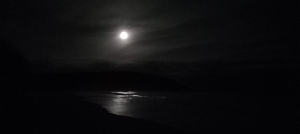
We are enjoying a quiet ‘mooch’ around Auckland – having visited this time last year, we don’t feel the need for rushing to see all the sights. It’s grey and cloudy here today, so not even worth going up the Sky Tower!
To summarize our New Zealand adventure, I must mention a few things that we’ve noticed . . . .
Kiwis (that’s the human sort!) have a wonderful accent – legs become ‘leegs’. . . .yes become ‘yees’. . . “How are ya GUYS?” “Have a wonderful day GUYS?” “What can I geet ya GUYS?”
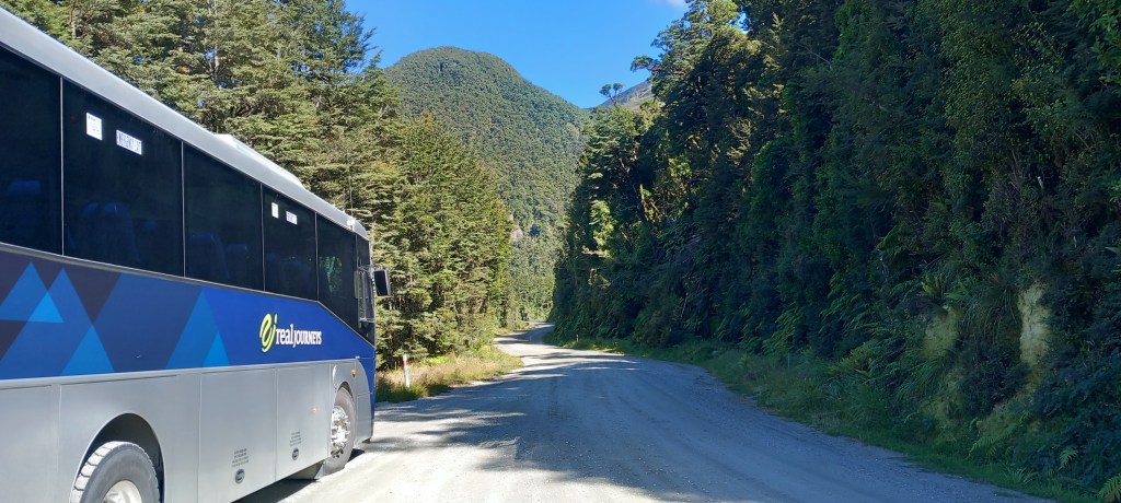
One Lane Bridges are the norm – built in the days of horse and cart.
Coffee caravans are everywhere and they carry ALL types of coffee and ALL types of milk and always have a delicious array of cakes (yes, the waistline has grown!) – FABULOUS
Public toilets are abundant and 99% of the time – clean!
Pulling over to allow other cars to pass is normal – And you’re thanked for doing so!
Every stream, river, and culvert has a name! Even in the middle of nowhere!
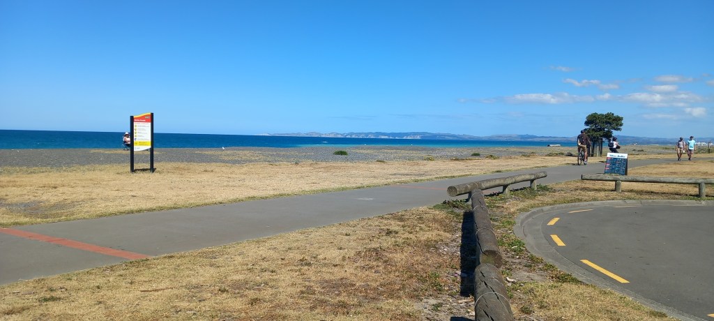
Every park and public footpath is well maintained and well signposted.
The mountain ranges that go all the way down both islands are criss-crossed with amazing mountain roads -Numerous VERY sharp bends are taken at speed by the locals, but take some getting used to for all the rental cars and motorhomes!
The scenery never fails to impress and the locals couldn’t be more friendly and welcoming.
It’s well worth the LONG & TIRING journey to get here from the other side of the world.
I can recommend Audley Travel if you’d like a problem free holiday – no worries, all accommodation and tours prebooked – all we had to do we had to do was drive there!
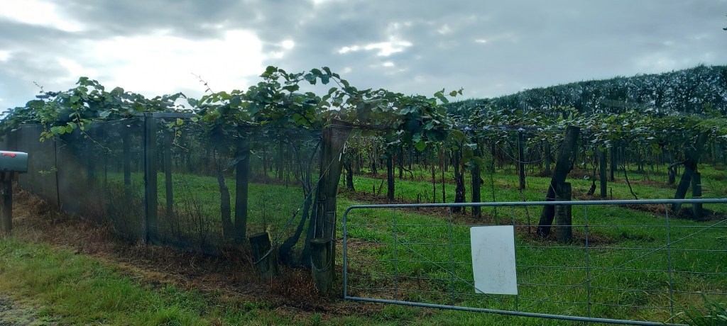
Typical North Island sceneryA Kiwi Grove – always hidden behind high hedges for wind protectionMercury Bay
And drive we (mostly I!) did – 3840 km / 2386 miles – wonderful.
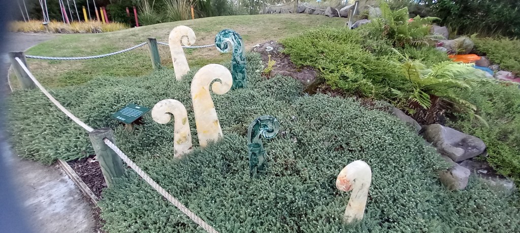
Rotorua – A last minute decision to visit a Glass Blowing Workshop proved worthwhile. Not only do they make and sell beautiful glassware – all inspired by the surrounding landscapes – they have also set up a glass sculpture garden. A clever idea for allowing the glass blowers to experiment and show off the results. Note the furled ferns, seen everywhere we’ve been. Also, the ingenious flowers shrewdly placed to create a waterfall feature.
Furled ferns – a symbol of hope . . .Glass flowers cleverly positioned to form a waterfall
Another visit to a geothermal park was on the cards. First, a little bit of science . . . New Zealand has a huge supply of geothermal energy due to the fact that it sits on the boundary between two tectonic plates. Geothermal energy taps the earth’s natural heat flow from the hot mantle up into the cooler crust. Power stations abound in this area!
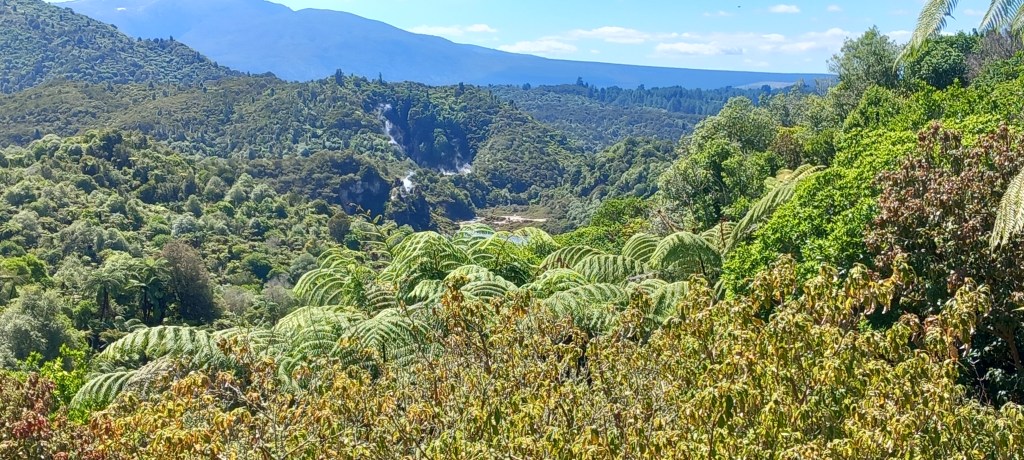
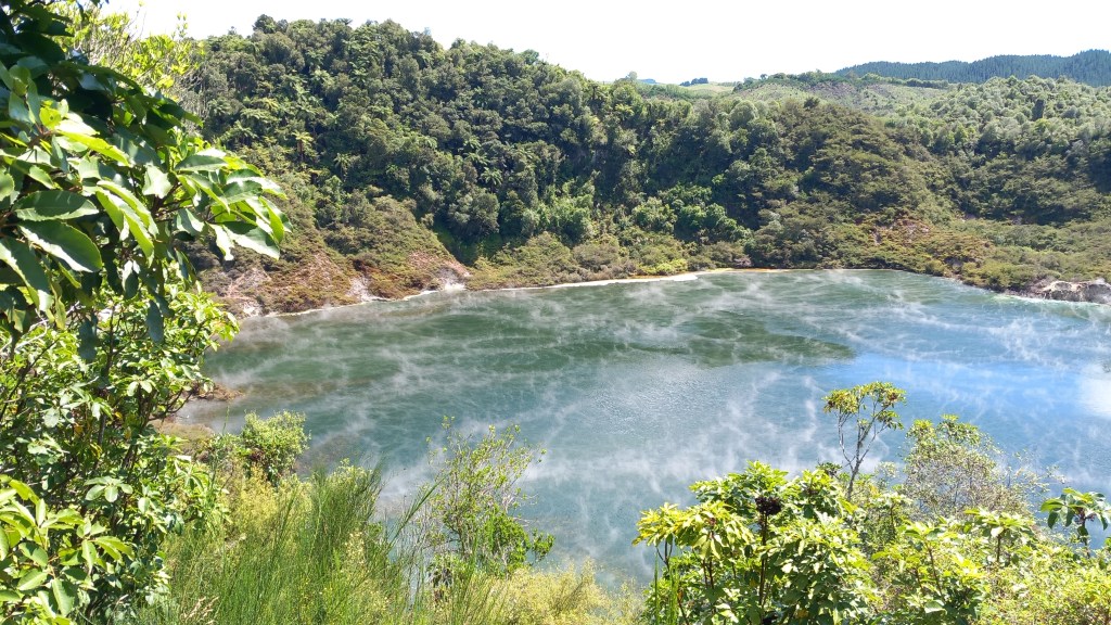
Waimangu Volcanic Valley was awe inspiring. In 1886 the Mt Tarawera Volcano erupted, causing a huge split in the land and forming 22 craters. Everything in the valley was decimated. Hot springs and geysers continued to bubble in the valley and still do today. Thirty years later (1915) plants and trees began to grow again, with no human input. It is easy to see that the native forests have completely re-established themselves.
Native Forests have regenerated – *note steam rising from various craters in the valley
In 1917 one of craters erupted violently, deepening and enlarging itself significantly. Known as Frying Pan Lake, the crater quickly filled with water and now has an area of 38,000 square metres, making it the world’s largest hot water spring. It averages 6 metres deep with a temperature of 55 degrees C.
Frying Pan Lake
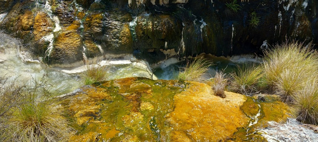
As we have found throughout New Zealand, the park was really well interpreted, footpaths were well kept with clear signage, and everyone showed respect for their surroundings. We followed the river valley, enjoying the brightly coloured hot spring algae and noting the plumes of steam erupting all around us. A challenging climb up many steps took us to Inferno Lake where we caught glimpses of the turquoise water under masses of steam. An unseen geyser ‘plays about’ at the bottom of this crater . . . .spooky or what?!
Hot water loving algae & silica deposits make a colourful display
Needless to say, the ‘rotten egg’ smell takes some getting used to in this area. Not only in the geothermal parks, but throughout the town – I was aware of the smell in the hotel! A guided tour of ANOTHER geothermal park, included watching a geyser in motion. Many moons ago, local Maoris used to stand washing themselves with soap. It didn’t take long for them to realize that the soap was setting off the geysers. Hence today, a geyser is set in motion by a ‘feed of soap’ every morning at a set time, to entice the tourists – they come by the bus load!
Lady Knox Geyser – set off with soap!
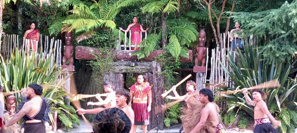
We spent an interesting evening learning about Maori culture and customs. Lots of war battle cries, lots of chanting and dancing. We were served a full three course meal, some of which had been cooked in a “hangi” ( heated stones in an underground pit) – all of which was absolutely delicious!
The Maori’s welcome us!
Coromandel Peninsula has been our last stop on this epic adventure. More spectacular scenery accompanied us on our journey north from Rotorua. Well kept farmland with the ever-present mountain ranges in the background. Much more dairy farming on the North Island, compared with many more sheep farms in the South. We stopped to have a walk up to Wairere Falls. A strenuous 45 minute walk, each way. through the forest, climbing over and around huge boulders led us to the base of this 153 metre cascade. Impressive to see during the drier summer months . . . this must be even more spectacular to see during the rainy winter months.
Wairere Falls
Our accommodation in Whitianga is a three bedroom apartment on three floors – Peter NOT amused to be carrying heavy suitcases up three flights of stairs! However, it is one minute from the idyllic seafront.
Whitianga Sea Front
We caught a little ferry across the inlet to be met by our mini bus and guide for a full day’s tour of the area. We visited an old gold mine in the forest at Puketui – the present government is keen to begin mining gold again – as you can imagine there is a lot of objection from nature lovers!
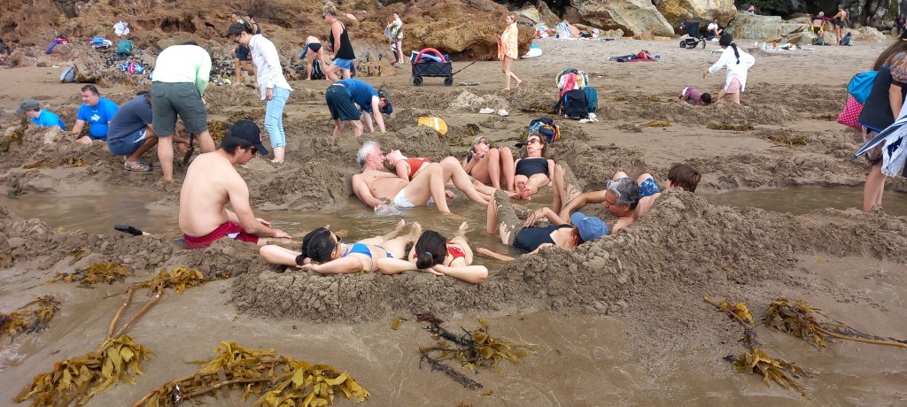
Hot Springs Beach was an eye opener. When the tide is out, many hot springs can be found by gentle digging with a spade (sold on the beach, of course!). A few hours relaxing in your own little hot spa is what the locals enjoy!
Hot Springs Beach
A long (up & down!) walk in the hot afternoon sunshine led us to Cathedral Cove – an idyllic beach only accessible by foot – which gets cut off by the incoming tide.
Cathedral Cove
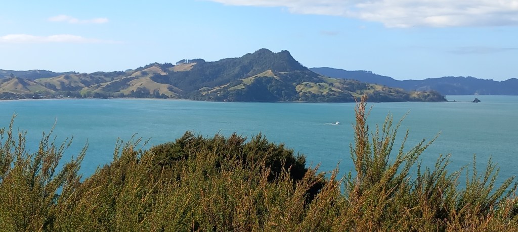
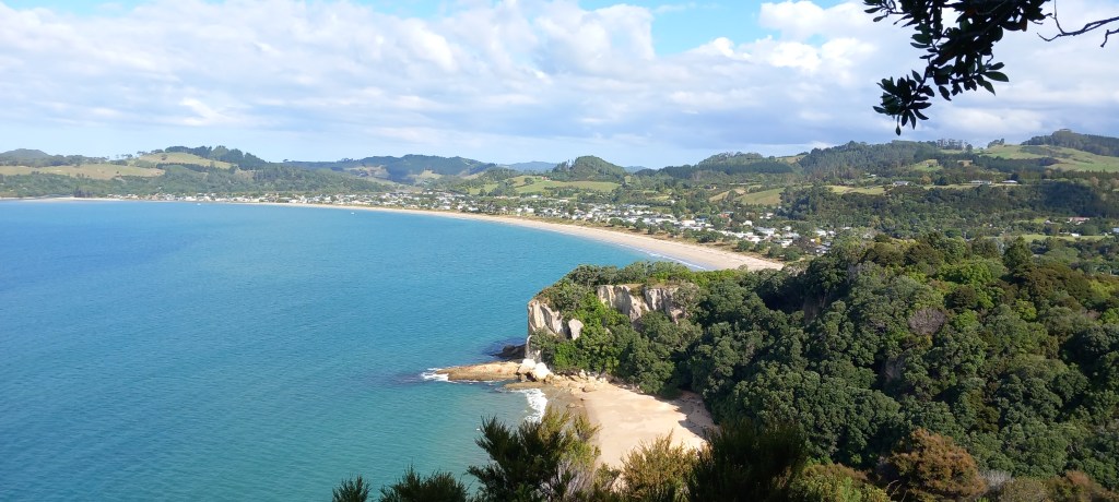
Our last stop was Shakespeares Cliff, where we had our final history lesson, looking over Cook’s Beach – where Captain James Cook came in HMS Endeavour in 1769 on a mission to record the Transit of Mercury, as well as taking lots of plant specimens. Cook named the bay where he was moored . . . Mercury Bay.
Cook’s Beach
A quiet day today before we make our way to Auckland. I’ll send a final summary from there. . . . . .
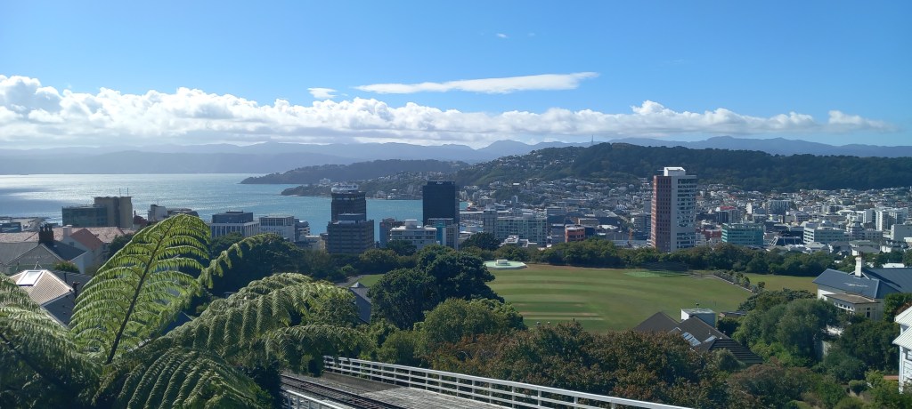
Wellington: Wellington is New Zealand’s capital city. With a population of just 427,000 (compared to London’s 9 million!), it is nicely compact and easy to get around. The parliament buildings are known as The Beehive, with good reason. The harbourfront is full of atmosphere with many shops and cafes. A tiny red cable car chugs up the hill to the Botanical Gardens and some wonderful views over the city. A leisurely walk twists and turns, through various themed gardens, back down to town. Of course for me, the rose gardens were the best!
The Beehive – New Zealand’s parliament building!
Wellington city from the top of the Cable CarRoses – and I’m happy!
A rainy afternoon was a perfect time to visit the Te Papa National Museum. Inspirational displays led us through New Zealand’s history, including a very moving exhibit on the battles at Gallipoli. Stories from young refugees gave wonderful accounts of how New Zealand’s population has developed over the years. One of the ‘fun’ aspects was standing in a small wooden house, experiencing an earthquake. For those of us lucky enough to live away from major faults in the earth’s surface, this gave real insight into just how terrifying this phenomenon can be!
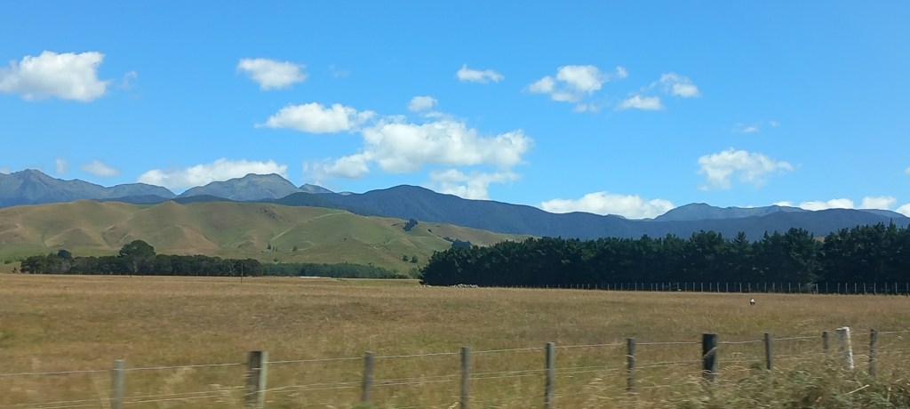
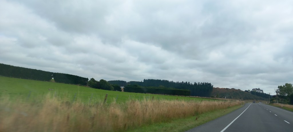
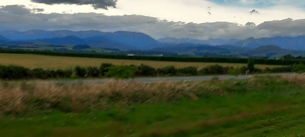
Napier: A full days driving took us north and east up the rugged east coast, passing through deep river valleys, and a couple of amazing mountain passes. Lots of sheep and dairy farming intermingled with the odd vineyard, and always with a range of mountains in the distance.
New Zealand scenery
Napier is world renowned for its Art Deco (1930’s) style architecture. Allow me to fill you in . . . . .In 1931 Napier was all but flattened by a huge earthquake, heaving the lagoon two metres higher than it was before and making Napier 40 square kilometres bigger than it was previously. Few of the central buildings survived. A huge rebuilding project was quickly established, influenced by the architectural styles of the day. These 1930’s streetscapes are protected today by the Art Deco trust. We enjoyed a guided tour with a lovely 80+ year old lady, who championed everything Art Deco with great aplomb!
Art Deco style bank – note the Maori influence in the decorative carvingArt Deco style – bright colours, geometric, borders
With a population of 67,000, it’s a vibrant city. Many streets of thriving shops and restaurants, along with a wonderful seafront walk stretching for miles (good for my morning run!) and wall-to-wall sunshine! What more could we ask for . . . . .
Napier Seafront
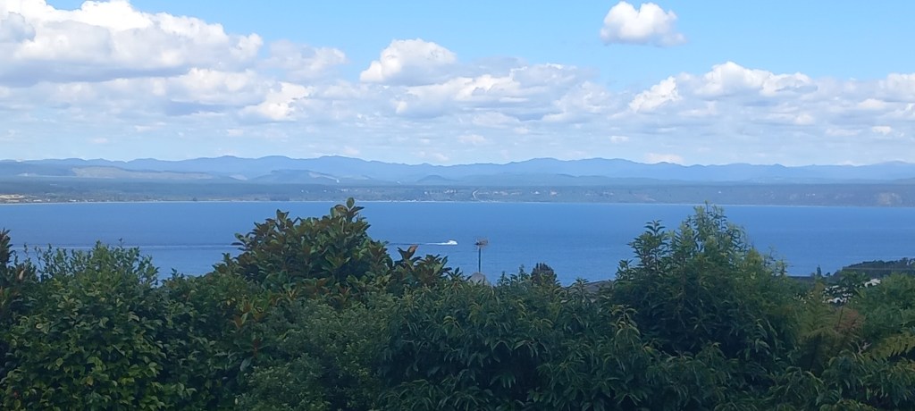
Taupo: From Napier, we headed inland across the wide Esk Valley and through another range of mountains – yes, another winding mountain pass! – before enjoying the plantation covered flat plains which lead to Taupo. The enormous lake here, the largest volcanic caldera in North Island, provides for the usual array of water sports whilst the surrounding geothermal fields are known for their hot springs and geysers.
Lake Taupo – pronounced “toe-paw”
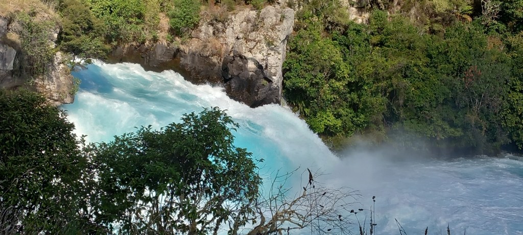
We took another nail-biting Jet Boat ride along the Waikato River (the longest river in NZ) to the foot of the Huka Falls, where about 120 cubic metres of water per second (yes! you read that correctly) were cascading over the rocks.
Huka Falls from above
Adding the tremendous force of water to the numerous 360 degree spins the boat did gave us enough adrenaline surge to last the rest of our holiday!!
Huka Falls from the boat – only 40% full at the moment!
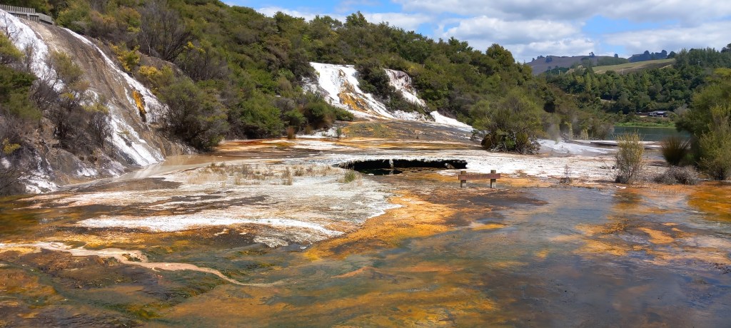
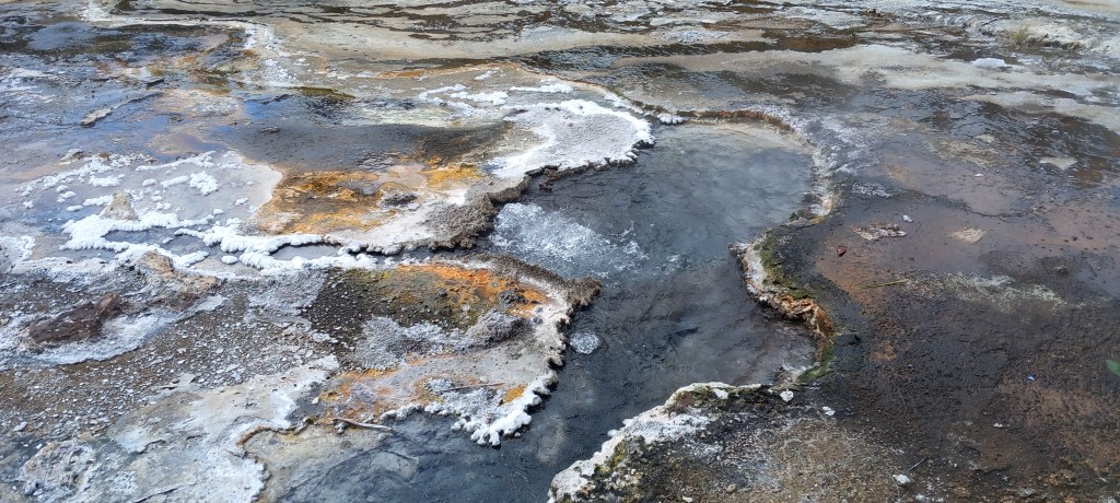
The Orakei Korako Taupo Thermal Area, proved to be just as exciting but in a much quieter way . . . a tiny ferry took us across the lake to some of the largest silica terraces in the world. There are 23 active geysers in this area – none of which performed for us today – but there was plenty of steam and bubbling going on in the numerous craters. This enormous terrace varies in thickness from just 20 mm to 20 metres in places. What’s more, it continues for another 35 metres under the lake!
Steam and bubbles from the huge silica terrace
Colourful algae growing in the hot water
Nearly 20 million litres of hot water per day trickles across the terrace and into the lake. I’ll leave you all to imagine the smell – rotten eggs anyone?? Unbelievable colours (orange, green, brown, pink) are formed by the algae growing in hot water with temperatures up to 60 degrees.
Bubbling boiling water from various craters
Mud pools have formed in places where the thermal fluids have chemically decomposed surface rocks to form clay. Underground energy heats the clay and boiling mud pools are created. The shop sold all sorts of beauty creams containing the mud, purporting to have marvellous results. Having witnessed the repulsive bubbling mud, I’m afraid the shop didn’t get any business from me!
Kaikoura: Continuing north from Christchurch, we passed through many miles of vineyards. Wonderful high hills, deep river valleys, along with an odd glimpse of the sea.. . . . A fabulous coastal road, winding past a turquoise blue sea, with impressive jagged rock formations, led us the final 12 miles into Kaikoura.
Our accommodation here was at the top of town, but with a very convenient 10 min walk DOWNHILL to shops and restaurants. This meant we ‘walked off our supper’ on the way back up the hill! Our host was a retired Army Police-dog handler – as you can imagine there was a lot of military talk going on!
Kaikoura is known for its seal colonies. All along its rocky coast it is easy to watch literally hundreds of fur seals. Luckily for us, there were many seal pups to watch frolicking in the water, lying sunning themselves on the rocks, or suckling from mother.
Fur Seal Pup feedingFur Seal pup and mother – enjoying a post lunch siesta!
We were prebooked on a whale watching cruise but sadly high winds overnight had woken the sea up! 35 passengers on the trip before ours had been seasick!! Only one whale had been spotted over the past couple of days . . . . it was an easy decision to cancel our whale-watching trip!
Nelson: Continuing north through Marlborough County, we noticed changes in the countryside. The deep greens of the south gave way to very dry grassy slopes. Browns and yellows were interspersed with odd rectangles of green pine forest or huge windbreak hedges. Vineyards covered all the north facing slopes (remember, we’re in the Southern Hemisphere!) and many valleys too. The vines are carefully irrigated so that the grapes fatten up and ripen, according to the acidity needed.
Passing over yet another mountain pass, we encountered RAIN! Yes, that wet stuff that UK is fed up with, finally arrived on our holiday here in sunny NZ! We descended into the city of Nelson (population 56,000) on the Tasman Sea and found our way to the lovely apartment of a golfing friend of Peter’s, who kindly offered us accommodation for our time in Nelson. Despite the inclement weather, our very hospitable hosts took us for a walk on Nelson beach, as well as leading us to the top of the hill to take in the views from the geographical Centre of New Zealand. Coffee in the Queen’s Gardens, was followed by a short trip up the coast to the Wharf at Mapau, where we disregarded the rain and enjoyed a good lunch.
Nelson from the Geological Centre of New Zealand
Abel Tasman National Park is renowned for its golden beaches, granite cliffs and its many walking tracks. Sunshine and fluffy clouds accompanied us as we took a cruise with commentary, all the way up the coast of the park. On the return journey we were dropped off and walked through thick native forest for two hours to another pick up point. The park is administered by the Department of Conservation – tourism is their income. Yes, the boat was crowded but there was space for everyone. We saw relatively few people on our walk and were able to sit quietly on the beach waiting for our return boat journey. The monitoring of where everyone was at all times was efficient but unobtrusive.
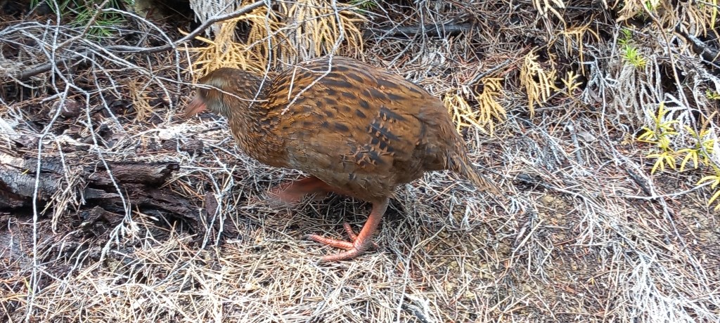
Cruise-Boat Vista – ramps are lowered onto the sand Footpath through the thick native forestA Weka – waiting nearby to see if he can nick our lunch!
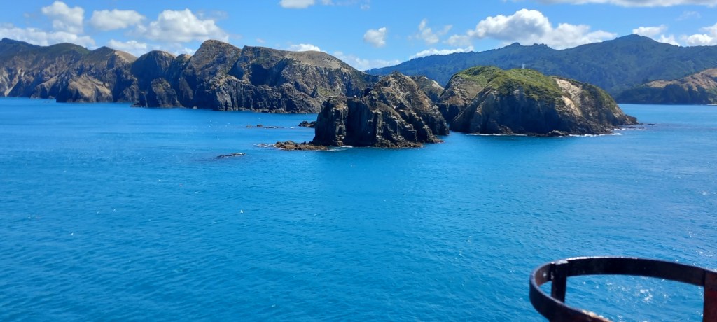
Picton & The Interislander Ferry: Today, we concluded almost four weeks of breath-taking travel on the South Island. Once again in brilliant sunshine with never-ending blue skies, we journeyed up and over two mountain passes from Nelson to Picton on the North-East coast. We returned our hire car to a site immediately adjacent to the ferry terminal. Yet again, we were lucky – we had a SMOOTH CROSSING to Wellington! The Cook Strait is notorious for rough seas, but today we treasured a relaxing time in the sunshine on the top deck.
Hikapu Reach leading into Pelorus Sound West Head – leaving the South Island
See you again soon with our adventures on North Island.
Dunedin: Driving north-east along the Southern Scenic Coastal Route, the flat farmlands of the very south progressed to rolling hills with wonderful wide valleys. Long straight roads took us past farmsteads hidden behind vibrant, thick hedges often on three sides of the property, acting as wind breaks. Free standing hedges often stand erect in the middle of a field to provide shelter from the wind for the animals. Wonderful views along the coastal cliffs and or beaches were interspersed with long bridges over wide river beds.
High hedges everywhere for windbreaks – for houses & livestock
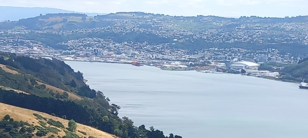
Our ‘boutique hotel’ in Dunedin was very central, allowing us to walk everywhere. It was a shock to our senses to be in a busy city after the tranquillity of the mountains and Stewart Island.
Dunedin Harbour
We were delighted to leave the city for a seven hour wildlife tour of the Otago Peninsula.. Our multi-talented mini-bus driver/guide took us all over the peninsula, giving us a full history and enchanting us with all the flora and fauna. Huge varieties of birds enjoy this quiet peninsula and Rob swept us away with his incredible knowledge of every plant, animal and bird. We walked through sand dunes and down onto the beach at Allan Bay which is full of fur seals. Several were lounging on the beach, but we gave them wide berth as they can get quite aggressive.
Fantasic beach at Allan’s Bay
Out on the furthest point of Otago Peninsula is a Southern Royal Albatross Colony. Carefully monitored and protected by the Department of Conservation, these magnificent birds come in to breed every two years. The male and female (who mate for life) take turns sitting on the nest for up to a year.
Southern Royal Albatross nesting on the point of the Otago Peninsula
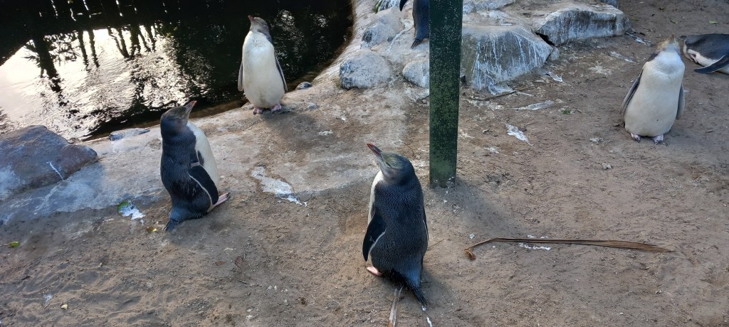
They can fly, staying in the air, for 10 – 12 months covering 120,000 miles thanks to their huge wingspan allowing them to fly without using much energy. They can even ‘lock’ their wings so that they can rest and sleep in the air. A visit to another beach had us watching the incoming tide at dusk to spot yellow eyed penguins coming in on the waves. Sadly, we weren’t lucky, but we did spy several who were already in their little man-made shelters dug into the dunes.A marvellous Rehabilitation Centre was set up in the 90’s for sick, starving or injured penguins. We saw yellow-eyed, blue, and crested penguins being gently improved and reoriented, ready to be released back into the wild.
Yellow-eyed penguins in rehabilitation unit
Oamaru: Continuing north and enjoying the winding coastal route with its lack of traffic and wonderful views, we arrived in Oamaru for the night. This ‘whitestone city’, has several Victorian buildings which sit resplendent in the local white limestone.
White limestone buildings in Oamaru
Koekohe Beach was a good find, both for its excellent coffee and its gift shop. However, a visit to the beach was more important to see the Moeraki Boulders – these perfectly spherical boulders date back 60 million years. No one knows yet, just how these boulders were formed – although there are plenty of theories!
Moerakiboulders
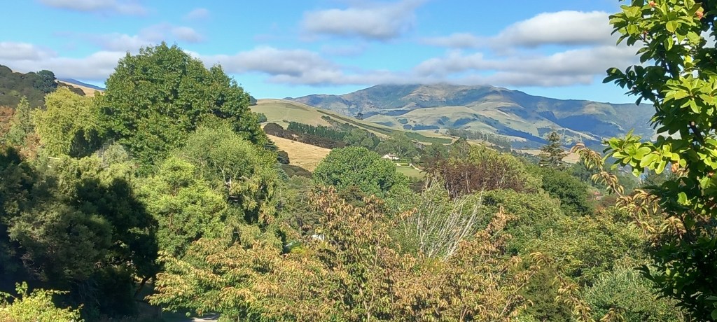
Banks Peninsula: This peninsula to the east of Christchurch is another little piece of paradise. High hills and sweeping valleys with many a winding road along the way, lead to the village of Akaroa.
LytteltonHarbour – where the first settlers from Britain arrived in 1850
We enjoyed a couple of nights in a farmhouse B&B nestled in a valley – beef and sheep are reared on this farm. Beautiful views over the hills along with splendid gardens just added to the effusive welcome from the hosts.
View from our bedroom at Croombe farm B&B
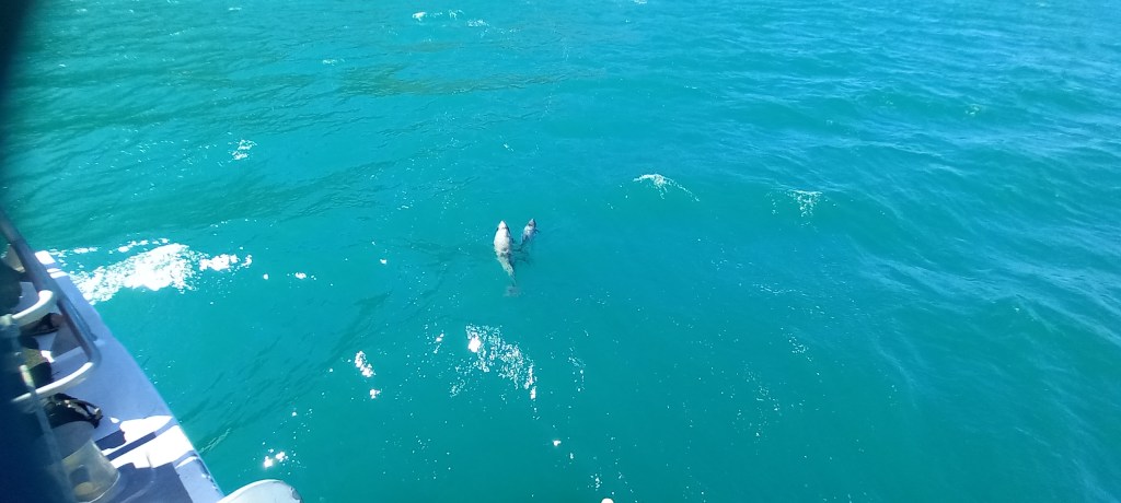
A two hour cruise took us out into the harbour to look for dolphins – we were not disappointed! Even saw a couple with calfs (known to Kiwis as rugbies, as they are about the size of rugby balls with fins!)
Hector Dolphin – mum & baby
The fabulous weather continues . . . . see you soon!
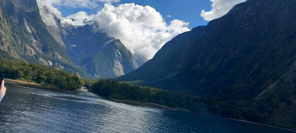
Another amazing journey, through rolling hills, wide valleys and the odd mountain pass took us further south and into Fiordland. We were based in Te Anau, a thriving little town (population 3000) on a lake of the same name. Huge choice of restaurants, cafes and shops with lots of opportunities for tours of the local fiords.
Lake Te Anau
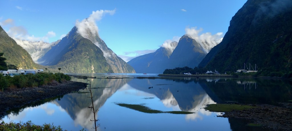
Milford Sound: Setting off very early to avoid queues of traffic, I enjoyed the challenge of driving the winding road up and over two mountain passes, as well as through a long, narrow, one-way tunnel to arrive at the ‘cruise’ terminal. Those of you who have followed our travels may remember that we visited Milford Sound last year on our cruise – we managed to get into it just after an enormous storm had gone through – hence all the waterfalls were full. This year, they are having drought conditions in Fiordland and many of the rivers and waterfalls have all but dried up! However, absolutely perfect weather greeted us, as we cruised the sound once again – this time with sunshine glinting on the water, and the wonderfully high mountains towering above us. It’s an awesome place!
Reflections on Milford SoundMilford Sound with an incoming river – photo on an angle – trying to avoid people’s heads!
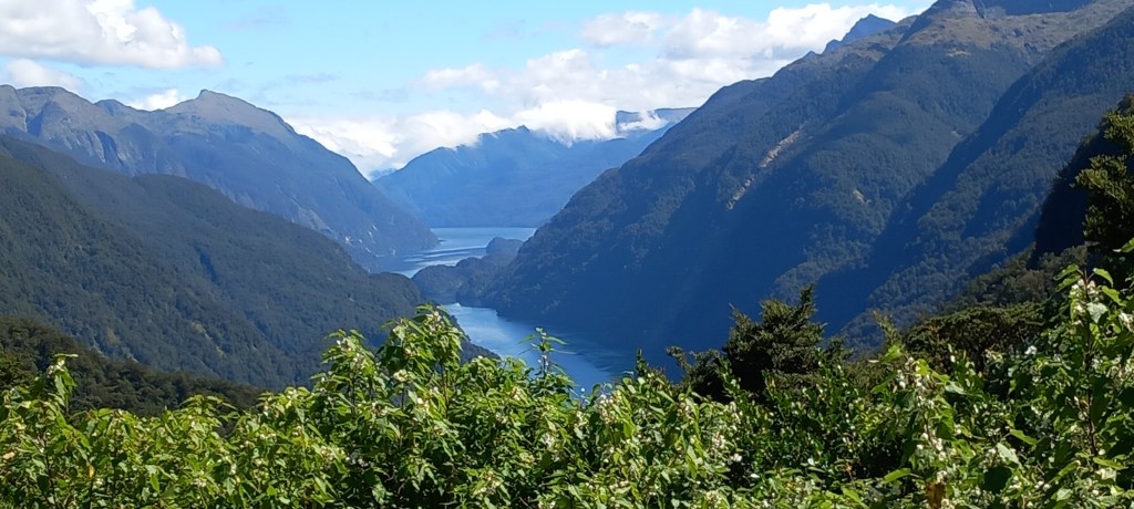
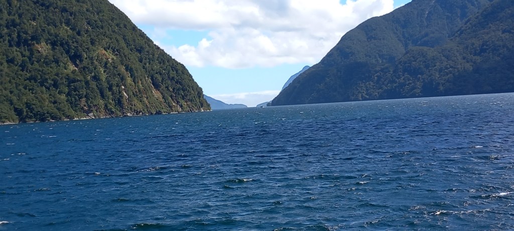
Doubtful Sound: Named ‘Doubtful’ by Captain James Cook in 1770 (he was unsure it was navigable), this fiord is impossible to get to by land. From Te Anau, we took a 25 min bus ride to Lake Manipuri, then a 45 min boat ride across the lake to a tiny, isolated jetty at West Arm. From here, we took a further 50 min bus ride, along a dirt road through the bush to Deep Cove on the edge of Doubtful Sound. Quite the journey!
Doubtful Sound from aboveDoubtful Sound in all its glory
I should explain here that this dirt road was built to aid the construction of New Zealand’s biggest hydro electric station. Construction began in 1964 – it took 8 years and 1800 men to build it under extremely difficult circumstances. The generating units were built 200 metres BELOW the surface of Lake Manipuri, chiselling into a granite mountain! A ten-kilometre tailrace tunnel was excavated to take the water out of the station and into Doubtful Sound. A second tunnel was completed in 2002 which brought the station up to its full capacity. Workers were housed in makeshift temporary accommodation in the bush, all of which has been totally cleared away. However, the road now serves another purpose in that it brings tourists (in their thousands!) to Doubtful Sound.
Dirt road built originally for the construction of the Hydro Electric Station
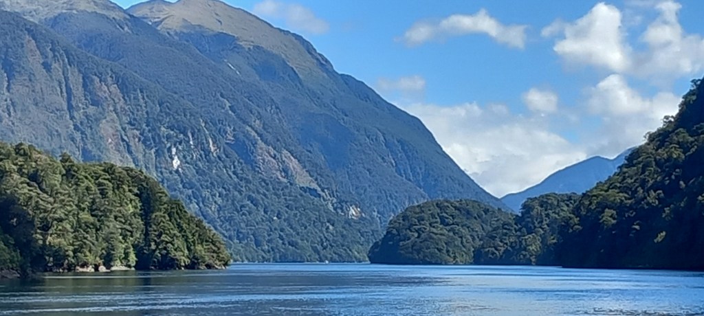
Cruising Doubtful Sound is an absolute joy because there are relatively few people there! The silence adds to the atmosphere. Again, we were blessed with good weather, and the views were as magical as ever.
Narrow entrance to Doubtful Sound (in the distance)
There is an island across the mouth of the fiord from the Tasman Sea, making the entrance very narrow. This explains not only Captain Cook’s assessment, but also clarifies why we didn’t enter Doubtful last year on Borealis, during those westerly storms.
Stewart Island: Thirty kilometres south of the mainland is New Zealand’s third largest island. Again, we were thankful for calm, sunny weather for the hour’s ferry crossing of the Foveaux Strait. More than 80% of the island is National Park, whilst the tiny population of 400 residents live in and around Oban. Our travel agent (Audley Travel) excelled themselves with the Stewart Island accommodation! Just look at the views from our bedroom across the Paterson Inlet!!
Fantastic views from our bedroom!
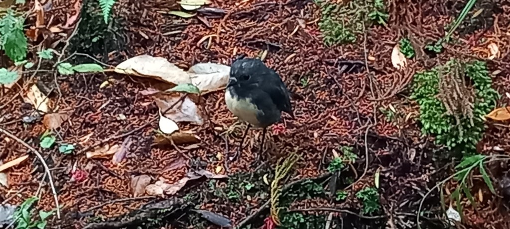
We enjoyed a guided tour of Ulva Island which is almost predator free. It was fascinating to learn about, and be standing in, primeval forest which has never been disturbed. We heard and then saw five different endemic birds – the local robin being the only one who was easy to photograph! These birds have never had predators, hence do not know how to protect themselves. Norway rats have managed to find their way on to the island (by swimming the 800 metres from the main island) and are being actively eradicated as we speak!
An Ulva Island RobinSea Lion on the beach at Ulva Island
Several times, we were entertained by the island’s ONE taxi driver – Greg, is fifth generation Stewart Islander. He knows EVERYONE, where everyone lives, and the intricate history of the place. During a two-hour tour with him, we were taken to the furthest outreaches of the 28 kms of road, up and down steep, narrow drives and shown every magnificent view – helped by marvellous weather!
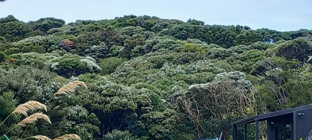
White blossom of Manuka trees
A late evening wildlife boat tour took us around the some of the smaller islands where we spotted seals and yellow-eyed penguins before disembarking us in Little Glory Cove. Armed with tiny torches and with firm instructions to stay silent and close to each other, we set off into the forest following our guide. After an hour, we finally saw two of the many thousands of Brown Kiwis who live on the island! No photos I’m afraid – taking photos in the dark has never been my forte. But it was a wonderful experience to see these protected birds foraging in the dead of night, amongst the undergrowth. Much bigger than I had imagined, with very strong legs which they use to fight with, and the amazing long beak which has nostrils at the end of it. It’s their sense of smell which helps them locate insects for food.
Sunset over Stewart IslandMoonlight adding the atmosphere to our night tour
Our visit to Stewart Island will be remembered for the Brown Kiwis!
Long straight roads across the valleys, interrupted by plenty of single lane suspension bridges, along with curvaceous mountain passes led us briefly back to the coast at Bruce Bay. A tiny beach side kiosk was doing a roaring trade with many sorts of coffee and freshly made homemade cakes and biscuits (made by local villagers).
Bruce Bay – west coast of South Island
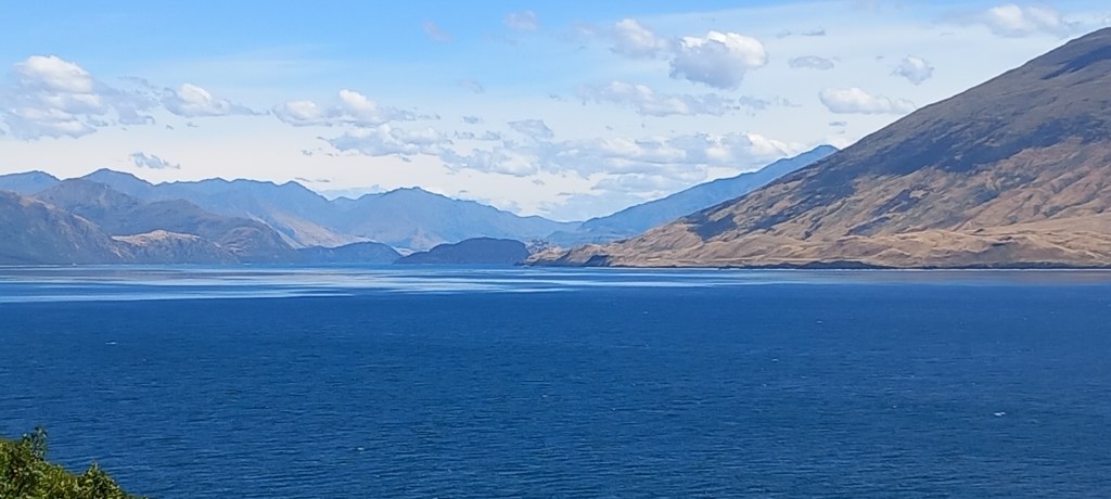
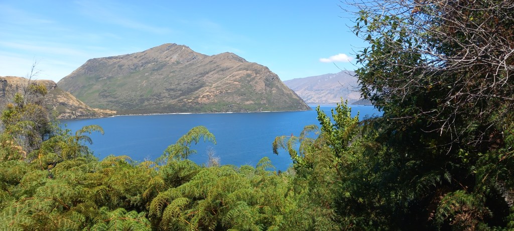
We turned inland heading south-east – the mountains and scenery were just stunning – all helped by brilliant weather. Towns which look quite big on the map, are tiny – 300 inhabitants and most of those live on distant farmsteads! Having negotiated yet another very windy mountain pass, we arrived at the blue waters of Lake Wanaka. More marvellous views as we drove the length of the valley beside this 26 mile lake, to the town of Wanaka – population just over 12,000. A bustling town with lots of cafes and restaurants, plenty of boating activities and a craft market.
Single lane bridges give drivers a challenge.Amazing Blue Glacial waters of Lake Wanaka
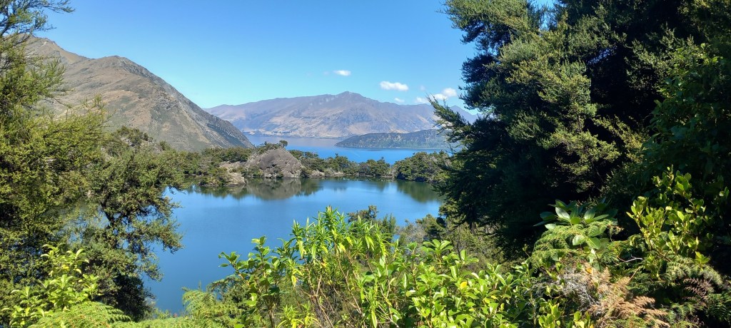
A 25 minute speedboat trip down the lake (320 metres deep!) took us to Mou Waho (The Outer Island) – an uninhabited island, where our tour guide led us up a challenging climb of 178 metres to the summit for more fantastic views. The native bush on this island was fascinating – did you know there is a Manuka tree AND a Kanuka tree? Manuka honey, of course, is known for its healing properties, whereas Kanuka honey is “just good honey” according to our guide! A mountain top lake (rain-filled) called Arethusa Pool made for some good photos, before we began our descent (always worse on the knees than the ascent!) back to the boat.
Views from the summitArethusa Pool, atop Mou Waho
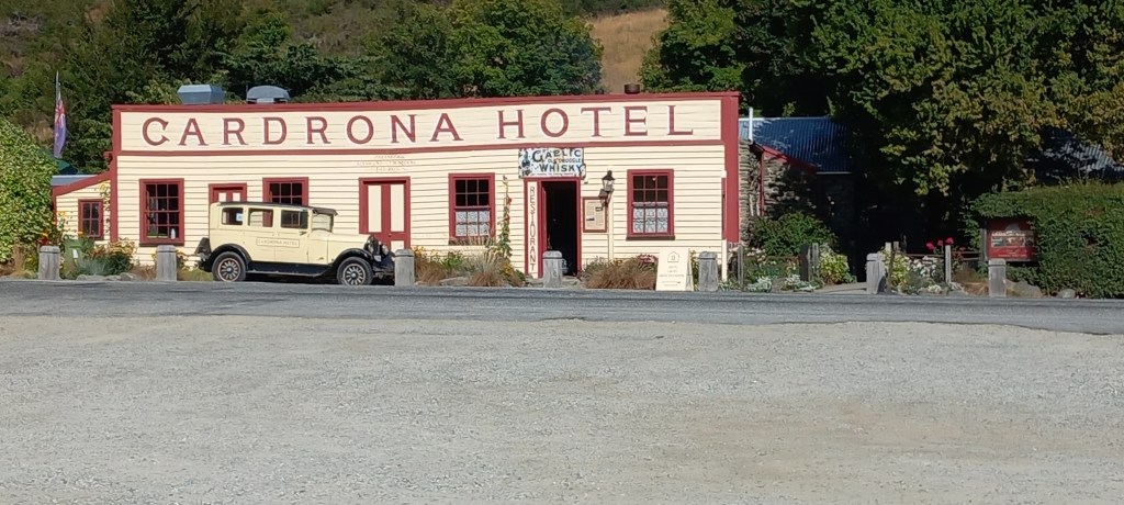
Queenstown: Driving south from Wanaka, took us through Cardrona where we enjoyed coffee at an ancient hotel (1860’s gold rush) before heading up and over the Crown Range Mountains, and down to Queenstown – population 24,000.
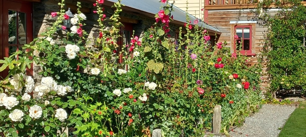
Cardrona Hotel – 1860’s (1936 Chrysler) Gardens of the Cardrona Hotel
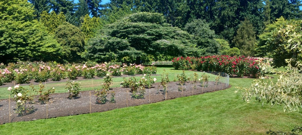
Nestled beside Lake Wakatipu, Queenstown is a VERY busy tourist destination – all sorts of lake activities area on offer. Local ski resorts keep the town busy through the winter as well. A very long beach keeps the sunbathers happy – very few of them venture into the chilly glacial waters. Queenstown gardens provide lots of walks under tall trees, interspersed with beautiful flower beds and fountains – yes, more roses to keep me happy!
Queeenstown Gardens
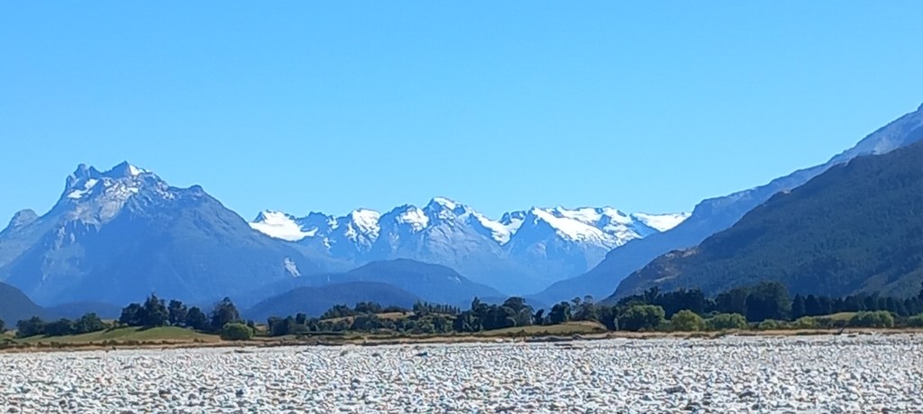
Huge excitement today, as we enjoyed a Jet Boat ride across the lake, and up a winding river into the wilderness. Absolutely thrilling to skim across the water at high speed, whizzing around corners and then squeal with delight at the odd 360 degree turn on the spot – showering all of us with water! The beautiful blue skies, and snow covered mountains made the photos spectacular. A real charge of adrenalin, with the bonus of being in such an idyllic place.
The rather windswept duo, in the wilderness!The snow-c0vered Southern Alps
We move on tomorrow to Fiordland – more later . . . .
Some of you have queried the 16 hr flight from Dubai to Sydney – it’s listed as being just under 15 hrs. However, our departure was delayed, thanks to two passengers deciding that they were NOT flying, so their baggage had to be removed from the plane. That meant we were late into Sydney and had to sit on the tarmac for 50 minutes waiting for a gate to be free!! 16 hrs in total!
Christchurch to Hokitika – Our transfer from hotel to train station was made all the more pleasant with a very helpful and informative driver who accompanied us all the way to our carriage, having made sure our luggage was safely stowed. This particular driver – a lady! – was a crystal geek, hence we got on very well!
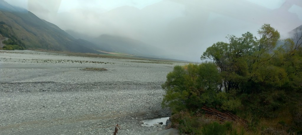
The Tranzalpine train travels west from coast to coast over 223 km, across the flat Canterbury plains, which are dotted with remote farmsteads before rising a little into the foothills of the Southern Alps. Huge glacial river beds are crossed by many precipitous bridges. Mind boggling to think that there has been a pass through these mountains since the 1800’s – the gold rush being the initial motivation, closely followed by coal and timber in the early 1900’s. Arthur’s Pass is the highest settlement in NZ at 900m. One of the world’s longest tunnels – Otira tunnel at 8.5 km in length – aids the slow descent through the forests and valleys towards Greymouth on the coast of the Tasman Sea.
Approaching the Southern Alps – travelling westHuge glacial river beds as seen from the train . . .
We collected our nice, roomy car from the station, and headed south along the only coastal road (Route 6 for those of you following on a map!) . Lots of lush mixed forest kept us company, along with the pounding waves of the ocean.
Our comfy car – roadsides are ablaze with crocosmia – beautiful.
The converted Fire Station in Hokitika where we stayed deserves a mention. One of the best places we’ve EVER stayed, this ‘boutique apartment’ was beautifully designed – a blend of contemporary and heritage – each room named after a fire chief. Absolutely everything provided, making a very comfortable and enjoyable stay. The beach was 100m away – good for long bracing walks AND my morning run!
Sunset on Hokitika beach
Hokitika was founded as a gold-mining settlement in 1864. It is on a wild stretch of coastline, that has claimed many a ship in its time. These days it is known for its driftwood-littered beach – regular competitions are held for driftwood sculptures. The town is also awash with highly prized Pounamu, or greenstone – jade to you and me! Sadly, due to luggage weight restrictions, not to mention the dwindling bank card, I had to settle for a pair of earrings!
Hokitika beach – littered with driftwood – one of the many sculptures . . .
Franz Josef is further south within the Westland National Park. Glorious shorts and T-shirt weather accompanied us through more lush forests, but also lots of flat scrubby land, intercepted with wide glacial riverbeds coming down from the mountains which serve as a continual back drop. Tiny towns (including one called Ross!) pop up infrequently, hence coffee and a loo need a bit of forward planning!
Wide glacial river beds – it must be spectacular in the spring, when the rivers are full . . .
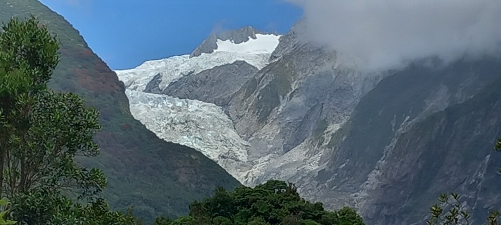
Franz Josef boasts its own glacier. One of many along the Southern Alps, this one is closer to sea level than most. A prebooked helicopter trip up to the glacier was sadly cancelled as the notorious cloud (in Maori, New Zealand is called Aotearoa which is often translated as “the land of the long white cloud”) decided to sit on the mountain at the wrong moment! However, there are lots of local walks which give wonderful views of this rapidly diminishing spectacle. The clouds lifted later in the day to help with the photos! Note the swaths of scarlet across the mountains – the Rata tree is in flower. Reminds me of the purple hue across Scottish hills . . .
Franz Josef Glacier, retreating fast thanks to climate changeNote the red of the Rata Tree – endemic to NZ
This journey gets better by the day, and there is lots to tell you. I’ll send another entry within the next couple of days – don’t want to overload you!
Hello Dear Followers – yes, Peter & Marilyn are travelling again!. New Zealand has been on our bucket list for some time, so we decided to bite the bullet! There was a LOT of flying (not good for our carbon footprint, I know!) as we made our way to the other side of the globe. Emirates treated us well . . . . Birmingham to Dubai, a seven-hour flight . . . A quick transfer through Dubai airport (which is like a small city!) where we boarded an Airbus A380 (600 passengers!) for the sixteen-hour (yes 16!) flight to Sydney, Australia. We were lucky enough to fly Premium Economy – what a joy! Comfy seats with extra leg room, great food and lovely service. Only one step up from economy but so worth it!
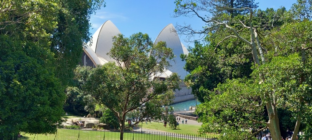
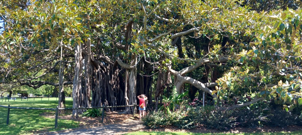
We chose to stopover for two nights in Sydney a) because we love the city and b) to give our bodies a chance to recuperate a little from jet lag. Glorious summer weather (28C), along with seeing our dear friends who flew down from Queensland to spend the time with us, made our visit to Sydney as good as ever. We enjoyed the Botanical Gardens once again – such a joy to see summer flowers and lush greenery after the miserable grey UK winter.
Sydney’s Opera House hidden behind the lush Botanical Gardens
Banyan tree spreading itself in Sydney’s Botanical Gardens
During the evenings we joined the happy crowds around Darling Harbour, luxuriating in the balmy warmth over a meal. By sheer fluke, our visit coincided with Australia Day, and we were delighted to share a traditional Ozzie barbecue with our goddaughter and her family in the suburbs. It was a real treat, mate!
Christchurch. We finally landed in New Zealand after a further three hour flight from Sydney. Christchurch is NZ’s second largest city with a population of 390,000. As most of you will remember, the city centre and surrounds were badly hit by an earthquake in 2010, with aftershocks lasting into 2011. Rebuilding is still going on, both business and residential, the aim being to regrow the city to a population of nearer 900,000. There are very few tower blocks, and all new builds are being built to withstand earthquakes.
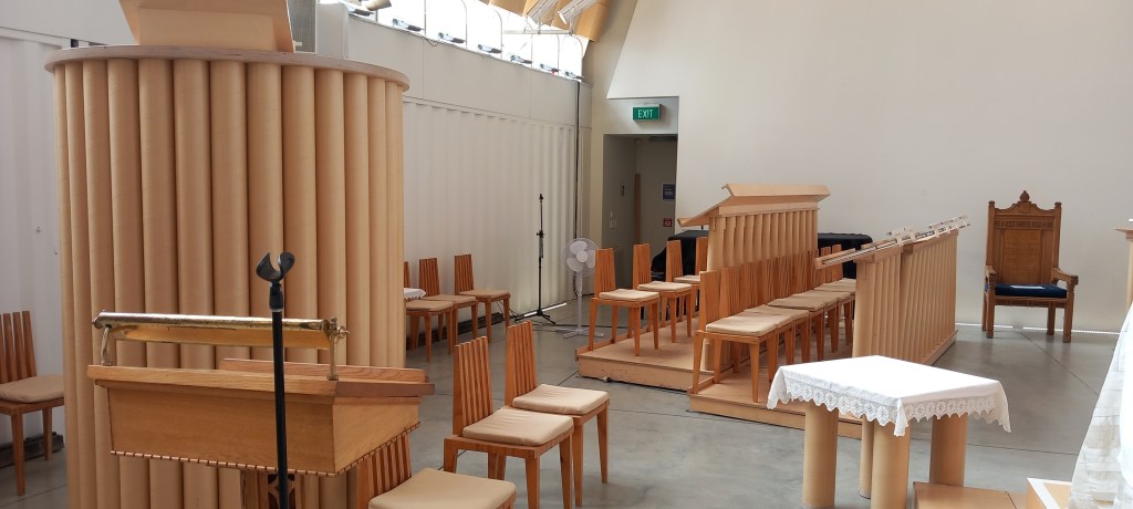
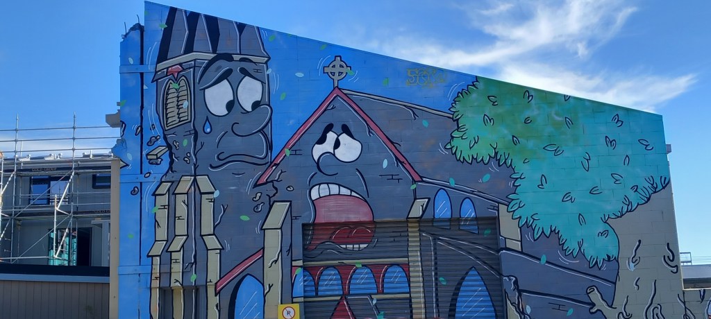
The Cathedral was badly damaged in the earthquake – the Transitional Cathedralis cleverly furnished with cardboard tubes – note pulpit and choir stallsStreet art is everywhere – note parts of the cathedral crying as the masonery flies off
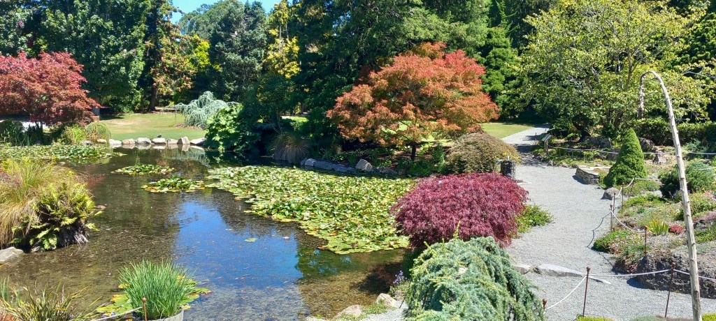
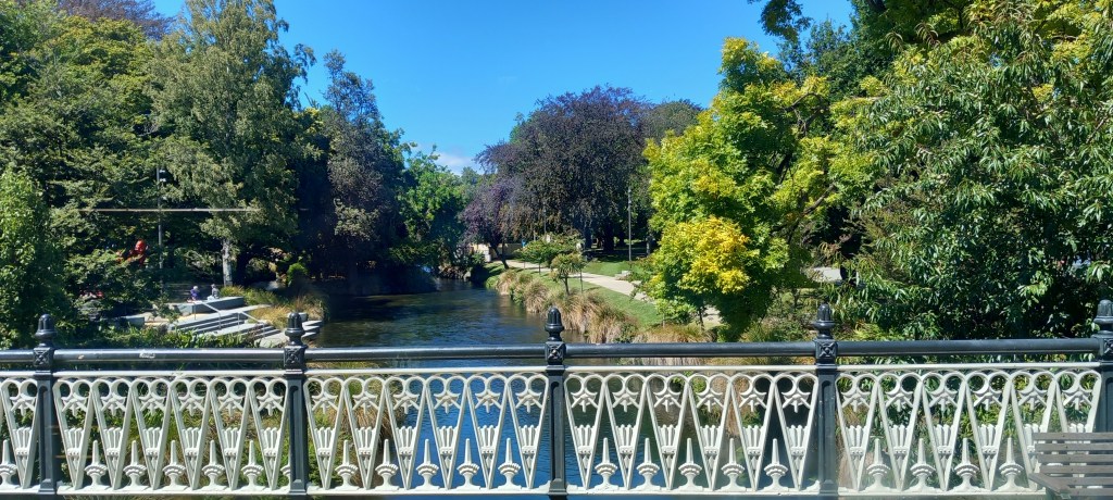
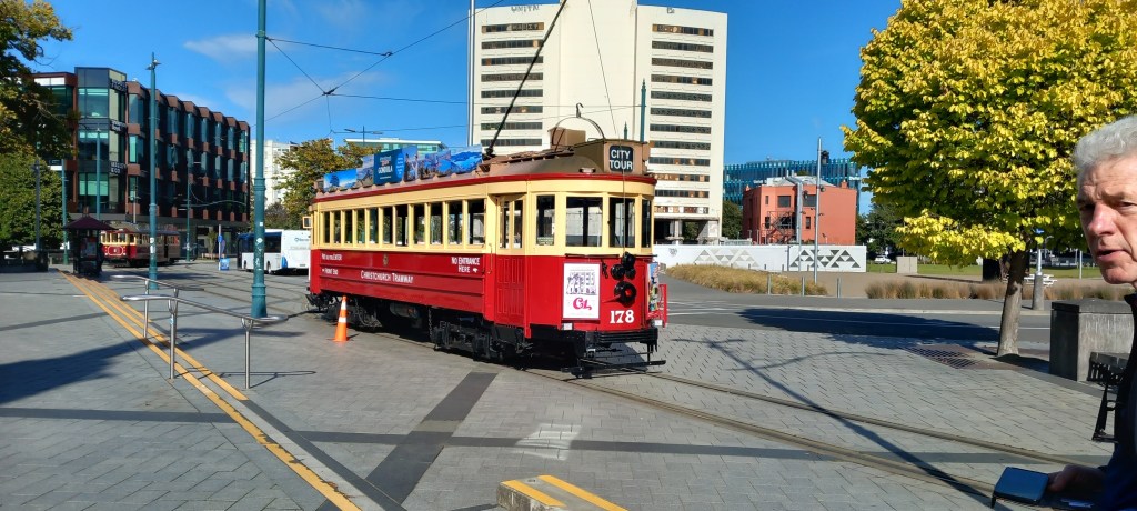
Christchurch is known as ‘the garden city’ with its 1200 green areas – beautiful parks full of colour and fountains, along with the meandering River Avon add to its charm. Vintage tramcars trundle around the city passing many heritage buildings.
Stunning Rose Gardens are integral to the Botanical GardensBeautiful Botanical Gardens
The River Avon meanders through the cityVery old TramCars trundle around the centre, their drivers relaying the history of the area
The city feels unmistakeably British – not surprising really, as it was founded by 750 Brits (all approved by the Church of England) who arrived on four ships, having endured 99 days of ghastly conditions at sea from Gravesend in 1850. They proceeded to develop the land around the river. One hundred and seventy-five years later it’s thriving and working hard to regain its notoriety and importance.
We move on tomorrow – could I remind those of you who have not yet subscribed to the blog . . .it is very easy to subscribe – just follow the link on the right hand side of my blog, where it asks you to enter your email address. You will NOT be inundated with emails (I promise!). But when you subscribe, you will receive an email with my latest entry whenever I publish one (approximately every 4-6 days) . This saves you having to remember to check the blog – and we all know how bad our memories are these days!!
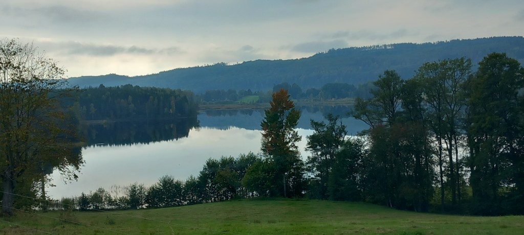
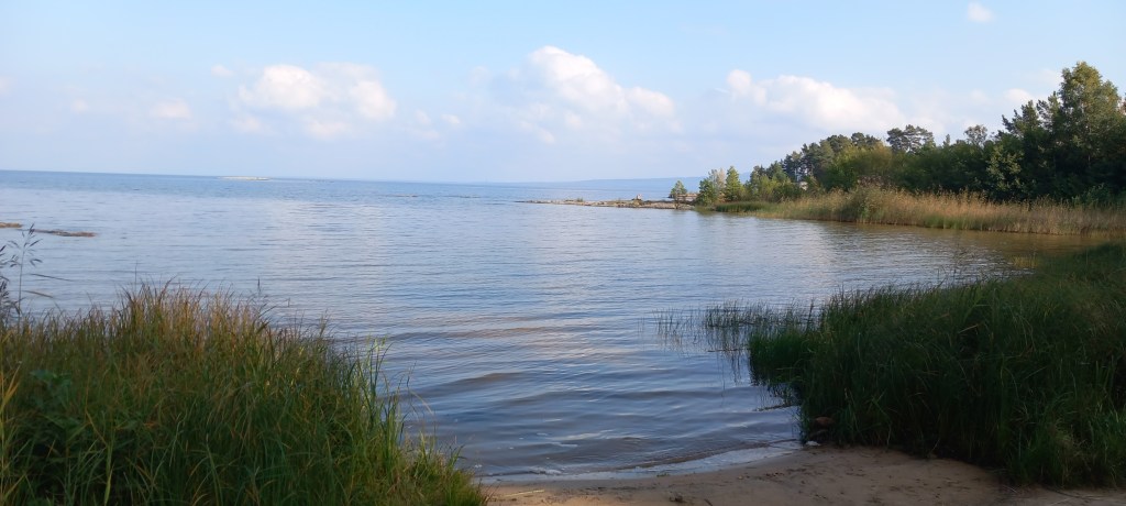
Heading south-west from Stockholm, we headed for Lake Vänern – the largest lake in Sweden. Covering an area of nearly 2,200 square miles, it spreads over three provinces and stretches for 140 km in length. We enjoyed a stop near the northern end at Karlstad – beautiful beaches beyond the trees with water extending as far as the eye could see.
The beach at Karlstad with islands on Lake Vanern
Driving south down the western side of the lake we encountered some challenging narrow, windy back roads, but so worth doing when we encountered views like this . . .
Breathtaking reflections on a very still (and grey) day
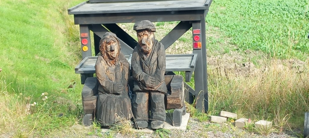
At one stage I pulled into the end of a farm track to allow a couple of cars to pass us – and there were “Eric and Rosa” (I decided to call them) sitting in splendour looking out for the milk tanker each day!
Meet Eric & Rosa!
We had a night at Håverud campsite, so that the canal geek in the passenger seat could have a look at the aqueduct, inaugurated in 1868. It is only 32.5 metres long and is just a long steel duct, recently renovated for the tourism industry. What makes it unique is the combination of road, rail and canal all bridging the river gorge in a space of about 50 meters. The aqueduct was crucial in completing the Dalsland Canal. There are 12 km of navigable channels between many lakes which make up a 250 km stretch of waterway going from Lake Stora Le to Lake Vänern. There is a 66m height difference which is covered by 31 locks. Reputed to be one of the most beautiful waterways in the world, it is now frequented by leisure boats.
Haverud Aqueduct stretches over an enormous river gorge
In the south-east corner of the lake is an area known as Kinneviken, which includes Kållandsö Island. Here we stayed on an idyllic campsite, 3 km off the main roads, in the trees and 200m from the lake. It was so peaceful, we decided to stay on for a few nights to walk and chill out. After such an adventure, it was bliss to just stop and enjoy the quiet. The weather was NOT the best, but we managed to walk between showers.
The peace & tranquility by the lakeRocky shores and gentle lapping water
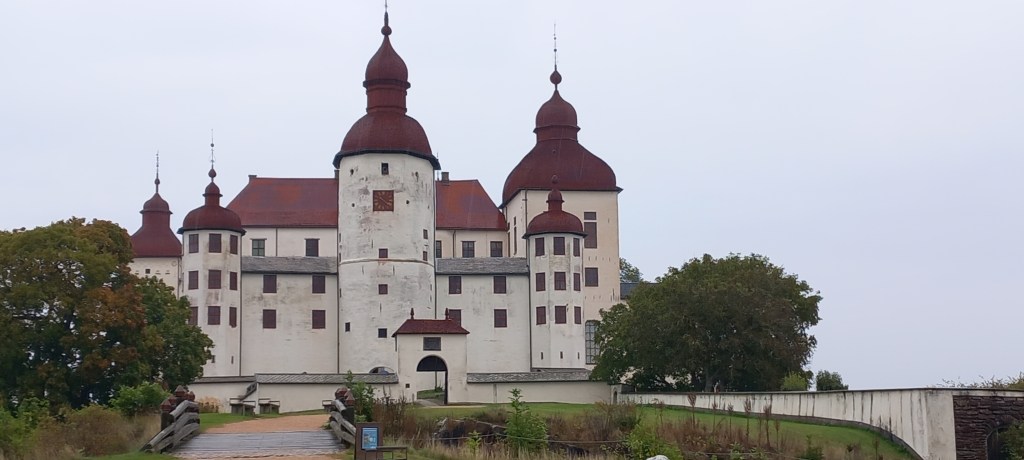
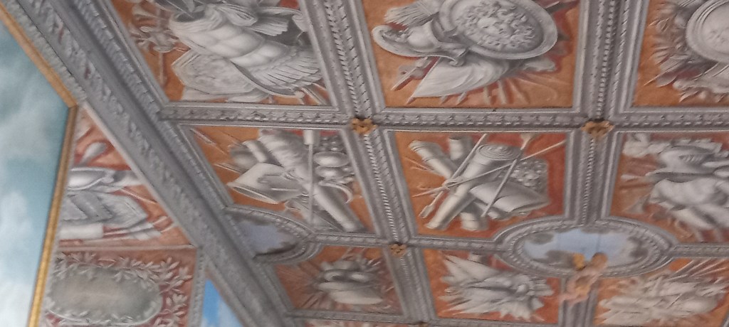
Läckö Slott (Lacko Castle) was cleverly built in the 1600s on a steep cliff and surrounded on three sides by water, at the northeast edge of Kållandsö Island. It was the brainchild of a highly esteemed Bishop, to defend his huge diocese. Since then, it has had a checkered history, but more recently has been taken over by the government for tourism. Our guided tour included only 6 of the 250 rooms in the castle – most of the furniture and fittings have been removed over the years. It is now painted in the original Baroque style.
Lacko CastleCeilings painted in Baroque Style – some of the cornice carvings still exist
Gothenburg (Göteborg) sits on the west coast of Sweden, due east of the northern tip of Denmark. An easy bus ride took us into the city, from our campsite in one of the suburbs. Sweden’s second largest city has a marvellous ‘young’ vibe to it. The 23 foot Poseidon Statue (the Sea God) is considered a fitting figure to watch over this seaside city. Well regarded in the past for its ship building industry, these days the city is known for the Volvo car industry and its vibrant night life. Some thirty-four percent (34% ) of the population was born outside the country or has at least one parent born abroad.
Poseidon Statue in Gothenburg – sorry it was a very grey, wet day!
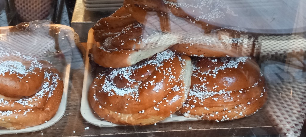
The Old Town (HAGA) is full of lovely street cafes and little artisan shops. The original cinnamon bun is said to come from here! Huge dinner plate size ‘pull and share’ buns draw in the crowds.
Cinnamon buns the size of dinner plates -sorry about the reflection from the window!Old buildings, canals and blue trams (built in Gothenburg)
Enormous shopping centres dominate the city centre (one mall has 200 shops!). These centres are teeming with people at all times of the day and night – and everyone is carrying shopping purchases. There’s certainly no recession in Sweden!
Lilla Torg square in the Old Town area of Malmo
We catch the ferry from Malmo this evening to begin our homeward journey. Given that we will retrace our steps following the same route through Germany and The Netherlands to Hook of Holland for the ferry to Harwich, I will end this particular holiday blog here.
Sunset over Oresund Bridge – which takes you to Denmark from Malmo.
To sum up our adventure:
We (mostly I!) will have driven 4400 mi ( 7000 km)
On 9 tanks of diesel.
And stayed on 27 campsites.
And we have LOVED every minute of Scandinavia!
Thank you ‘followers’ – it’s nice to have your ‘likes’ and the odd comment.